Atlanta Swelters: A Detailed Look at the Week’s Weather Woes
By
Amy Freeze
Terrific temperatures and stormy surprises—here's what's in store for Atlanta and the Southeast. Dive deep into our comprehensive weather forecast.
As Atlanta hits near-record temps and storms roll in, find out how the weather might impact your week with our detailed forecast.
Welcome to our weather deep dive! Atlanta and neighboring regions in the Southeast are gearing up for a sweltering week with temperatures skyrocketing and late-week storms approaching. Our special report covers all the regional nuances, including tempo shifts, storm patterns, and precautions to take. Amidst this, the UV index reaches alarming highs. Stay updated and prepared with our in-depth analysis.
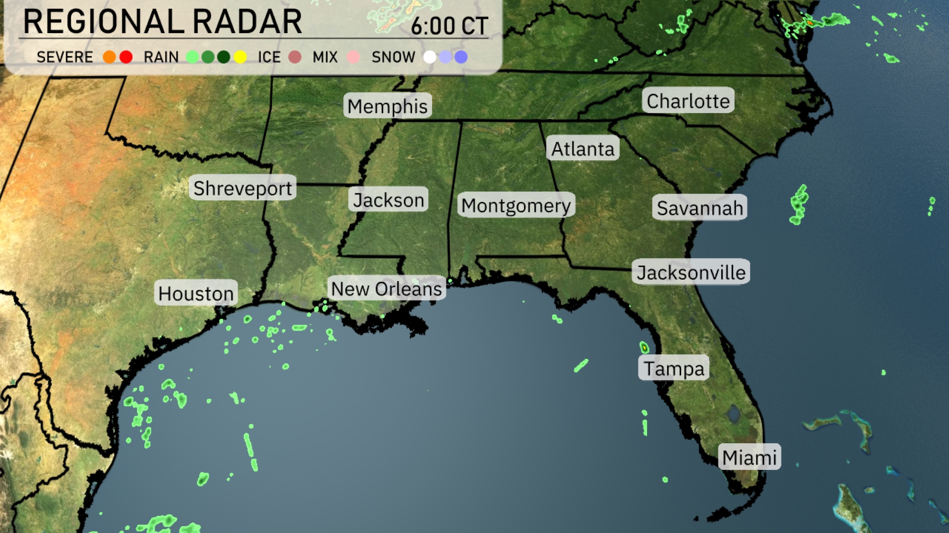
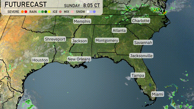
The Regional Radar shows scattered showers across the Gulf Coast, affecting areas like Houston and New Orleans. Light rain is making its way towards Montgomery and Atlanta, while Charlotte remains under partly cloudy skies. Jacksonville is mostly dry, but some patchy clouds are moving in from the south. Miami is experiencing scattered showers, but conditions are expected to clear up as the day progresses.
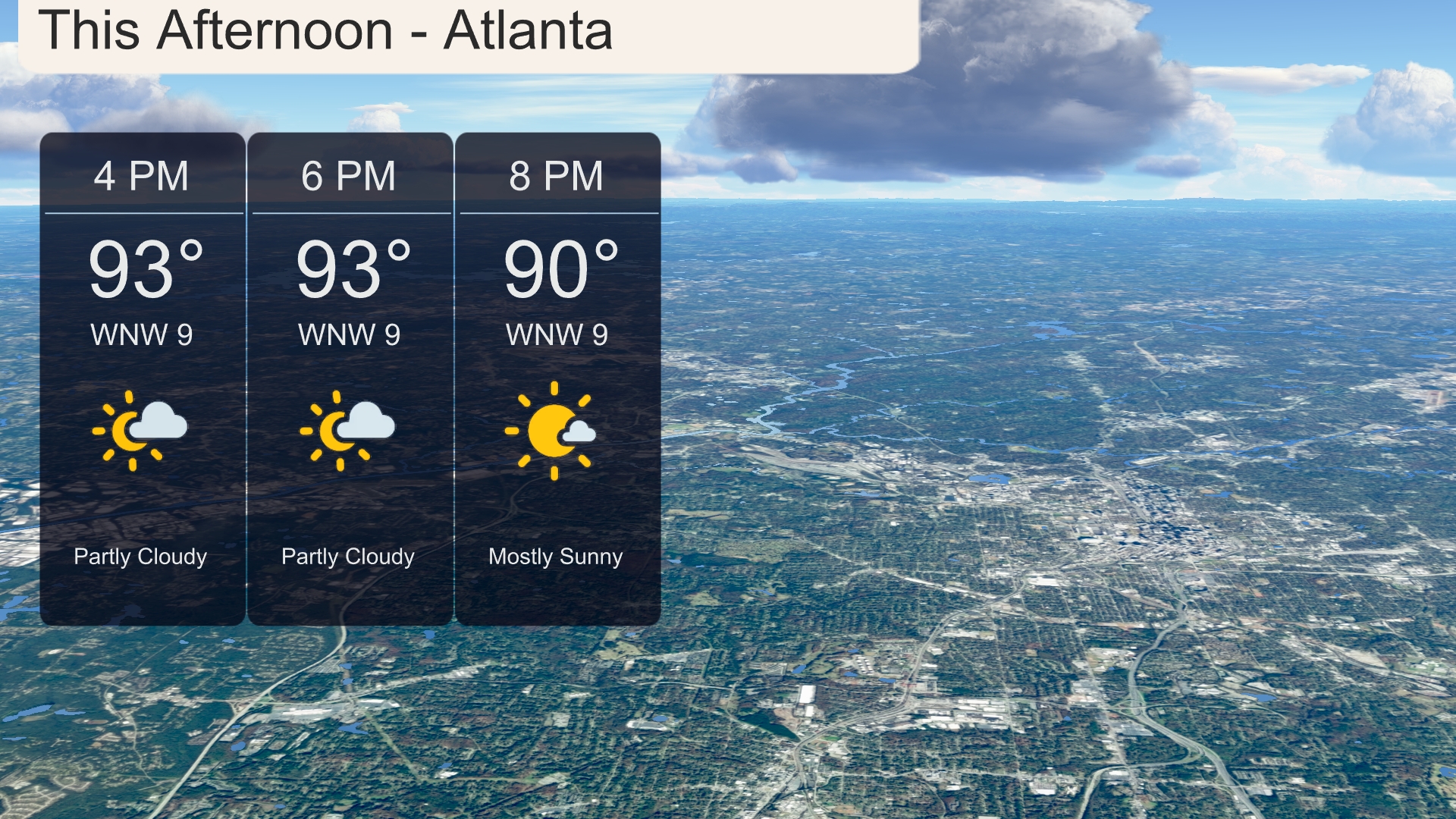
This afternoon in Atlanta, temperatures will hover around 93 degrees under partly cloudy skies. A steady WNW wind at 9 miles per hour will be present. As the afternoon progresses, expect a shift to mostly sunny conditions by 8 PM with the temperature slightly cooling to 90 degrees.
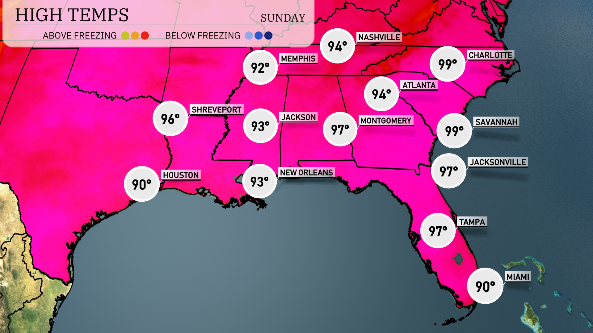
Today’s regional high temperatures in the Southeast are certainly noteworthy. Atlanta is heating up with a high of 94 degrees, while just south, Savannah is reaching a sweltering 99 degrees. Montgomery will see a high of 97, closely following Jackson at 93 degrees. Over in New Orleans and Tampa, we expect highs of 93 and 97 degrees respectively. Coastal cities like Miami are somewhat cooler with a high reaching only 90 degrees due to that refreshing onshore flow.
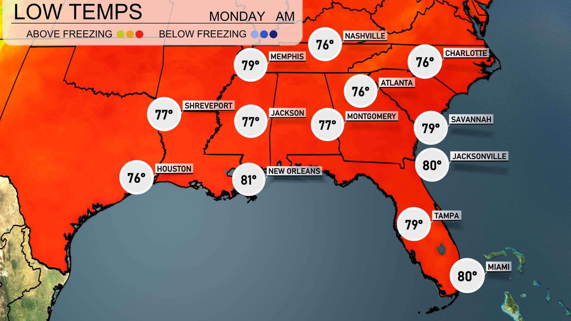
Tonight, temperatures will remain warm across the Southeast, with lows of 79 degrees in Savannah and Jacksonville. Expect a mild night in Atlanta and Montgomery, both forecasting 77 degrees. Meanwhile, Memphis will cool down to 76 degrees, offering a slight drop compared to previous nights. Houston sits at 76, while New Orleans will stay warm at 81 degrees.
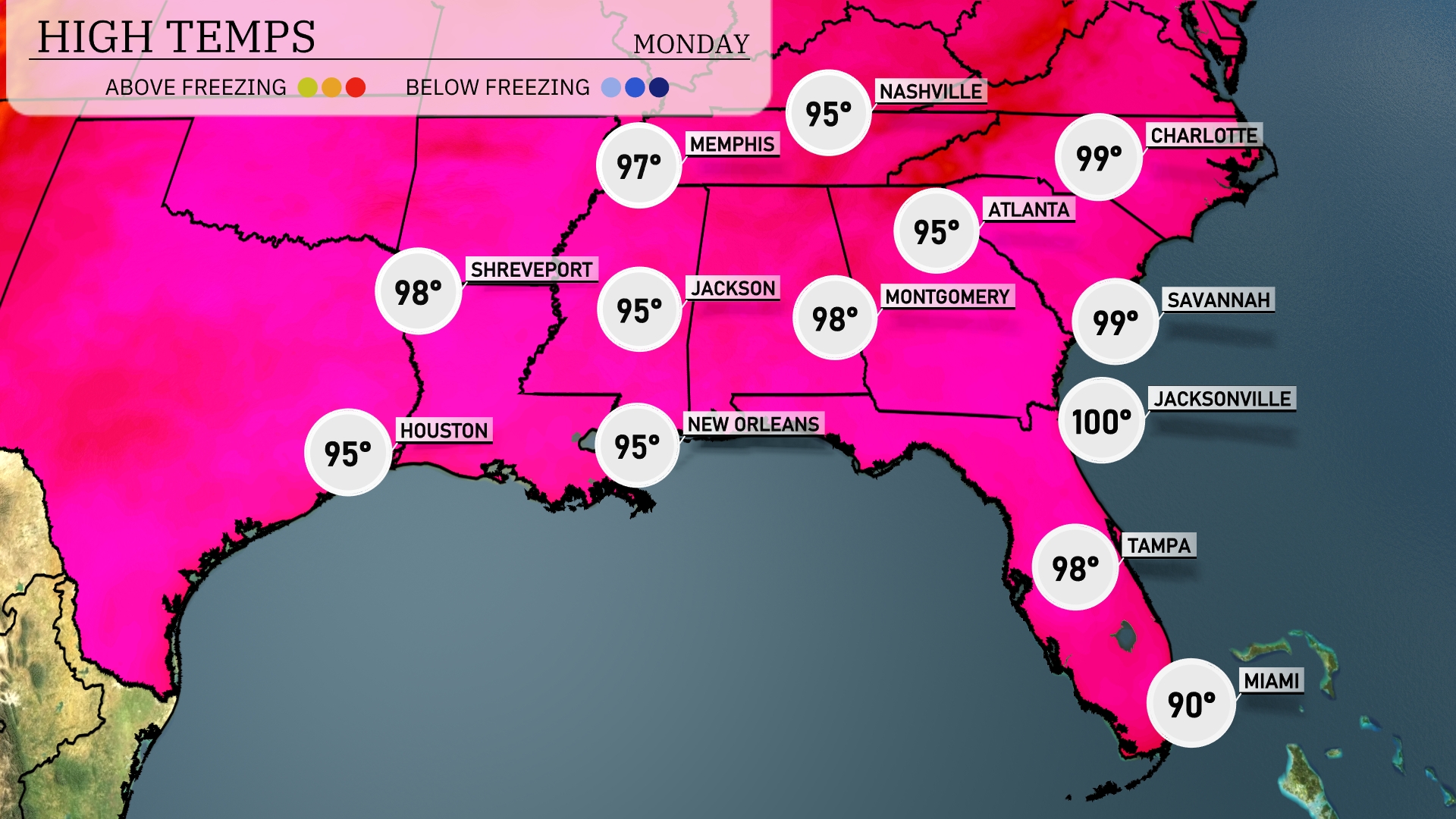
Tomorrow, Jacksonville is set to reach a sweltering high of 100 degrees. In Savannah, expect similar conditions with a high of 99 degrees. Tampa will see temperatures climb to 98, while Atlanta is forecasted to hit a warm 95 degrees. Further inland, Jackson is also expected at 95 degrees, and New Orleans will match that at 95 degrees as well. The Southeast is experiencing above-average temperatures, largely driven by a persistent high-pressure system influencing the region.
Expect an active weather pattern in the Southeast as a cold front progresses through the region. Starting in central Arkansas and Louisiana, moving towards Mississippi and Alabama by morning, embedded thunderstorms may produce heavy downpours and gusty winds. During Tuesday, look for these systems to reach Atlanta and extend towards the Carolinas, with showers from Savannah to Jacksonville into Wednesday. Rainfall could accumulate significantly, posing a localized flooding risk. Post-frontal cool air filters in, offering relief from recent heat as we head into the latter part of the week.
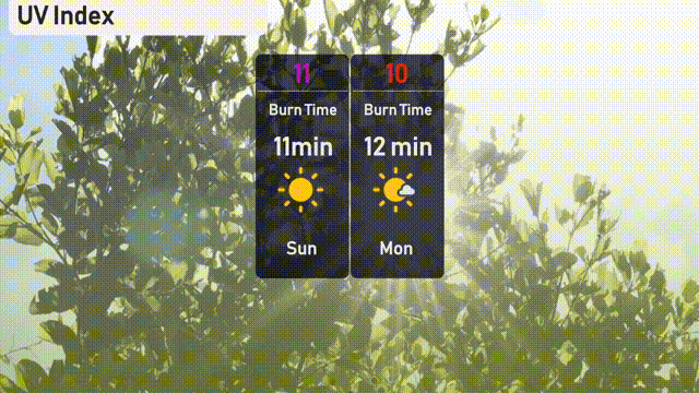
The UV index in Atlanta will be very high on Sunday with a value of 11, indicating a burn time of just 11 minutes in direct sunlight. On Monday, the index slightly decreases to 10, with a burn time of 12 minutes.