Atlanta’s Weather Whirlwind: From Sunshine to Storms
By
Amy Freeze
Explore the dynamic weather patterns affecting Atlanta and the Southeast from clear skies to impending storms and how it impacts your week.
This afternoon promises clear skies in Atlanta, but keep your umbrella close as storms brew towards the evening. Join us as we delve into a comprehensive forecast for Atlanta and the broader Southeast.
The weather patterns across Atlanta and the Southeast are showing a mix of clear skies and storms. Today in Atlanta, temperatures will hit 86 degrees, but thunderstorms are expected by the evening. Across the Southeast, conditions vary from rain showers in New Orleans to strong storms near Tallahassee. A cold front tomorrow will bring scattered thunderstorms and a brief respite from the heat. Stay prepared with our detailed analysis and weather tips.
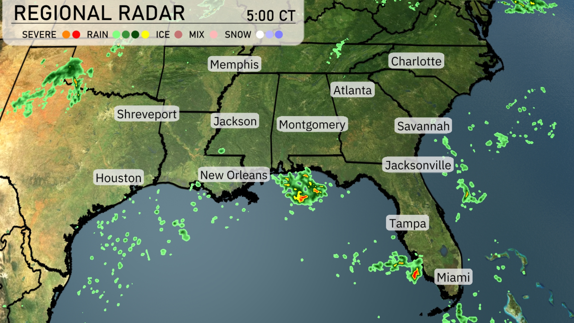
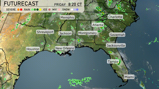
The Southeastern radar indicates active weather patterns, particularly along the Gulf Coast. New Orleans is currently experiencing rain showers, with rainfall also present southwest, moving toward the city. Some strong storms are noted near the Florida Panhandle, just south of Tallahassee, and precipitation is affecting the Jacksonville area as well. Most of the rest of the region is enjoying clear skies, especially from Atlanta to Charlotte, although clouds are beginning to move in, suggesting future rain events.
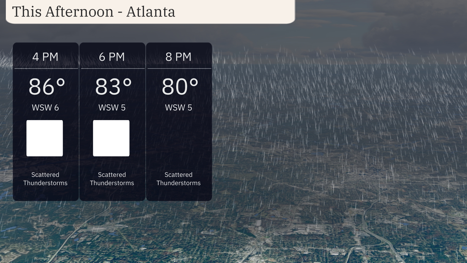
Temperatures in Atlanta this afternoon will reach 86 degrees by 4 PM, with scattered thunderstorms likely. Winds will come from the west-southwest at 6 mph, dropping to 5 mph by 6 PM when the temperature slightly decreases to 83 degrees. Thunderstorm activity continues, so keep an umbrella handy. By 8 PM, temperatures will ease to 80 degrees, with winds remaining steady and storms tapering off.
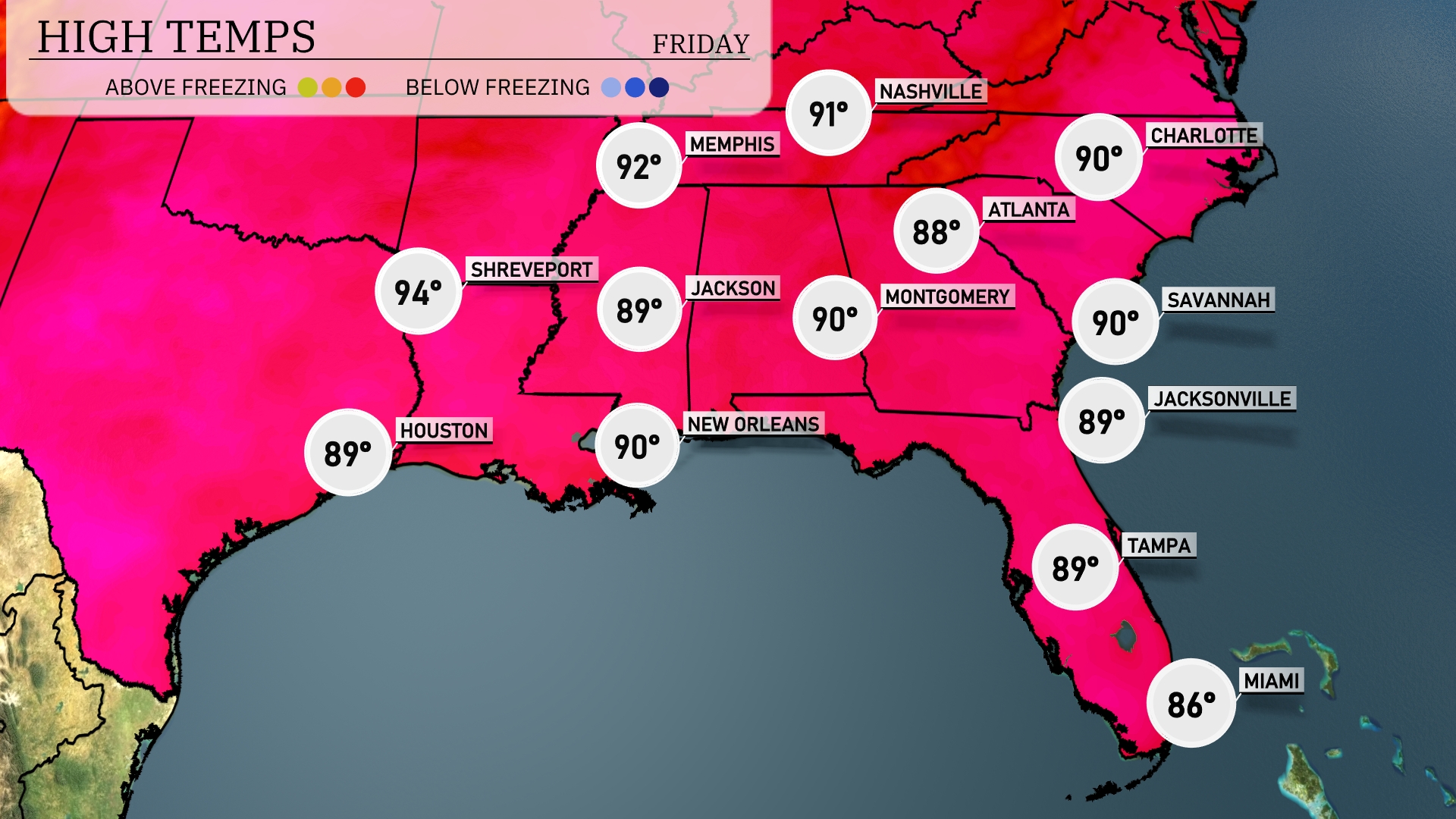
Today in the Southeast, we’re seeing warm temperatures across the board. Shreveport is leading the pack with a high of 94 degrees, while Houston stays slightly cooler at 89. New Orleans and Montgomery both reach 90 degrees, and Jackson is close behind at 89. Farther east, temperatures in Atlanta and Savannah are consistent, hitting 90 as well. Over in Florida, Tampa is at 89, and Miami cools down to 86 with some cloud cover.
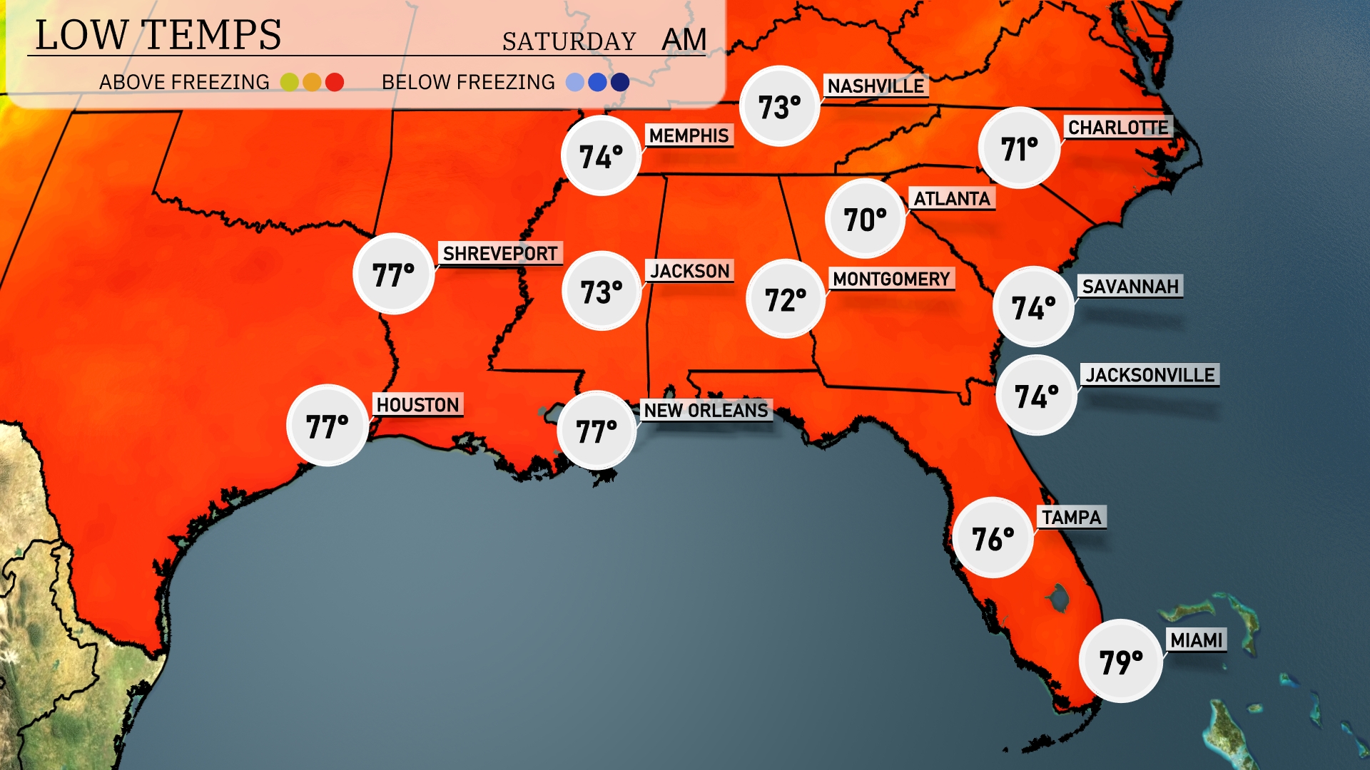
Tonight, Memphis will drop to 74 degrees, while Nashville cools to 73. In Jackson, expect a low of 73 degrees. Montgomery will see a comfortable 72 degrees, with Atlanta at 70. The coastal cities of Jacksonville and Savannah are both forecasted to have lows of 74 degrees.
Tomorrow, Atlanta will heat up to a warm 91 degrees. In Jacksonville, temperatures will also reach 91, while Montgomery sees a high of 90. Memphis will experience a slightly cooler day at 88 degrees, and New Orleans is expected to be around 88 as well. In contrast, Shreveport is set to soar to a sizzling 96 degrees, signaling above-average temps across much of the Southeast due to a ridge of high pressure influencing the weather patterns. Expect continued warm conditions as summer maintains its grip on the region.
A cold front is set to sweep through the Southeast tomorrow, sparking scattered thunderstorms from Shreveport to Savannah. Expect strong winds and brief downpours, especially along the Gulf Coast from New Orleans to Jacksonville. The system could bring localized flooding, so stay alert and mindful of rapidly changing conditions. By evening, cooler and drier air stabilizes over Memphis and Atlanta, bringing a respite from today’s storms. Temperatures are projected to drop slightly, with clearer skies settling in behind the front.
The UV index in Atlanta is very high at 9 on this Friday, with a burn time of only 15 minutes. As we move into Saturday, the index peaks at 10, offering an even quicker burn time of 12 minutes.