Atlanta’s Weather Rollercoaster: Sun, Storms, and Temperature Twists!
By
Amy Freeze
Explore the dynamic weather changes sweeping through Atlanta and the Southeast with our comprehensive weather report.
Experience a whirl of weather with sunny days, expected storms, and a dramatic temperature drop in Atlanta. Get all the details in our full forecast.
Join us as we delve into the diverse weather patterns affecting Atlanta and the broader Southeast region. From the warmth of 90 degrees to unexpected thunderstorms and a significant temperature dip following a cold front, we cover every aspect. Prepare for the weather with our safety tips on UV exposure and more in our detailed seven-day forecast. Full details at: https://amyfreeze.ai/atlanta-weather-rollercoaster
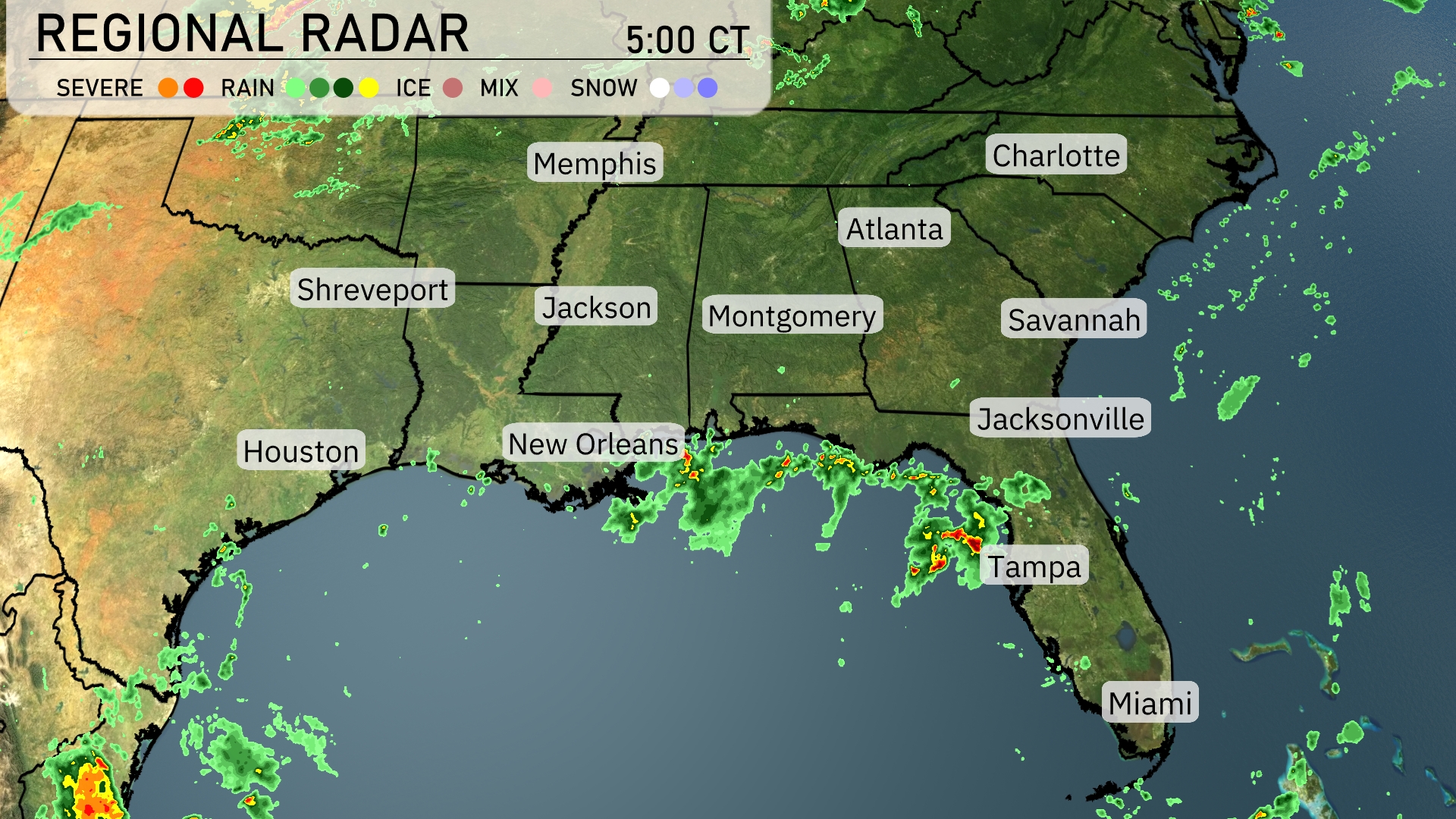
Across the Southeast, rain showers are sweeping across the Gulf Coast, with heavy rainfall centered around Tampa and extending up to New Orleans. Jacksonville is also experiencing pockets of precipitation. The skies over Georgia and the Carolinas remain mostly clear as clouds are yet to advance from the west. In the northern part of the region, locations like Memphis and Nashville are enjoying calm and clear conditions.
Atlanta’s afternoon forecast features mostly cloudy skies with temperatures around 86 degrees. Winds will come from the southwest at 5 to 6 miles per hour. Scattered thunderstorms are expected to develop later, providing some relief from the heat. Temperatures will remain steady at 85 degrees by 6 PM.
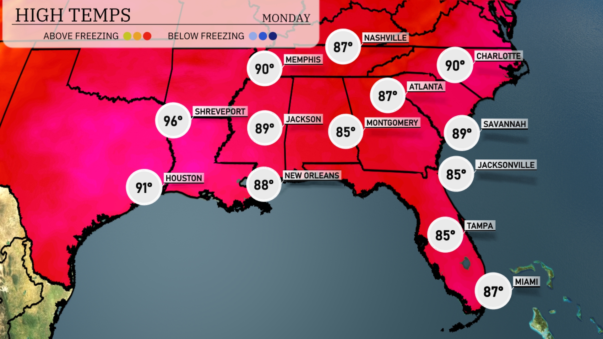
Today, the Southeast is experiencing warmer temperatures across the region. Atlanta hits a high of 90 degrees, matching Charlotte’s temperature, while Nashville reaches 87. In the Gulf Coast, New Orleans is slightly cooler at 88 degrees, with Jackson close behind at 89. The coastal areas of Florida see a pleasant 85 degrees in both Tampa and Jacksonville, while Miami lags slightly cooler at 87.
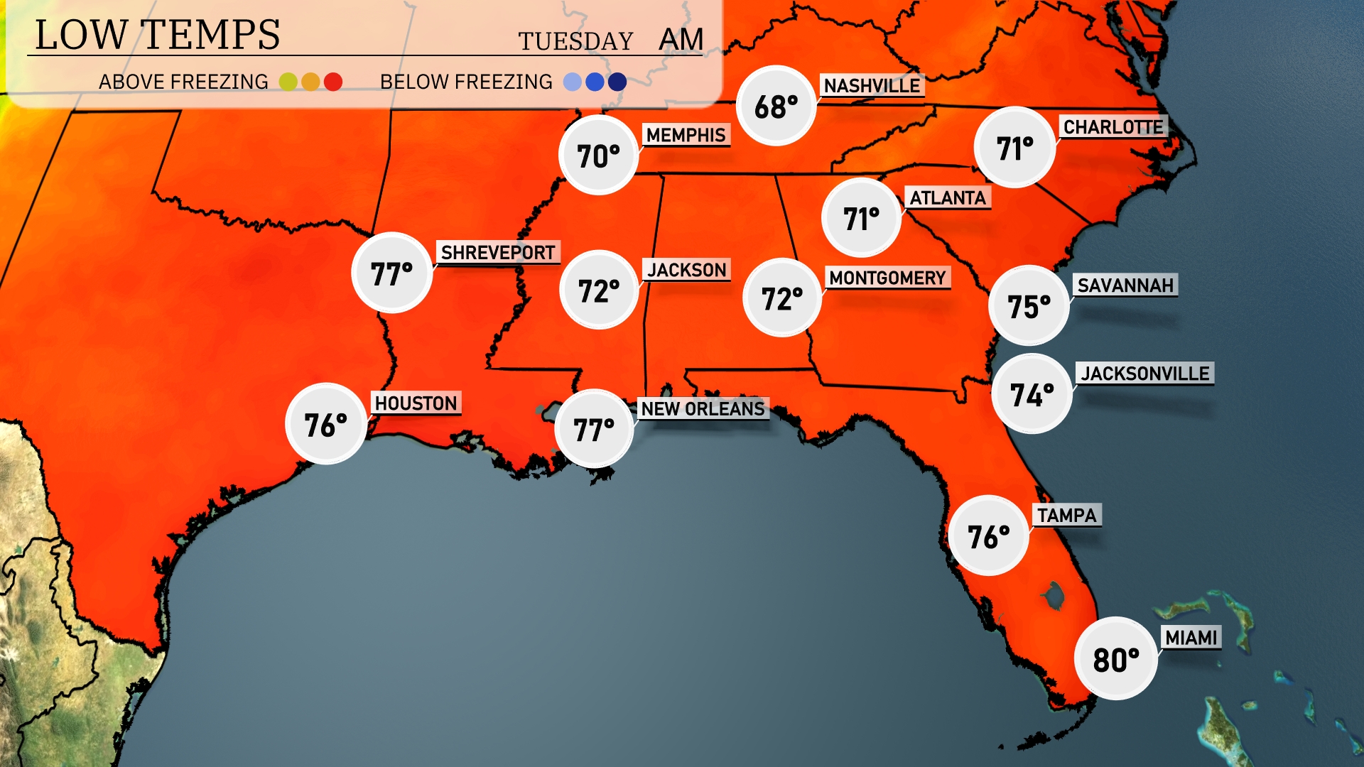
Tonight, Memphis will cool down to 68 degrees, while Nashville sees a low of 71. In Jackson, temperatures will drop to 72 degrees. Expect a chilly 74 in Jacksonville and 75 in Savannah, with Tampa resting at 76 degrees.
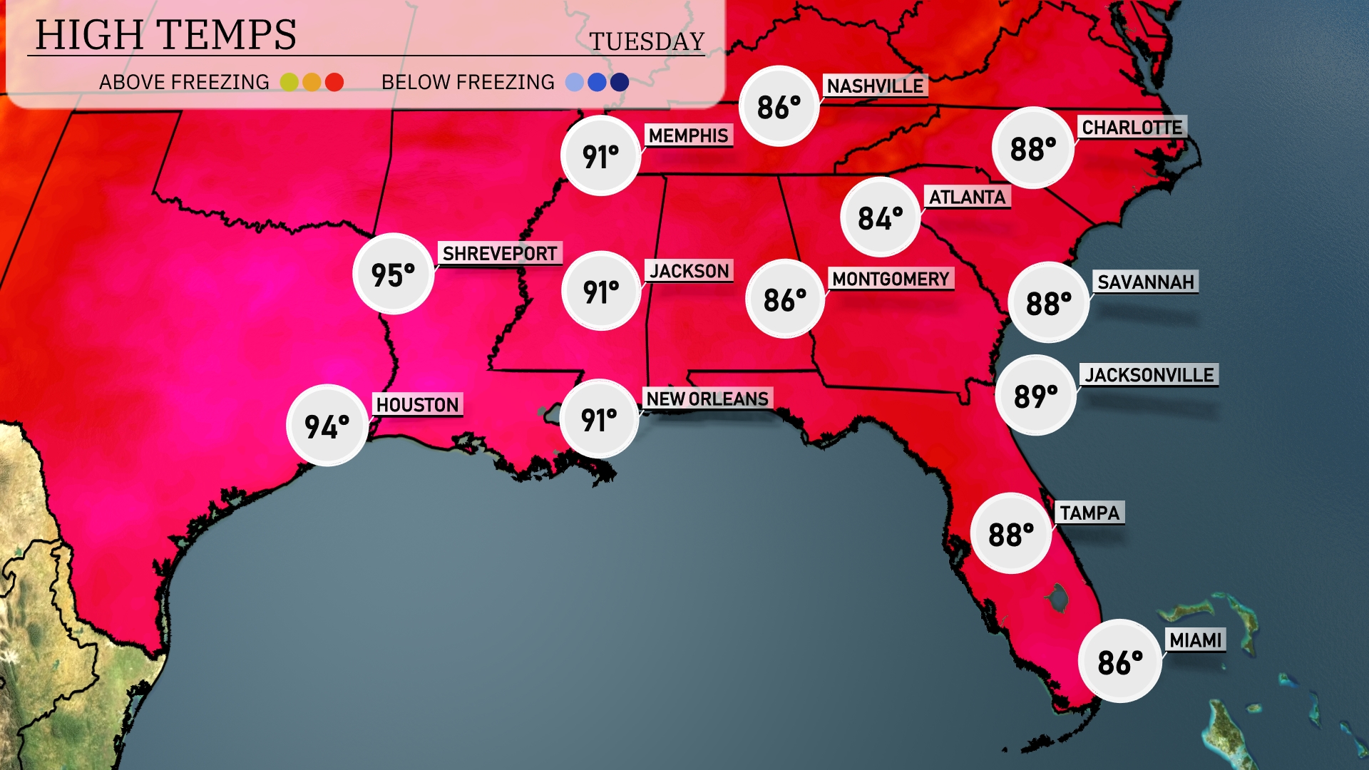
Tomorrow in the Southeast, we expect a sizzling day, particularly in Shreveport, with temperatures soaring to 95 degrees. Houston isn’t far behind, hitting 94 degrees, while Jackson and New Orleans will both reach a warm 91 degrees. Expect a slightly cooler day in Montgomery, where highs are forecasted at 86 degrees. The coast will also see warmth, with Tampa at 88 degrees and Jacksonville at 89 degrees, all indicative of a prevailing warm air mass influencing the region.
A cold front is pushing across the Southeast, bringing a significant shift in weather tomorrow. Expect widespread thunderstorms and heavy rain from New Orleans through Atlanta, with severe weather potential including high winds and isolated tornadoes. Rainfall amounts could exceed one inch, increasing the risk of flash flooding in low-lying areas. Daytime temperatures will drop by 10 degrees post-front, offering relief from the current heat.
The UV index in Atlanta is extreme at 10 for both Monday and Tuesday, with a burn time of just 12 minutes. Limit sun exposure during midday hours, and be sure to wear high SPF sunscreen, protective clothing, and a wide-brimmed hat.