From Sun to Storms: Navigating Atlanta’s Dynamic Weather Patterns
By
Amy Freeze
Experience the vibrant shifts in Atlanta's weather, from soothing sunny mornings to electrifying stormy evenings. A detailed guide to what's ahead.
Get ready for a rollercoaster of weather in Atlanta! Starting with sunny skies at 79°F and moving into stormy evenings with possible thunderstorms. Stay informed and prepared with our full forecast.
Atlanta’s weather lineup brings a mix of conditions. The day begins at a warm 79°F under sunny skies, escalating to 84°F by mid-morning. However, the serene start gives way to potential thunderstorms as a cold front moves in, promising scattered showers and thunder across the Southeast. By nightfall, expect more stable temperatures but prepare for storm impacts. For a detailed seven-day forecast and safety tips during severe weather, visit our blog at https://amyfreeze.ai/.
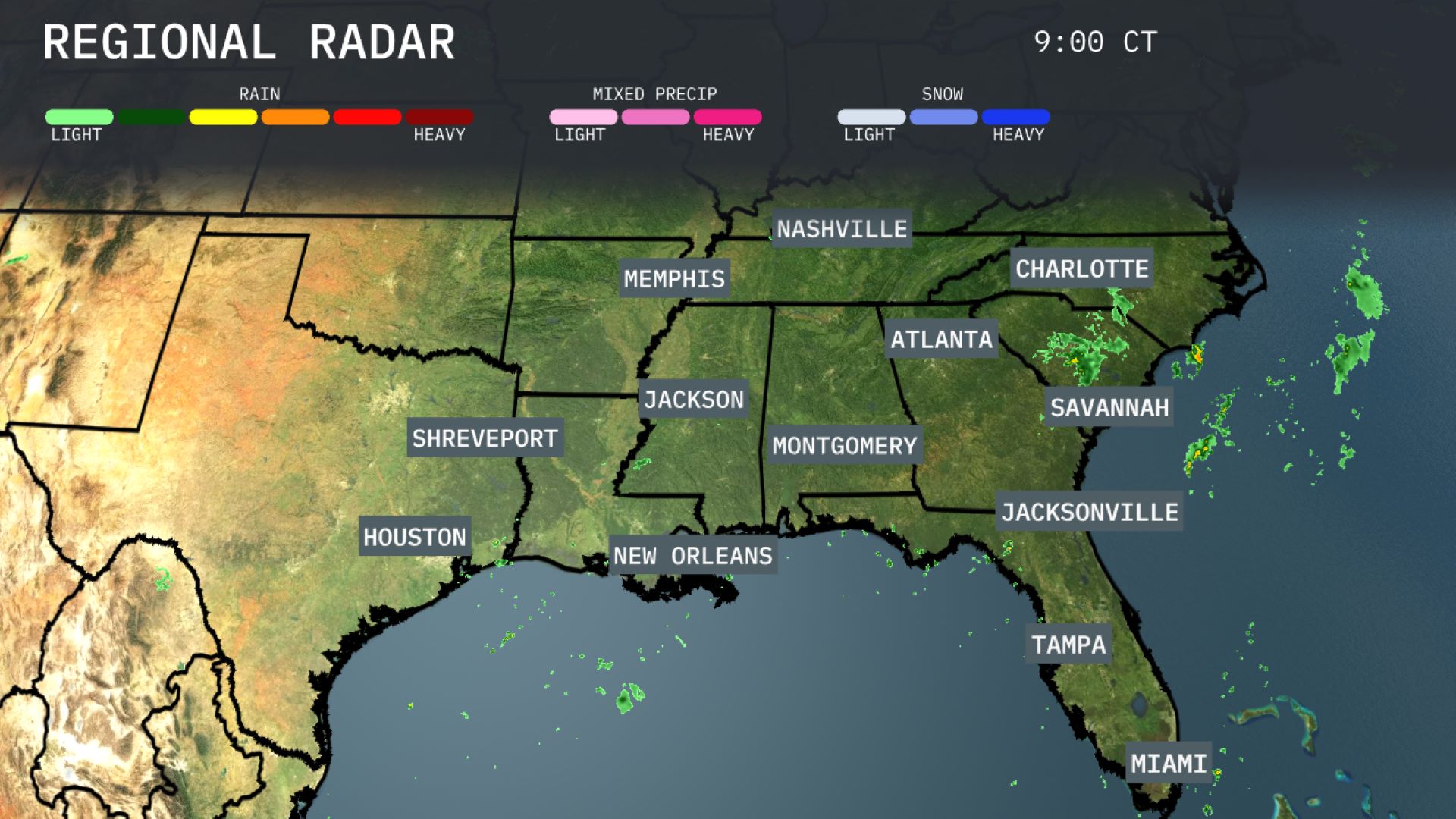
A band of showers is developing over the Florida Panhandle stretching towards Jacksonville, with scattered rain moving along Georgia’s coastline towards Savannah. The greater part of the Southeast, including Atlanta, Montgomery, and Charlotte, currently enjoys mostly clear skies with increasing cloud cover as we move through the day. New Orleans and nearby areas remain dry for now, setting up a contrasting picture across the region. Weather conditions in Houston and across the Southeast appear calm, but expect gradual changes as systems shift throughout the day.
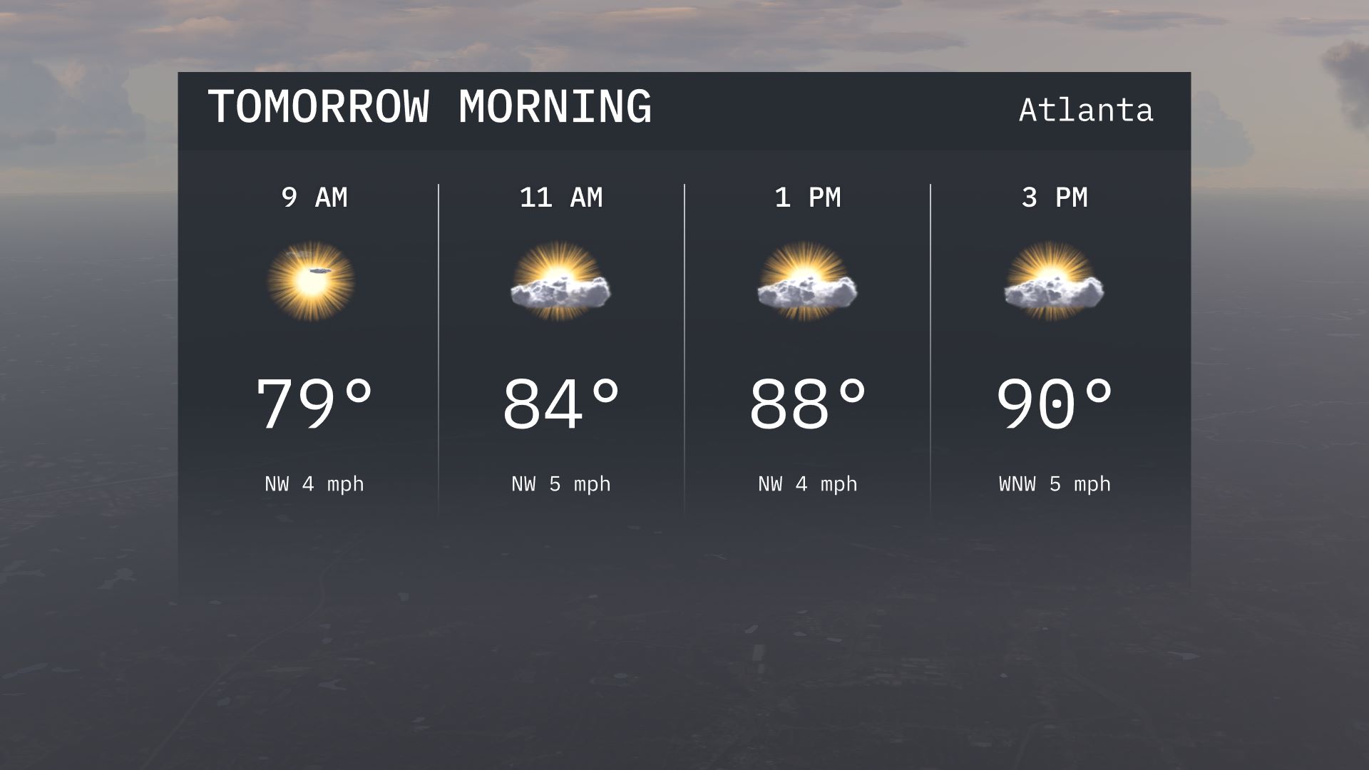
Atlanta’s temperatures tomorrow morning start at 79 degrees under sunny skies, transitioning to 84 degrees by 11 a.m. A light northwest wind will be present.
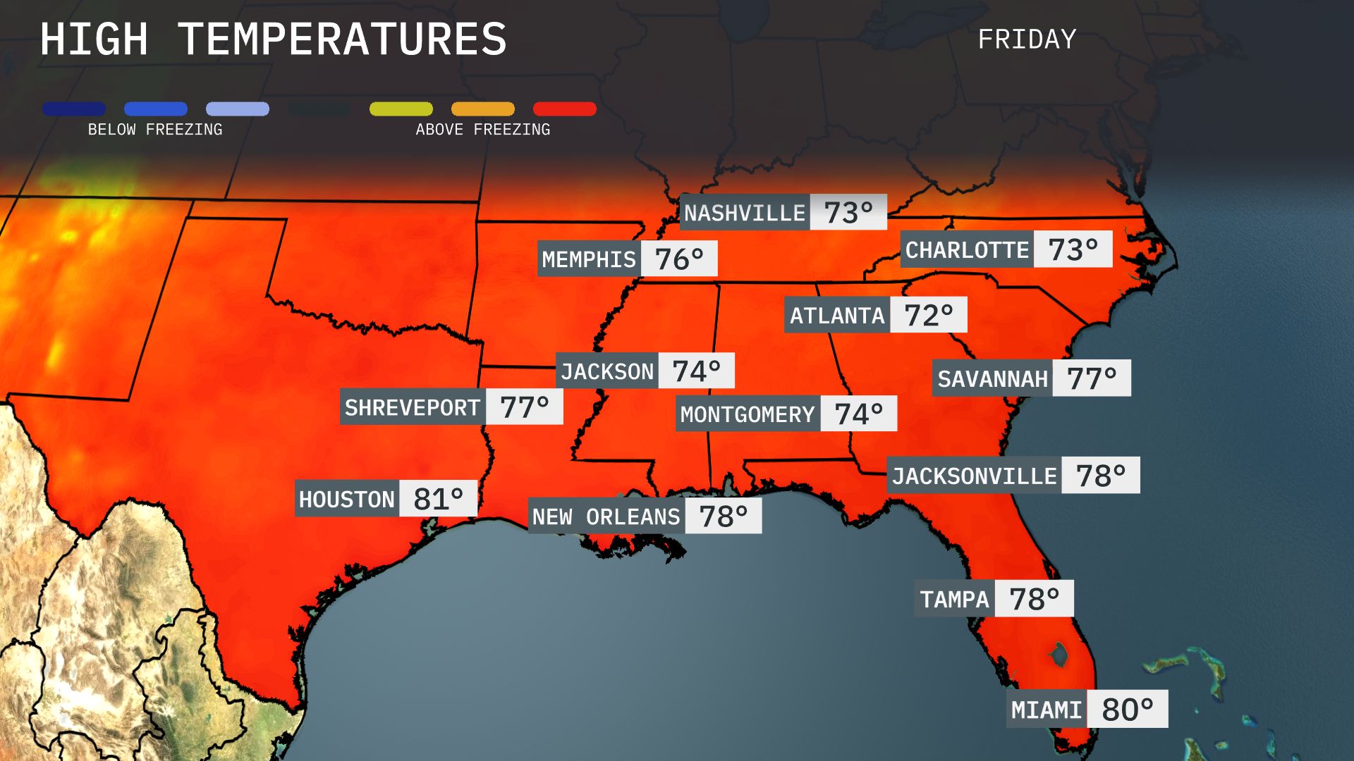
Tomorrow, high temperatures in the Southeast will see a warm uptick, with Houston reaching 81 degrees. New Orleans will enjoy a pleasant 78 degrees, while Memphis is set for a high of 76. In contrast, Atlanta and Nashville will be cooler, with highs around 72 and 73 degrees, respectively. Jacksonville is expected to see a slightly warmer day at 78 degrees.
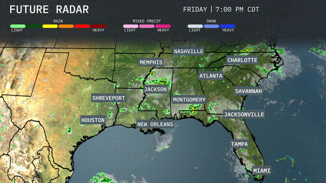
A cold front is moving into the Southeast tomorrow, bringing scattered thunderstorms from New Orleans to Montgomery and up towards Nashville. Expect heavy rain and the potential for localized flooding in areas around Jackson and Memphis through the afternoon. Storms will continue stretching eastwards, impacting Atlanta and Charlotte by late evening. Temperatures will drop slightly post-front, leading to cooler, yet still humid conditions across the region. Be prepared for possible severe thunderstorm warnings from the N-W-S, particularly in Mississippi and Alabama.
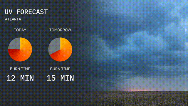
The UV index in Atlanta has reached a high level today, leading to a burn time of 12 minutes in direct sunlight. For tomorrow, expect a similar scenario with a slight increase in burn time to 15 minutes.
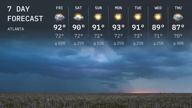
For the 7 day forecast in Atlanta:
Friday: It’s a wet start to the weekend with showers and a high of 92 degrees, cooling down to 72 degrees overnight.
Saturday: Slightly cooler with scattered storms expected, reaching a high of 90 degrees and dipping to 72 degrees.
Sunday: The weather calms with partly sunny skies and a high of 91 degrees, the low stays around 72 degrees.
Monday: Mostly sunny and warm at 93 degrees, cooling to 72 degrees as night falls.
Tuesday: Sunshine continues with a high of 91 degrees, evening brings a low of 73 degrees.
Wednesday: The sun dominates with a high reaching 89 degrees and a nighttime low of 71 degrees.
Thursday: Ending the week with increasing cloudiness and a chance of rain, temperatures manage to reach a high of 87 degrees and a low of 70 degrees.