Dive into the latest weather updates for Atlanta and the Southeast with Meteorologist Amy Freeze. From clear skies to impending storms, learn what's looming over the horizon!
Discover what’s in store for Atlanta’s weather with Meteorologist Amy Freeze. From sunny mornings to stormy days, find out how the weather could affect your plans.
Welcome to our comprehensive weather update with Meteorologist Amy Freeze. As Atlanta prepares for a varied weather pattern, here are the essentials you need to know. Thursday kicks off with cloudy skies and a moderate UV index, perfect for a brief outdoor stint, but be mindful of the increasing UV levels by Friday. The weekend promises clearer skies and rising temperatures, a splendid opportunity for outdoor activities. As the new week begins, warmer temperatures and the chance of scattered clouds may adjust your outdoor schedules. Stay updated and prepared with our daily insights.
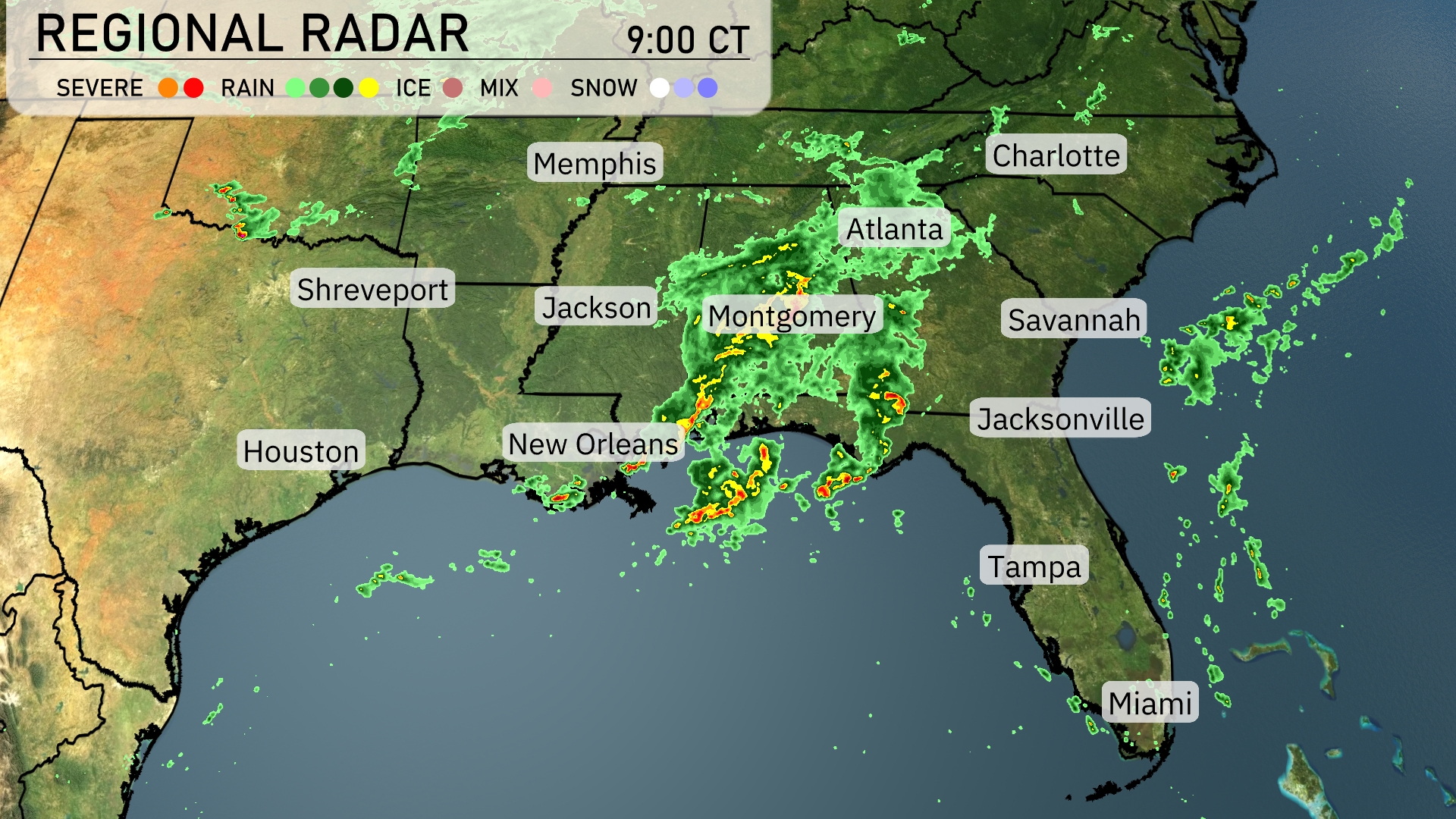
The Southeast is dealing with a dynamic weather situation. Severe thunderstorms are impacting areas around Montgomery, moving eastward. Rain showers extend from Gulfport to Montgomery, creating damp conditions. Cloud cover and light rain are reaching into Atlanta, while Charlotte remains under clouds for now. Coastal cities like New Orleans and Savannah are currently clear of precipitation, but rain is approaching.
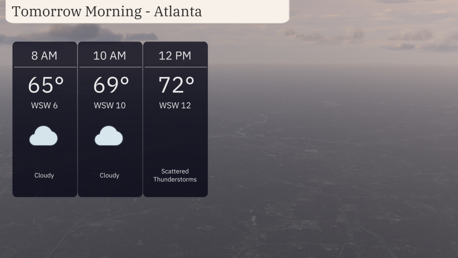
Tomorrow morning in Atlanta starts off cloudy with temperatures rising from 65 degrees at 8 AM to 69 degrees by 10 AM. Winds will be coming from the west-southwest, ranging from 6 to 10 miles per hour. The clouds will give way to scattered thunderstorms by midday, ushering in a breeze at 12 miles per hour and temperatures reaching 72 degrees.
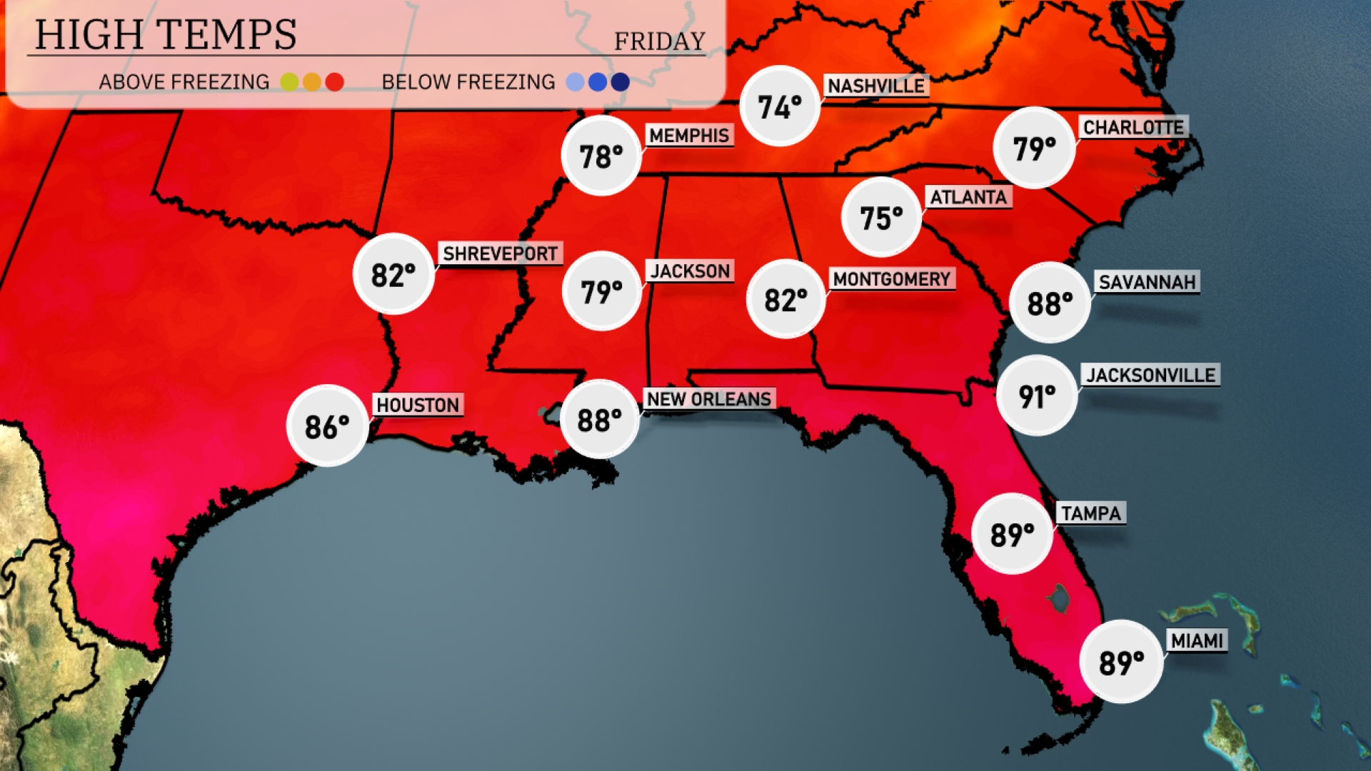
Tomorrow Atlanta will reach a high of 75 degrees, while Montgomery sees similar warmth at 82 degrees. Farther south, Nashville will be cooler at 74 degrees, though Jacksonville will warm up significantly, hitting 91 degrees. In the Gulf, New Orleans is set to enjoy a high of 88 degrees, making it a classic summer day. Miami rounds it off with a warm 89 degrees, keeping the tropical feel alive.
Plan for a busy weather day across the Southeast tomorrow. A dynamic cold front will advance through the region, triggering numerous showers and storms from Louisiana through Georgia. Expect the heaviest activity from Baton Rouge to Atlanta during the morning hours, where localized flooding is possible. Keep an eye on the possibility of gusty winds and isolated thunderstorms, especially in cities like Montgomery and Jacksonville.
The UV index in Atlanta on Thursday is moderate at 4, meaning a burn time of about 35 minutes in direct sunlight. By Friday, the UV index increases to 6, reducing the burn time to roughly 23 minutes.
For the 7 Day Outlook in Atlanta:
Thursday: Mostly cloudy with a high of 72 degrees and a low of 62.
Friday: Clear skies, expect it to warm up with a high of 76 degrees and a low of 58.
Saturday: Mostly clear and sunny, reaching a high of 83 degrees with a low of 61.
Sunday: Partly cloudy, a high of 83 degrees and the temperature dropping to 62 overnight.
Monday: Clear skies, with the temperature climbing to 86 degrees and a low of 62.
Tuesday: Partly cloudy, warmer with a high of 88 degrees and a low around 66.
Wednesday: Continues partly cloudy, the high near 87 degrees and a low of 69.