Atlanta’s Weather Scoop: Sunny Starts with Stormy Interruptions!
By
Amy Freeze
Meteorologist Amy Freeze delivers an insightful update on Atlanta's weather dynamics, from serene morning conditions to looming storms. Stay prepared with our comprehensive guide.
Discover the latest Atlanta weather forecast by Amy Freeze, featuring sunny mornings and stormy afternoons. Ensure a safe and informed week with our updates.
Greetings, Atlanta residents and travelers! Amy Freeze here with your expert forecast for the upcoming week. Expect a diverse range of weather conditions from clear, sunny mornings to powerful storms sweeping across the Southeast. With in-depth analyses and updates, you’ll be fully prepared for whatever the weather has in store. Join me as we navigate through the days, ensuring safety and planning efficiently. Check the full story on our blog: https://amyfreeze.ai/
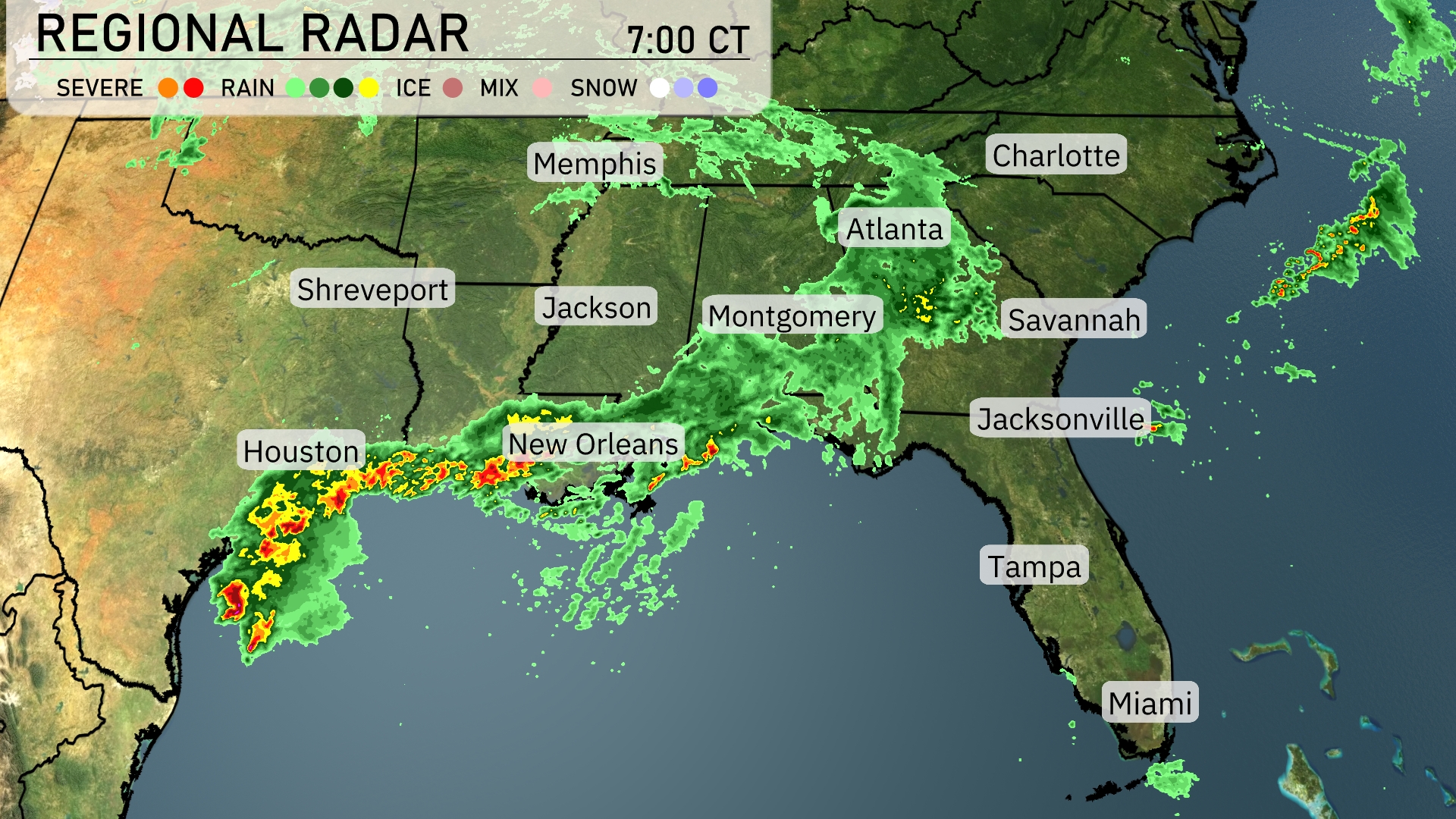
A line of severe storms is stretching from Houston to New Orleans, bringing heavy rain and possible thunderstorms. Jackson is experiencing moderate rainfall as precipitation moves northeast towards Atlanta. Coastal regions like Savannah and Jacksonville are currently under cloudy skies as rain continues to progress towards the Carolinas. Memphis remains dry for now, but showers are anticipated later in the day. Across Alabama, light rain is observed around Montgomery, gradually making its way eastward.
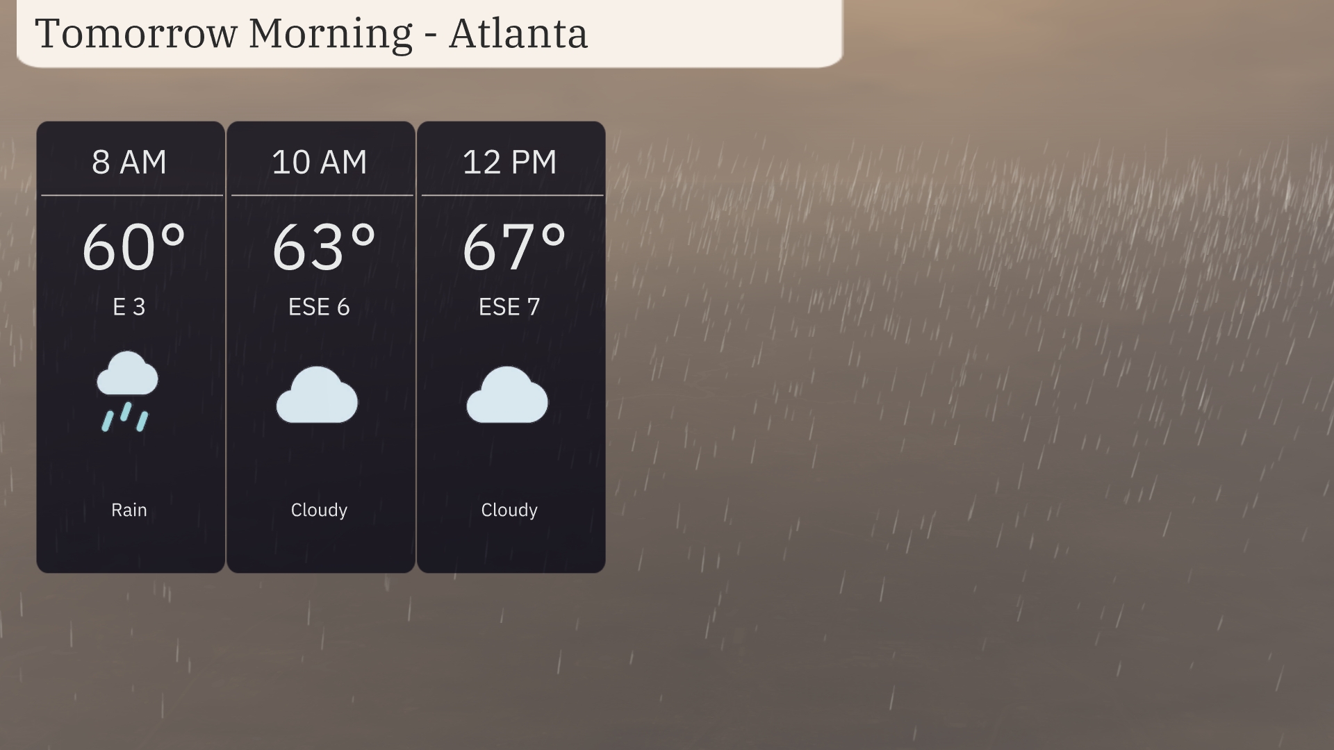
Tomorrow morning in Atlanta, expect temperatures to start at 60 degrees with light rain at 8 AM. By 10 AM, temperatures will rise to 63 degrees as the rain subsides and clouds persist, with an east-southeast wind at 6 miles per hour. By noon, look for 67 degrees under cloudy skies, with the wind gently picking up to 7 miles per hour from the east-southeast.
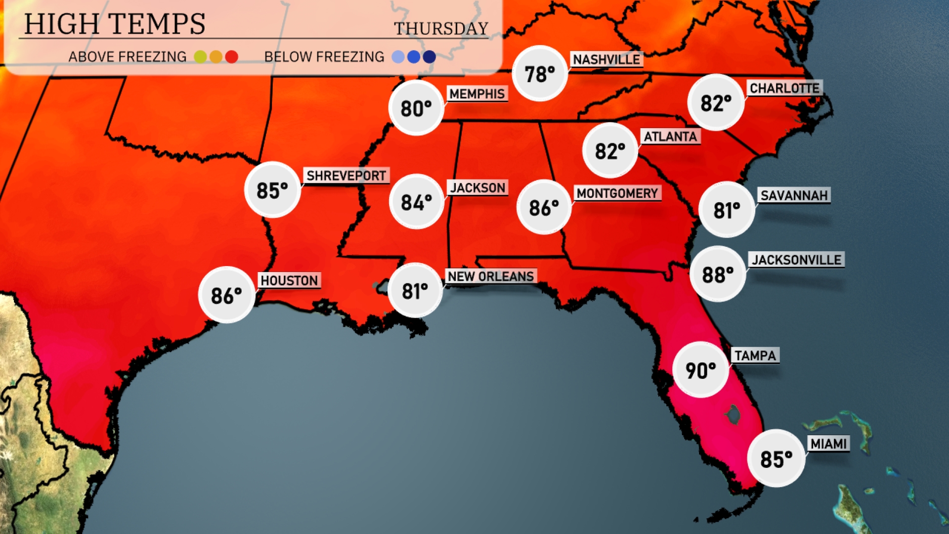
By tomorrow afternoon, the Southeast will experience above-average high temperatures. Tampa will sizzle at 90 degrees, making it one of the hottest cities in the region. Jacksonville isn’t far behind, expected to reach 88 degrees, while Atlanta will see a warm 82 degrees. Memphis will enjoy a pleasant high of 80 degrees, and New Orleans will remain comfortable at 81 degrees.
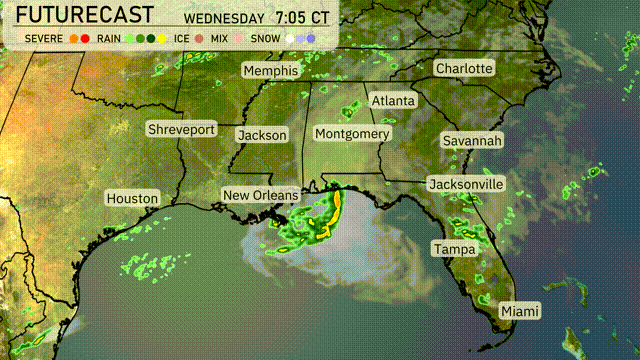
Tomorrow, the Southeast will experience an active weather pattern as a cold front advances from the west, bringing thunderstorms across the region. Anticipate storms impacting areas from New Orleans to Jacksonville by mid-morning, with the potential for heavy rain and gusty winds. Travelers should prepare for delays, especially during the morning commute in cities like Atlanta and Montgomery. Rainfall may surpass an inch in some areas, leading to localized flooding concerns. By Thursday, expect cooler and drier conditions with decreasing storm activity across the Southeast.
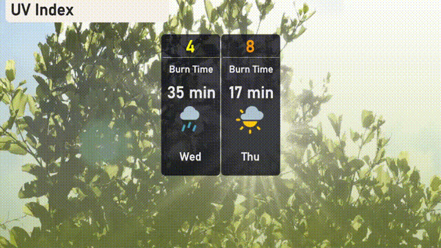
On Wednesday in Atlanta, the UV index will be moderate at 4, with sun exposure risks leading to a burn time of about 35 minutes. As you plan for Thursday, anticipate a high UV index of 8 which suggests a quicker burn time of just 17 minutes.
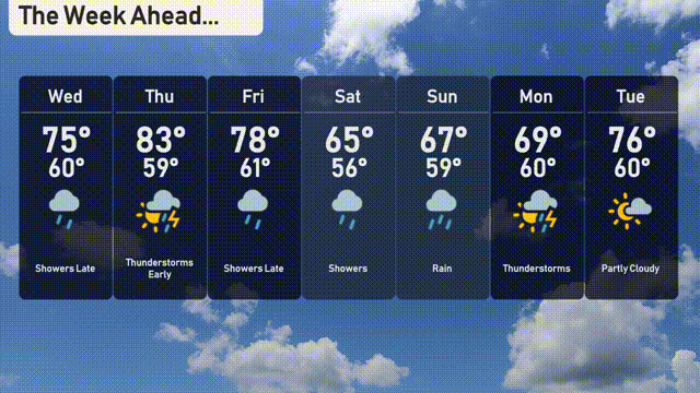
For the 7-day weather outlook in Atlanta:
Wednesday: Showers late in the day with a high of 75 degrees and a low of 60.
Thursday: Thunderstorms early with highs climbing to 83 degrees, the overnight low drops to 59.
Friday: Showers are likely, with temperatures reaching 78 degrees during the day and cooling to 61 at night.
Saturday: Cloudy with rain showers, expect a high of 65 degrees and a low of 56.
Sunday: Rainy, with temperatures peaking at 67 degrees and dipping to 59 overnight.
Monday: Thunderstorms return, hitting a high of 69 degrees with a low around 60.
Tuesday: Partly cloudy conditions with a daytime high of 76 degrees and a nighttime low of 60.