Atlanta’s Weather Lens: Cloud Cover & Looming Storms
By
Amy Freeze
Explore today's dynamic weather in Atlanta, from cloudy skies to imminent thunderstorms, and get a sneak peek into the weekly forecast.
Today in Atlanta, expect partly cloudy skies with a stormy afternoon on the way. Dive deeper into what this means for the Southeast.
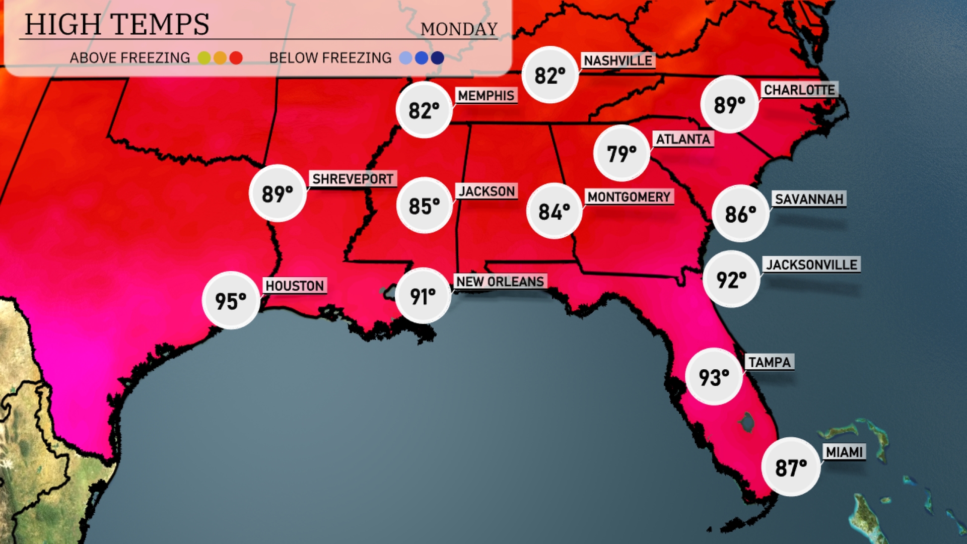
This comprehensive coverage of Atlanta’s weather today highlights the partly cloudy conditions with a detailed look at the moving storm front. Temperatures across the Southeast are rising, with Atlanta at a comfortable 82 degrees. Read on to discover how these conditions will evolve into the evening and the expected weather for the upcoming week, including potential thunderstorms and cooling temperatures post-front.
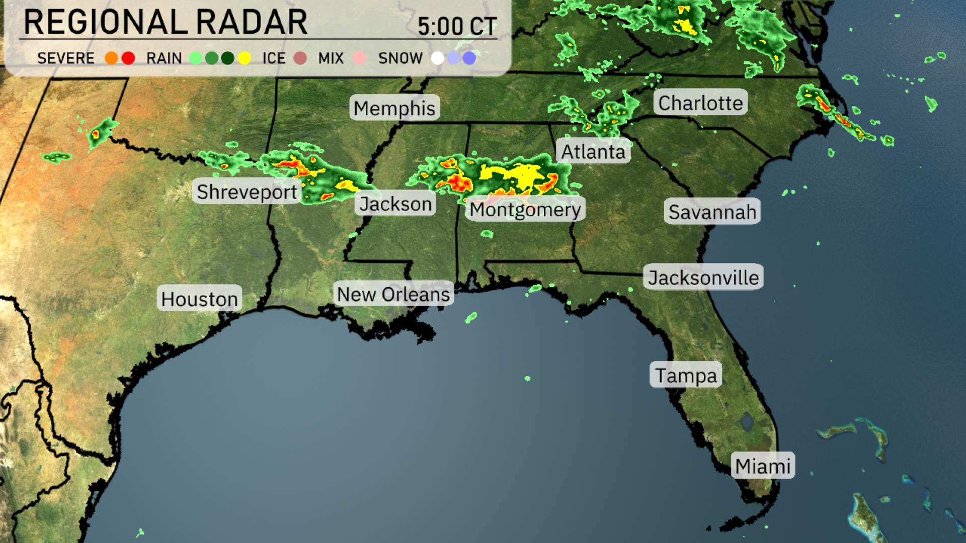
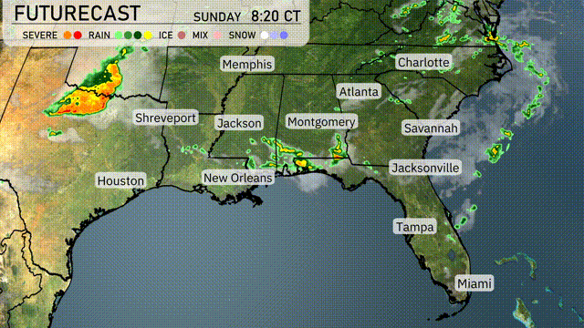
On the Regional Radar, a line of storms is sweeping from west to east, tracking from Shreveport, Louisiana towards Jackson, Mississippi. Memphis is experiencing moderate rainfall with potential thunderstorms moving southeast. Atlanta is currently under cloud cover with rain approaching from the west, promising a wet afternoon ahead. The coastal regions of the Carolinas, including Charlotte, are anticipating showers later as the weather system advances eastward.
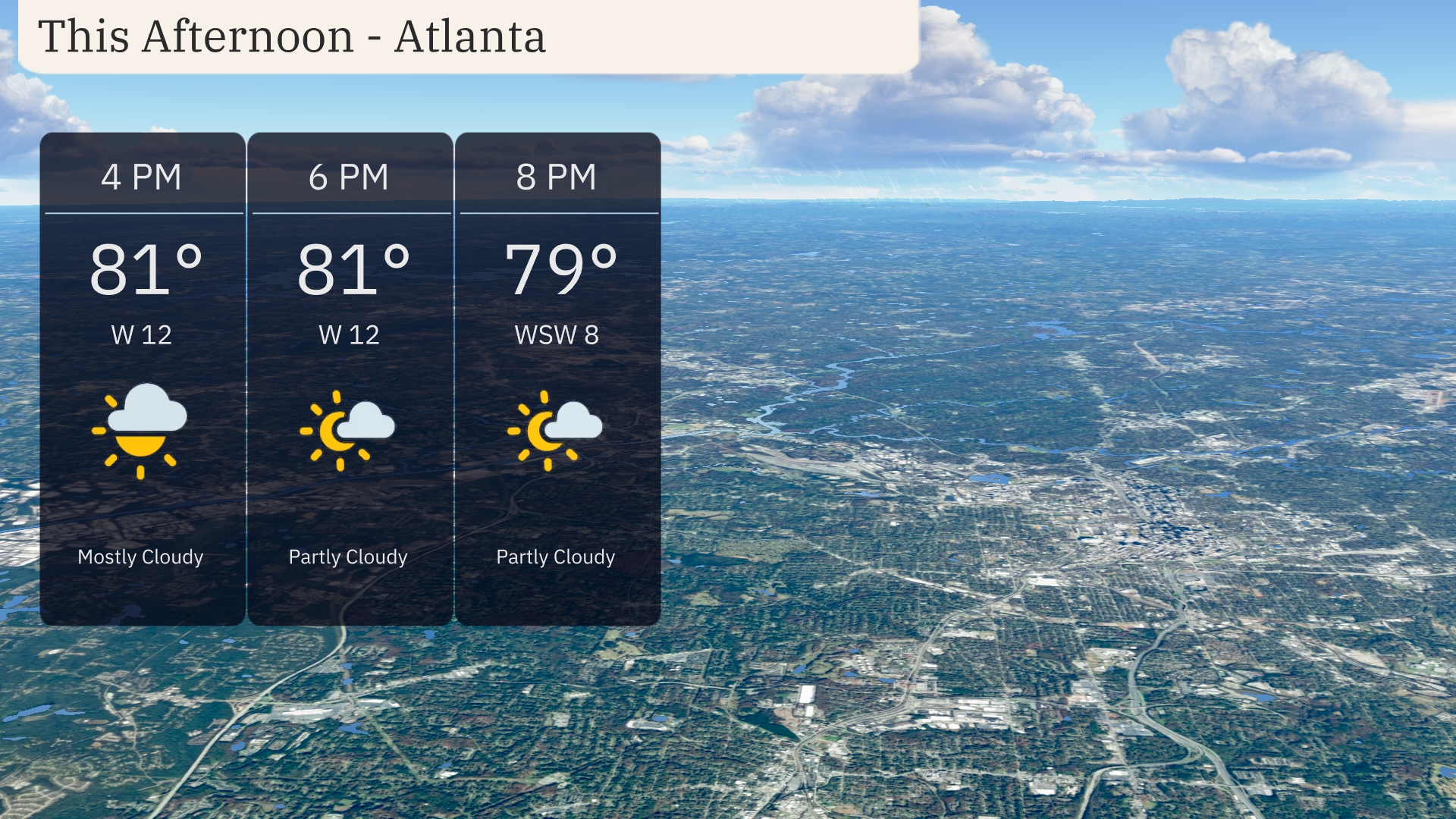
Throughout the afternoon in Atlanta, temperatures are consistent at 81 degrees, with a west-southwest wind at 12 miles per hour. Moving into the early evening, conditions remain warm with temperatures holding steady at 81 degrees, while the wind continues at 12 miles per hour. By 8 PM, the temperature slightly drops to 79 degrees, with a breeze shifting to 8 miles per hour from the west-southwest.
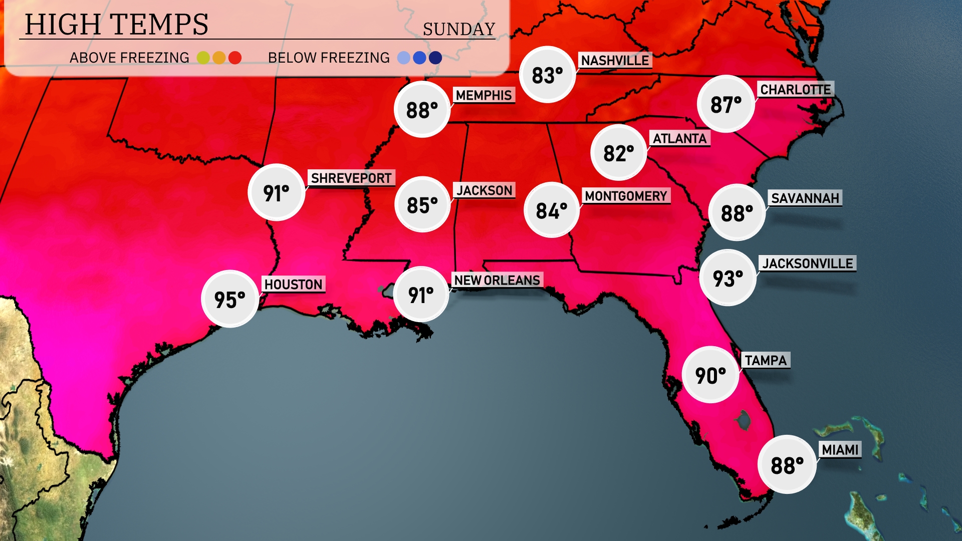
This afternoon’s high temperatures across the Southeast are heating things up! Houston is leading the pack at 95 degrees, while New Orleans reaches a steamy 91. Jacksonville is hot as well, hitting 93, and Atlanta checks in at a comfortable 82. Memphis is slightly cooler with a high of 88, while Tampa enjoys a warm 90. Keep in mind that this warm-up comes with the potential for scattered thunderstorms later in the day.
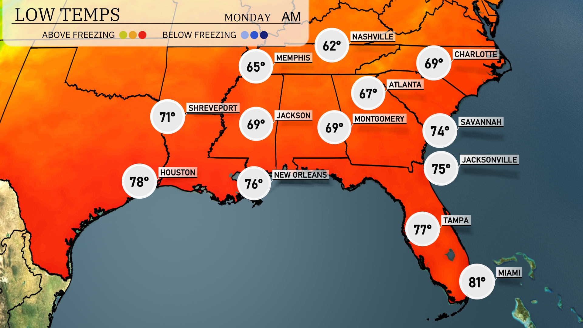
Tonight, Nashville will dip to 62 degrees, while Memphis is anticipated to see a low of 65. Jackson and Montgomery are both forecasted to settle at 69 degrees. Expect a cooler night in Shreveport with a low of 71, while warmer coastal cities like New Orleans and Tampa will remain much milder at 76 and 77 degrees respectively.
Tomorrow in Houston, expect a scorching high of 95 degrees, well above average for this time of year. New Orleans will also see elevated temperatures at 91 degrees, with plenty of humidity in the air. Meanwhile, Atlanta can anticipate a warm day with a high of 79 degrees. Further east, Jacksonville will heat up to 92 degrees, while Tampa reaches a sizzling 93 degrees.
A cold front will shift across the Southeast tomorrow, bringing showers and thunderstorms from Houston to New Orleans by morning, and progressing eastward to Montgomery and Atlanta by late afternoon. Expect rainfall accumulation around an inch, with potential for localized flooding. Isolated severe thunderstorms are possible with the main threats being damaging winds and hail from Shreveport to Savannah. Temperatures will drop by about 5-10 degrees across the region behind the front. Dry and cooler conditions are anticipated by late Tuesday into Wednesday as the front clears the area.
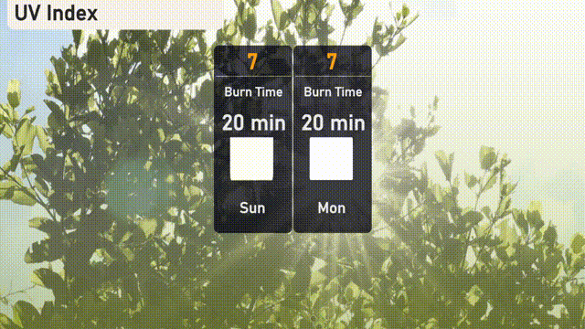
Atlanta’s UV index will be high today and tomorrow, reaching a level of 7, with a sunburn possible in about 20 minutes.