Atlanta’s Weather Watch: From Clear Skies to Storm Alerts
By
Amy Freeze
Meteorologist Amy Freeze guides you through Atlanta's changing weather patterns, from delightful sunny mornings to a caution for upcoming thunderstorms. Read for daily updates and tips!
Amy Freeze delves into the weather landscape of Atlanta—expect mostly sunny skies with a shift to stormier conditions by midweek. Get all the details on what to expect right here!
In this detailed post, Meteorologist Amy Freeze explains the weather dynamics from sunny forecasts to potential thunderstorms in Atlanta and across the Southeast. Understand the daily temperature fluctuations and how to prepare for the changing conditions. Plus, insights into UV index warnings and safety tips. Full 7-day forecast and comprehensive weather analysis inside!
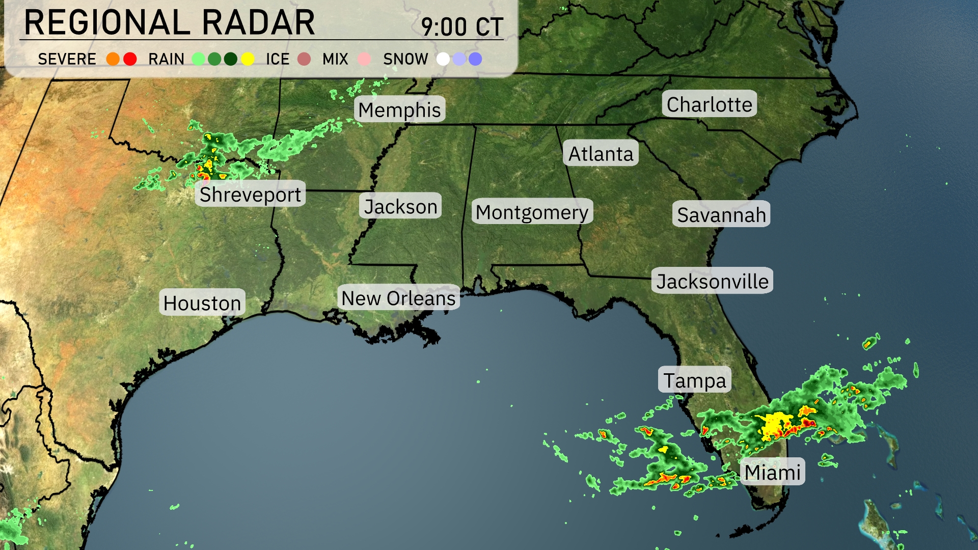
The Southeast region is currently experiencing a mix of weather conditions as indicated by the radar. A band of rain showers is stretching from Houston across New Orleans and into southern Mississippi, providing a wet start to the day in these areas. Meanwhile, Miami is on the edge of a more concentrated area of showers, including some heavy downpours pushing northward. Elsewhere across the region, cities like Atlanta and Charlotte are still under clear skies but should anticipate increased cloud cover later as the systems move. Jacksonville and Tampa are seeing scattered showers, which could intensify through the day.
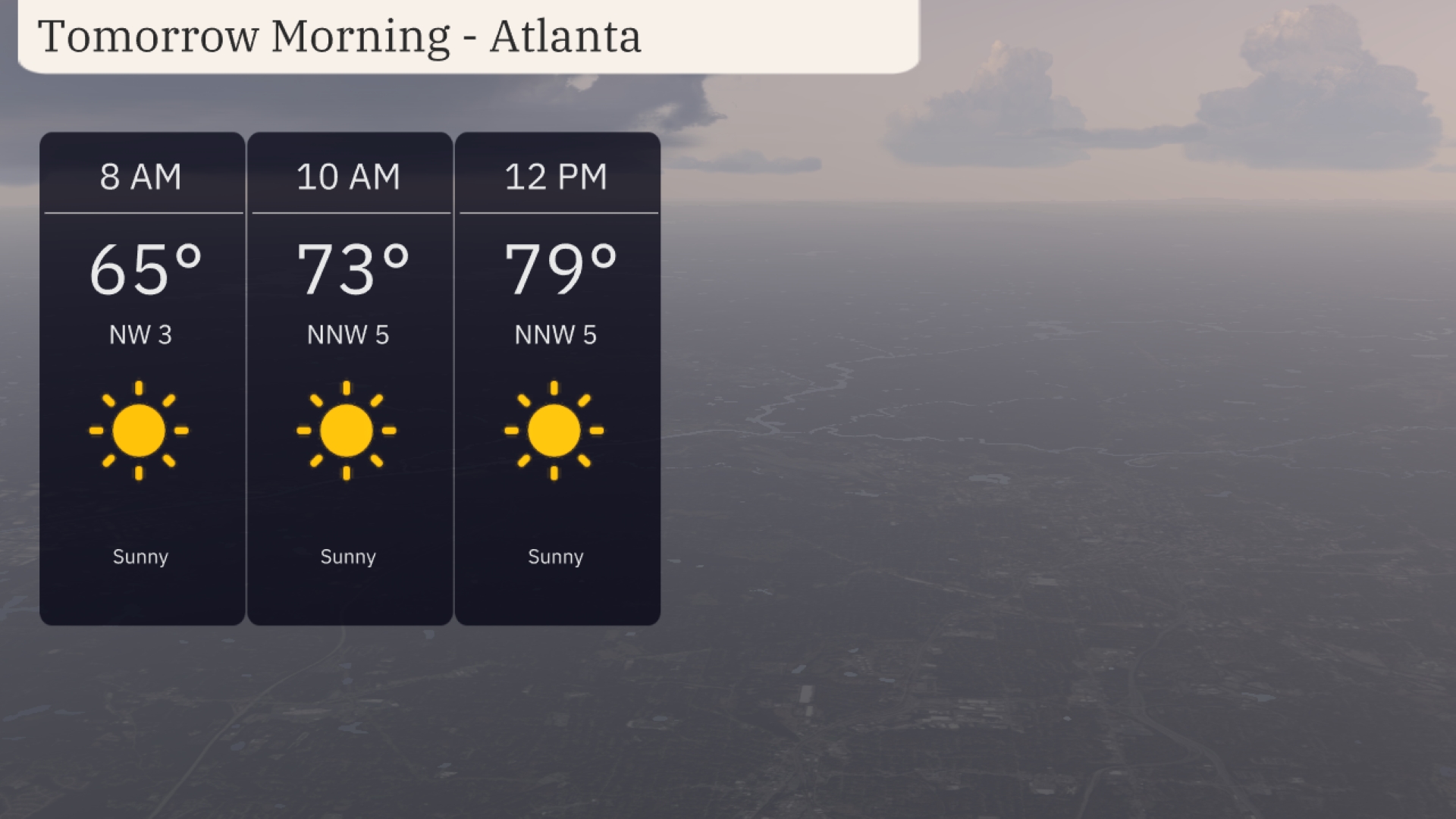
Tomorrow Morning in Atlanta, start the day with clear skies and a bright, sunny outlook. Temperatures rise from 65 degrees at 8 AM to 73 degrees by 10 AM, with a light north-northwest wind at 5 miles per hour. By noon, it will be 79 degrees under sunny skies, making for a pleasant start to your day.
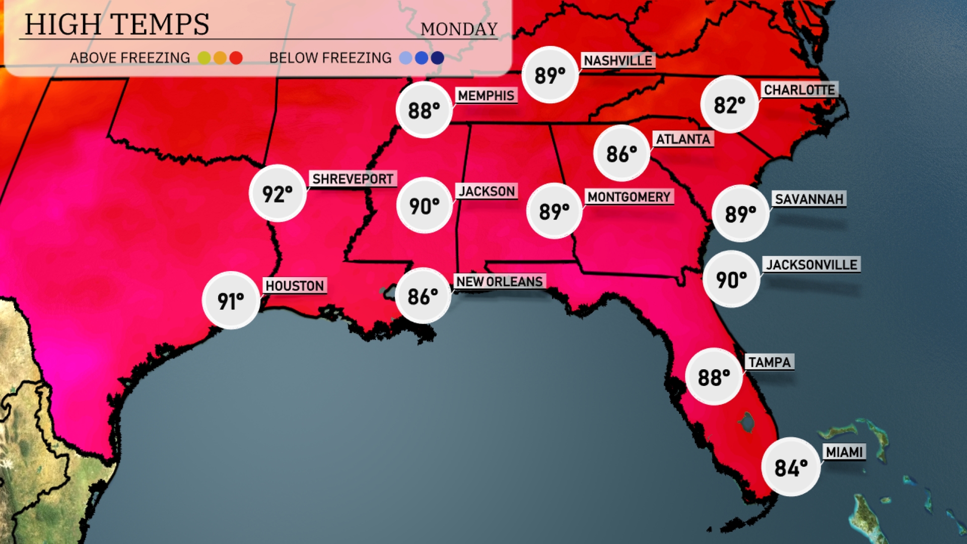
Tomorrow Atlanta is expected to reach 86 degrees, while Savannah will be slightly warmer at 89. Jacksonville and Montgomery both forecast highs of 90 degrees, indicating above-average warmth for this time of year. Meanwhile, Houston will see a high of 91, and Shreveport is anticipated to hit 92 degrees, making it one of the warmest spots in the area.
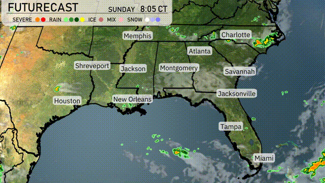
Starting Tuesday, an active weather pattern takes hold in the Southeast with increasing chances of thunderstorms due to a cold front pushing through the region. Look for scattered storms from Houston, progressing eastward through Shreveport, Jackson, and into Montgomery by Wednesday afternoon. The Greenville and Charlotte areas might experience localized heavy rain and strong winds, so stay weather aware. The frontal system will cool down temperatures slightly, offering a mild late week in cities like Atlanta and Jacksonville. Although no severe weather is expected at this time, keep an eye on updated forecasts as systems evolve.
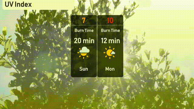
The UV index in Atlanta for Sunday is at a high of 7, suggesting a burn time of approximately 20 minutes in direct sunlight. As we move into Monday, the intensity increases with a UV index reaching 10, reducing the burn time to just 12 minutes!
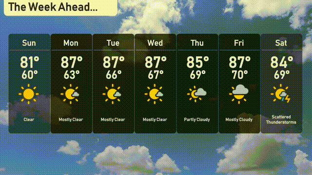
For the 7 day forecast in Atlanta:
Sunday: Clear skies with a high of 81 degrees and a low of 60.
Monday: Mostly clear, warming up with a high of 87 degrees and a low of 63.
Tuesday: Partly cloudy conditions with temperatures reaching a high of 88 degrees and a low of 66.
Wednesday: Another partly cloudy day, with a high of 87 degrees and a low again at 66.
Thursday: Partly cloudy, slightly cooler with a high of 85 degrees and a low of 69.
Friday: Watch for isolated thunderstorms, reaching a high of 86 degrees and a low of 70.
Saturday: Scattered thunderstorms expected, with a high of 84 degrees and a low of 69.