From Sunscreens to Umbrellas: Navigating Atlanta’s Week of Weather Extremes
By
Amy Freeze
Atlanta's week in weather delivers everything from scorching sun to severe storms. Explore how temperatures in the 90s and unexpected thunderstorms could affect your daily plans and safety precautions.
Atlanta faces a dynamic weather week ahead with high temperatures and potential thunderstorms. Get the latest on what each day holds and how to prepare for heat and rainfall.
This week in Atlanta’s weather brings a rollercoaster of conditions. With temperatures soaring up to the 90s and thunderstorms on the horizon, knowing how to navigate these extremes is crucial. Learn about the high UV index and its dangers, and get practical tips on managing through the heat and potential storms. Plus, discover what each day has in store from sunny skies to significant downpours and how these can impact your outdoor plans.
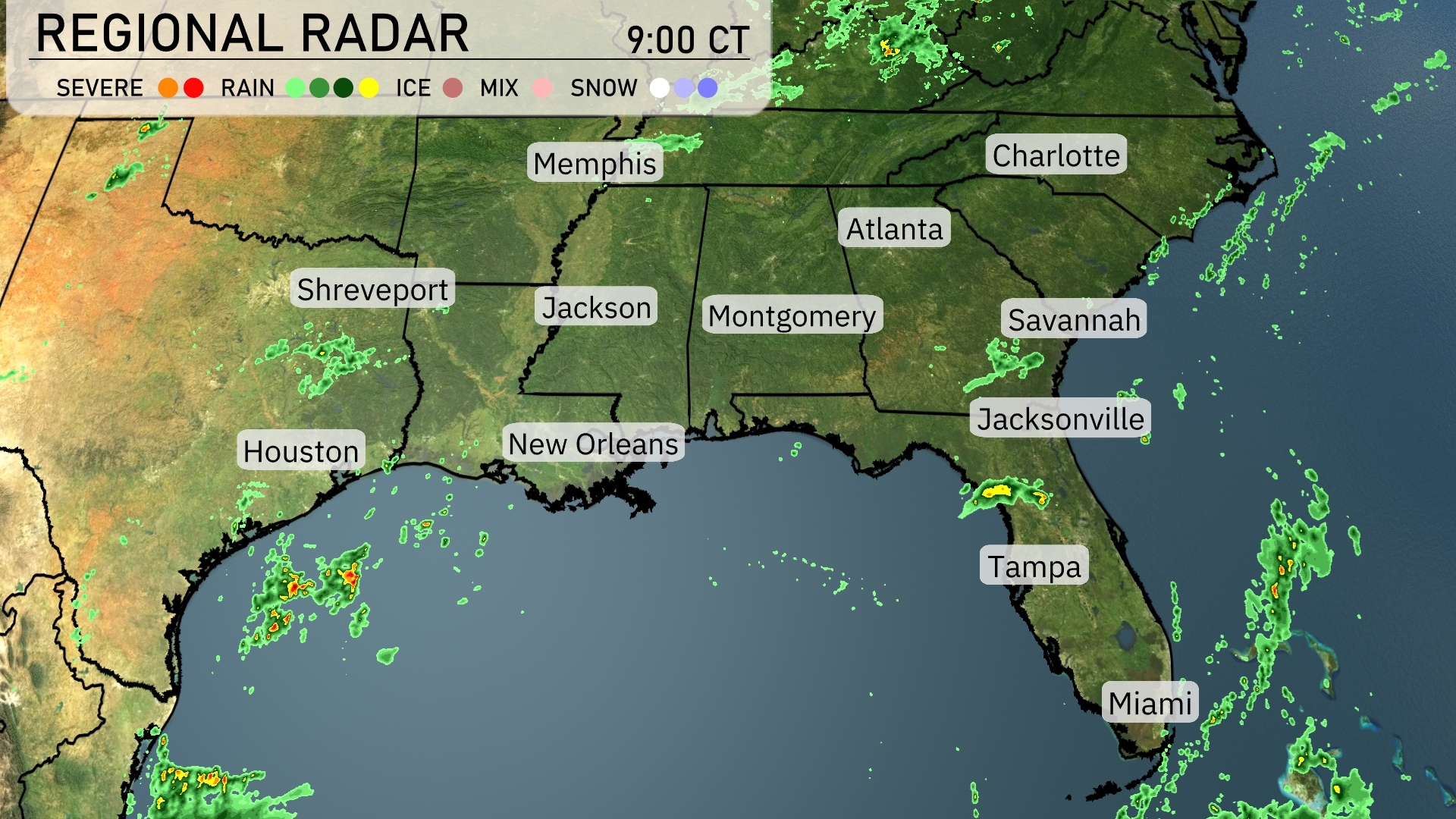
The radar shows scattered showers moving through central Alabama, making their way toward Montgomery. Rainfall is currently affecting areas east of Jacksonville, Florida, with additional showers dotted along the coastlines stretching south towards Miami. Memphis remains dry with clear conditions, while Houston is experiencing more isolated storm activity offshore in the Gulf. Meanwhile, clouds are increasing around Charlotte as a weather system approaches from the west.
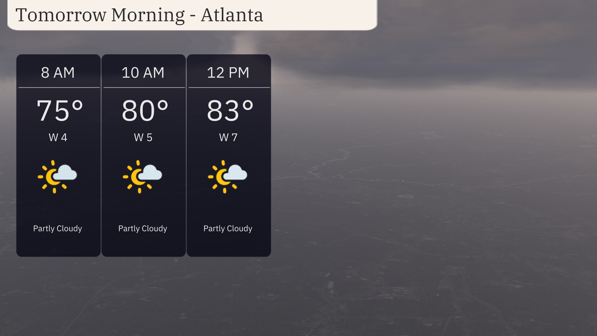
Atlanta’s tomorrow morning weather will start off partly cloudy with temperatures at 75 degrees at 8 AM. By 10 AM, expect temperatures to rise to 80 degrees with winds from the west at 5 miles per hour. As we approach midday, temperatures will reach 83 degrees, with a slight increase in wind speeds to 7 miles per hour.
Tomorrow, high temperatures in the Southeast will soar, with Atlanta reaching 90 degrees. Memphis will be close behind at 89 degrees, while Montgomery also anticipates a high of 90. New Orleans is set for 88 degrees, and further south, Tampa should see a warm 93 degrees. These temperatures are well above average for this time of year, driven by a high-pressure system bringing warmth and clear skies across the region.
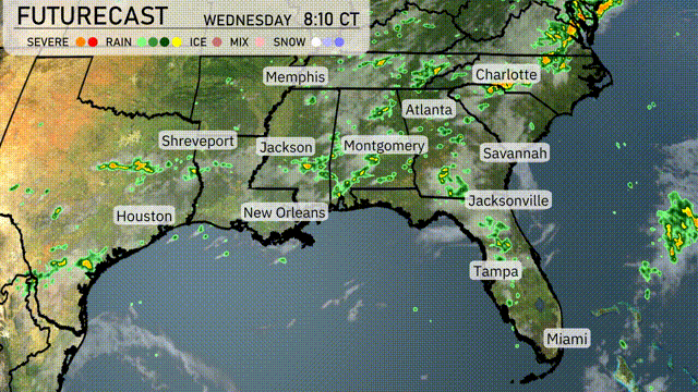
Expect a dynamic day across the Southeast as showers and thunderstorms develop in the region. A cold front advances eastward, impacting areas from Houston to Charlotte, with New Orleans and Atlanta seeing scattered thunderstorms by morning. Heavy rainfalls are possible, especially from Montgomery to Savannah, which could lead to localized flooding. Temperatures will hover in the mid-80s before cooling slightly behind the front. Remain alert for severe weather alerts, as isolated storms may be strong, particularly in Mississippi and Alabama.
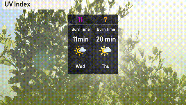
The UV index in Atlanta on Wednesday will be very high at 11, with a burn time of just 11 minutes in direct sunlight. Exercise caution and wear a hat, sunglasses, and sunscreen if outdoors. Thursday’s index will be high at 7, with sunburn possible in about 20 minutes.
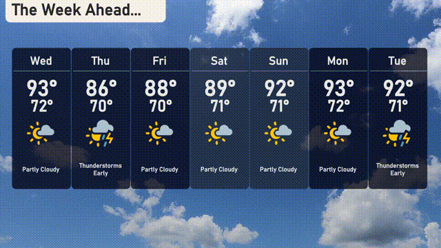
For the 7 day forecast in Atlanta:
Wednesday: Expect partly cloudy skies with a high of 93 degrees and a low of 72 degrees.
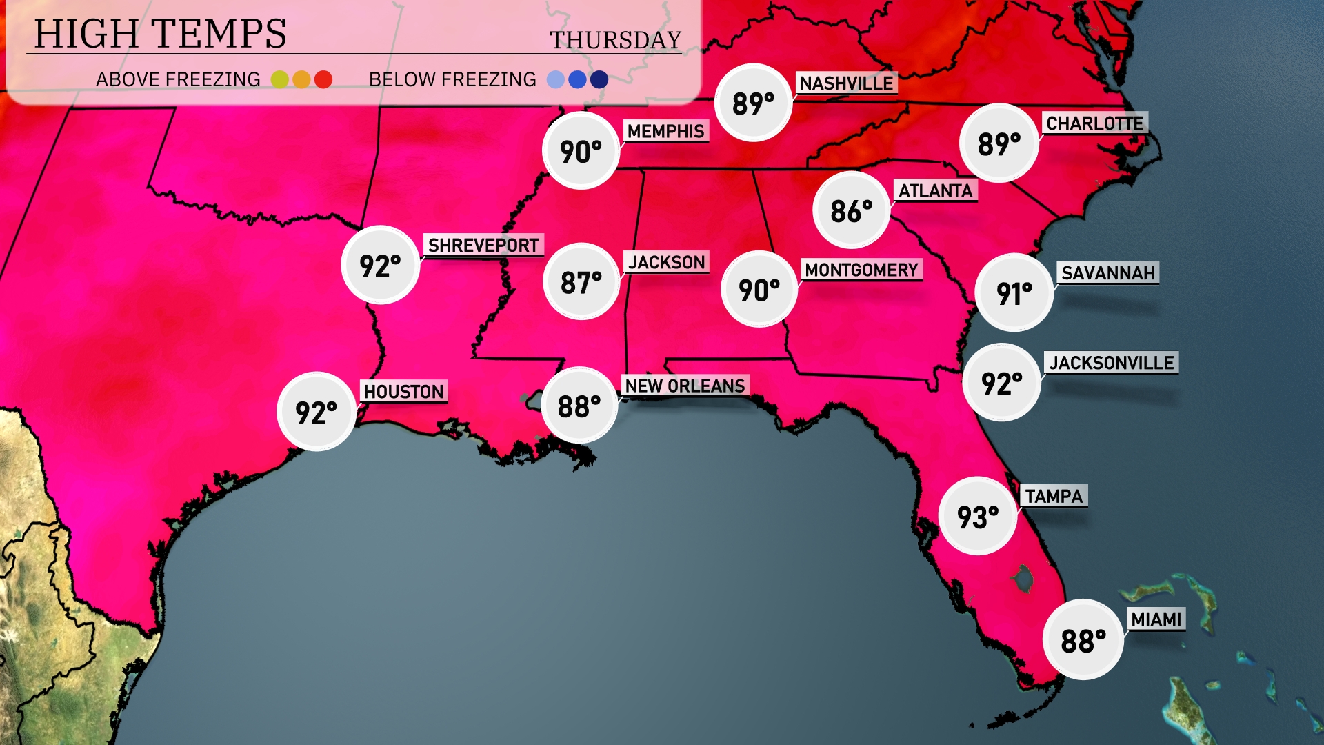
Thursday: Thunderstorms are likely early, followed by a high of 86 degrees and a low of 70 degrees.
Friday: Partly cloudy day on Friday with a high reaching 88 degrees and a low at 70 degrees.
Saturday: Partly cloudy again, temperatures will hit a high of 89 degrees and drop to 71 degrees overnight.
Sunday: Mostly sunny with a daytime high of 92 degrees and an overnight low of 71 degrees.
Monday: Another day of sunshine with temperatures climbing to 93 degrees during the day and a low of 72 degrees.
Tuesday: Thunderstorms likely early, expect a high of 92 degrees with a low of 70 degrees.
Stay safe and enjoy the week in the Peach State!