Atlanta’s Weekly Weather Watch: From Scorching Heat to Storm Alerts
By
Amy Freeze
Explore how Atlanta's weather will shift from sunny skies to potential storms with our breakdown of the Southeast's unpredictable weather pattern this week.
Stay updated with Atlanta’s variable weather this week—from sunny mornings to impending storms. Discover the impact on your area and how to stay prepared.
This week in Atlanta promises a roller-coaster of weather conditions, spanning from partly cloudy mornings with bearable temperatures to intense afternoon heats and likely storm alerts. Understand the nuances of this week’s highs and lows across the region, potential storm paths including severe weather threats and learn crucial safety tips to navigate the unpredictable Southeast weather comfortably.
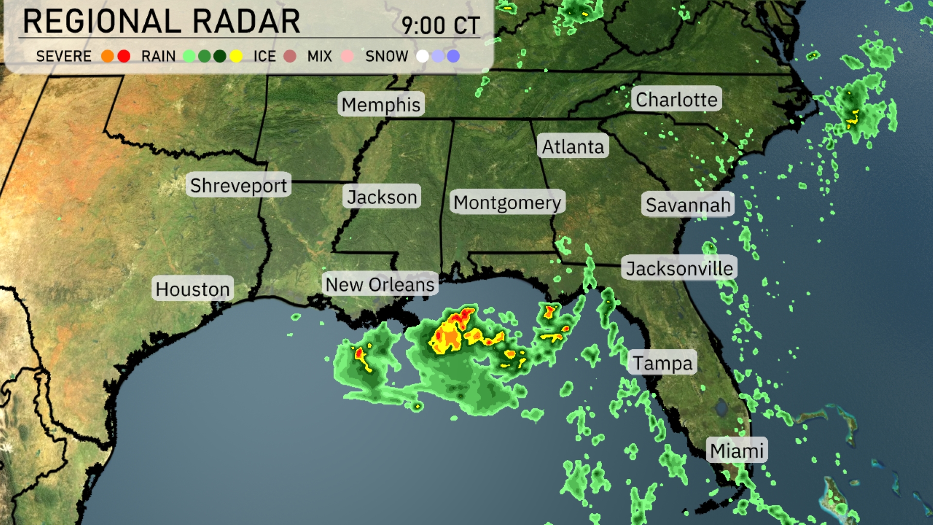
A stormy system is currently impacting the Southeast region, with severe weather just south of New Orleans extending over the Gulf of Mexico. Showers are tracking through Jackson and heading northeast towards Atlanta, with Montgomery seeing increased cloud cover. Rainfall is also approaching Jacksonville and spreading across northern Florida. Charlotte remains mostly dry, although conditions are expected to change as the system progresses.
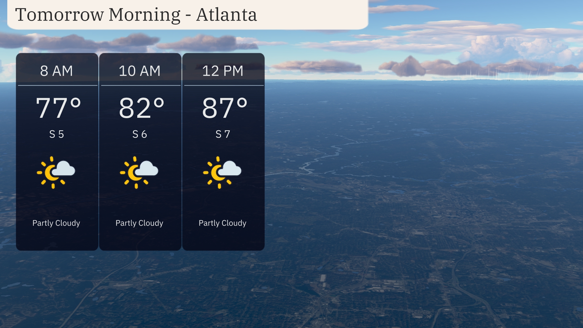
For tomorrow morning in Atlanta, temperatures rise from 77 degrees at 8 AM to 87 degrees by midday. Expect partly cloudy skies throughout the morning, accompanied by a gentle south breeze at 5 to 7 miles per hour. It’s a warm start, so ensure you’re staying cool and hydrated.
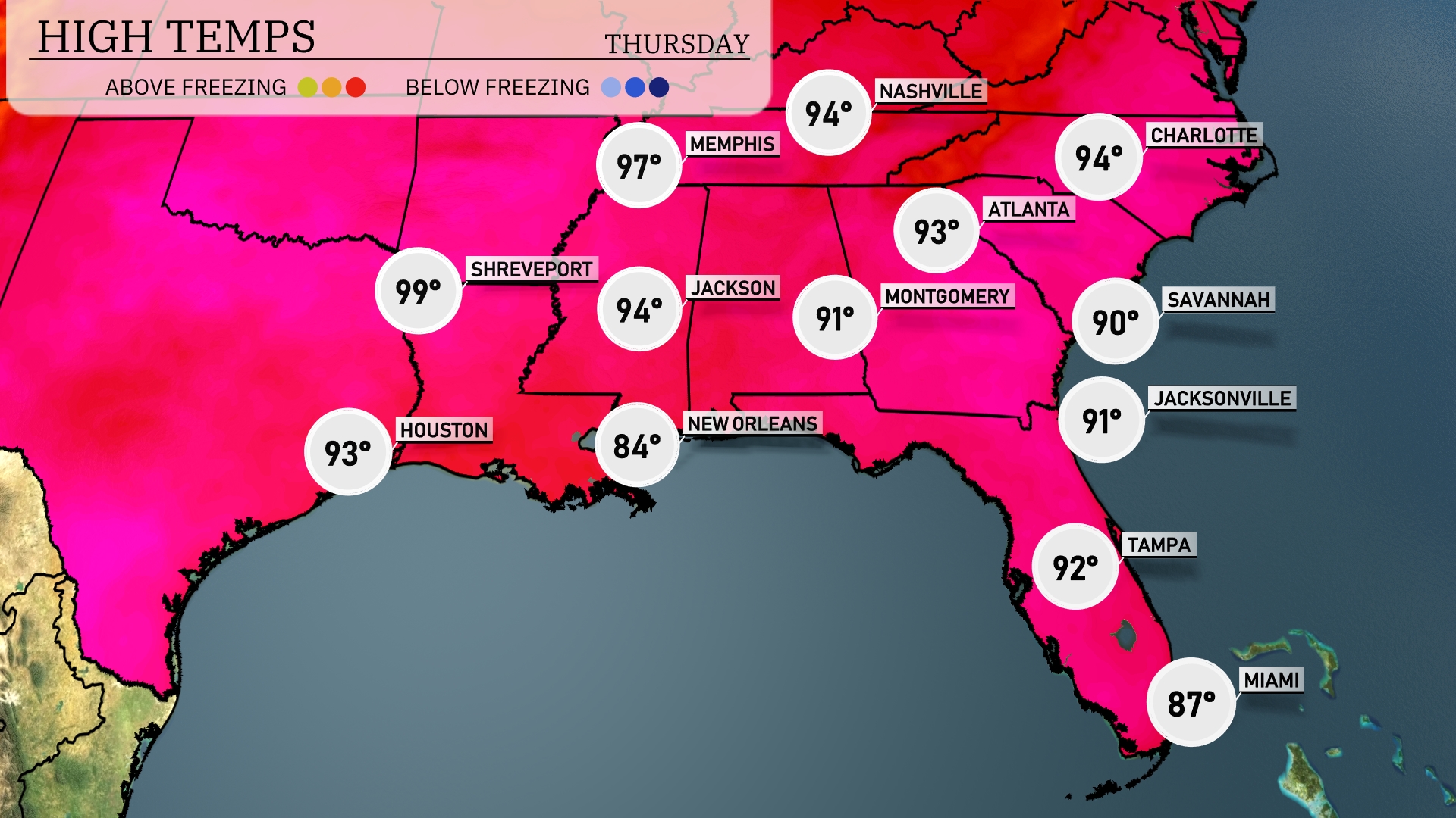
Tomorrow, Shreveport will soar to a scorching 99 degrees, while Jackson hits a high of 94. In Atlanta, expect temperatures around 93, with Charlotte not far behind at 94. Montgomery will reach 91 degrees, showcasing the warmth across the Southeast. New Orleans, meanwhile, will be slightly cooler at 84, illustrating a diverse temperature trend in the region.
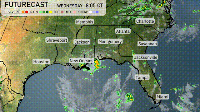
A slow-moving cold front is making its way through the Southeast, bringing scattered thunderstorms and heavy rainfall from Houston to Miami. By tomorrow morning, anticipate these storms intensifying as they progress eastward, impacting major cities like New Orleans, Montgomery, and Atlanta, potentially causing flood concerns due to heavy downpours. Along the Gulf Coast, isolated severe storms with damaging winds are possible from New Orleans to Jacksonville. Coastal areas like Tampa and Savannah will experience persistent showers and storms lifting up from the Gulf, especially during the late afternoon into the evening. As the front passes, expect a slight drop in temperatures across the region but improvement in conditions by late Thursday.
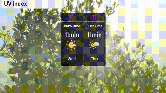
The UV index in Atlanta escalates to a very high 11 today and tomorrow. Expect to experience sunburn in just about 11 minutes under direct sunlight, so apply sunscreen liberally and wear protective clothing.
For the 7 Day Outlook in Atlanta:
Wednesday: Partly cloudy with a high of 92 degrees and a low of 75.
Thursday: Continuation of partly cloudy skies with temperatures reaching 93 degrees and a low of 74.
Friday: Another partly cloudy day, expect a high of 92 degrees and a low of 73.
Saturday: Partly cloudy conditions persist with the temperature peaking at 92 degrees and a low of 74.
Sunday: Isolated thunderstorms are possible, with a high of 92 degrees, cooling down to 74 degrees at night.
Monday: Partly cloudy skies again, highs around 93 degrees with a nighttime low of 74 degrees.
Tuesday: Thunderstorms are anticipated early, bringing a daytime high of 93 degrees and a low of 74 degrees.