Explore the dynamic weather patterns transforming Austin this week, from serene sunsets to upcoming storms.
This week in Austin brings changing skies and notable temperature shifts. Stay tuned for daily details and safety tips!
In this week’s Austin weather update, we experience everything from mild evenings to potential severe storms across the Southern Plains. With temperatures oscillating and dramatic weather incoming, it’s crucial to stay prepared. Our blog dives deeper into what each day holds, backed by expert forecasts and tips to navigate the capricious Texas weather efficiently. For your daily updates and more, click here: https://amyfreeze.ai/austin-evening-chill-weekly-weather-dynamics
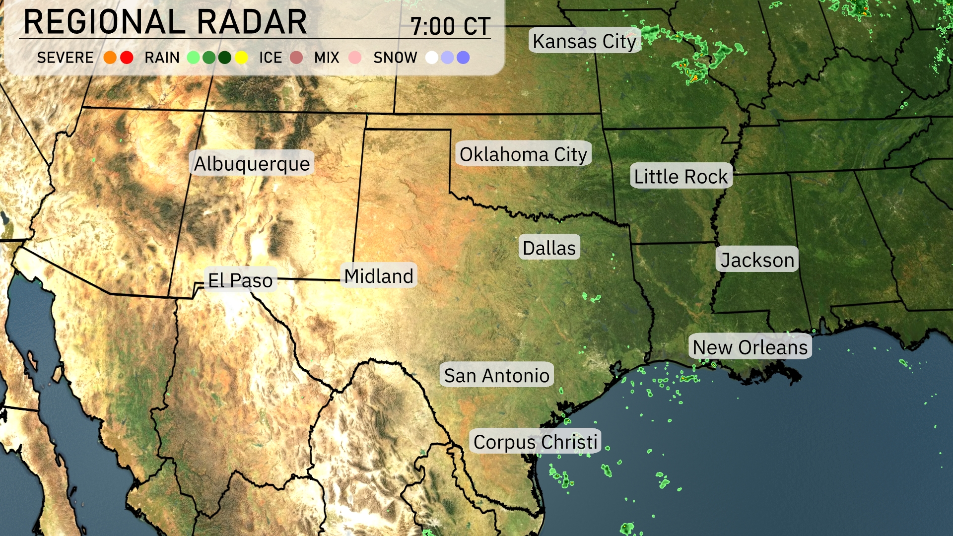
The Southern Plains are experiencing a tranquil morning with plenty of sunshine across most areas, providing a gentle start to the day. A few isolated showers are popping up near Dallas and Corpus Christi, though they are sparse at the moment. As we look towards Kansas City, there’s a hint of some cloud cover building up, but it’s staying dry for now. Texas cities like El Paso and San Antonio are basking in clear skies, making it ideal for outdoor plans.
This evening in Austin, temperatures begin at 86 degrees at 9 PM, gradually cooling to 82 degrees by 1 AM. Winds will maintain a southeast direction at about 6 miles per hour. The cloud cover will start as mostly cloudy, shifting to partly cloudy as we move through the late evening. Overall, it should be a calm and pleasant night ahead.
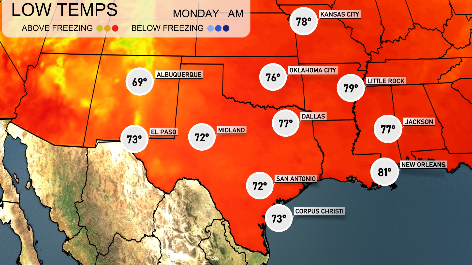
Tonight in the Southern Plains, temperatures will dip significantly, with Dallas reaching a low of 77 degrees. Oklahoma City is expected to see a nighttime low of 76, while Midland will drop to 72 degrees. San Antonio and El Paso will remain warmer, both settling at 72. Meanwhile, Little Rock will cool down to 79 degrees.
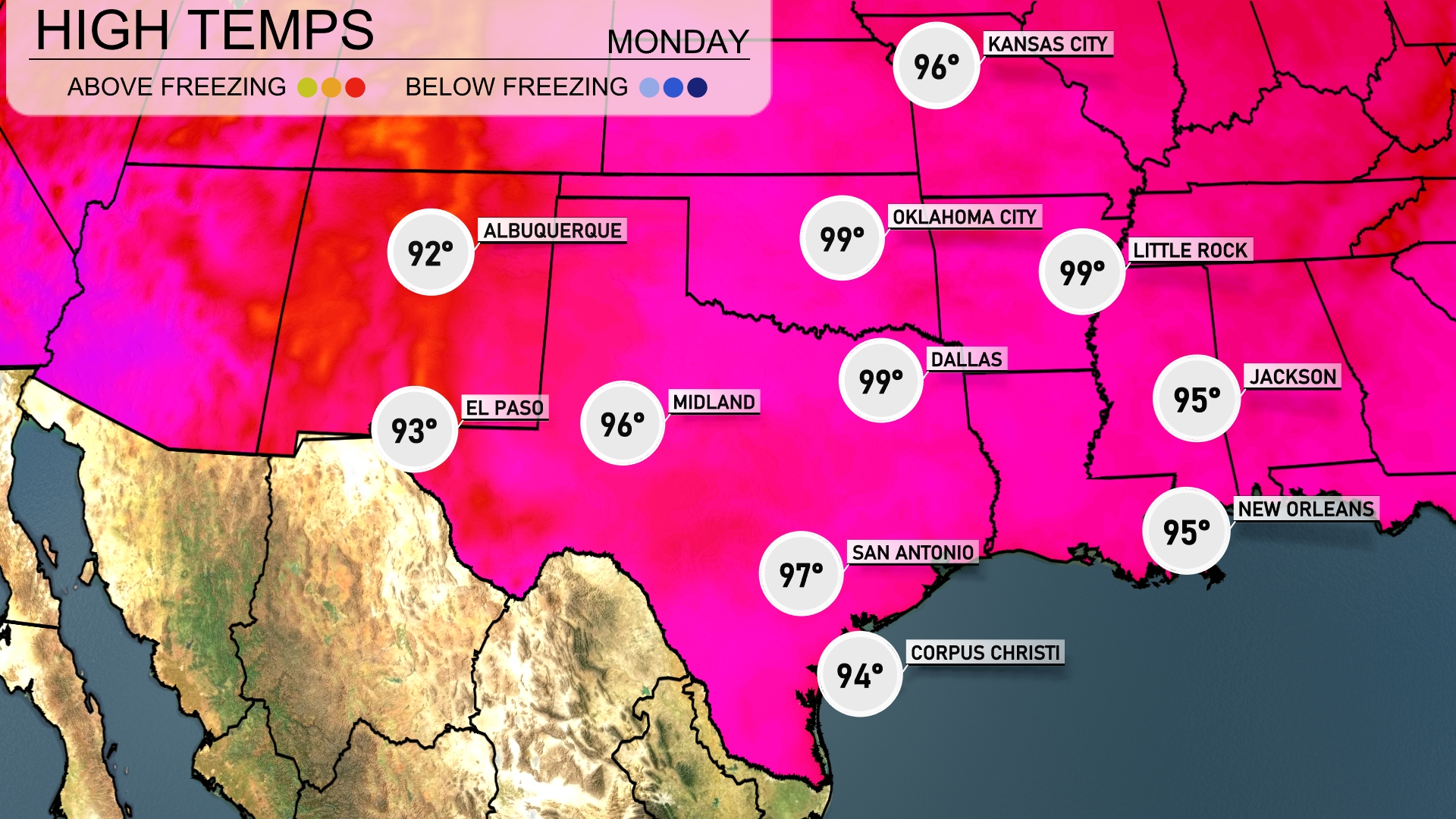
Tomorrow in El Paso, the high will reach 93 degrees. Midland is expected to be a bit warmer at 96 degrees. San Antonio will see the temperature climb to 97 degrees, while Corpus Christi is forecasted for a high of 94 degrees. Dallas will heat up to 99, matching Oklahoma City’s high. Little Rock also anticipates reaching 99 degrees, indicating a region experiencing above-average temperatures.
Look for some pretty dynamic weather across the Southern Plains, with rain sweeping in from Dallas down to Corpus Christi, giving some welcome moisture to the area. Oklahoma City may experience stronger storms, so keep an eye out. With an unstable air mass combined with an incoming cold front, there’s a real possibility of severe weather from Jackson to New Orleans. Over the next 24 to 48 hours, these developments could lead to much cooler temperatures and some beneficial rainfall across the plains, though flash flooding is a risk in prone areas.
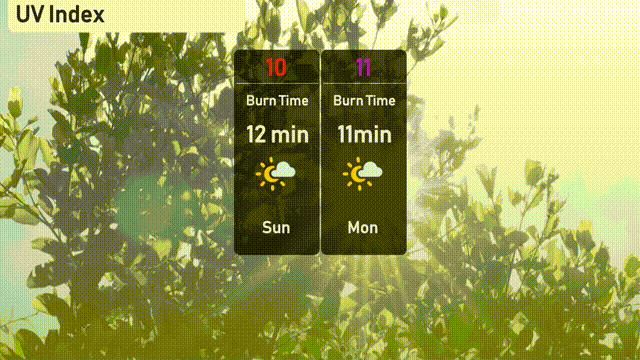
The UV index in Austin will be extreme at 10 on Sunday, with a burn time of just 12 minutes in direct sunlight. On Monday, it reaches an even higher level of 11, reducing the burn time to a rapid 11 minutes! Make sure to use strong sunscreen and take extra precautions against prolonged sun exposure.
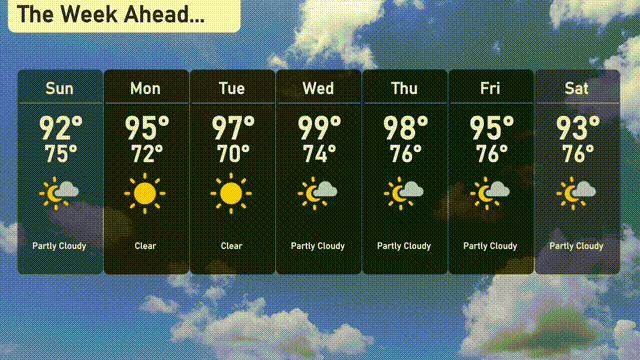
For the 7-day forecast in Austin:
Sunday: Partly cloudy with a high of 92 degrees and a low of 75 degrees.
Monday: Clear skies expected and warmer, reaching a high of 95 degrees, cooling to 72 degrees at night.
Tuesday: Clear again; heating up even more with a high of 97 degrees and a low of 70 degrees.
Wednesday: Watch for partly cloudy skies, with temperatures peaking at 99 degrees and an overnight low of 74 degrees.
Thursday: Partly cloudy with a bit of a cool down to a high of 98 degrees and a low of 76 degrees.
Friday: Partly cloudy skies continue, with highs around 95 degrees. The low will be 76 degrees.
Saturday: Partly cloudy, with temperatures reaching 93 degrees for the high and a low of 76 degrees.
Stay safe out there, and enjoy the week!