Austin Heats Up: A Look at This Week’s Sizzling Southern Plains Forecast
By
Amy Freeze
Explore the dynamic weather patterns affecting Austin and the Southern Plains with a detailed look at the week’s temperatures, storm forecasts, and essential weather safety tips.
This week in Austin: Expect soaring temperatures, scattered showers, and extreme UV levels! Dive into our blog for a detailed look at what’s coming up in the weather across the Southern Plains.
This week, the Southern Plains, particularly Austin, are witnessing some dramatic weather shifts—from sizzling temperatures around 97°F to potential severe storms. With the UV index hitting critical highs, it’s crucial to stay protected. Explore our complete guide packed with forecasts, safety tips, and insights into the regional weather trends.
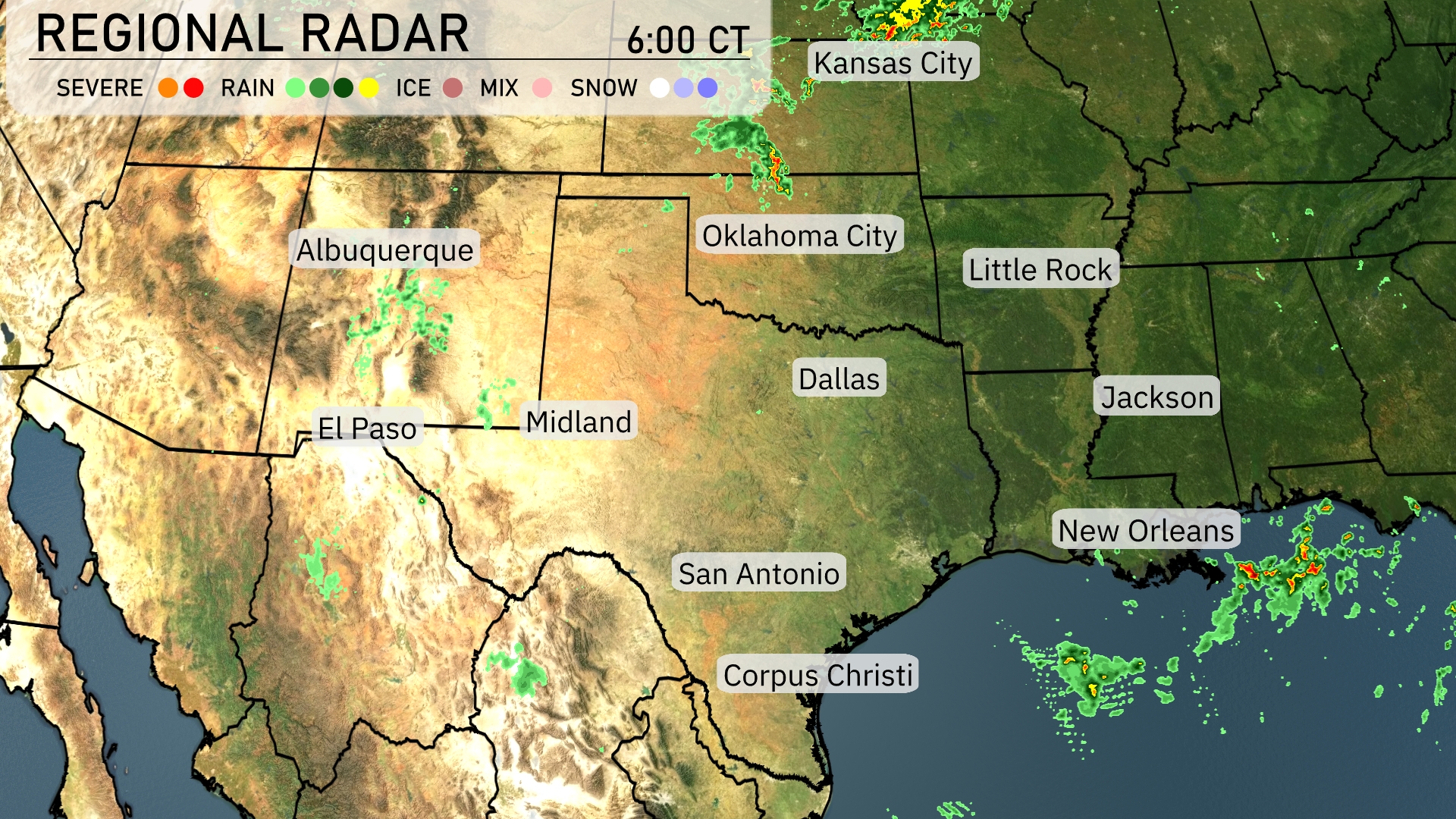
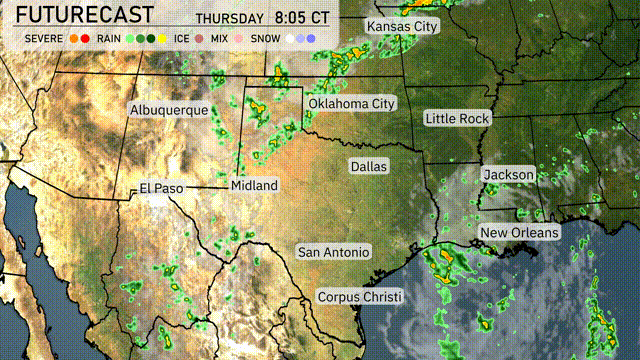
The regional radar reveals a line of storms sweeping across southeastern New Mexico, pushing eastward toward West Texas. Some scattered showers are affecting central New Mexico, particularly around Albuquerque. Meanwhile, the Texas Panhandle near Oklahoma City and parts of southern Kansas remains mostly clear. Clouds are gathering along the Gulf Coast near New Orleans, where localized rainfall can be expected.
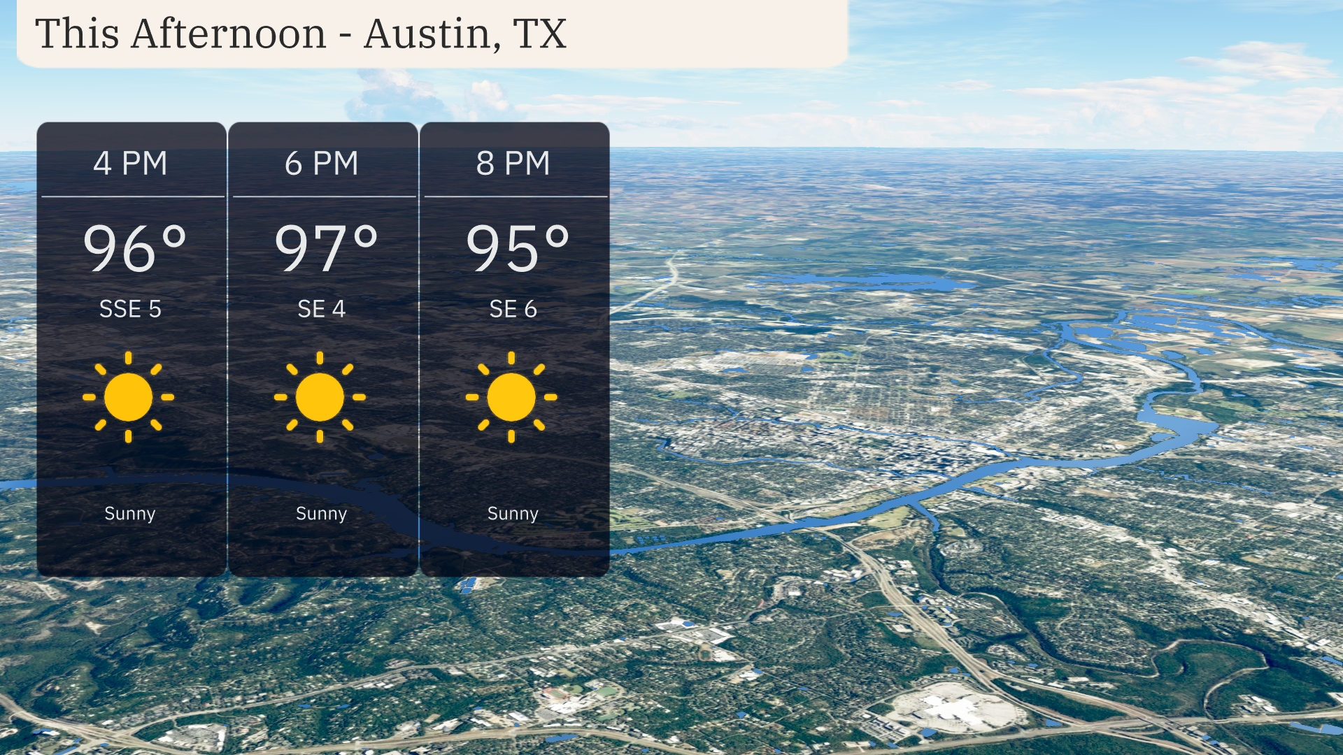
Temperatures in Austin this afternoon are heating up to 97 degrees with lots of sunshine. Winds will be light, shifting slightly from south-southeast to east-southeast at 4 to 6 miles per hour. It’s a good day to stay hydrated and enjoy the warm, sunny weather.
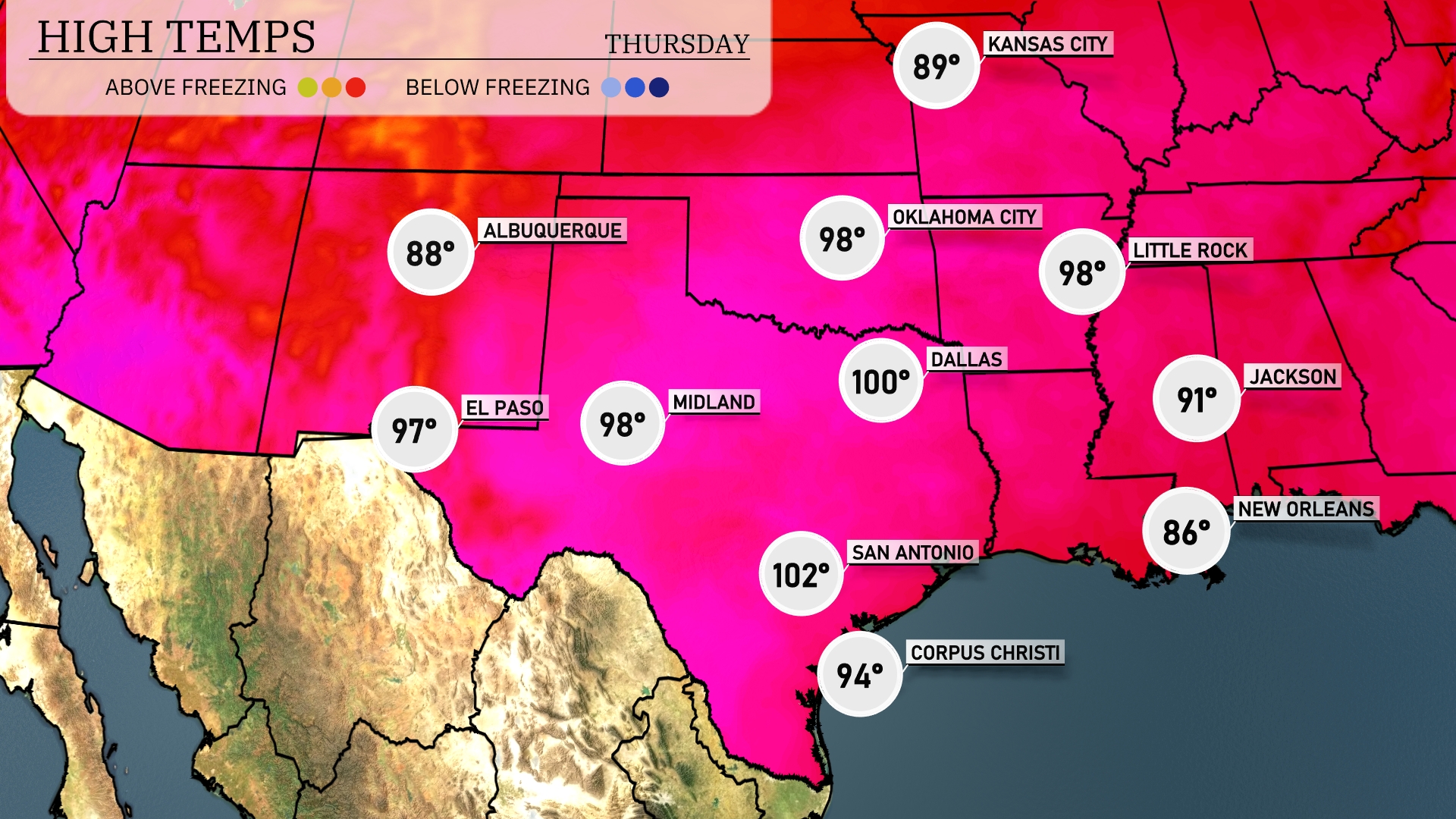
Today’s regional high temperatures show a real contrast across the Southern Plains. In Dallas, we’re looking at a sizzling high of 100 degrees, while Midland is not far behind at 98. San Antonio is feeling the heat too, reaching a high of 102 degrees. Meanwhile, Oklahoma City is set to hit a high of 98, creating quite the warm atmosphere throughout the region. Down in New Orleans, expect a cooler sea breeze with a high of 86 degrees.
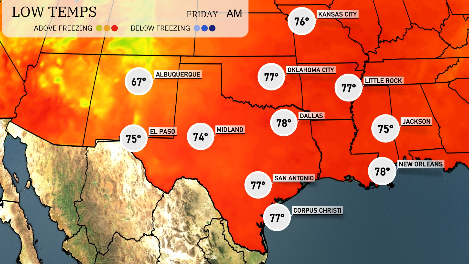
Tonight, Oklahoma City will drop to 77 degrees. In Dallas, expect a low of 78, while Midland cools to 74. San Antonio is forecasted to reach 77 degrees, and Little Rock will see a low of 75. Albuquerque will be slightly cooler at 67 degrees, indicating a notable drop in temperatures across the Southern Plains.
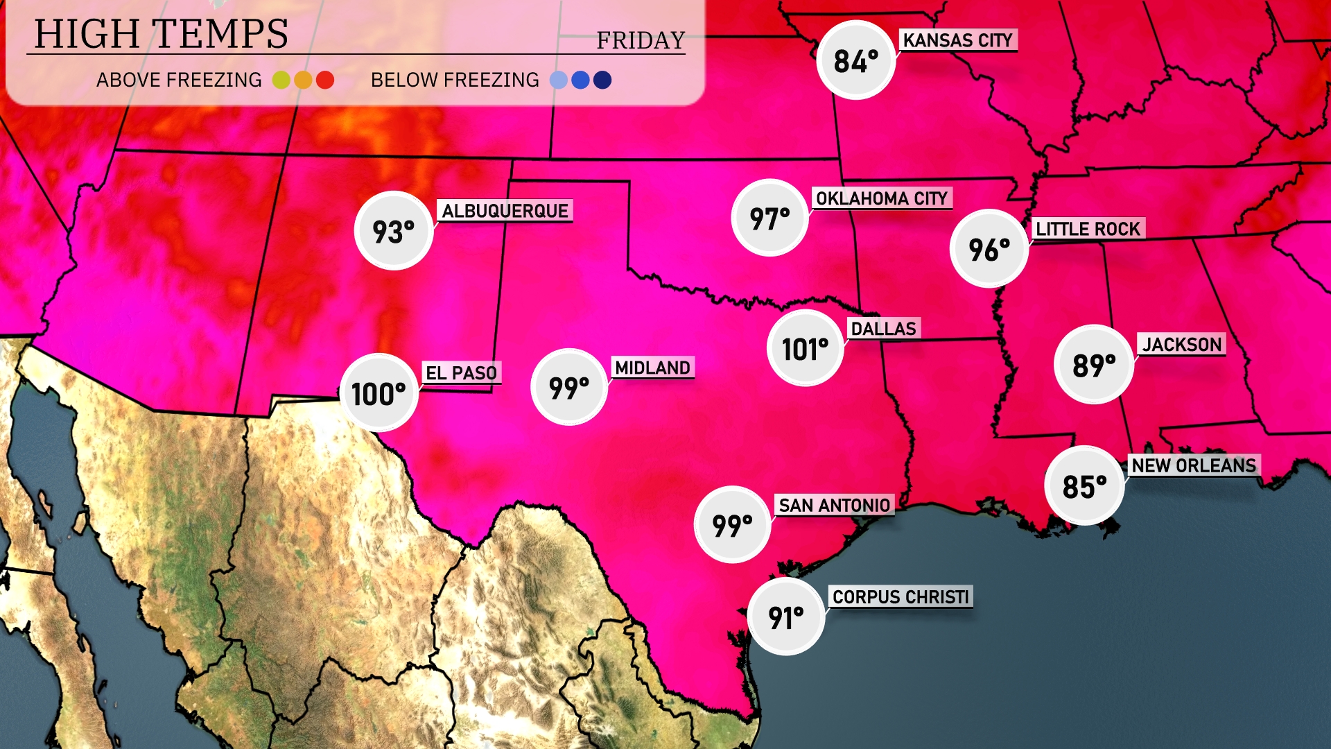
Tomorrow, El Paso anticipates a scorching high of 100 degrees. Midland will reach 99 degrees, while Dallas will be slightly warmer at 101 degrees. San Antonio will also see a high of 99 degrees, indicating a trend of above-average temperatures across the region. Meanwhile, temperatures in Corpus Christi and New Orleans will be milder, peaking at 91 and 85 degrees, respectively. These warm highs are influenced by a persistent heat pattern across the Southern Plains.
Expect a dynamic weather day tomorrow across the Southern Plains. Scattered showers and thunderstorms are forecast from Dallas to Corpus Christi, bringing beneficial rainfall to the region. Oklahoma City could experience stronger storms, with the potential for heavy rainfall and gusty winds. An unstable air mass, combined with an approaching cold front, elevates the risk for severe weather, particularly in the southeast portion of the area through Thursday night. Stay alert for any severe weather alerts as the situation develops.
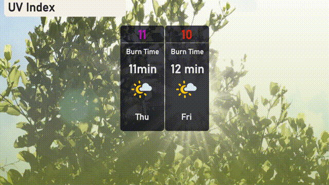
The UV index in Austin is expected to be extreme on Thursday with a value of 11, leading to a rapid burn time of just 11 minutes. Stay protected with broad-spectrum sunscreen and protective clothing. On Friday, an index of 10 means only slightly less time in the sun for a burn—around 12 minutes.