Weather Whiplash: Austin’s Sunny Highs and Stormy Lows
By
Amy Freeze
Explore a detailed forecast of Austin's weather: clear skies mixed with storm predictions and temperature spikes. Stay prepared with insightful weather trends.
Don’t miss a beat with our detailed weather analysis for Austin and the Southern Plains. From high heat to storm surges, know what’s coming.
Austin greets the day with partly sunny skies and a gentle southern breeze, while nearby regions brace for varying weather patterns. Discover temperature trends, storm predictions, and essential tips to navigate the Southern Plains’ weather dynamics efficiently. With a UV index at a peak, understanding sun safety is more crucial than ever. Stay updated with our in-depth analysis and prepare effectively for the week ahead.
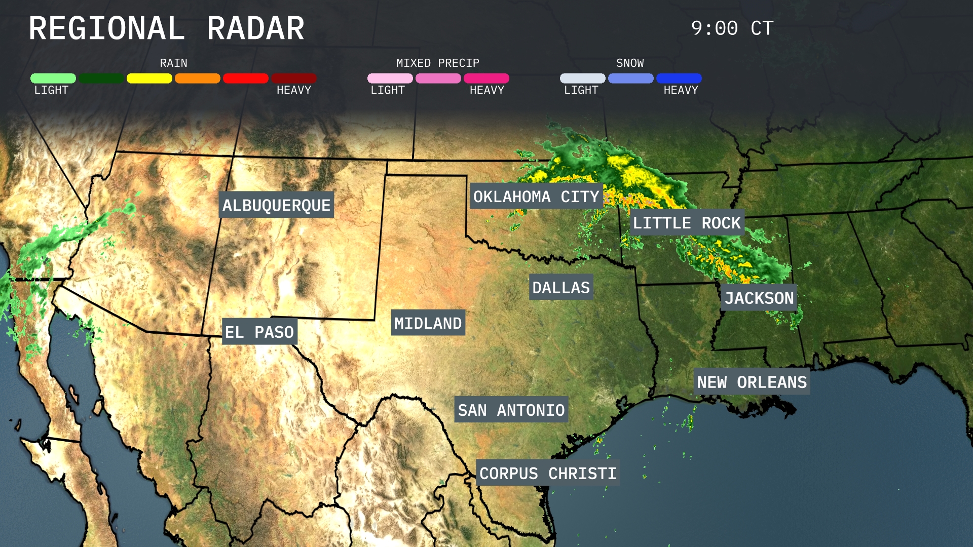
A line of heavy rain is stretching from Oklahoma City to Little Rock, bringing significant precipitation to these areas. In Jackson, storms are moving through rapidly, with heavy rain expected to continue. Clear skies persist around Dallas and San Antonio, providing a break from the wet conditions elsewhere. A system near the border between southern Colorado and New Mexico is spreading showers into El Paso, while Corpus Christi stays dry.
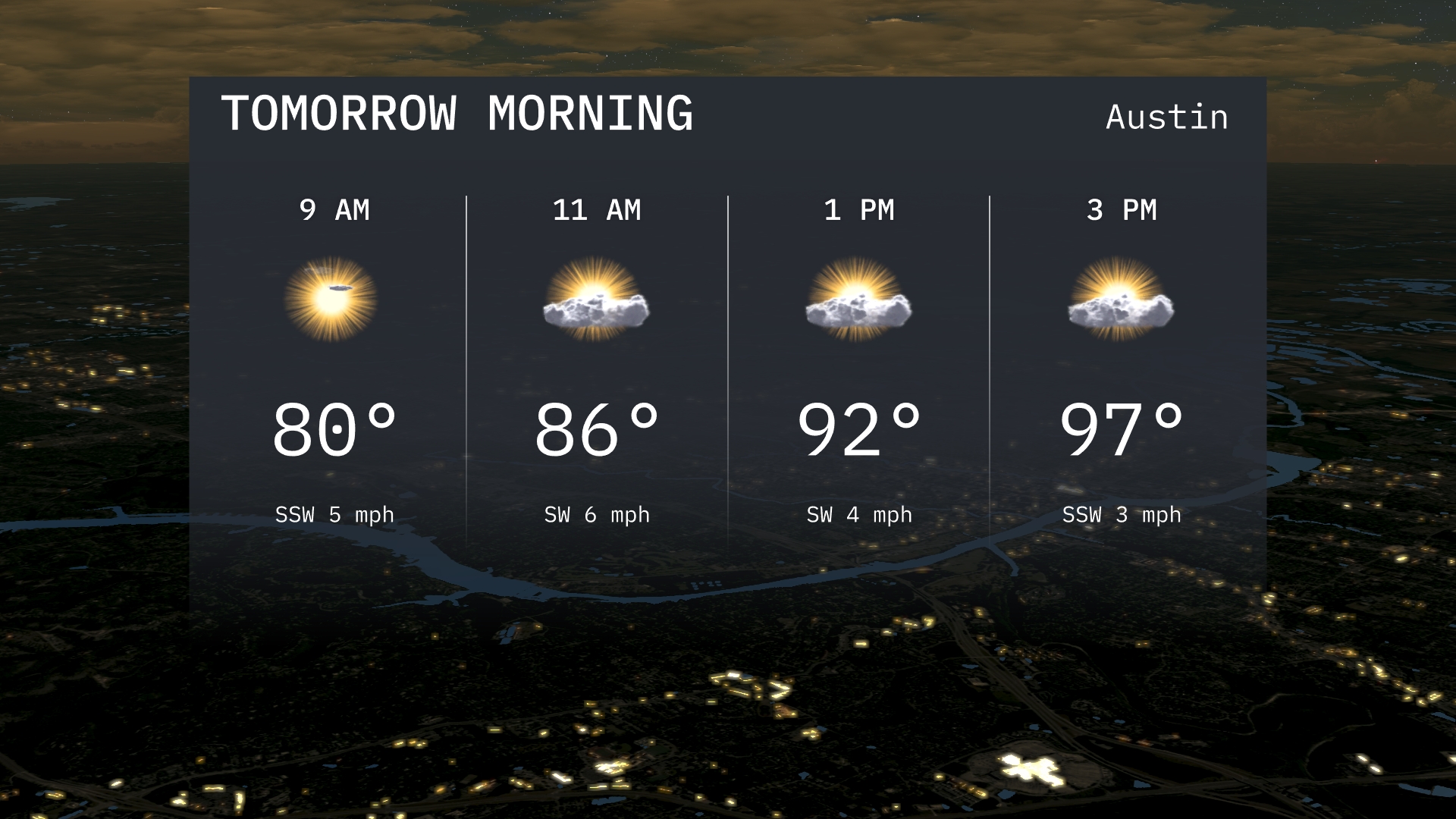
For tomorrow morning in Austin, expect temperatures to rise from 80 degrees at 9 AM to a warm 86 degrees by 11 AM. There will be partly sunny skies with a gentle breeze, predominantly from the south-southwest.
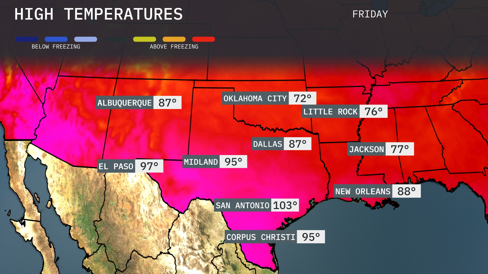
Tomorrow in El Paso, we can expect a sweltering high of 97 degrees. Midland will experience a warm day with temperatures climbing to 95 degrees, while Dallas also reaches a notable 87 degrees. San Antonio is looking at a significant spike, hitting 103 degrees, which is well above average for this time of year. Meanwhile, Oklahoma City will see cooler conditions with a high of just 72 degrees, presenting a stark contrast to the southern areas. In Little Rock, temperatures will be moderate, peaking at 76 degrees.
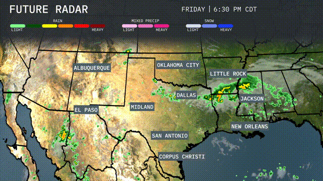
The Southern Plains will experience an active weather pattern tomorrow. Expect persistent rain from Dallas to Corpus Christi, bringing essential moisture to the region. Oklahoma City may face stronger storms due to an unstable air mass. An approaching cold front heightens the risk of severe weather, particularly in southeastern areas.
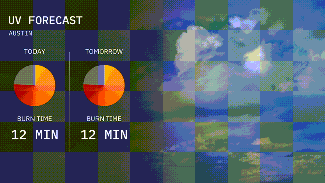
The UV index in Austin will be very high today at 10, with a burn time of just 12 minutes in direct sunlight. Tomorrow, the conditions remain the same with a UV index of 10 and burn times again around 12 minutes.
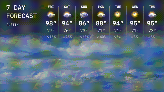
For the Austin 7 Day Outlook:
Friday: Prepare for a hot day with a high of 98 degrees and a low of 77 degrees.
Saturday: The heat continues with a high of 94 degrees and a low of 76.
Sunday: Expect thunderstorms with a high of 86 degrees and a low of 73, rain chances increase to 60 percent.
Monday: Thunderstorms linger, a high of 88 degrees and a low of 71.
Tuesday: Things start to dry out with mostly sunny skies, temperatures rising to 94 degrees and a low of 71.
Wednesday: Warm and sunny, with the mercury hitting 95 degrees during the day, cooling down to 71 at night.
Thursday: Another sunny day with a high reaching 95 degrees again and a low of 73.