Austin Weather Alert: From Scorching Heat to Stirring Storms
By
Amy Freeze
Discover how Austin's weather is shaping up with highs hitting the 100s, plus a look ahead at potential severe weather across the Southern Plains.
Austin heats up with temps in the high 90s and warnings of thunderstorms. Stay prepared with the latest forecast and essential sun safety tips.
This week, Austin and the surrounding Southern Plains are experiencing substantial weather changes. From sizzling temperatures reaching near triple digits to the increasing possibility of severe storms, residents should stay vigilant. Our report covers detailed temperature predictions, storm warnings, and crucial sun safety measures as the UV index hits very high levels. Keep updated and learn how to protect yourself from weather extremes.
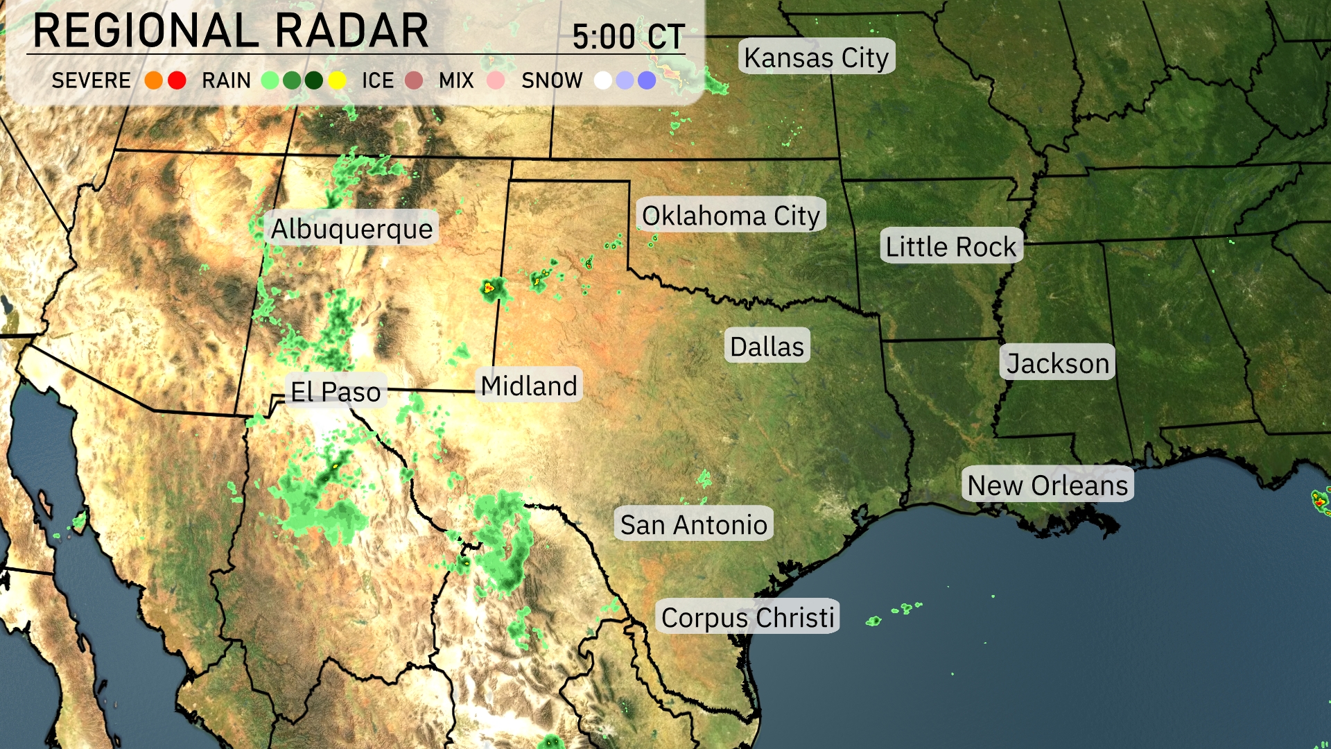
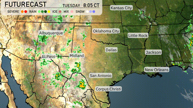
Storms are developing along the eastern New Mexico border, with activity extending towards Midland. El Paso is experiencing isolated showers moving southeastward. Oklahoma City and Dallas remain clear under high pressure, while rain showers are drifting east across southern Louisiana, approaching New Orleans. Keep an eye on the cloud cover increasing over San Antonio as the system progresses.
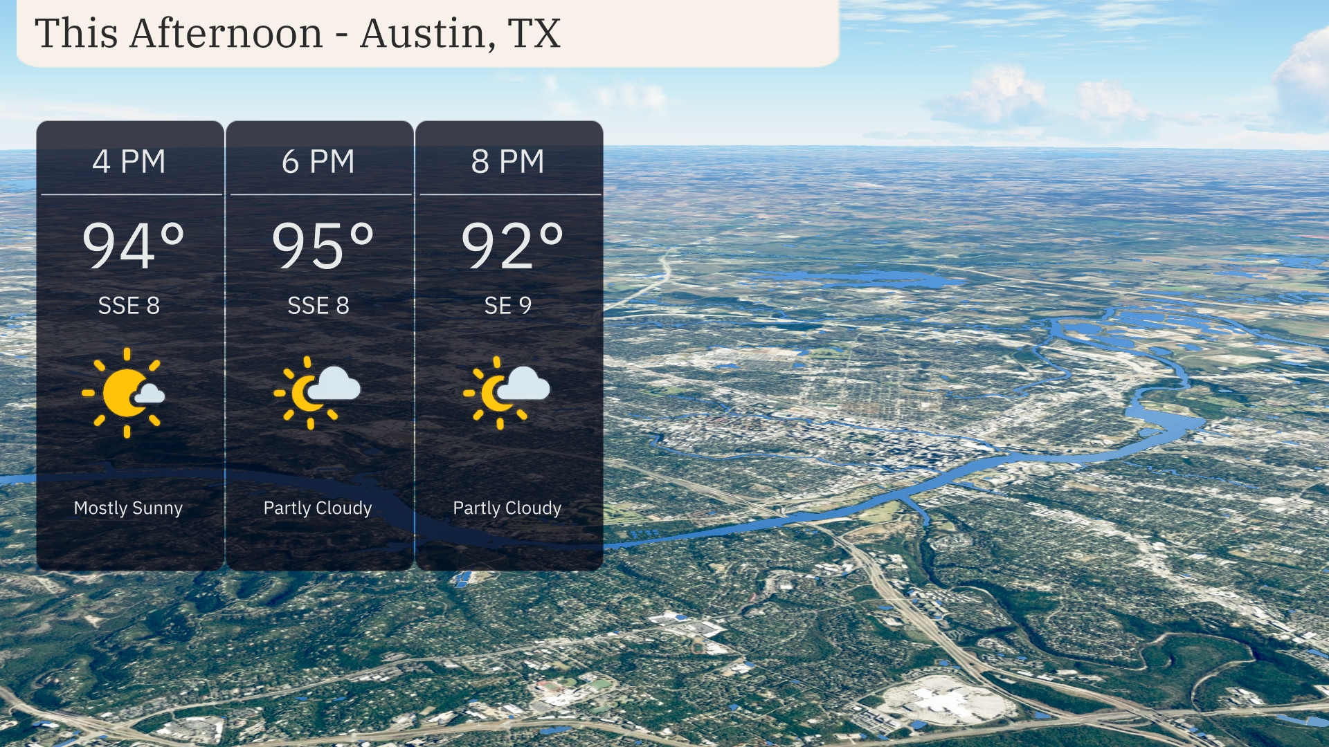
Temperatures will rise to 95 degrees by 6 PM, with a steady southeast wind around 8 miles per hour during the afternoon. Expect mostly sunny skies transitioning to partly cloudy as the evening approaches. Stay hydrated as we navigate this warm afternoon in Austin.
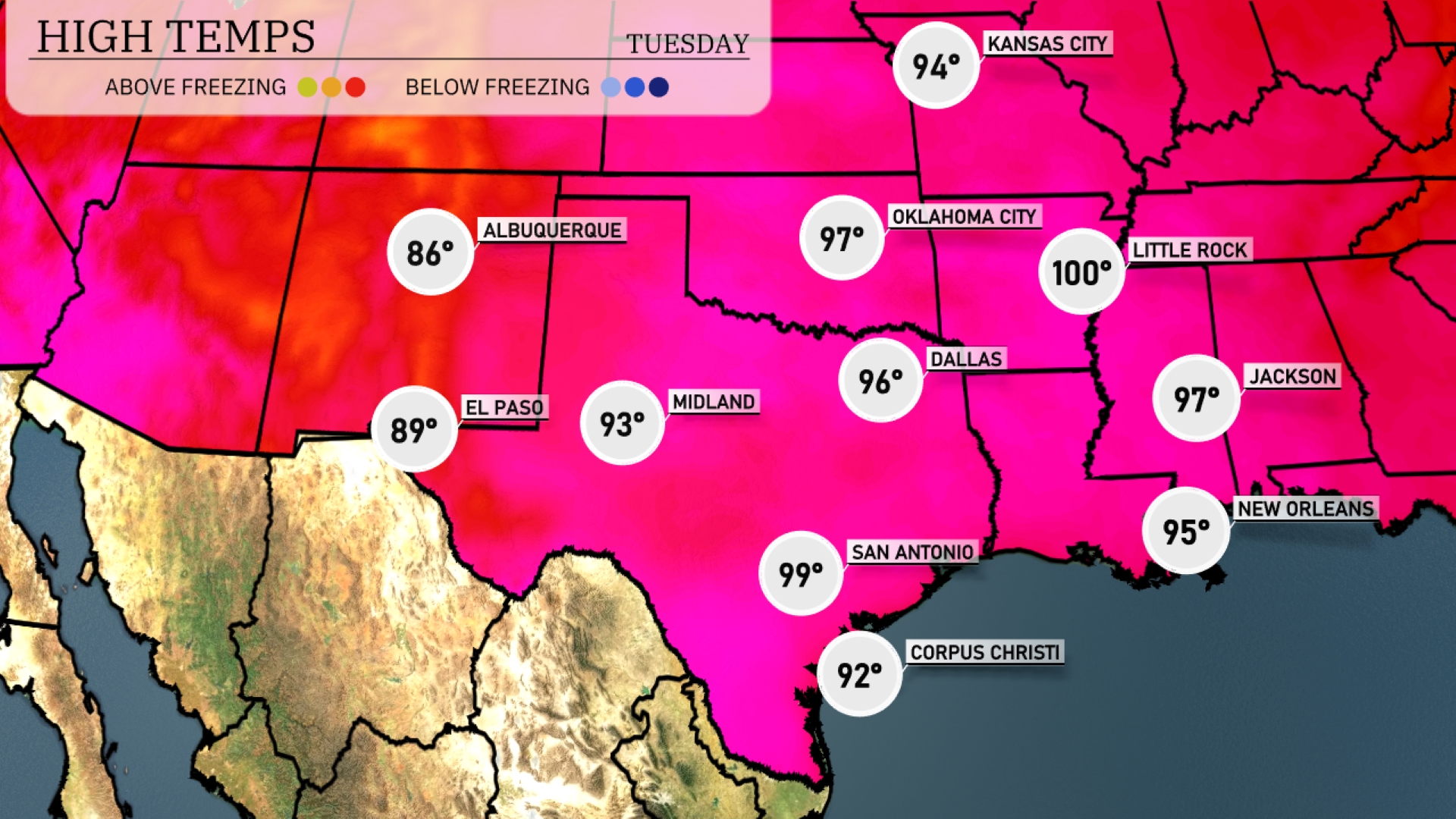
High temperatures across the Southern Plains are really heating up today. Little Rock tops the list with a sizzling 100 degrees, while Dallas isn’t far behind at 96. San Antonio is looking to reach 99, creating some serious summer heat. El Paso is slightly cooler at 89 degrees, and Midland follows with a high of 93. Expect a mix of sunshine and heat advisories as warm conditions prevail throughout the region.
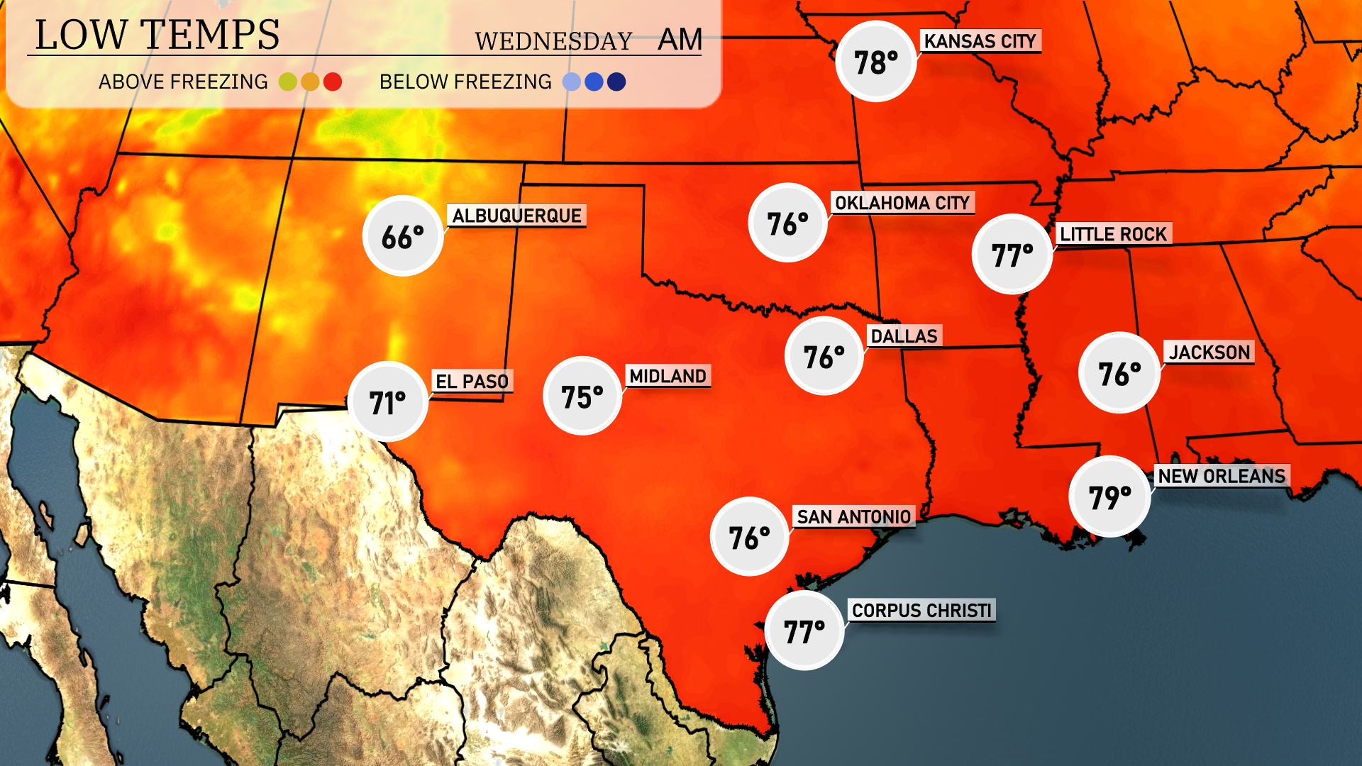
Tonight, Oklahoma City is expected to drop to a low of 76 degrees. Dallas will see similar temperatures at 76, while Little Rock will dip slightly cooler to 75. San Antonio remains warm at 76 degrees, with Corpus Christi only a bit milder at 77.
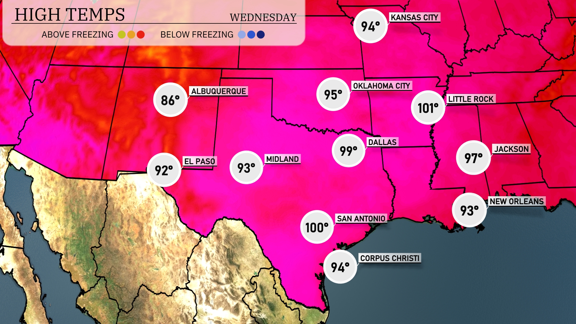
Tomorrow in the Southern Plains, expect some scorching highs. Dallas will reach a sweltering 99 degrees, while San Antonio is set to hit 100 degrees. Midland should see a high of 93 degrees, and El Paso will be just a degree cooler at 92. Little Rock is in for an exceptionally hot day, with a projected high temperature of 101 degrees. Meanwhile, New Orleans and Jackson will experience slightly cooler temperatures of 93 and 97 degrees, respectively, contrasting with the widespread heat across Texas.
An approaching cold front will bring rain and thunderstorms across the Southern Plains tomorrow. From Dallas to Corpus Christi, expect beneficial rains, while Oklahoma City could face stronger storms. Be prepared for potential severe weather as the unstable air mass interacts with the front, raising the risk of damaging winds or hail from Tuesday afternoon into the night. By Wednesday, the system shifts eastward, potentially affecting areas from Little Rock to New Orleans with bouts of intense rain and storms. Temperatures will drop slightly behind the front, bringing cooler conditions and clearer skies for the latter part of the week.
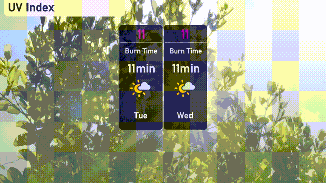
The UV index in Austin will reach a very high level of 11 today and tomorrow. Sun exposure risks are significant, with a burn time of just 11 minutes. Prioritize sun safety by using sunscreen, wearing hats, and seeking shade during peak sun hours.