Explore the vibrant weather patterns affecting Austin and the Southern Plains, featuring sunny highs to stormy lows. Get prepared for what tomorrow holds!
Kick-start your day with the latest weather news! From the intense heat in El Paso to the brewing storms in Dallas, we’ve got the Southern Plains covered. Buckle up for an engaging read on how to tackle these diverse conditions!
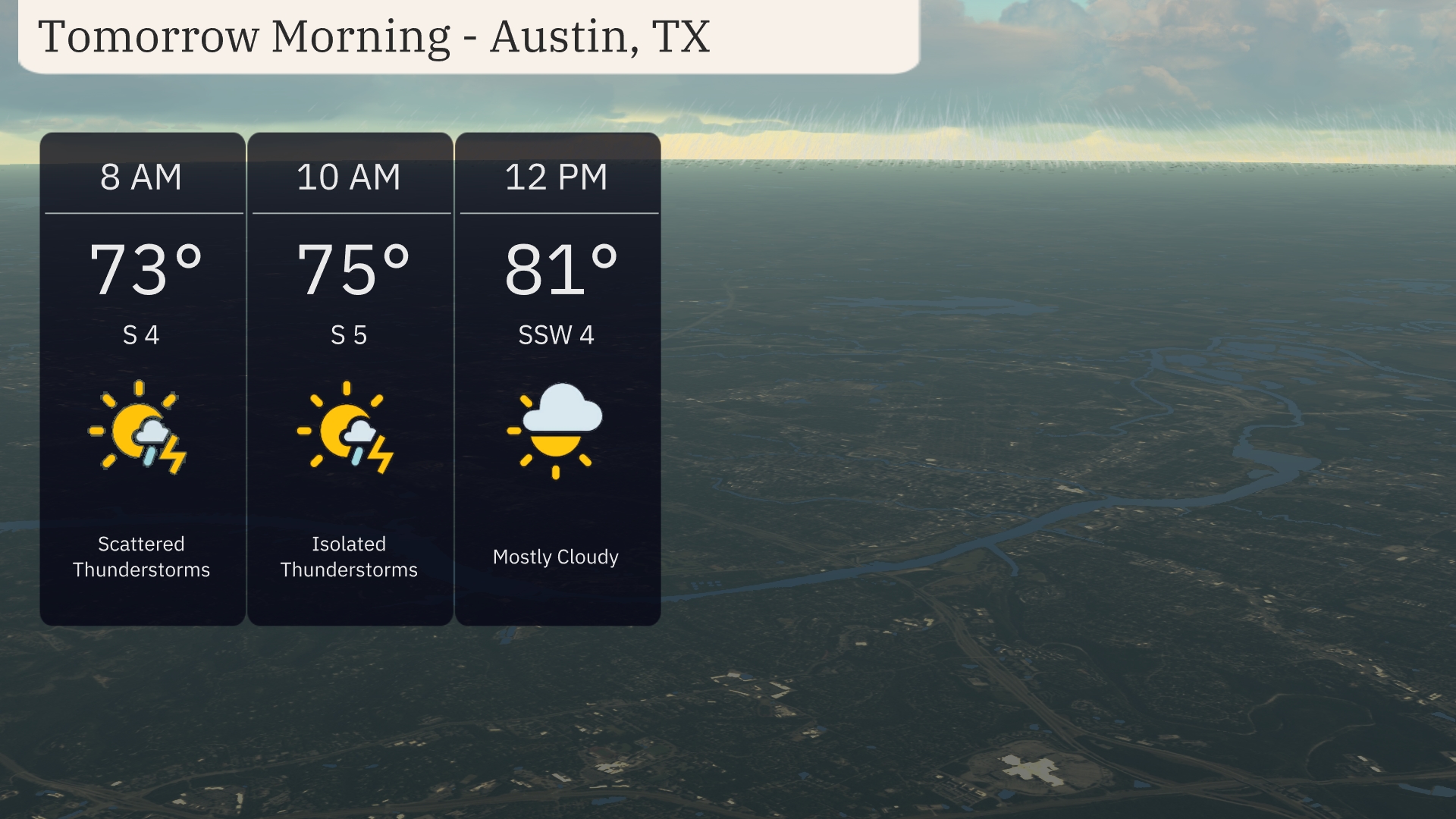
Welcome to your detailed guide on navigating the volatile weather conditions across Austin and the entire Southern Plains region. Tomorrow brings a mix of clear skies and scattered thunderstorms in Austin, with temperatures fluctuating between 73°F and 81°F. The day unfolds with light winds and slight temperature increases, followed by isolated thunderstorms. This piece dives deeper into what these patterns mean for your daily activities and how the broader Southern Plains are gearing up for a hot and stormy season. Don’t miss out on the full insights, exclusively at https://amyfreeze.ai/
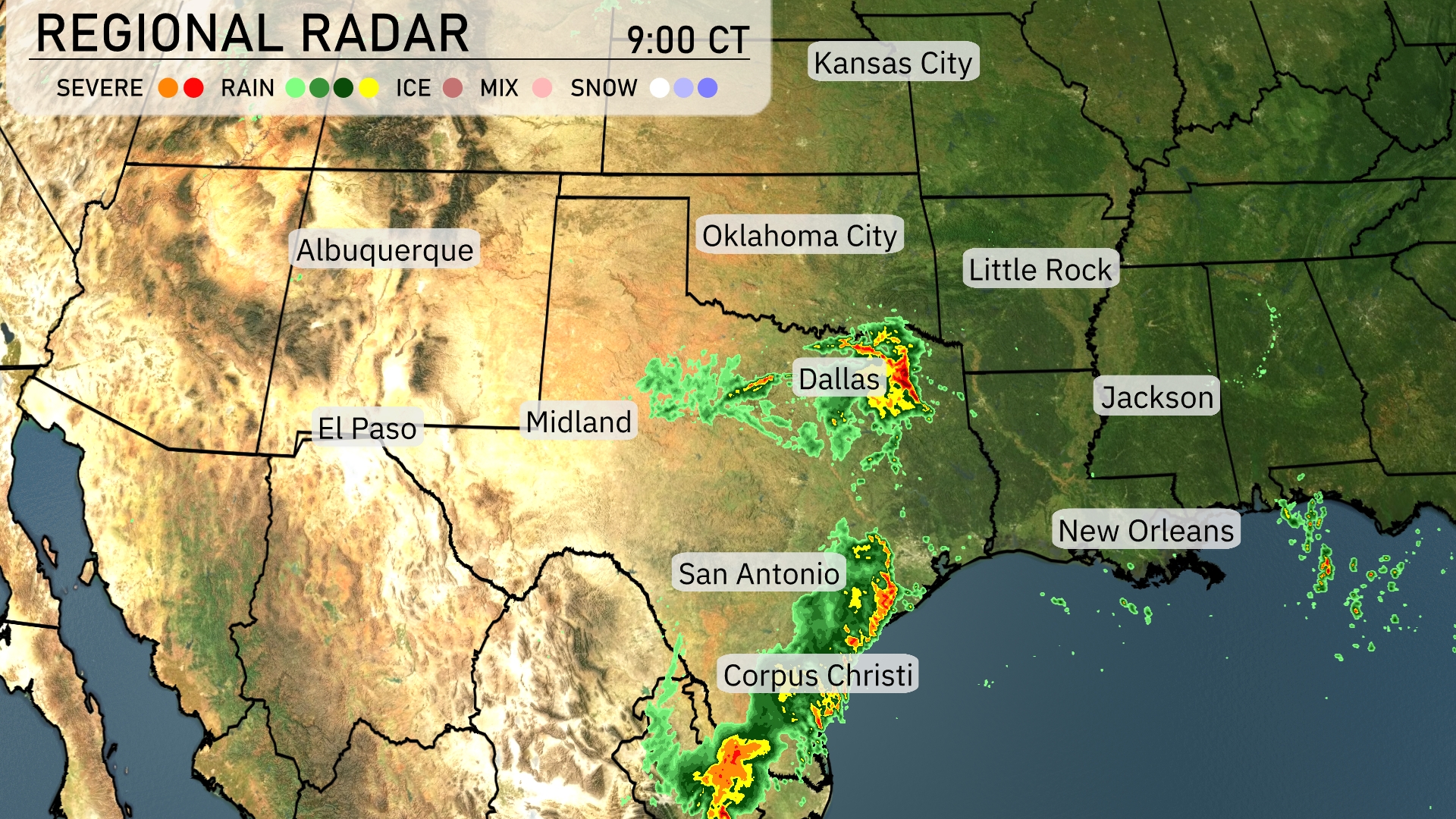
In the Southern Plains region, a significant line of storms can be seen advancing toward Houston, with Dallas already experiencing severe weather. Corpus Christi is under a mix of intense rain showers and gusty winds. The radar also shows rainfall extending from San Antonio toward the Gulf Coast. Oklahoma City remains dry, with clear conditions persisting across the western parts, including Midland and El Paso.
Tomorrow morning in Austin, expect scattered thunderstorms with temperatures starting at 73 degrees and rising to 75 degrees by 10 AM. Winds from the south will be light at 4 mph early, increasing slightly to 5 mph. Thunderstorms will become isolated as the morning progresses. By noon, look for mostly cloudy skies and temperatures reaching 81 degrees.
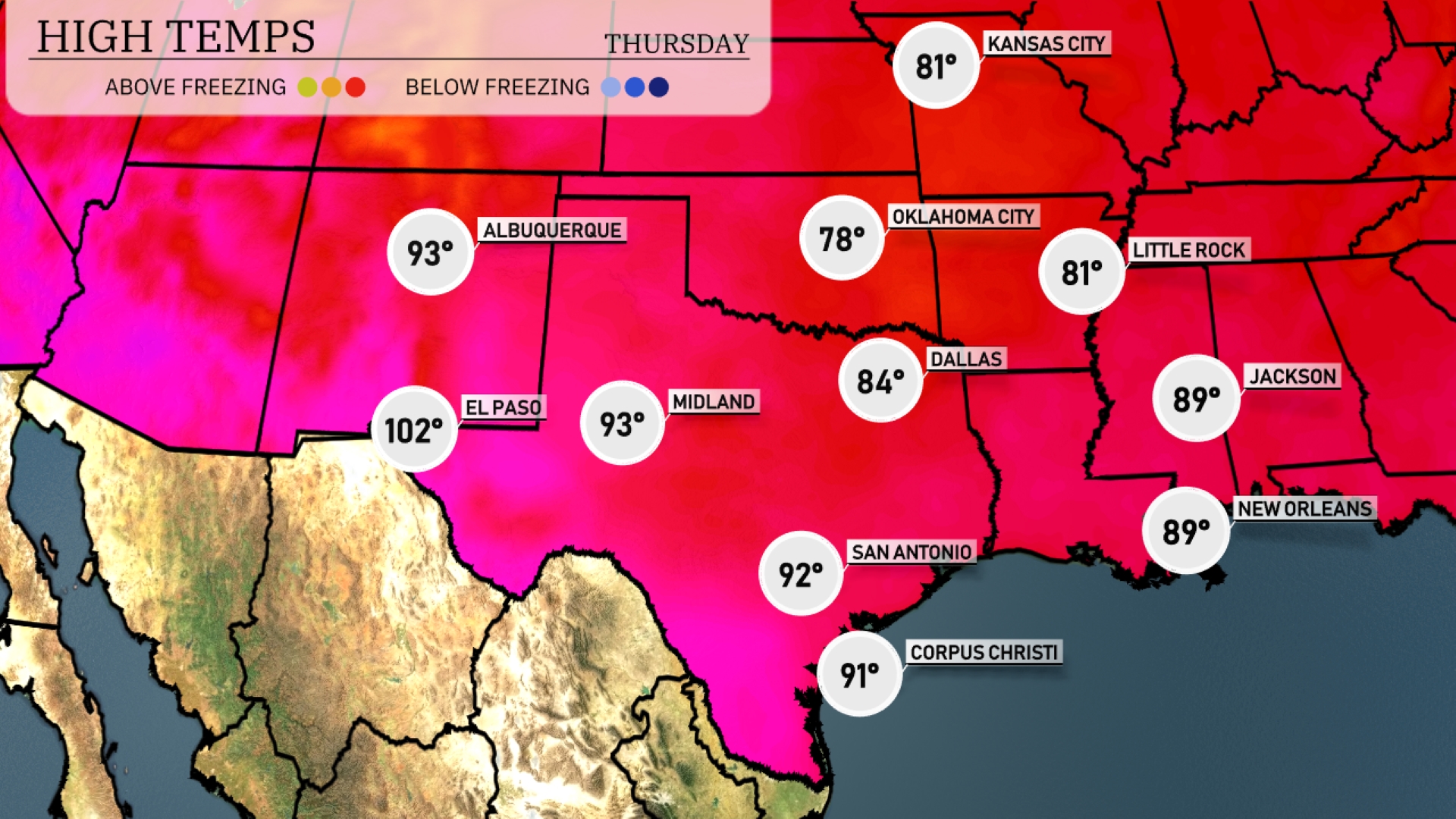
Tomorrow in El Paso, the high will soar to a scorching 102 degrees, making it well above the seasonal average. Midland is also heating up, with temperatures reaching 93 degrees. In contrast, Dallas will have a milder day at 84 degrees, while San Antonio is expected to hit 92 degrees. Expect warm conditions in Corpus Christi, with temperatures peaking at 91 degrees. Jackson and New Orleans will see highs of 89 degrees, reinforcing a trend of warm weather across the Southern Plains.
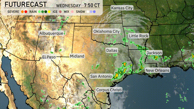
Expect an active weather day across the Southern Plains tomorrow. A strong cold front will push through, initiating rain and thunderstorms from Dallas to Corpus Christi, with potential for more intense storms near Oklahoma City. With an unstable atmosphere, severe weather is possible, including strong winds and localized flooding. Further east, showers will extend from Little Rock to New Orleans.
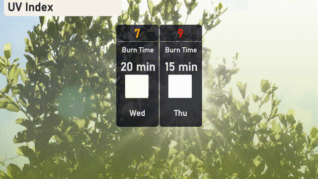
The UV index in Austin will be a high of 7 on Wednesday, with a burn time of about 20 minutes if you’re out in the sun. On Thursday, expect a very high index of 9, making the sun’s rays intense, with a quicker burn time of just 15 minutes.
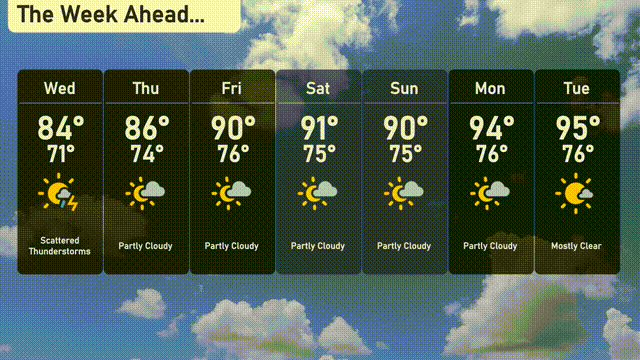
Wednesday: Scattered thunderstorms are expected with a high of 84 degrees and a low of 71 degrees.
Thursday: Warmer with partly cloudy skies, reaching up to 86 degrees and a nighttime low of 74 degrees.
Friday: Partly cloudy conditions with the temperature rising to 90 degrees and dipping to 76 degrees at night.
Saturday: Expect more clouds with a high of 91 degrees and a low of 75 degrees.
Sunday: Partly cloudy once again, maintaining a high of 90 degrees and a low of 75 degrees.
Monday: The temperature climbs to 94 degrees under partly cloudy skies with a low of 76 degrees.
Tuesday: The week wraps up with mostly clear skies and a high of 95 degrees, with evening temperatures around 76 degrees.