Austin’s Sizzling Summer: Sun, Storms, and Everything In-Between
By
Amy Freeze
Explore the dynamic weather patterns over Austin and the Southern Plains, from stifling heatwaves to refreshing rainfalls and severe storm alerts.
From Austin’s afternoon highs of 94°F to nocturnal storm warnings across the Southern Plains—catch up on all the essential weather developments.
https://www.youtube.com/watch?v=RJLIng-LXn8
This week’s weather forecast for Austin shows an oscillation between intense heat and abrupt rainfall. Witness highs reaching 94°F and preparing for storm-induced disruptions with our protective tips. Explore the implications of an unstable air mass bringing thunderstorms and the cold front expected to lower temperatures and stabilize the weather by Thursday.
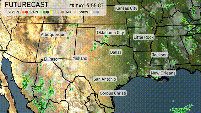
Scattered thunderstorms are developing across south-central Kansas and moving towards Kansas City, suggesting rain showers will continue in the area. Albuquerque and El Paso are experiencing showers seen over southern New Mexico and western Texas. Southeast Texas, including areas around Corpus Christi and San Antonio, shows precipitation moving towards the Gulf Coast. The eastern parts of Louisiana are also seeing rain showers near New Orleans.
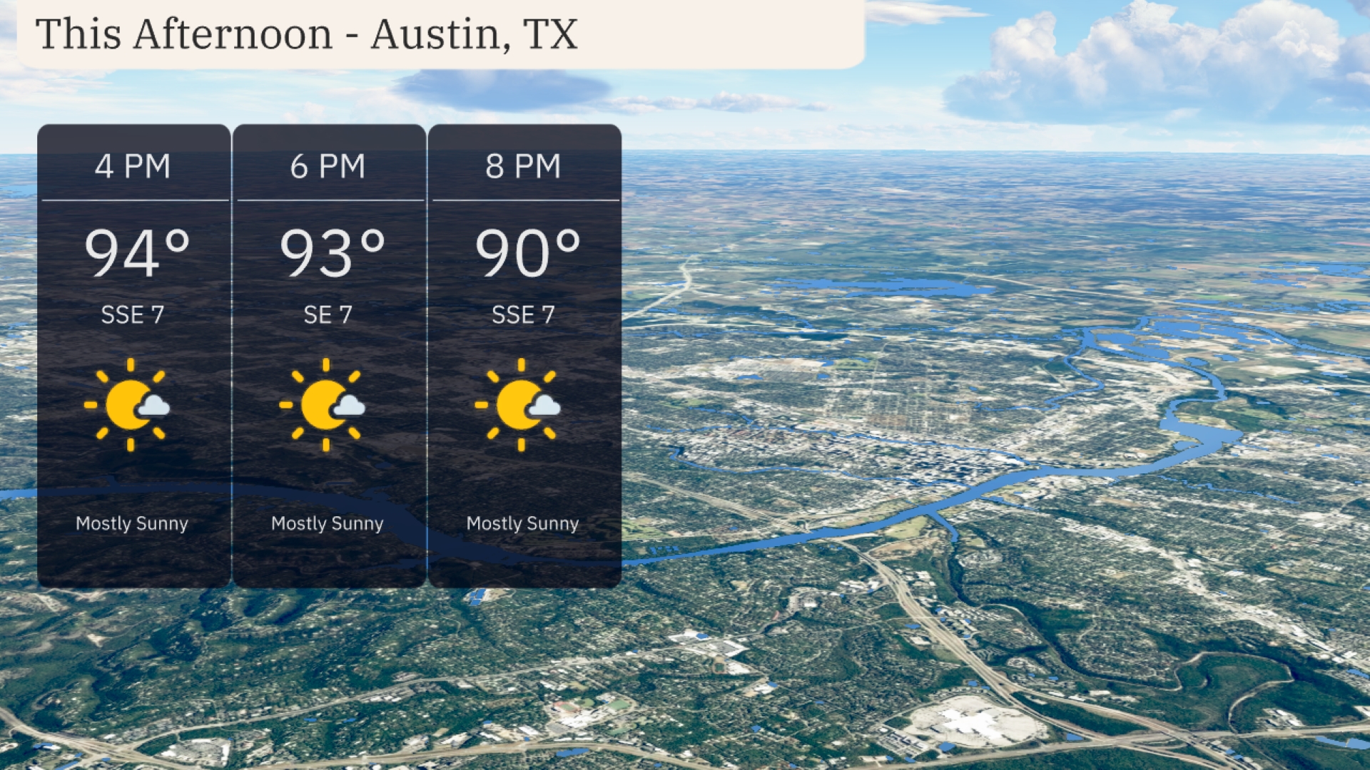
Austin’s afternoon will be mostly sunny with temperatures hitting 94 degrees by 4 PM, gently cooling to 90 degrees by 8 PM. Expect a consistent south-southeast wind around 7 miles per hour throughout the afternoon.
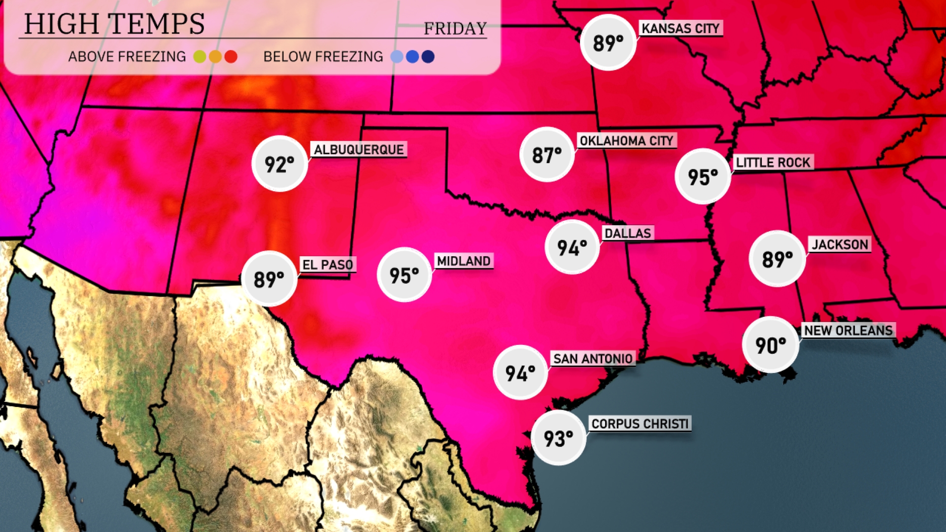
In the Southern Plains today, we’re seeing some impressive high temperatures. El Paso is expected to reach 89 degrees, while Midland will be a bit warmer at 95. Dallas is forecasting a high of 94 degrees, with San Antonio matching that temperature. Over in Little Rock, expect a warm day at 95 degrees as well. Down in New Orleans, temperatures will be slightly cooler at 90 degrees, providing a nice contrast to the heat in Texas.
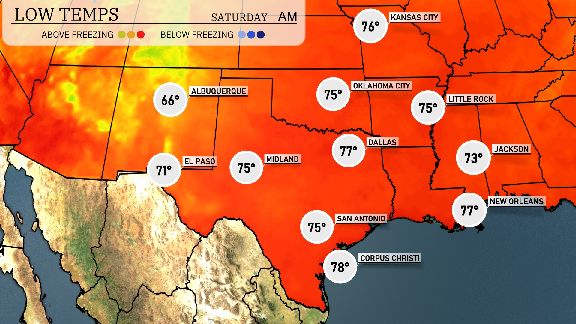
Tonight, lows in the Southern Plains are expected to be milder, with Dallas hitting 77 degrees and Little Rock dropping to 75 degrees. Oklahoma City will also see a low of 75. San Antonio and Midland will match those temperatures, both settling at 75. Albuquerque will cool down to 66 degrees, the coolest of the key cities in the region.
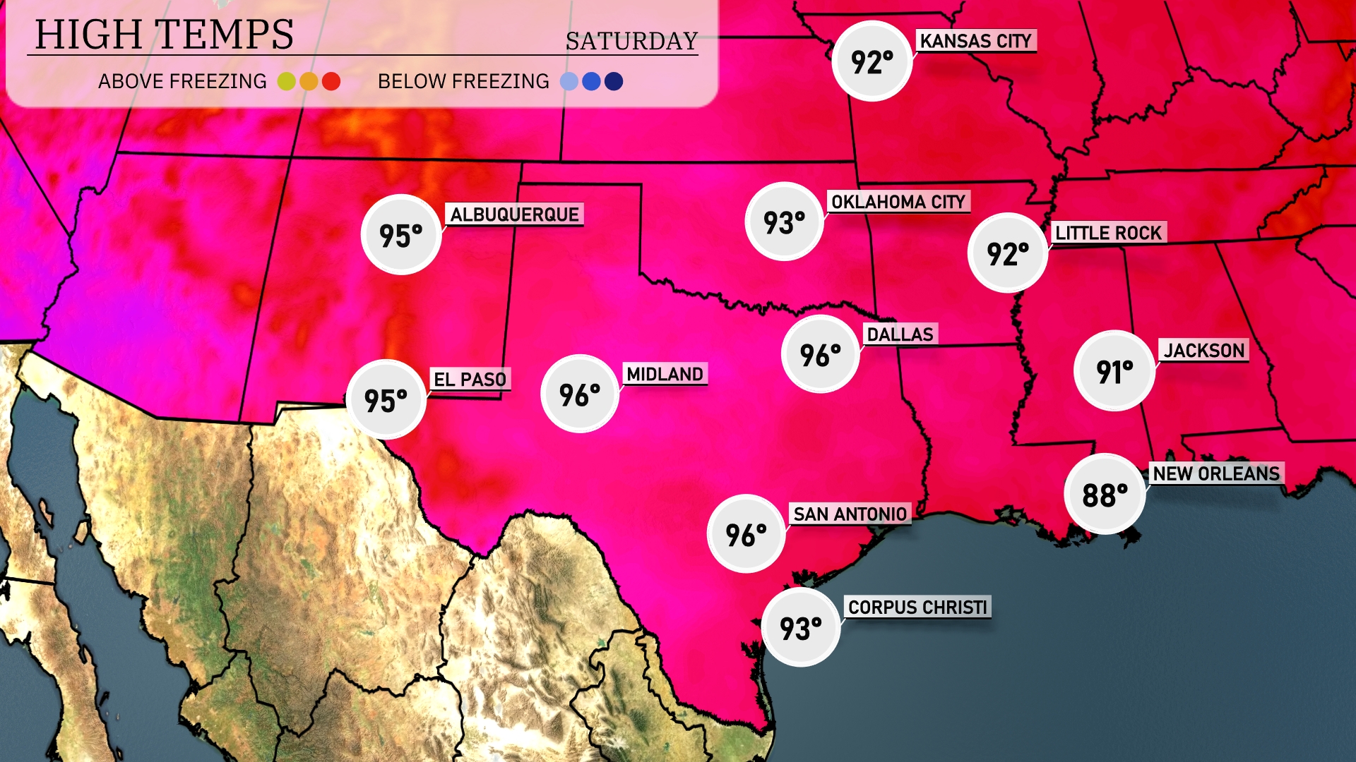
Tomorrow in the Southern Plains, El Paso and Midland will see highs around 96 degrees, indicating a continued warm trend for the region. San Antonio isn’t far behind at a balmy 96 degrees as well, reflecting above-average temperatures for this time of year. In Dallas, expect a slight dip to 92 degrees, while Oklahoma City will mirror that at 93 degrees. Farther east, Little Rock anticipates a high of 92, and Jackson will reach 91 degrees, maintaining warm conditions.
A cold front sweeping across the Southern Plains will bring a mix of scattered thunderstorms, primarily targeting Oklahoma City, Dallas, and Midland, late into the night. There’s an increased chance for severe weather, including strong winds and the potential for hail, so stay weather alert. Rainfall will provide much-needed relief from drought conditions, particularly from Dallas down to Corpus Christi. The unstable air mass ensures more thunderstorms continue into Wednesday morning across Kansas City and Jackson. Temperatures will drop slightly following the front, with clearer skies expected by Thursday.
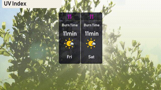
The UV index in Austin peaks at a high of 11 on both Friday and Saturday, with direct sunlight burn times of just 11 minutes.