Austin Sizzles and Drizzles: A Week of Sun, Showers, and Safety Tips
By
Amy Freeze
Explore this week's dynamic weather in Austin—from scorching highs to soothing breezes and unexpected downpours. Find out how to stay safe under the extreme UV rays!
Catch the full scope of this week’s weather in Austin! From sunny skies to the looming risks of surprise showers and high UV index, learn all about what to expect and how to protect yourself.
Welcome to a comprehensive look at Austin’s weather this week, where the sun rules but doesn’t overshadow occasional rainfalls. With temperatures peaking near the century mark and a UV index that warns of quick burns, staying informed is your first step to staying safe. Dive deeper into daily forecasts and expert tips on managing high heat and sudden storms. Visit the full forecast details and safety advice at https://amyfreeze.ai/
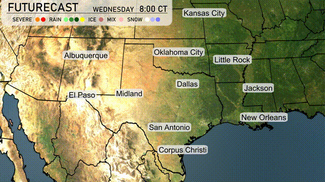
Showers are currently developing in western Texas, particularly around Midland and El Paso. San Antonio is beginning to see some rain activity moving in from the west. Over in Louisiana, New Orleans is experiencing thunderstorms progressing offshore. Meanwhile, the skies remain mostly clear for Oklahoma City and Dallas, providing a break from any precipitation.
In Austin, temperatures this afternoon will hover around 96 degrees with sunny skies. Expect a consistent south-southeast wind at 7 to 8 mph throughout the afternoon. The clear conditions bring a warm and bright setting, perfect for any outdoor plans.
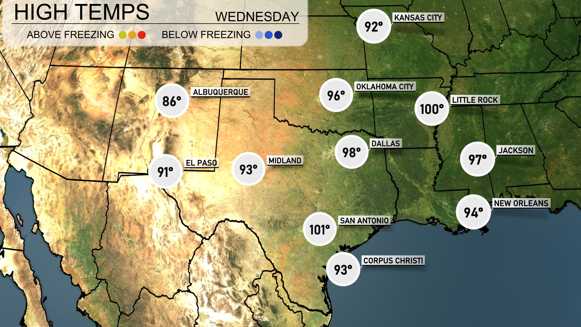
Today’s high temperatures in the Southern Plains are quite varied and quite warm. Dallas will see a high of 98 degrees, while nearby Fort Worth mirrors this heat. San Antonio is even hotter, hitting a sizzling 101 degrees. In Oklahoma City, expect a high of 96, and Little Rock will match that temperature with a high of 100 degrees. Further east, New Orleans wraps up the day with a high of 94, providing a notable contrast as temperatures cool slightly in the eastern part of the region.
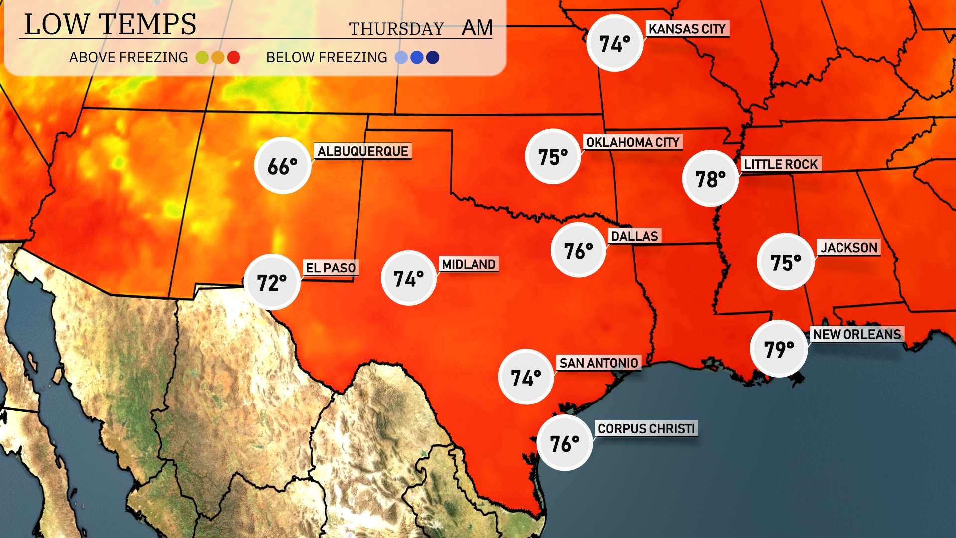
Tonight, Oklahoma City will drop to 76 degrees, while Dallas sees a low of 78. San Antonio will also cool down slightly to 74 degrees. Expect Midland to register a low of 74, and El Paso will remain warmer at 72 degrees.
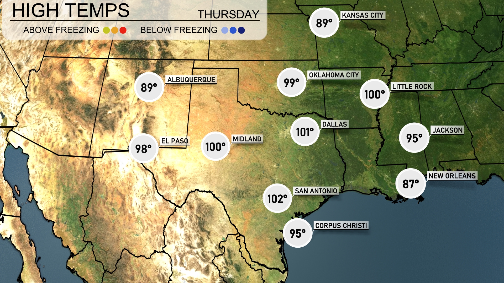
Tomorrow in El Paso, expect a high of 98 degrees, while Midland will reach a scorching 100 degrees. San Antonio is looking at a high of 102 degrees, indicating some above-average temperatures for this time of year. Dallas and Little Rock are both forecasted to hit 100 degrees, contributing to a heat trend across the Southern Plains. Meanwhile, temperatures in New Orleans will stay cooler at 87 degrees, while Jackson hits 95 degrees.
A frontal system will cause thunderstorms from Oklahoma City to Little Rock late tomorrow. Expect heavy rainfall and potential flash flooding in these areas. Dallas could see intermittent showers continuing through Wednesday. Prepare for gusty winds in Midland and El Paso with a dry pattern post-front. Temperatures will remain seasonally warm in the southern plains through Wednesday night.
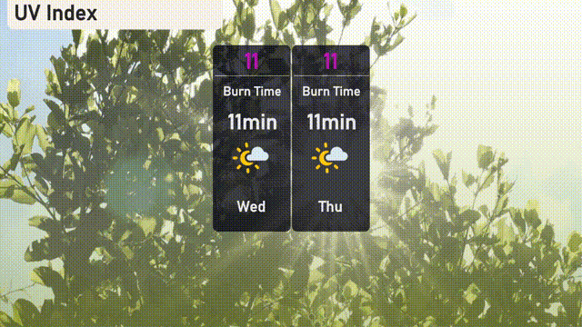
The UV index in Austin will soar to an extreme level of 11 on Wednesday and Thursday, making sun exposure very risky with a burn time of just 11 minutes. Ensure you’re wearing sunscreen and protective clothing when outdoors to prevent skin damage. Consider seeking shade between 10 a.m. and 4 p.m. to minimize exposure to strong UV rays!