Austin’s Sunny Morning and Southern Plains Storm Watch
By
Amy Freeze
Wake up to sunny skies in Austin while preparing for potential storms across the Southern Plains. Your comprehensive weather guide is here.
Austin will see a sunny morning with calm winds and rising temperatures. Read on to find out about storm alerts across the Southern Plains and how to stay safe!
Good morning, Austin! Today kicks off with a radiant sunrise and gentle breezes. But while you enjoy the warmth, let’s not forget our neighbors. From central New Mexico to Dallas, storms are sweeping across the Southern Plains. Our latest blog dives deep into what to expect from these erratic weather patterns and how to prepare for them. Stay safe and informed with our thorough analysis, whether you’re stepping out in Austin or anywhere across the storm’s path. Read more: https://amyfreeze.ai/
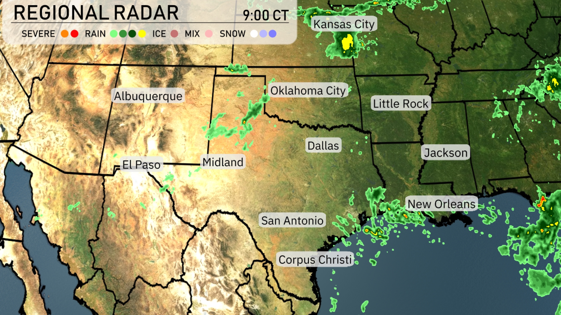
A band of showers is trailing across central New Mexico towards El Paso, with some isolated thunderstorms. Rain is sweeping through central Texas, extending towards Midland, with scattered showers developing around San Antonio. The Gulf Coast near New Orleans is also experiencing sporadic storm activity, pushing northeastwards. Further north, Kansas City has some isolated showers as well, while much of Oklahoma and Arkansas remain relatively dry and clear.
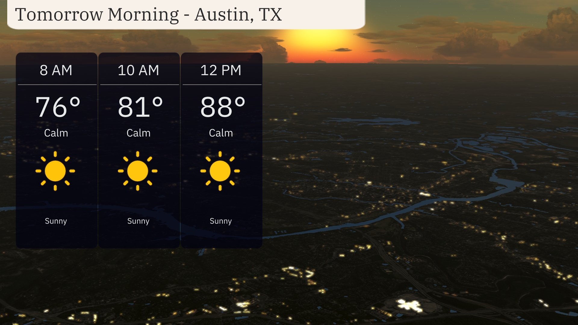
Austin will enjoy a sunny start to the day with temperatures rising from 76 degrees at 8 a.m. to 88 degrees by midday. Expect calm winds throughout the morning, making for a serene weather pattern. The clear skies provide a picturesque backdrop for your morning activities.
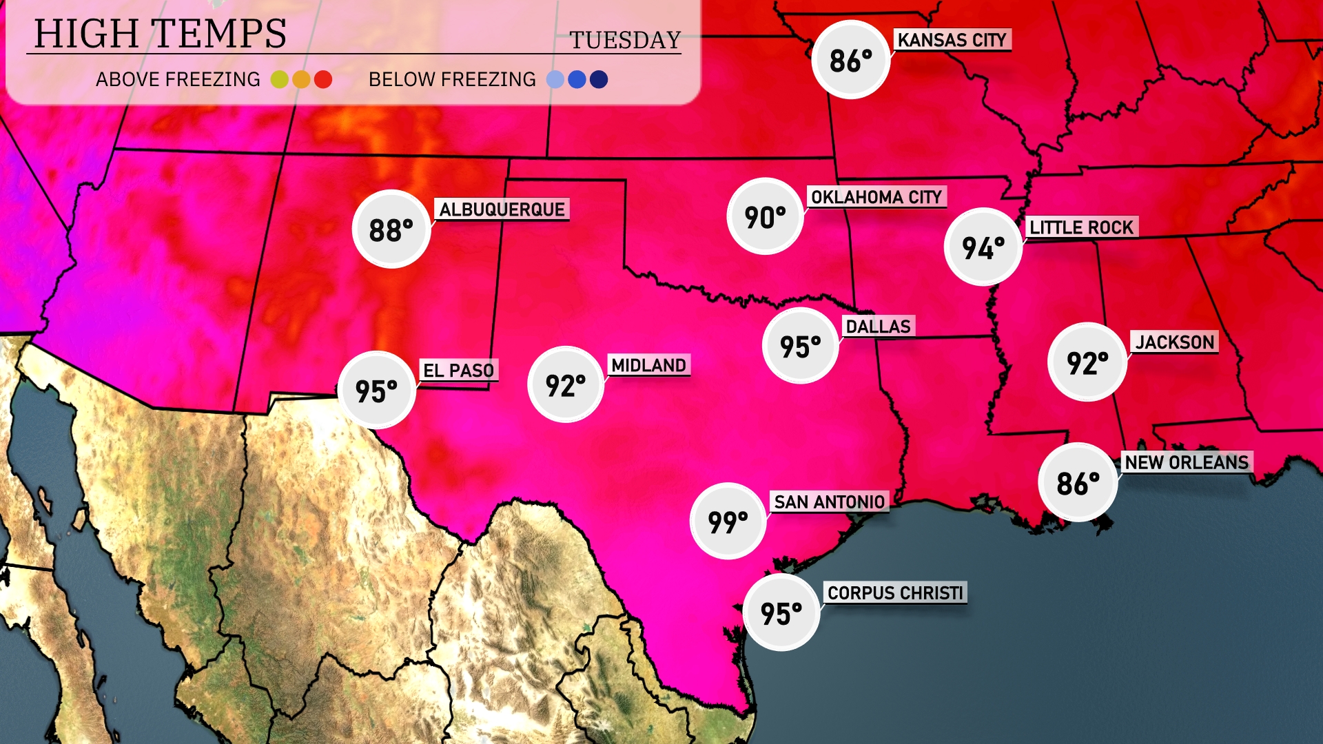
Tomorrow in El Paso, temperatures are set to reach 95 degrees, while Midland will see a high of 92. San Antonio is heating up significantly, with a high of 99 degrees expected. Dallas will be slightly cooler at 95 degrees, and Little Rock is forecasted to hit 94 degrees.
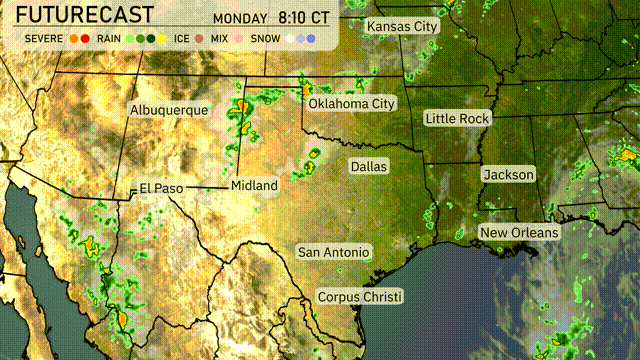
Expect a wet start to the day across the Southern Plains with rain showers from Dallas extending south to Corpus Christi. Oklahoma City might experience some stronger storms due to an unstable air mass and a cold front moving through the region. It’s crucial to stay alert for severe weather warnings, particularly in eastern Texas and surrounding areas, as conditions could support the development of severe thunderstorms. Rainfall will help alleviate dry conditions in the region but could lead to localized flooding if too intense. Temperatures will cool slightly after the front passes, leading to comfortable and clearer skies by midweek.
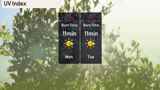
In Austin, the UV index is a very high 11 on both Monday and Tuesday, with a burn time of just 11 minutes in direct sunlight.
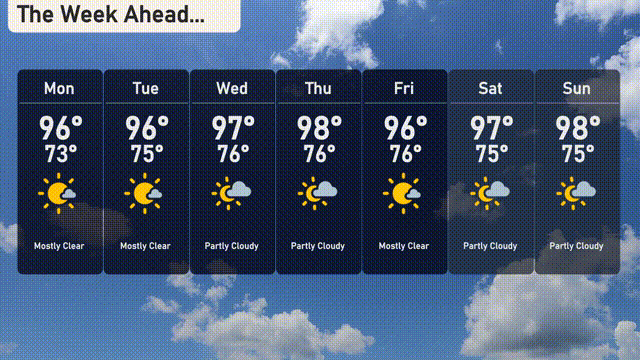
Monday: Mostly clear skies with a high of 96 degrees and a low of 73 degrees.
Tuesday: Another mostly clear day, high reaching 96 degrees, low at 75 degrees.
Wednesday: Partly cloudy, expect a high of 96 degrees and a low of 76 degrees.
Thursday: More partly cloudy conditions, with temperatures peaking at 98 degrees and dipping to 76 degrees at night.
Friday: Look for partly cloudy skies once again, high at 96 degrees and the low remaining at 76 degrees.
Saturday: Partly cloudy with a high of 97 degrees and a low of 75 degrees.
Sunday: The skies will be partly cloudy, with the high reaching 98 degrees and a low of 75 degrees.