Austin’s Weather Canvas: Sunny Mornings and Southern Plains Storm Tracker
By
Amy Freeze
Dive into Austin's weather patterns with Meteorologist Amy Freeze as we explore a range of conditions from sunny mornings to potential storm threats across the Southern Plains.
Explore the latest weather trends with Amy Freeze, featuring a sunny start in Austin and upcoming storms in the Southern Plains. Stay informed and prepared!
Join Amy Freeze as she delves into the varied weather patterns affecting Austin and the broader Southern Plains. From the morning’s gentle breezes to looming storm threats, our detailed analysis keeps you one step ahead. Learn how to navigate these conditions with our practical tips and stay safe with our weather safety guidelines.
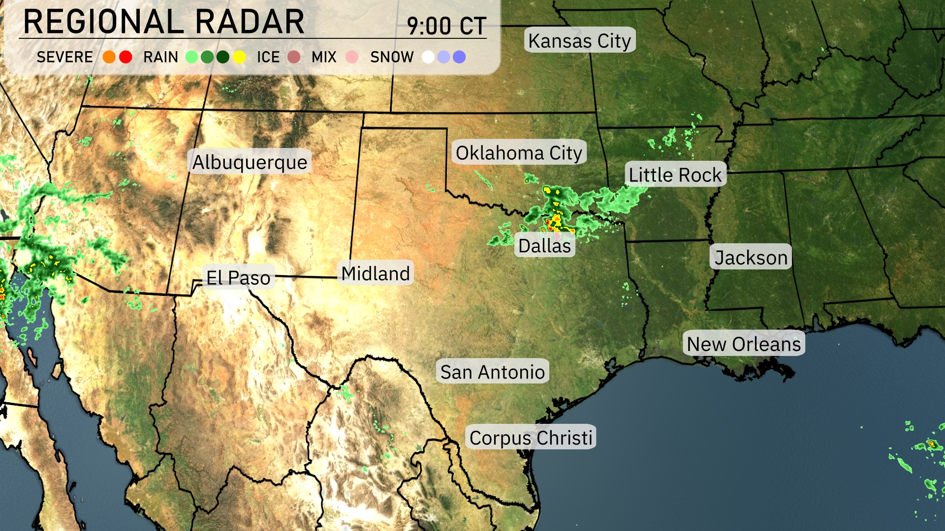
A line of storms is pushing east-northeast through Dallas, bringing heavy rain and thunderstorms to the area. Oklahoma City to Little Rock is under rain showers that are rumbling through the region. El Paso is seeing some scattered rainfall moving in from the west. Jackson and New Orleans remain shielded from precipitation at the moment, enjoying relatively clear skies. Midland to San Antonio is also experiencing a calm weather pattern right now.
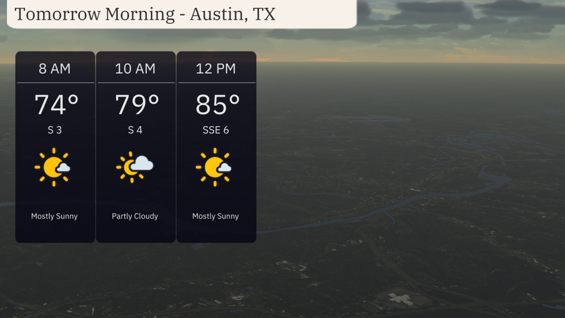
Tomorrow morning in Austin is set to start mostly sunny with temperatures rising from 74 degrees at 8 AM to 79 degrees by 10 AM. Expect a gentle breeze from the south at 3 to 4 miles per hour early on. By noon, temperatures will reach 85 degrees under mostly sunny skies with a light south-southeast wind at 6 miles per hour.
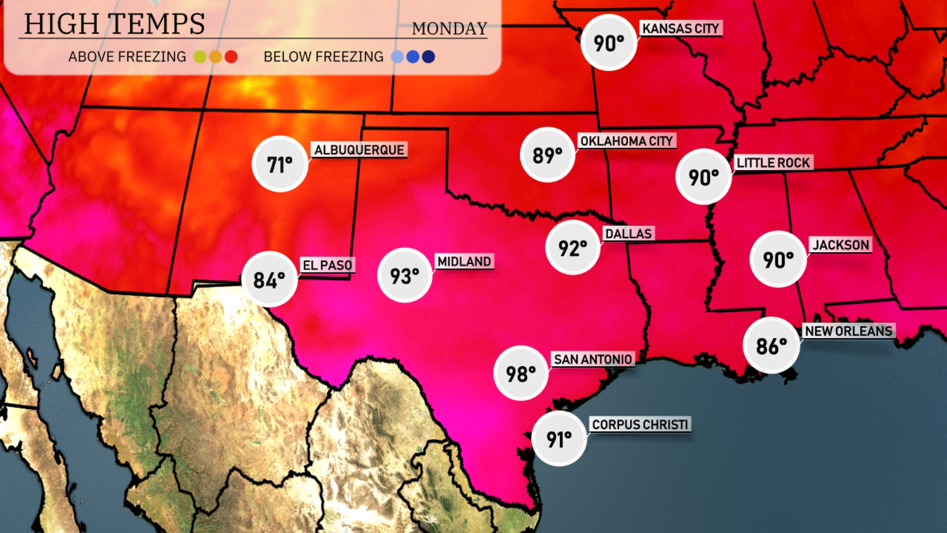
Tomorrow San Antonio leads with a high of 98 degrees, while Midland is set to reach 93 degrees. El Paso will warm up to 84 degrees, and Dallas is expected to hit 92 degrees. As we move east, temperatures in New Orleans will be around 86 degrees and Little Rock around 90 degrees.
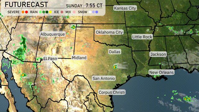
Tomorrow in the Southern Plains, expect a mix of weather patterns. Rain will stretch from Dallas to Corpus Christi, delivering much-needed moisture. Oklahoma City is in line for potentially stronger storms, driven by an unstable air mass and a cold front approaching. Areas in southeast Oklahoma through to Wednesday night should remain vigilant for severe weather alerts. Temperatures will trend cooler post-storms, but drier conditions will swiftly follow.
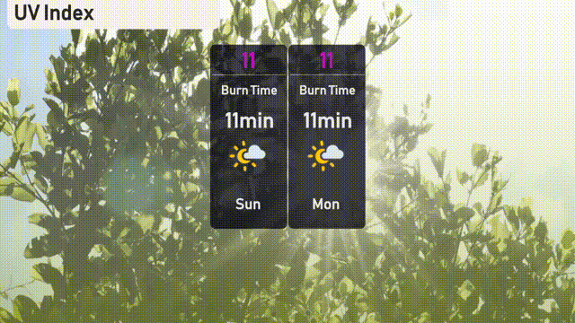
The UV index in Austin will be very high, reaching 11 today. Expect rapid sunburn within just 11 minutes of direct sunlight exposure.
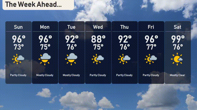
For the 7-day forecast in Austin:
Sunday: Partly cloudy with a high of 96 degrees and a low of 73.
Monday: Mostly cloudy, continuing with highs at 96 degrees and lows at 75.
Tuesday: Similar weather with mostly cloudy skies, highs peaking at 96 degrees and lows at 75.
Wednesday: A slight dip in the heat with partly cloudy conditions, expect a high of 88 degrees and a low of 75.
Thursday: Temperatures rise with partly cloudy skies, reaching a high of 92 degrees and a low of 76.
Friday: Another warm day under partly cloudy skies, high of 96 degrees and a low of 77.
Saturday: Mostly clear skies as temperatures soar to 99 degrees and a low of 76.