Morning Clouds to Noon Sun: Austin’s Weather Rollercoaster
By
Amy Freeze
Explore a detailed forecast for Austin, covering the dynamic shifts from morning clouds to clear skies, alongside insights into the weather trends across Southern Plains this week.
Get ready, Austin! Your week features everything from cloudy mornings at 77 degrees to sunny afternoons up to 96 degrees. We discuss the changing skies and what these shifts mean for your plans!
This week in Austin starts with cloudy mornings but soon gives way to clearer skies and warmer temperatures, reaching up to 96 degrees. Across the Southern Plains, expect variable conditions including severe storms in Oklahoma City and persistent heat in El Paso. Don’t miss out on essential tips for managing these conditions and staying safe from the extreme UV rays! For a comprehensive day-by-day Austin forecast and regional weather trends, visit our detailed blog post.
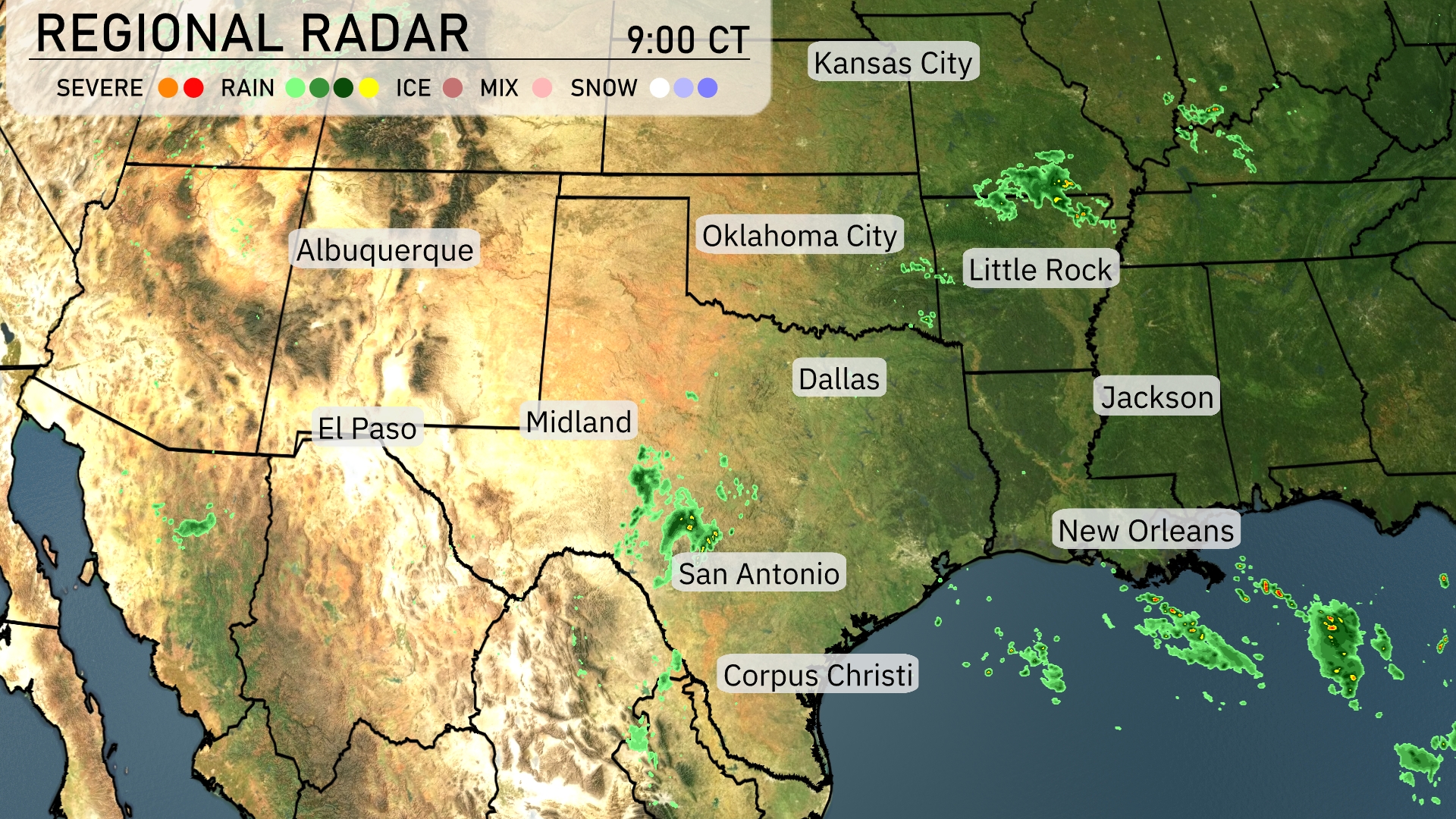
Across the Southern Plains, pockets of rain are scattered in southern Texas, particularly near San Antonio and Corpus Christi, creating a damp morning for these areas. In contrast, areas like Dallas and Oklahoma City remain dry with clear skies for now. Little Rock is experiencing some isolated showers, while New Orleans is watching moisture move up from the Gulf, hinting at some scattered rain throughout the day. The western regions around El Paso and Midland are enjoying calm conditions under clear skies.
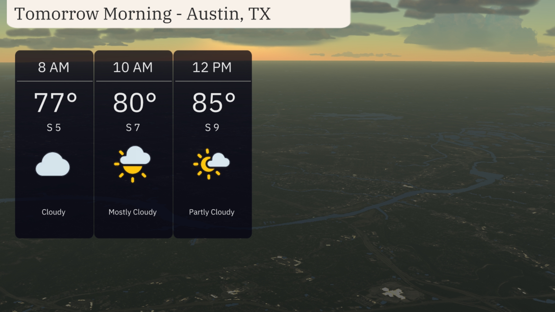
For Austin tomorrow morning, expect it to be cloudy at 8 AM with a temperature of 77 degrees and a light southern breeze at 5 miles per hour. By 10 AM, the sky will transition to mostly cloudy with a temperature of 80 degrees, winds increasing to 7 miles per hour from the south. The clouds will begin to clear by noon with temperatures reaching 85 degrees and a southern wind at 9 miles per hour.
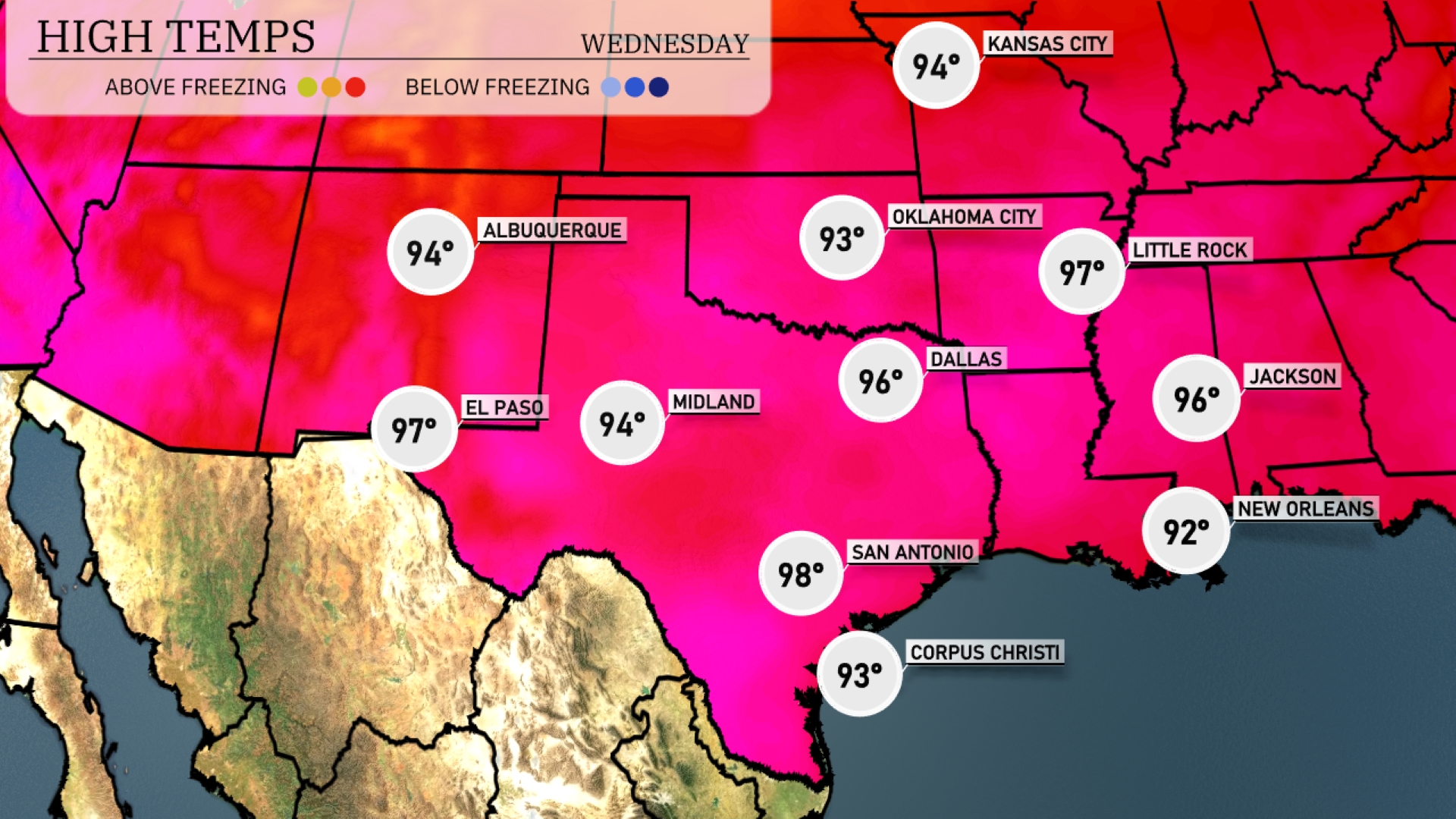
Tomorrow in El Paso, expect a high of 97 degrees, while Midland will reach 94. Dallas will see slightly warmer temperatures with a high of 96 degrees. In San Antonio, temperatures are predicted to spike to 98 degrees, contributing to above-average readings for this time of year. Little Rock is also heating up, anticipating a high of 97 degrees, influenced by a strong ridge of high pressure in the region.
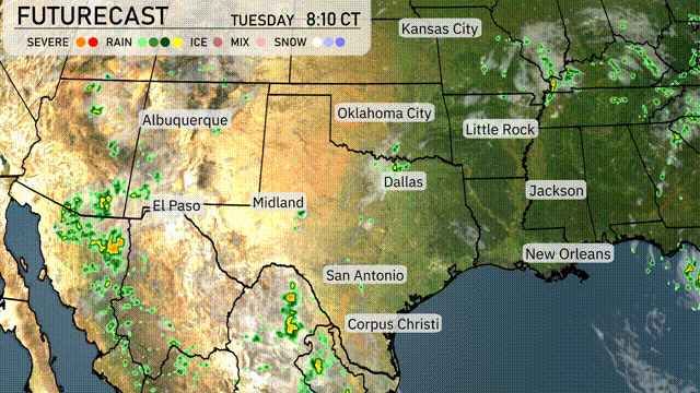
A cold front is moving through the Southern Plains, bringing much-needed rain from Dallas to Corpus Christi tomorrow. Oklahoma City may experience stronger storms as the unstable air mass interacts with this front. Be prepared for severe weather warnings in the area through Wednesday night, particularly in southeastern regions. By late Tuesday, expect lingering showers and thunderstorms extending into Arkansas. Temperatures across the region are expected to remain warm, but brief cooling may follow storm passages.
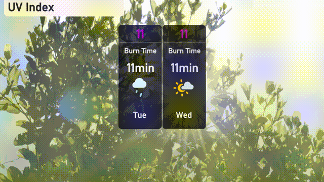
The UV index in Austin is extremely high at 11, resulting in a burn time of just 11 minutes on both Tuesday and Wednesday. Ensure you take extra precautions with sunscreen and protective clothing.
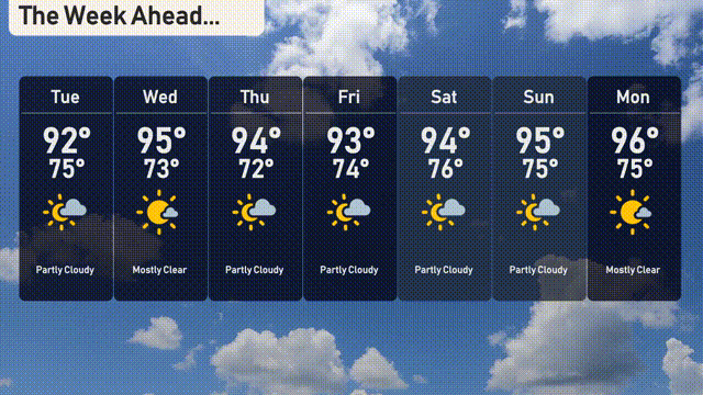
For the 7-day forecast in Austin:
Tuesday: Partly cloudy skies with a high of 92 degrees and a low of 75 degrees.
Wednesday: Mostly clear conditions, warming up to 95 degrees with a nighttime low of 73 degrees.
Thursday: Looking at partly cloudy skies with a daytime high of 94 degrees and a low of 72 degrees.
Friday: Another partly cloudy day with temperatures reaching 93 degrees and dipping to 74 degrees overnight.
Saturday: Partly cloudy with a high of 94 degrees and a nighttime low of 76 degrees.
Sunday: Mostly clear with temperatures hitting a high of 95 degrees and a low of 75 degrees.
Monday: Finishing off with mostly clear skies and a high of 96 degrees, low around 75 degrees.