Austin’s Week in Weather: Sun, Storms, and the Science Behind It
By
Amy Freeze
Explore a week of weather in Austin, from soaring temperatures to storm advisories, and what it means for your week ahead.
This week in Austin brings everything from sun to thunderstorms. Find daily highs, lows, and important storm warnings to keep you prepared.
Austin Afternoon News – 06/10/2025: This is your comprehensive guide to the week’s weather in Austin and the surrounding Southern Plains. From sunny afternoons with highs reaching the 90s to severe storm advisories by night, we cover all the trends and safety tips. Detailed daily forecasts include temperature changes, precipitation, and severe weather warnings to help you plan and stay safe throughout the week.
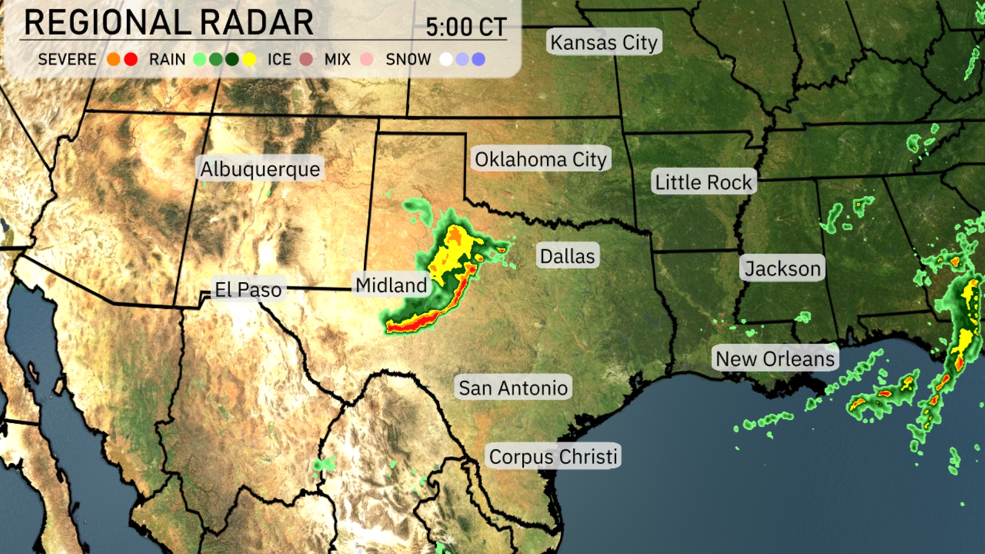
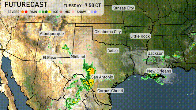
A line of severe storms is sweeping through West Texas, stretching from Midland towards San Antonio, while showers are developing over the Gulf of Mexico, heading towards New Orleans. Oklahoma City and Little Rock remain dry under clear skies, but Dallas is seeing some scattered rain showers. The far eastern parts of Texas are dealing with light rain approaching from the east. Watch for rain showers developing near Jackson as well, moving towards the east.
Temperatures in Austin this afternoon will reach up to 89 degrees around 4 PM, with mostly cloudy skies. Expect a light east-southeast wind at 4 miles per hour, shifting to east-northeast by 6 PM as temperatures dip slightly to 87 degrees. By 8 PM, partly cloudy conditions will emerge, with temperatures cooling to 85 degrees and a light easterly breeze.
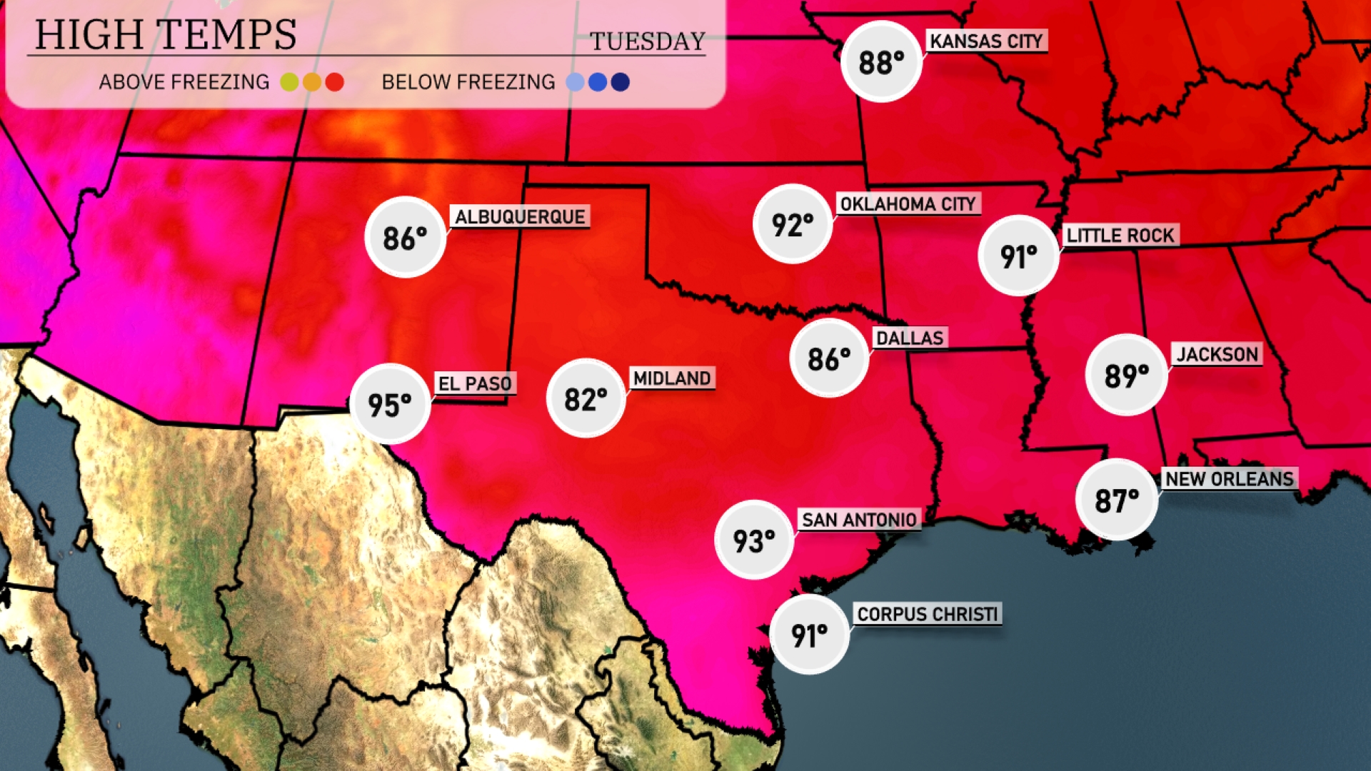
Today, we’re seeing some warm temperatures across the Southern Plains. In El Paso, we’re expecting a high of 95 degrees, while Midland will be a bit cooler at 82. San Antonio is on the warmer side with a high of 93. Dallas is sitting at 86 degrees, and Little Rock will reach 91. Jackson has a pleasant day ahead with a high of 89, and New Orleans is coming in slightly cooler at 87 degrees.
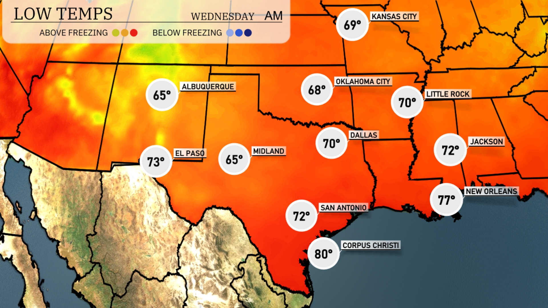
Tonight in the Southern Plains, temperatures are expected to cool down significantly. Dallas will see a low of 70 degrees, while Little Rock and Oklahoma City will drop to 68. Oklahoma City temperatures might feel chilly compared to recent days, with a notable drop to 67 in the Oklahoma City area. Farther south, San Antonio will have a mild low of 72 degrees, while Corpus Christi remains warmer at 80.
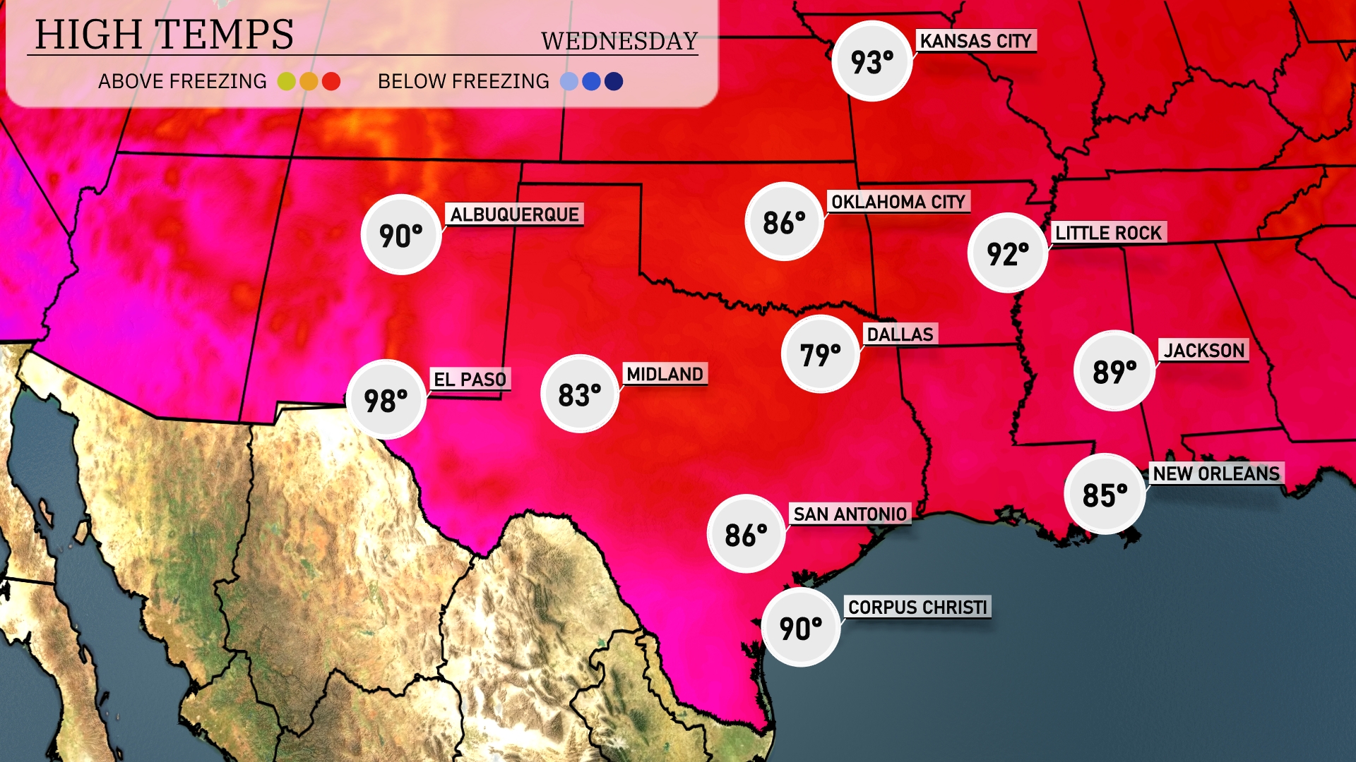
Tomorrow, El Paso is set for a hot 98 degrees, while Midland will see a warm high of 83. The temperature in Dallas will reach 79 degrees, which is slightly below average for this time of year. San Antonio isn’t far behind with a high of 86 degrees, staying consistent with seasonal norms. Corpus Christi will round out the region’s warmth with a high of 90 degrees, indicating a typical summer day in the Southern Plains.
A potent cold front approaches the Southern Plains, sparking a day of unpredictable weather. Expect rain from Dallas reaching down to Corpus Christi, offering beneficial rainfall. Oklahoma City stands a chance of experiencing more potent storms, driven by a highly unstable air mass. With severe weather risks present, particularly in Southeast areas by Wednesday night, stay prepared for potential warnings. Post-front, temperatures drop noticeably, clearing conditions towards the weekend.
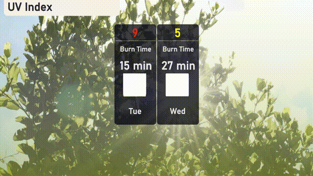
The UV index in Austin is expected to be high at 9 on Tuesday, posing a sun exposure risk with a burn time of about 15 minutes. Models indicate a moderate level of 5 on Wednesday, reducing the burn time to 27 minutes. Remember to wear sunscreen and take breaks in the shade!