Austin’s Week of Weather Whiplash: From Sunny Skies to Storm Alerts
By
Amy Freeze
Austin faces a dramatic shift in weather this week, starting with sunny mornings and escalating to potential severe storms. Get the full forecast and what it means for you.
Get ready, Austin! From serene mornings at 66°F to stormy afternoons, we’re tracking a turbulent weather week ahead. Stay tuned and stay safe.
This week in Austin brings a rollercoaster of weather conditions. Starting with calming sunny mornings at 66°F and escalating to storm threats with possible heavy rain due to a looming cold front. As temperatures soar to the 90s midweek, prepare for sudden shifts to cooler, drier air. Check out our tips for handling severe weather and understand what this means for your daily plans. For more detailed insights, visit our blog at https://amyfreeze.ai/
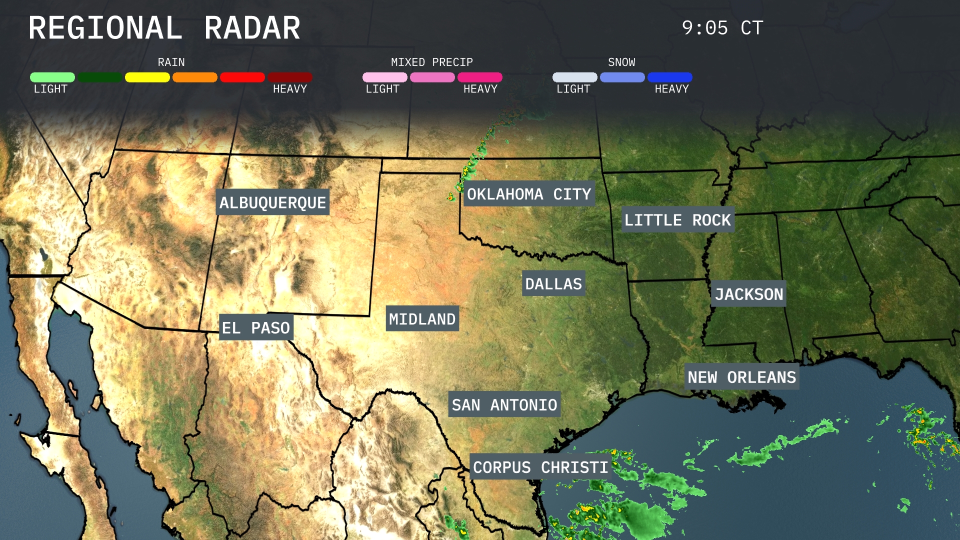
A line of storms is advancing eastward from Oklahoma City, indicating the possibility of severe weather. The showers extend down towards Dallas, where moderate precipitation is evident, and are impacting areas near Midland with light rain. Meanwhile, Corpus Christi is experiencing substantial rain activity moving off the coast. Farther east, scattered rain showers are developing near New Orleans, with potential for more persistent rain in the area.
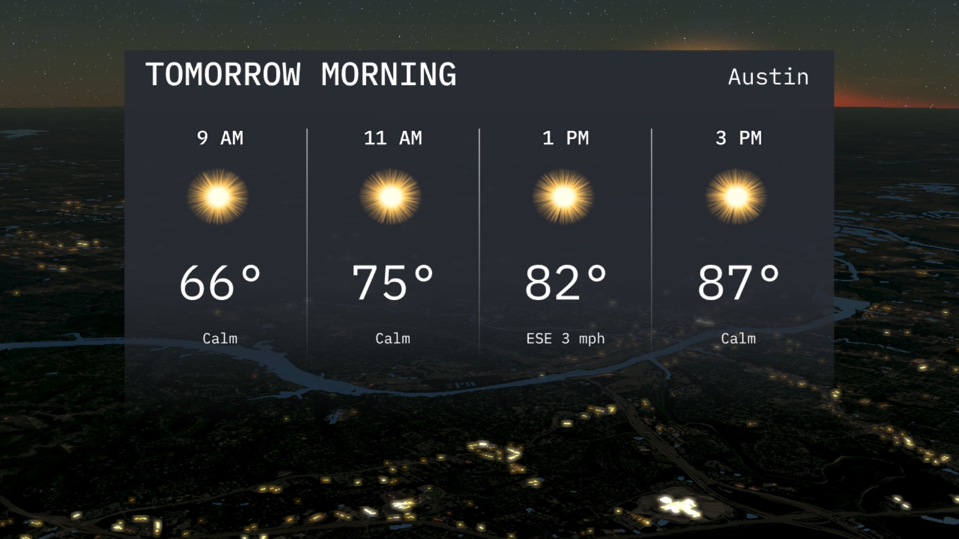
Tomorrow morning in Austin starts off calm with sunny skies and temperatures at 66 degrees by 9 AM. As the morning progresses, the temperature will rise to 75 degrees by 11 AM under continued clear conditions. A slight breeze may develop from the east-southeast.
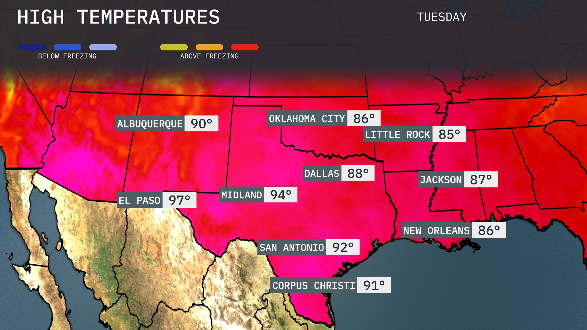
Tomorrow in El Paso, expect a high of 97 degrees, while Midland warms up to a sizzling 94. San Antonio is poised for a high of 92, and Dallas will reach 88 degrees. Over in Oklahoma City, temperatures are forecasted to hit 86, with Little Rock slightly cooler at 85. Jackson is anticipating a high of 87, showing temperatures that are above average for this time of year across much of the Southern Plains.
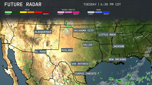
A cold front will push through the Southern Plains tomorrow, bringing rain and potentially severe weather from Dallas to Oklahoma City. Expect storms with the potential for strong winds and heavy rain, so keep an eye out for any severe weather alerts. Rain will provide much-needed moisture, particularly from Corpus Christi to San Antonio. Temperatures are set to drop slightly after the front moves through, bringing cooler and drier air by midweek.
The UV index in Austin is at 9 today, making it very high with a burn time of about 12 minutes in direct sunlight. Tomorrow, the index remains the same, with similar sun exposure risks.
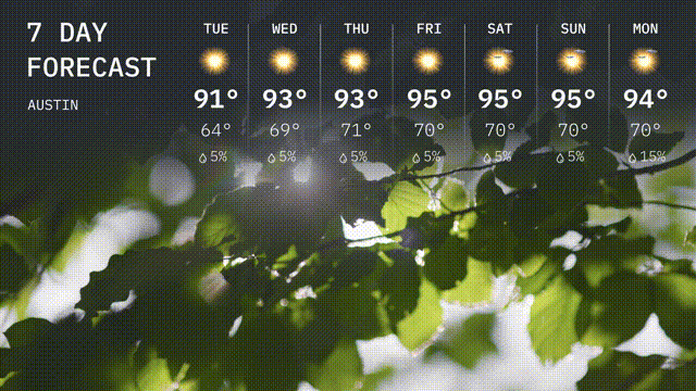
Tuesday: Sunny skies with a high of 91 degrees and a low of 64 degrees.
Wednesday: Warming up to 93 degrees, with the low around 69 degrees, mostly sunny.
Thursday: Similar conditions with plenty of sunshine, reaching a high of 93 degrees and a low of 71 degrees.
Friday: Mostly sunny and slightly hotter, high temperatures climbing to 95 degrees with a low of 70 degrees.
Saturday: Expect more sun with a high of 95 degrees and a low of 70 degrees.
Sunday: Sunny skies continue. Look for another high of 95 degrees and a nighttime low near 70 degrees.
Monday: Wrapping up the week with a high of 94 degrees, staying warm under mostly sunny skies, with a low of 70 degrees.