Austin’s Week in Weather: From Clear Skies to Storm Warnings
By
Amy Freeze
Explore a detailed breakdown of Austin's weather this week, from lovely sunny mornings to significant storm threats. Stay prepared with our comprehensive guide.
Get the latest on Austin’s weather! Begin your week with sunshine and brace for stormy afternoons. Visit our full blog at https://amyfreeze.ai/ for all the details.
This week in Austin, enjoy clear and sunny mornings with temperatures starting at a delightful 66 degrees. As the day progresses, prepare for a shift as we anticipate strong thunderstorms driven by a powerful cold front moving through the Southern Plains. Explore the detailed day-by-day forecast, from sunny highs to stormy lows, in our extensive coverage. Understand how these conditions can affect your daily plans and learn safety tips alongside. Read the full story at https://amyfreeze.ai/.
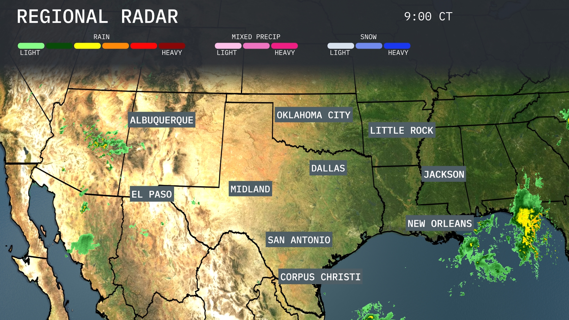
A look at the Southern Plains shows rain intensifying over New Orleans. Shifting west, light showers are impacting El Paso and stretching north toward Albuquerque. Skies remain clear across Dallas and Oklahoma City. There are some storms developing over Jackson, moving eastward into the surrounding areas.
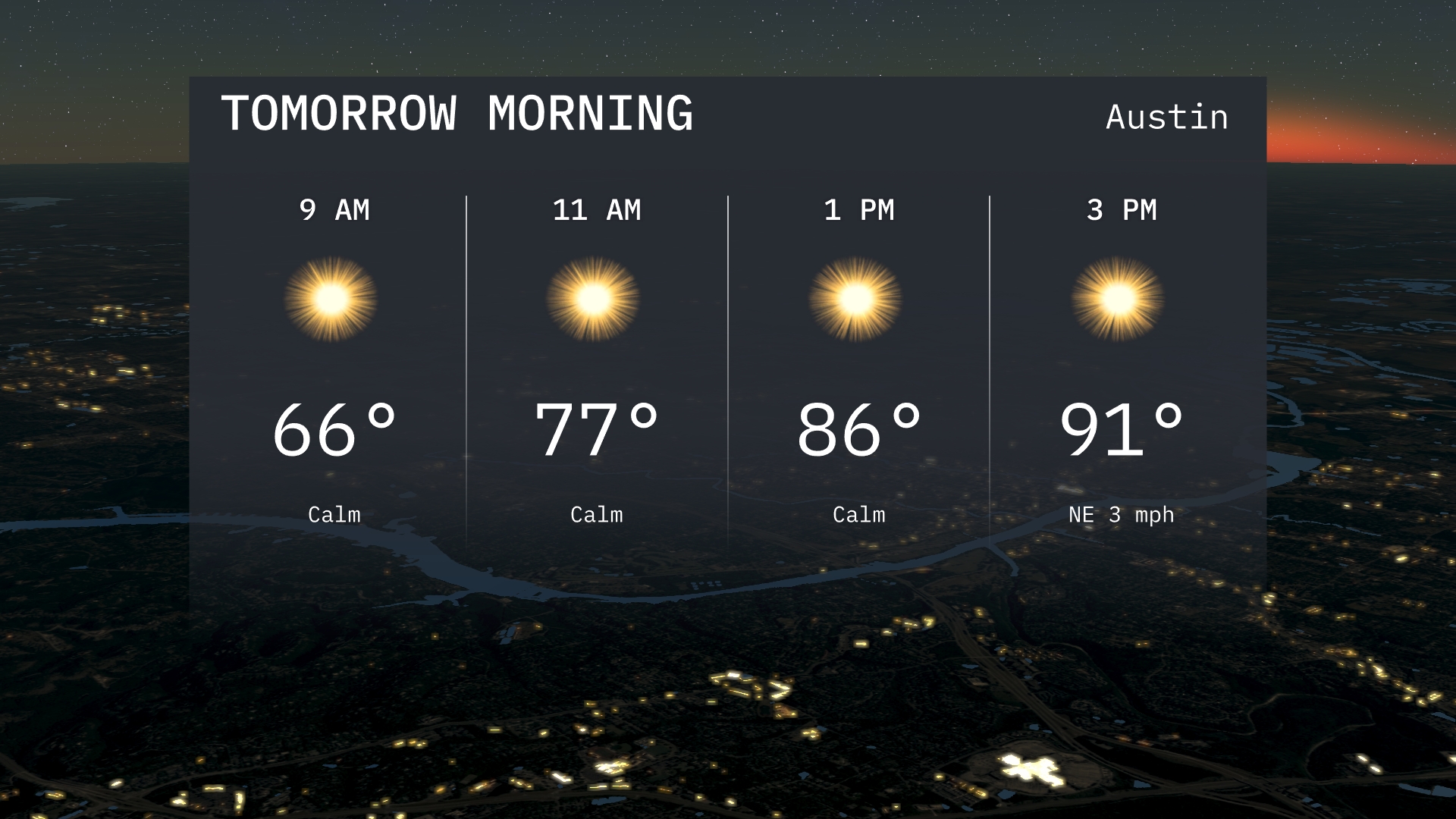
Austin’s morning will begin at 66 degrees by 9 AM with sunshine on the horizon. Temperatures will rise to 77 degrees by 11 AM as the calm conditions continue. Expect clear skies through the morning hours, offering a pleasant start to the day.
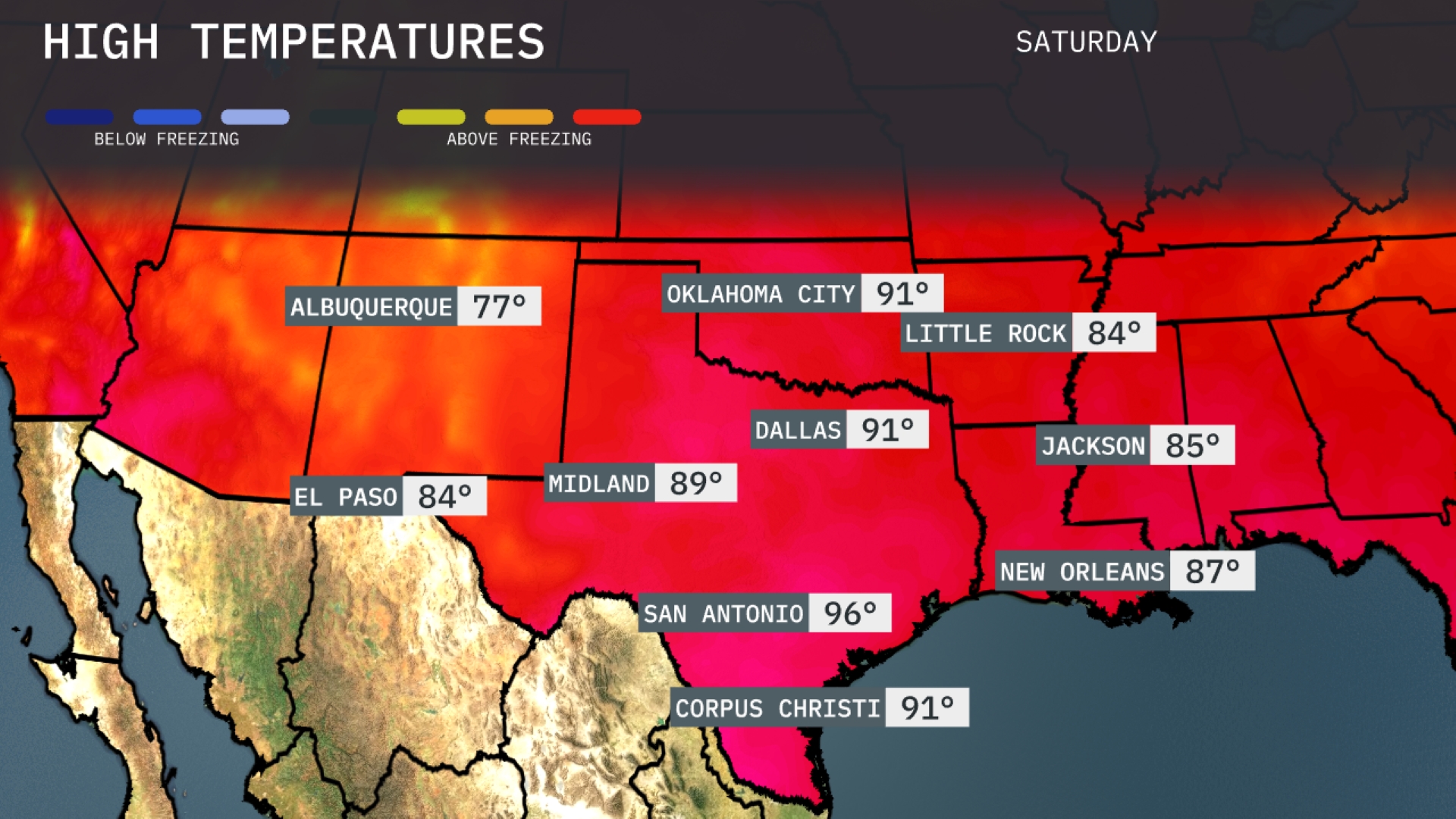
Tomorrow, Oklahoma City is forecasted to reach a high of 91 degrees, while Dallas also sees similar warmth with a high of 91. Midland is trending a bit cooler with a high of 89 degrees. Over in San Antonio, expect a sizzling high of 96, significantly above the average for this time of year. Corpus Christi is predicted to hit 91 degrees, and Jackson rounds out the region with a high of 85.
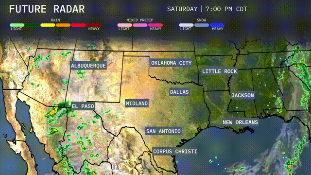
A powerful cold front is expected to surge through the Southern Plains tomorrow, initiating significant weather changes. Dallas to Corpus Christi can anticipate widespread thunderstorms, bringing beneficial rainfall and possible thunderstorm activity. Oklahoma City may experience severe storms due to an unstable air mass, with a risk of strong winds and hail. As the front progresses, Little Rock through Jackson will witness storm development in the afternoon, potentially causing localized flooding. Temperatures will drop post-storms, leading to cooler conditions by midweek.
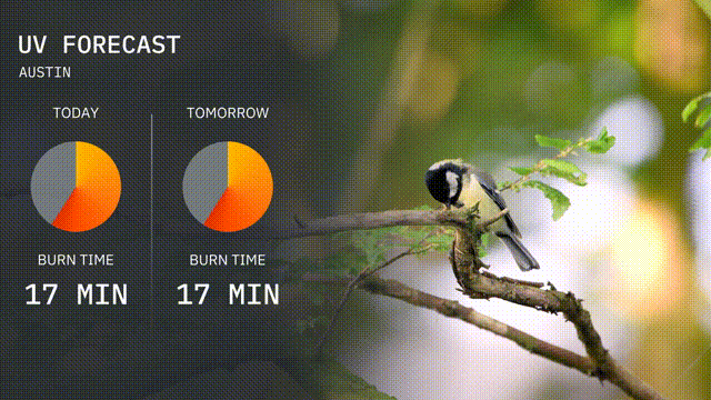
The UV index in Austin today remains high, with a burn time of about 17 minutes, so make sure to protect your skin if you’re outdoors. Tomorrow follows with similar conditions, offering no reduction in sun exposure risk. Sunscreen and hats are your best bets for staying safe!
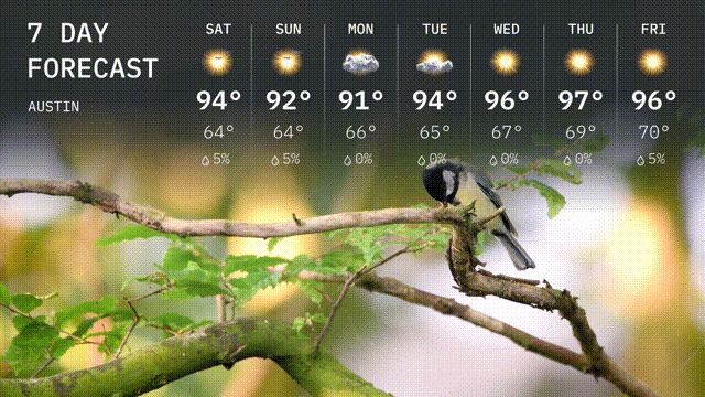
Saturday: Sunny and warm, with a high of 94 degrees and a low of 64 degrees.
Sunday: More sunshine ahead, peaking at 92 degrees with temperatures dipping to 64 degrees overnight.
Monday: Slightly cooler with a chance of precipitation. Daytime highs around 91 degrees and a low of 64 degrees.
Tuesday: Expect overcast skies with a significant chance of rain. Highs reaching 94 degrees and a low of 65 degrees.
Wednesday: Partly cloudy skies, warming up to a high of 96 degrees, with a low of 67 degrees.
Thursday: Another warm day with mostly sunny skies. The high will be 97 degrees, cooling down to 69 degrees.
Friday: Sunny and hot, reaching 96 degrees during the day with a nighttime low of 70 degrees.