Chicago Braces for Incoming Storms: A Detailed Midwest Weather Analysis
By
Amy Freeze
Explore our extensive weather breakdown as Chicago gears up for a stormy week, with insights on temperature trends and storm forecasts across the Midwest.
Chicago and the Midwest are on alert as storms sweep through, bringing varying temperatures and storm conditions. Get the latest updates and safety tips to navigate the week ahead safely.
Welcome to our detailed Midwest weather analysis for Chicago and surrounding areas. This week, the region faces a series of weather challenges, from intense heatwaves to incoming thunderstorms. Discover what these meteorological developments mean for your area with our up-to-date forecasts, UV index warnings, and safety advice to help you and your loved ones stay safe amidst fluctuating weather conditions. Don’t miss out on our insights into how these weather patterns will evolve throughout the week.
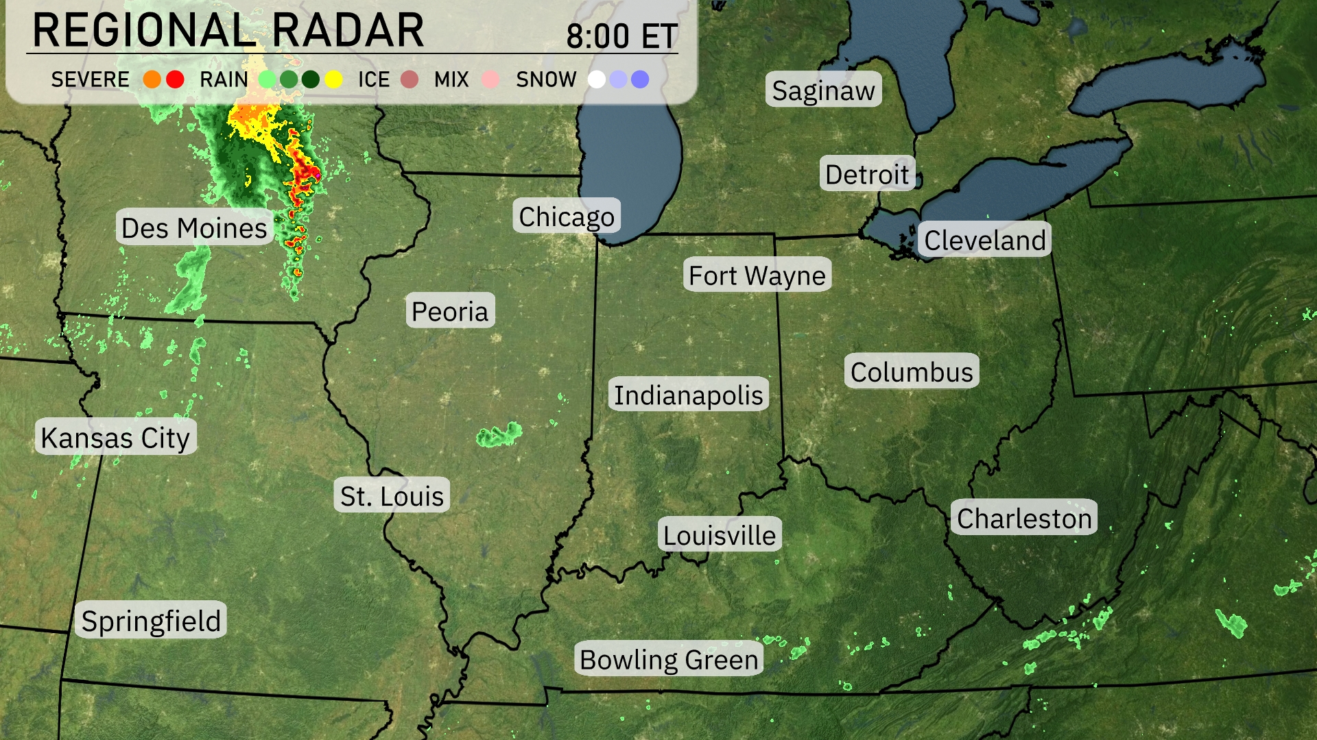
A line of strong storms is sweeping across Iowa, moving from Des Moines towards Chicago. The radar shows heavy rain and severe weather conditions, with bright reds and yellows, intensifying as it progresses southeast toward Peoria. Meanwhile, showers are scattered across southern Ohio near Bowling Green and Charleston. The rest of the Midwest, including cities like Indianapolis, Fort Wayne, and Detroit, remains relatively clear, enjoying a break from any precipitation.
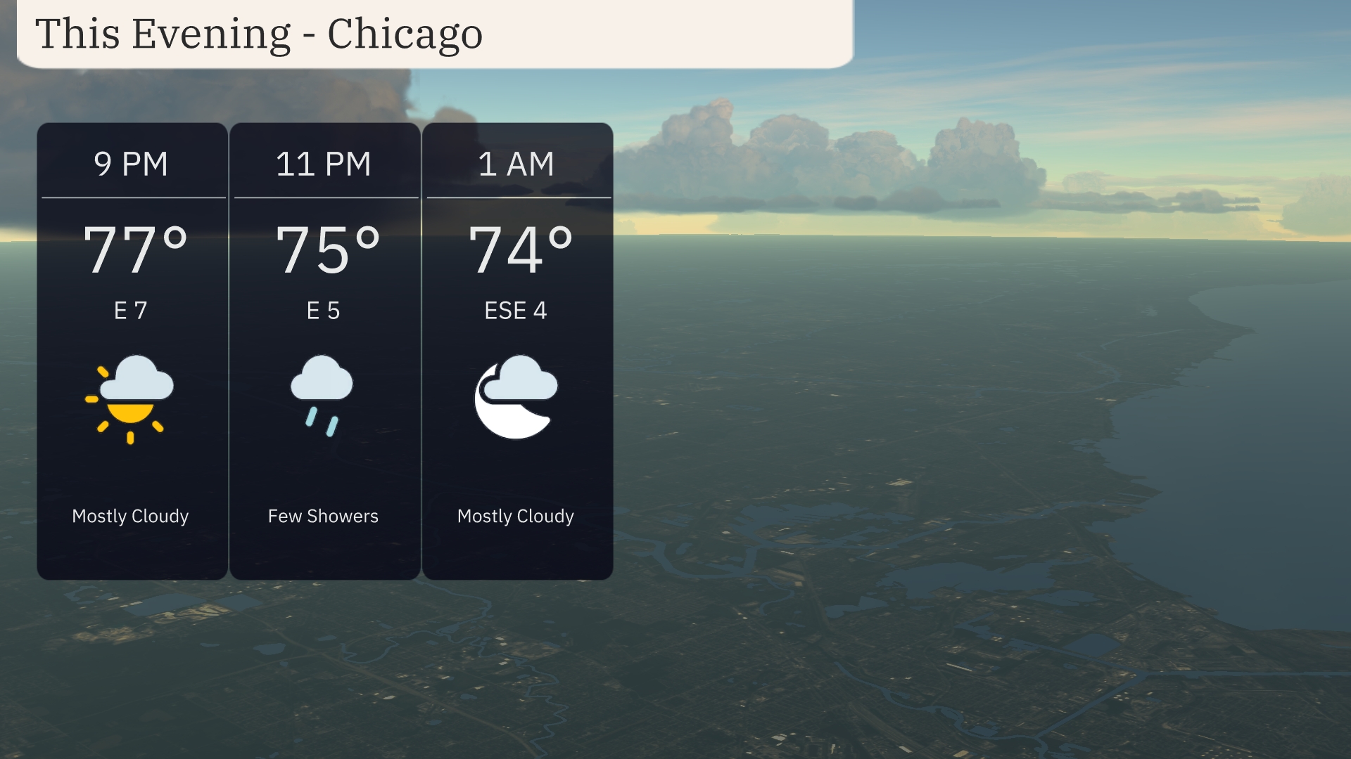
Temperatures in Chicago this evening will start at 77 degrees at 9 PM, gradually cooling to 74 degrees by 1 AM. Expect mostly cloudy skies with a chance of a few showers around 11 PM. Winds will be light, coming from the east and shifting slightly east-southeast at 4 miles per hour towards the end of the evening.
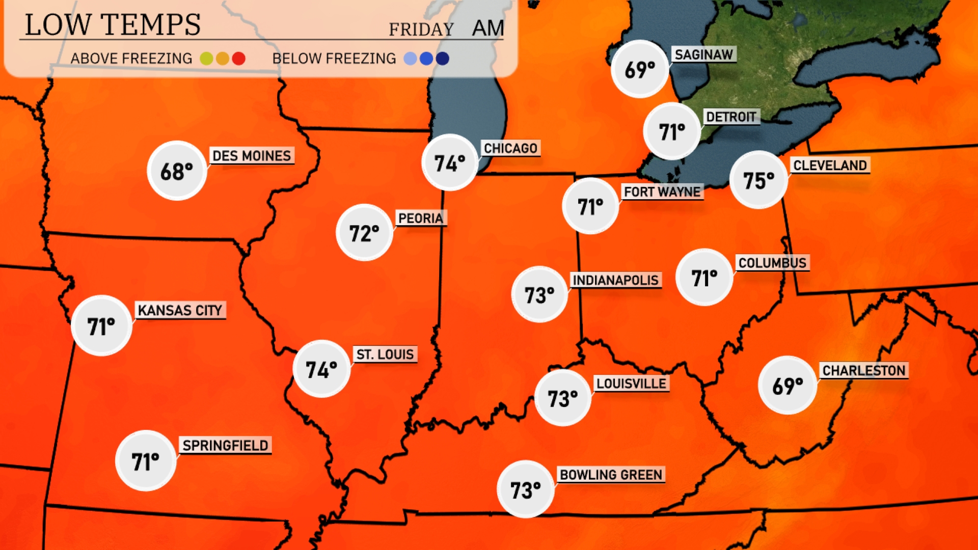
Tonight, Chicago will experience a low of 74 degrees, while St. Louis drops to 74 as well. Indianapolis will see temperatures fall to 71. Expect lows of 71 in Kansas City and 69 in Charleston, with Fort Wayne also around 71 degrees.
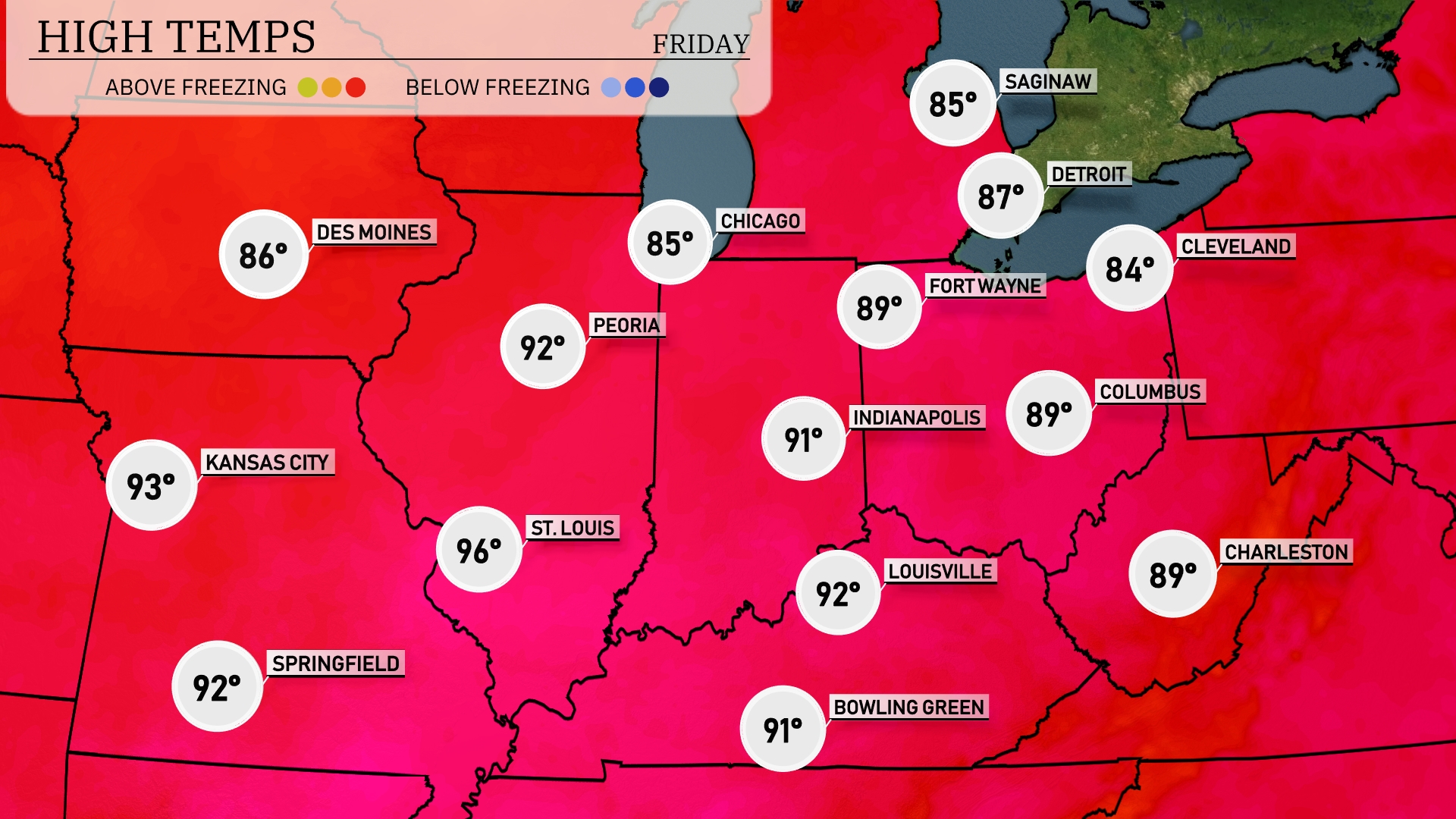
Tomorrow, the Midwest will experience notably high temperatures, with Kansas City reaching 93 degrees and St. Louis heating up to a sizzling 96 degrees. Further north, Chicago expects a high of 85 degrees, while Detroit will be slightly warmer at 87 degrees. Indianapolis is on track for a high of 89 degrees, closely followed by Louisville and Bowling Green, both expected to hit 92 degrees. These readings are significantly above average for this time of year, driven by a persistent heatwave influencing the region.
A cold front sweeps across the Midwest, potentially sparking scattered thunderstorms from Des Moines to Indianapolis by tomorrow afternoon. Be on alert for isolated heavy downpours and strong winds, particularly in areas like Peoria, where storm activity could escalate. Temperatures will dip slightly behind the front, bringing cooler, breezy conditions to cities such as Chicago and Detroit through Friday. Anticipate a changeover to clearer skies and reduced humidity by Friday evening as high pressure builds in from the west.
The UV index in Chicago will be very high, reaching 9 on both Thursday and Friday, with a burn time of approximately 15 minutes. Plan to take necessary precautions by applying sunscreen and wearing protective clothing if you’re outside. Avoid direct sun exposure during peak hours to minimize the risk of sunburn.
Thursday: Mostly cloudy with a high of 82 degrees and a low of 71 degrees.
Friday: Thunderstorms arriving late, reaching up to 87 degrees during the day with a low around 75 degrees.
Saturday: Partly cloudy with temperatures hitting 86 degrees in the afternoon and 70 degrees at night.
Sunday: Expect mostly clear skies, with temperatures peaking at 84 degrees and dropping to 68 degrees overnight.
Monday: Mostly sunny conditions with a high reaching 90 degrees and a low around 72 degrees.
Tuesday: Showers expected with daytime highs of 92 degrees and a nighttime low of 75 degrees.
Wednesday: Scattered thunderstorms with the high hitting 88 degrees and the low settling at 69 degrees.
Stay safe and enjoy your week!