Navigating Through the Storm: Chicago’s Comprehensive Weather Forecast
By
Amy Freeze
Tomorrow comes with a mix of clouds and clarity in Midwest skies. Dive into our detailed forecast to start your day prepared, from showers in Chicago to sunny spots in the region.
Meteorologist Amy Freeze brings you the latest weather trends in Chicago and neighboring cities. Prepare for a mix of rain and pleasant temperatures. Full forecast at https://amyfreeze.ai/
As the Midwest prepares for a frontal system affecting areas from St. Louis to Indianapolis, Chicago isn’t left out. With a consistent veil of rain predicted for tomorrow morning and a cooling trend towards noon, Meteorologist Amy Freeze spells out what your day could look like and how to plan ahead. Detailed temperature and wind changes, along with safety tips for potential localized flooding, are discussed. Visit our blog at https://amyfreeze.ai/ for daily updates and in-depth weather analysis.
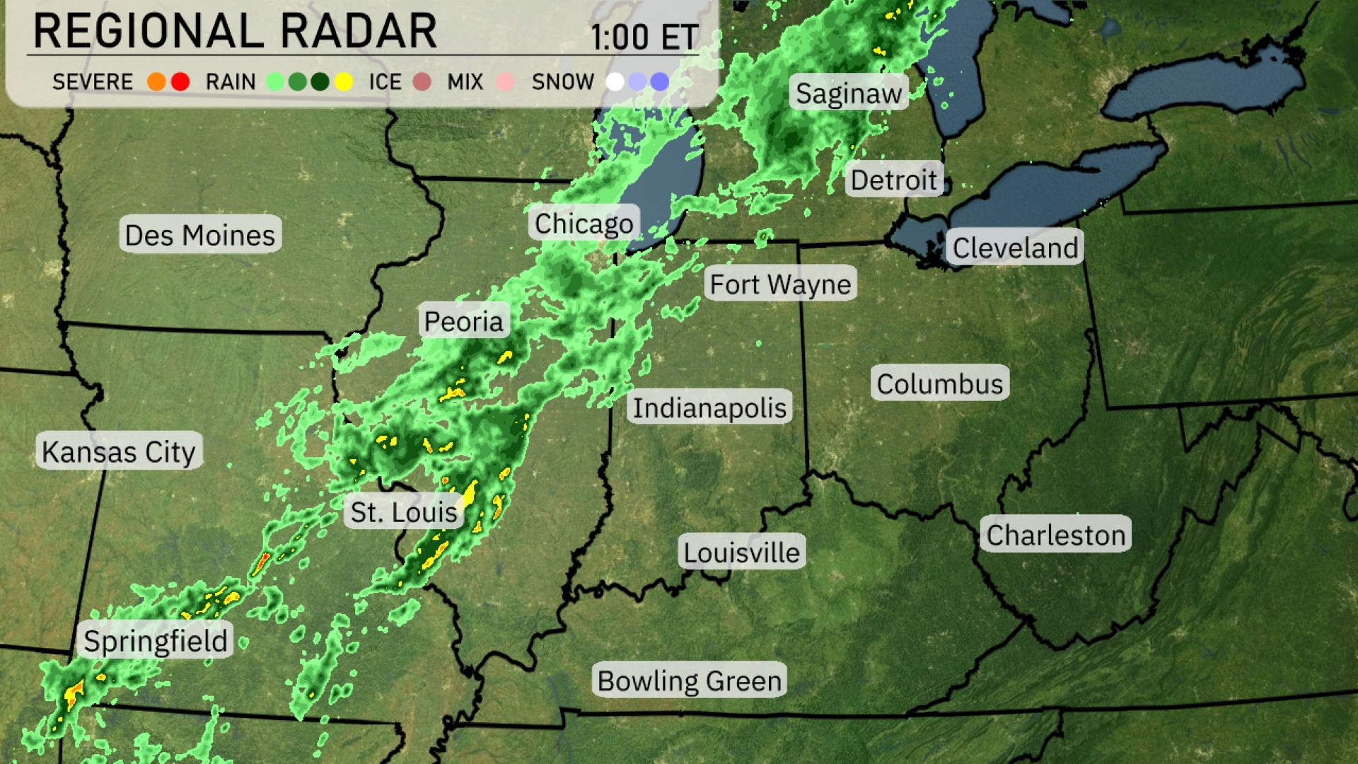
A line of storms stretches from St. Louis up through Peoria and into Chicago, bringing heavy rainfall and potential severe weather to these areas. Farther east, Fort Wayne and Detroit are beginning to experience increased cloud cover, indicating incoming precipitation. Springfield is already seeing active rain showers along this band. As the system advances, Cleveland can expect rain to arrive shortly. Areas south such as Louisville and Indianapolis are just at the edge of the system and may see rain developing later in the day.
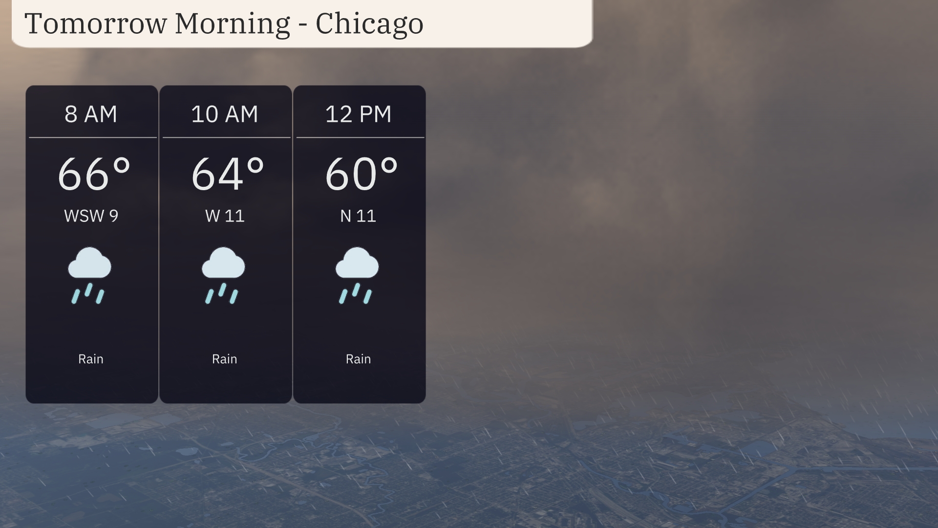
Tomorrow morning in Chicago, expect a rainy start with temperatures beginning at 66 degrees at 8 a.m. and gradually cooling to 60 degrees by noon. Winds will shift throughout the morning, moving from the west-southwest at 9 miles per hour to the north at 11 miles per hour.
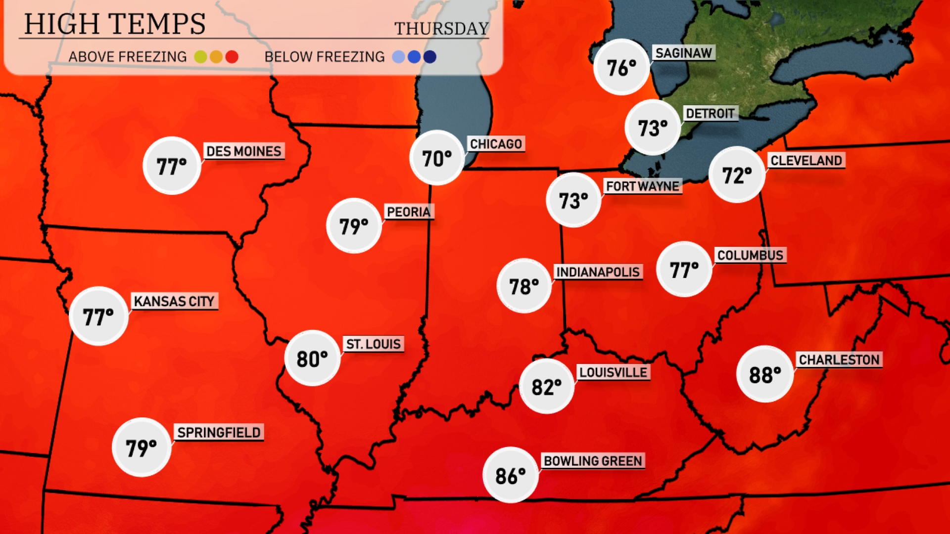
Tomorrow, St. Louis will soar to a high of 80 degrees, while Kansas City and Des Moines each see a pleasant 77. Peoria will warm to 79, and Indianapolis will experience a high of 78. Over in Louisville, temperatures climb even higher, reaching 82 degrees, with Bowling Green peaking at 86 degrees.
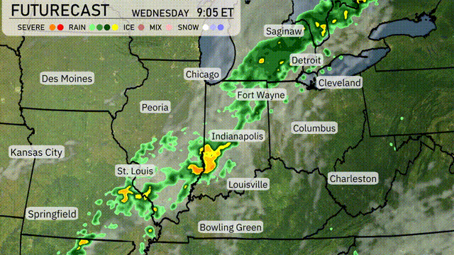
A frontal system is expected to move across the Midwest tomorrow, starting with rain spreading from St. Louis to Indianapolis by mid-morning. The heaviest showers will develop late morning into the afternoon, particularly between Fort Wayne and Cleveland, with potential for isolated storms. Throughout the day, expect persistent rain showers extending from Chicago to Detroit. Temperatures will dip as the system moves through, with cooler air settling in by evening. While severe weather isn’t prominent, localized flooding in low-lying areas might occur due to heavy rainfall.
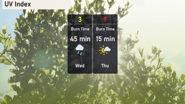
The UV index in Chicago is low today with a value of 3, providing minimal risk from UV exposure due to cloud cover. On Thursday, expect a high UV index of 9, translating to a burn time of around 15 minutes in direct sunlight.
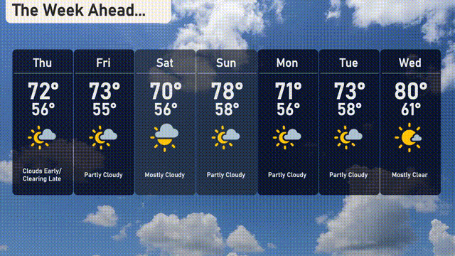
For the 7 Day Forecast in Chicago:
Thursday: Clouds early, clearing later with a high of 72 degrees and a low of 56 degrees.
Friday: Partly cloudy, reaching a high of 73 degrees and a low of 55 degrees.
Saturday: Mostly cloudy with temperatures peaking at 70 degrees and a low of 56 degrees.
Sunday: Partly cloudy as the day warms up to 78 degrees, dipping to 58 at night.
Monday: Mostly sunny skies, high of 71 degrees and a low of 56 degrees.
Tuesday: Expect partly cloudy conditions, with a high of 73 degrees and a low of 58 degrees.
Wednesday: Mostly clear skies, warming up to a nice 80 degrees during the day and cooling to 61 degrees at night.