Partly Sunny, Partly Stormy: Your Chicago Weather Insight
By
Amy Freeze
Your complete guide to today's weather for Chicago and the Midwest – from sunny forecasts to storm warnings.
Explore what’s happening in the skies above Chicago and beyond! From high temperatures to incoming storms, get all the details in our latest post.
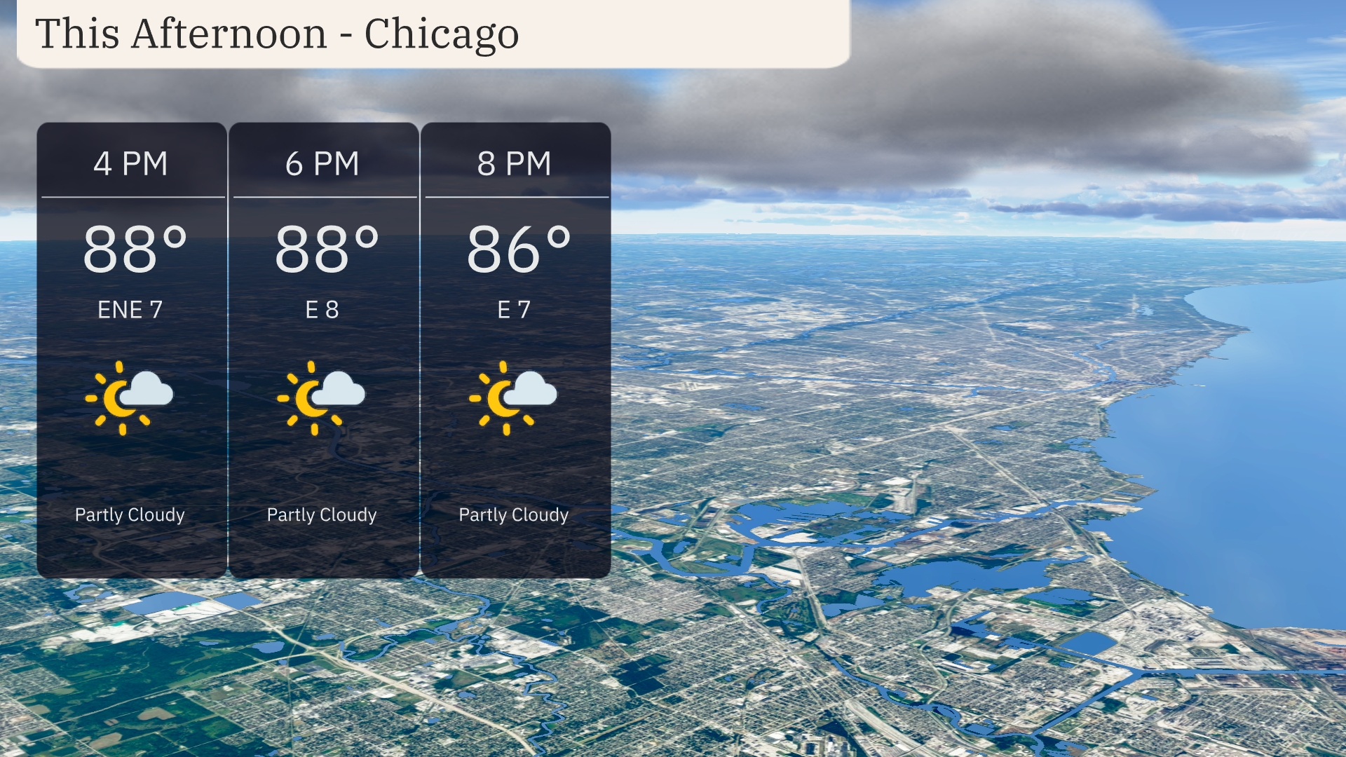
Amidst the changing skies, Chicago holds onto partly cloudy conditions this afternoon, with a pleasant 88°F. A storm system looms to the north, affecting parts of Michigan while bypassing most of the Midwest. Stay tuned as temperatures slight dip this evening, and prepare as storms may bring rain and potential flooding tomorrow. For a detailed 7-day forecast and safety tips against the high UV index, check our full update.
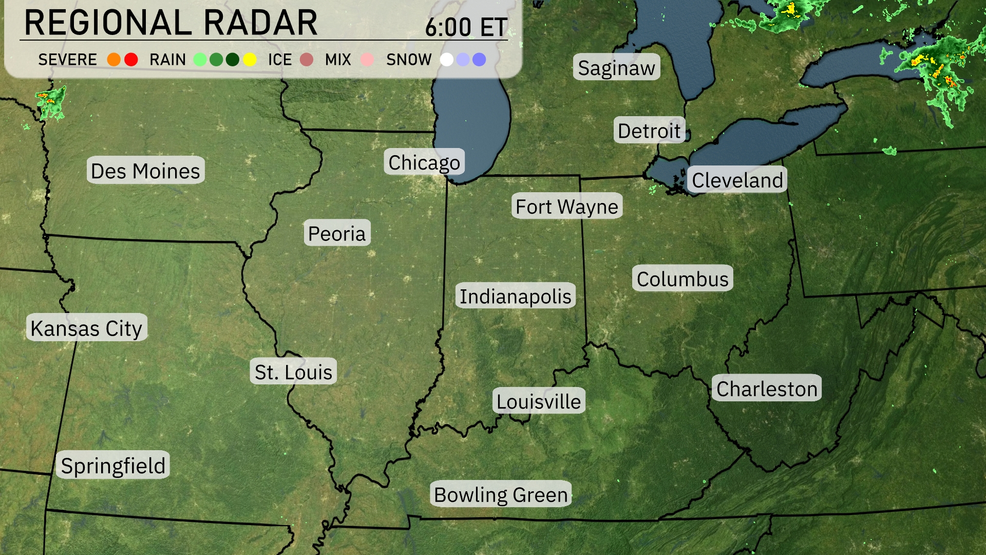
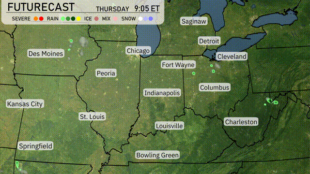
A storm system is brushing the very northern part of the Midwest, bringing precipitation over parts of Michigan, including Detroit and Cleveland, where rain is currently falling. Showers extend southwest, clipping northern Indiana near Fort Wayne. Most of the Midwest, however, enjoys clear and dry conditions from Chicago down to St. Louis, Springfield, and as far east as Columbus. The radar also indicates some clouds moving over Iowa but staying away from Des Moines for now.
Chicago’s afternoon sees temperatures holding steady at 88 degrees, with an east-northeast wind of 7 mph. Partly cloudy skies will persist throughout the afternoon, offering a mix of sun and clouds. Temperatures begin to ease slightly by evening, dipping to 86 degrees with the wind shifting to an easterly direction at 7 mph.
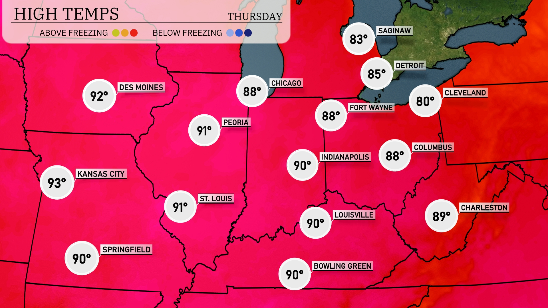
This afternoon, the Midwest is feeling the heat with highs reaching 93 degrees in Kansas City and 91 degrees in St. Louis. Peoria isn’t far behind with a high of 91, while Indianapolis and Fort Wayne both sit at 90. In Chicago, expect a milder day with a high of 88 degrees. To the north, Saginaw and Detroit are experiencing slightly cooler temperatures, topping out at 83 and 85 degrees respectively.
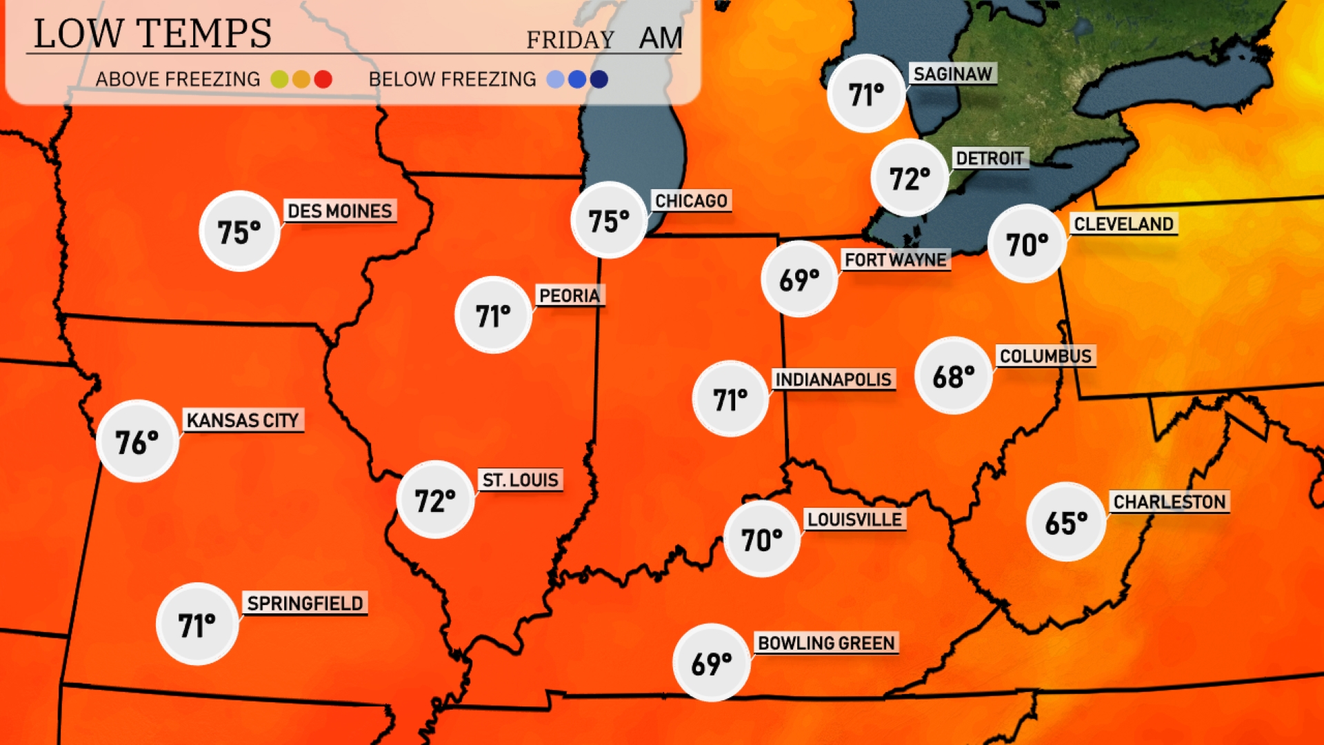
Tonight, Chicago will see a low of 75 degrees, while Des Moines is expected to drop to 75 as well. Indianapolis will register a cooler 71 degrees, with Fort Wayne at 69. Columbus will experience a chilly low of 68, and Charleston rounds out the forecast at 65 degrees.
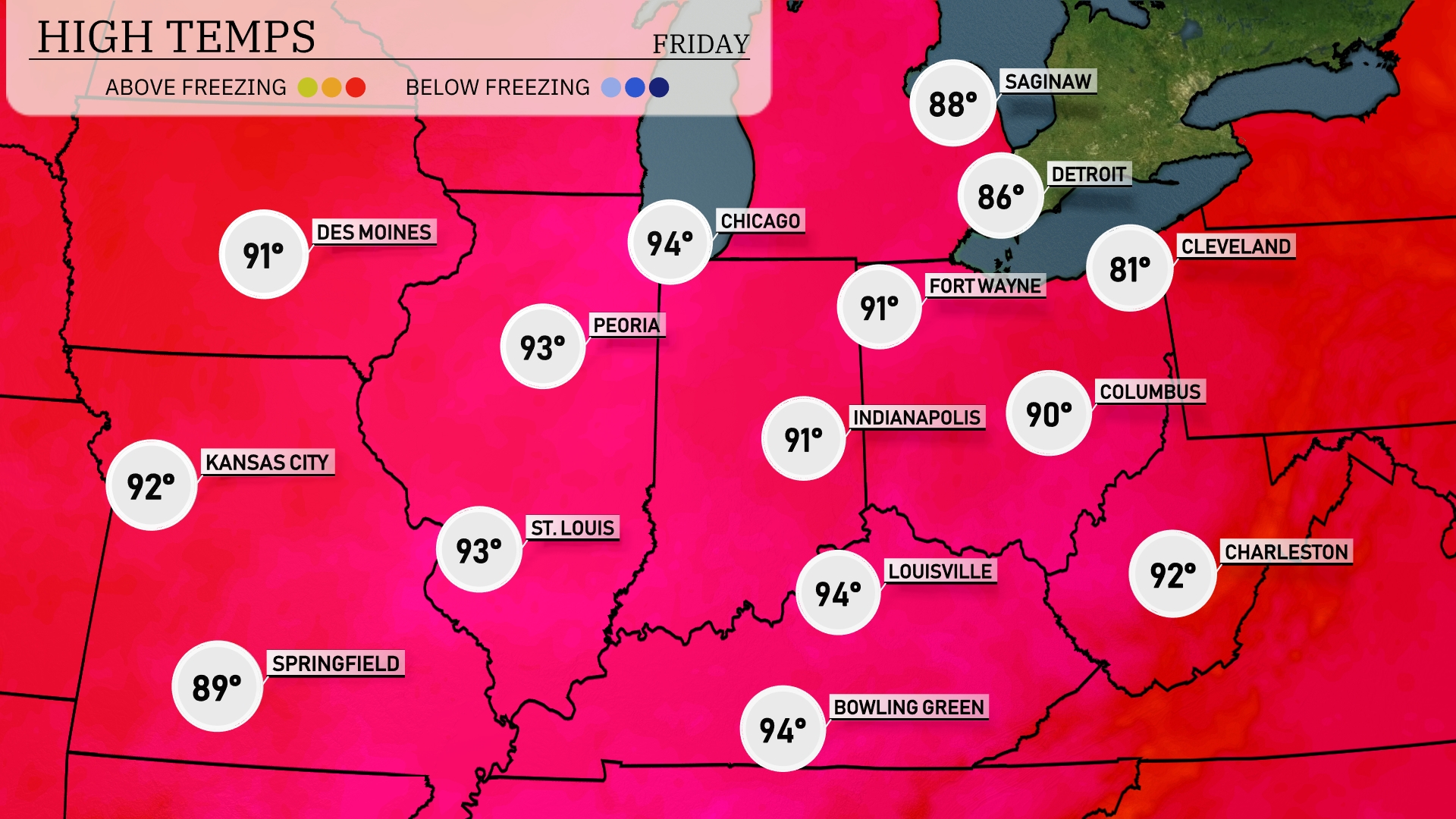
Tomorrow in the Midwest, expect sizzling high temperatures across the region. Chicago and Peoria will soar to 94 degrees, while Indianapolis is set for a high of 91. Kansas City will reach 92 degrees, with St. Louis not far behind at 93. Those in Fort Wayne can anticipate a warmer day at 91 degrees, and Cleveland will remain slightly cooler at 81.
A low-pressure system brings showers and occasional thunderstorms across the Midwest, stretching from Des Moines to Cleveland, through Indianapolis and Chicago. Expect moderate rain starting tonight, which will persist into tomorrow, with some areas seeing over an inch of accumulation. Temperatures remain mild for this time of year, ranging from mid-60s to low-70s. Pay attention to potential localized flooding, especially in urban areas, due to the cumulative rainfall. A cold front pushes through late tomorrow, leading to drier and cooler conditions as we move into the weekend.
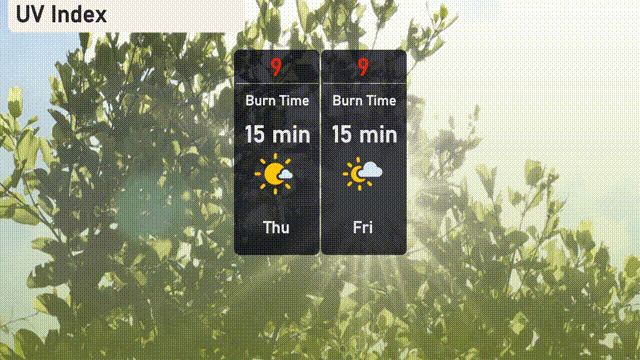
Chicago is experiencing a very high UV index of 9 both today and tomorrow, with a burn time of just 15 minutes in direct sunlight. It’s crucial to wear broad-spectrum sunscreen, a hat, and sunglasses for protection. Seek shade during peak sun hours to minimize exposure.