Chicago’s Morning Weather: A Guide to the Perfect Start
By
Amy Freeze
From gentle breezes to incoming showers, explore the essential weather forecast for Chicago and upcoming Midwest trends for a well-prepared day.
Get ready for your day with the latest weather forecasts for Chicago. From cloudy skies at dawn to light showers by late morning, know what to expect before you step out. Also, take a glance at the wider Midwest region’s weather conditions.
Tomorrow in Chicago, clouds will set the scene at dawn with temperatures starting at 62°F, ready to welcome light showers by late morning. Find out how the weather will shift throughout the day and what this means for your plans. Plus, with a cold front approaching, understand the potential for storms and prepare accordingly. Make sure to check back for updates and protect yourself from moderate UV exposure.
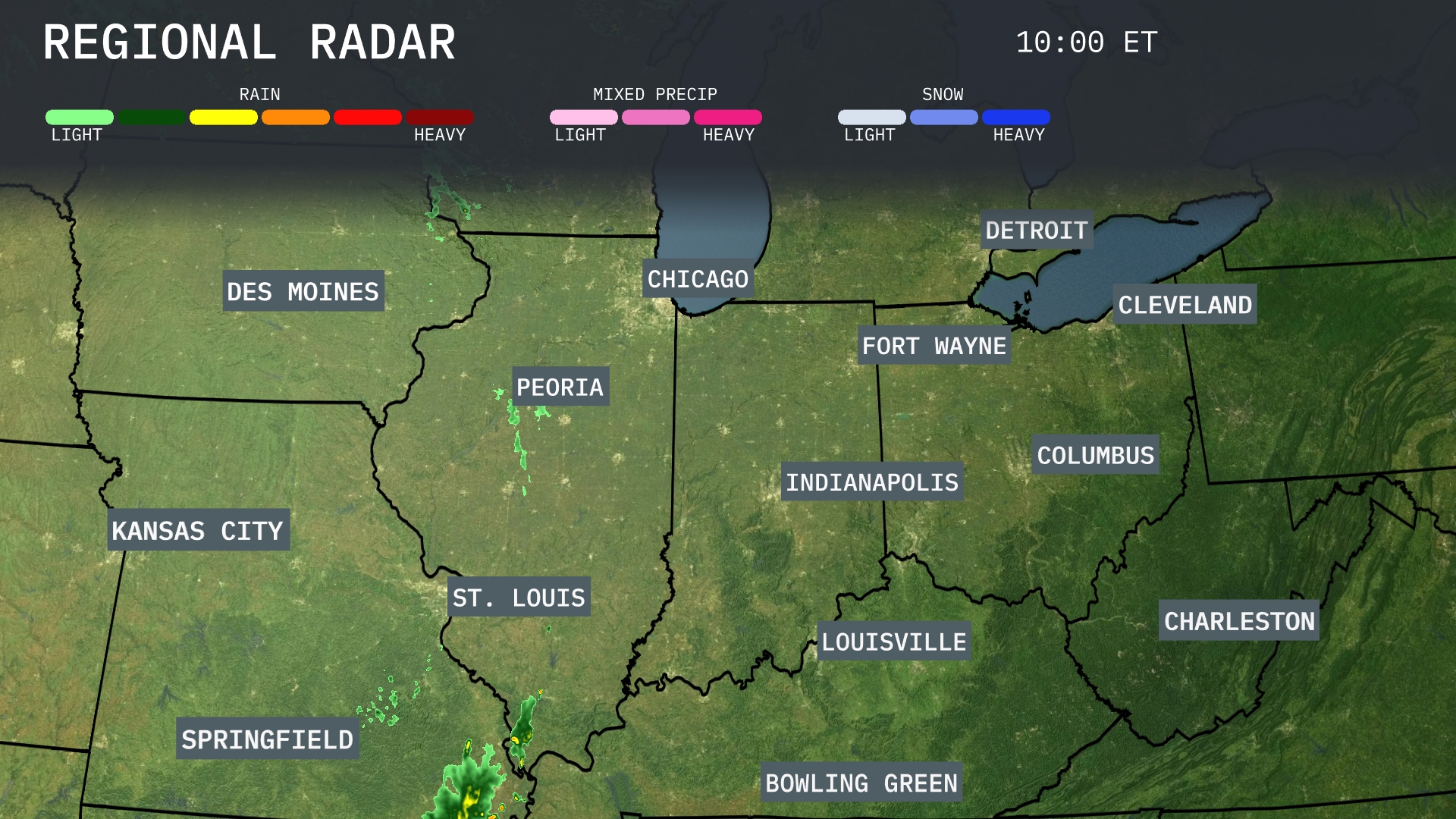
A band of rain showers is stretching from Springfield to St. Louis, moving northeast across central Illinois and will soon affect Peoria. Des Moines and Kansas City are experiencing dry conditions this morning, with clear skies expected to persist. Over in Indiana, Fort Wayne and Indianapolis remain dry, but cloud cover is increasing. Areas around Bowling Green in Kentucky are anticipating scattered light rain showers, while regions like Detroit and Cleveland remain clear with partly cloudy skies.
Tomorrow morning in Chicago will start off cloudy, with temperatures beginning around 62 degrees at 9 AM. Expect some light showers to roll through by late morning as temperatures climb slightly to 66 degrees by 11 AM. Winds will be coming from the southwest at about 10 to 15 miles per hour, adding a bit of a brisk feel to the day.
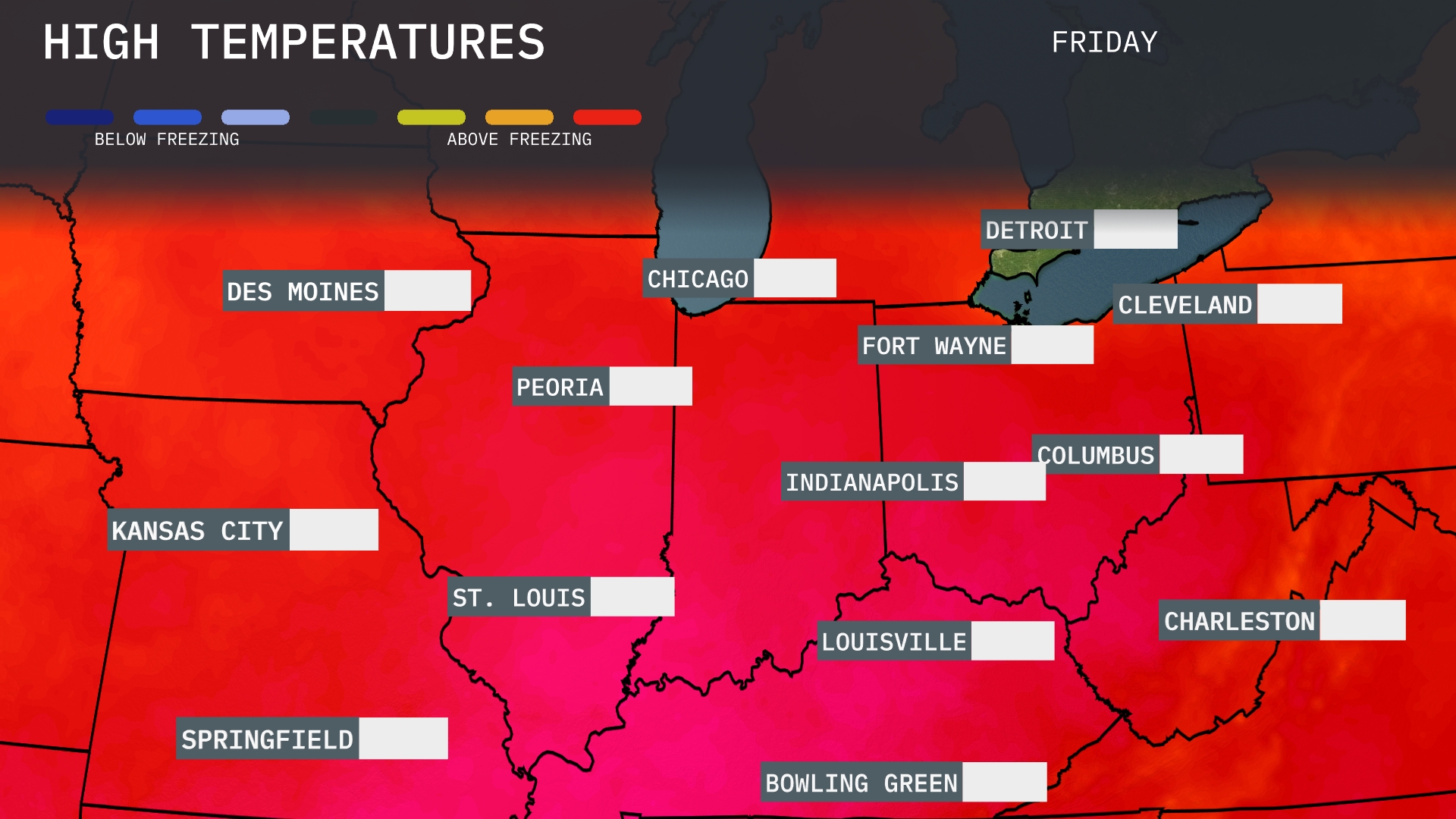
Tomorrow in Chicago, high temperatures will reach 83 degrees, significantly above the average for this time of year. Indianapolis is expected to see similar warmth with a high of 80 degrees. St. Louis will comfortably hit 82, while Kansas City is projected to reach 79 degrees. Meanwhile, temperatures in places like Peoria and Fort Wayne will peak around 81 degrees, contributing to a pleasant day across the Midwest.
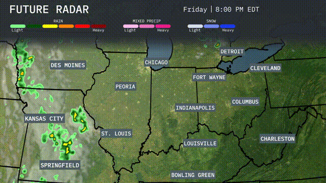
A cold front will approach the Midwest from the west, bringing storms through Kansas City and Springfield into St. Louis by Friday evening. Expect heavy rain and potential severe weather impacts, including gusty winds and isolated thunderstorm activity. Des Moines will also see some weather action, with showers spreading eastward across the region overnight. Temperatures remain warm ahead of the front, but cooler air will follow in the aftermath, noticeable by Saturday.
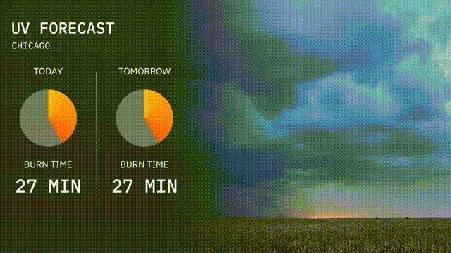
In Chicago, today’s UV index is moderate at 5, with an expected burn time of 27 minutes when under direct sunlight. Tomorrow’s index remains moderate, also at 5, indicating a similar burn time of 27 minutes.
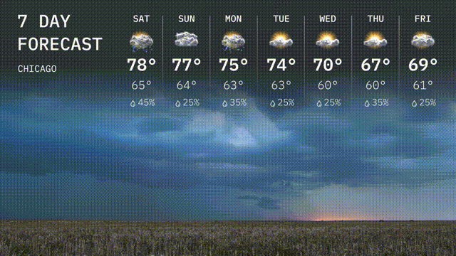
Saturday: Partly cloudy with a high of 78 degrees and a low of 65 degrees.
Sunday: A bit cloudy, reaching 77 degrees during the day and cooling to 64 degrees at night.
Monday: Expect a mix of sun and clouds with temperatures hitting 75 degrees, dropping to 63 at night.
Tuesday: Mild with partly sunny skies and a high of 74 degrees, the low is 63.
Wednesday: Clouds return with a high of 70 degrees and a cooler low of 60.
Thursday: Partly cloudy with the high at 67 degrees and a low around 60.
Friday: Partly sunny with a high of 69 degrees and cooling to 61 overnight.