Nostalgic Skies & Stormy Mornings: Your Chicago Weather Forecast
By
Amy Freeze
From serene mornings in Des Moines to stormy forecasts in Chicago, discover what the Midwest weather holds for you this week.
As clouds gather over Chicago, a stormy yet nostalgic morning sets the pace for a week of diverse Midwest weather. Discover daily forecasts that arm you with the insights you need for any weather changes!
Tomorrow reflects a canvas of cloudy skies and scattered storms across the Midwest. As Chicago wakes to a mild 77°F, the weather narrative unfolds with tales of warmth and possible storms. This detailed guide follows each day’s highs and lows, ensuring you’re not just prepared, but a step ahead in your weather readiness. Whether you’re planning a serene park day or gearing up for potential storms, this is your go-to read for all things weather-related in Chicago and beyond. From storm safety tips to enjoying sunny days, brace yourself for a week of weather contrasts!
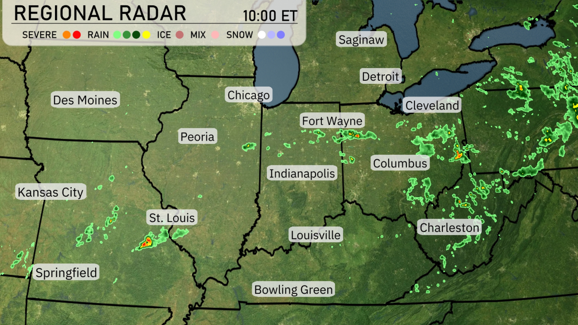
A line of storms is traversing the Midwest, with severe weather impacting areas south of St. Louis. Showers are making their way through the Ohio Valley, particularly around Columbus and Cleveland, causing widespread rain and embedded thunderstorms. In Fort Wayne, scattered storms are popping up, while Bowling Green and Louisville are experiencing cloudy skies with intermittent showers. To the northwest, Des Moines remains largely clear, offering a break from the active weather in the region.
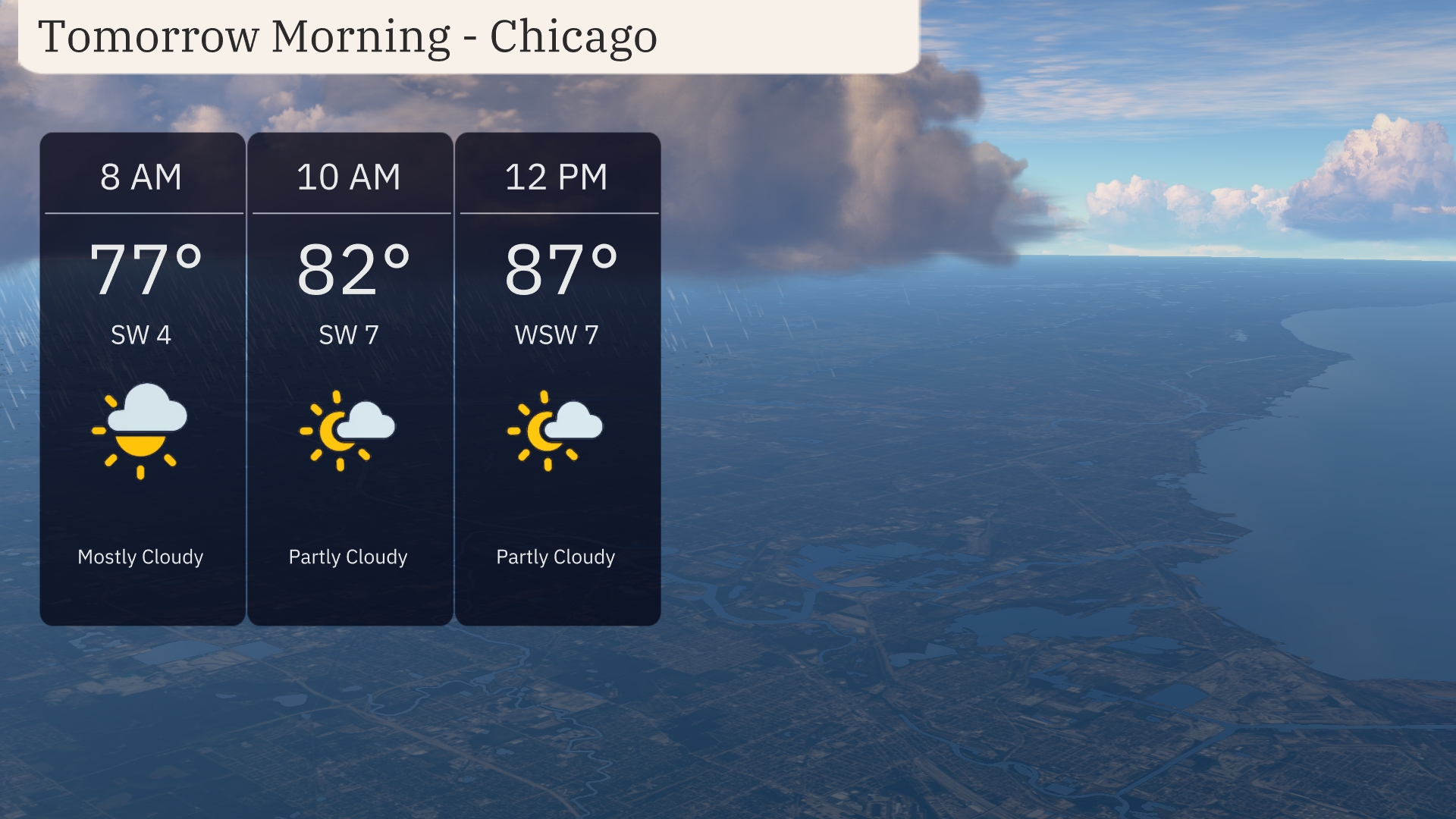
Tomorrow morning in Chicago, temperatures start at 77 degrees around 8 AM, with a light southwest breeze at 4 miles per hour. By 10 AM, expect a slight warm-up to 82 degrees and partly cloudy skies as winds shift slightly west-southwest at 7 miles per hour. By noon, temperatures rise to 87 degrees under partly cloudy conditions, maintaining that gentle breeze.
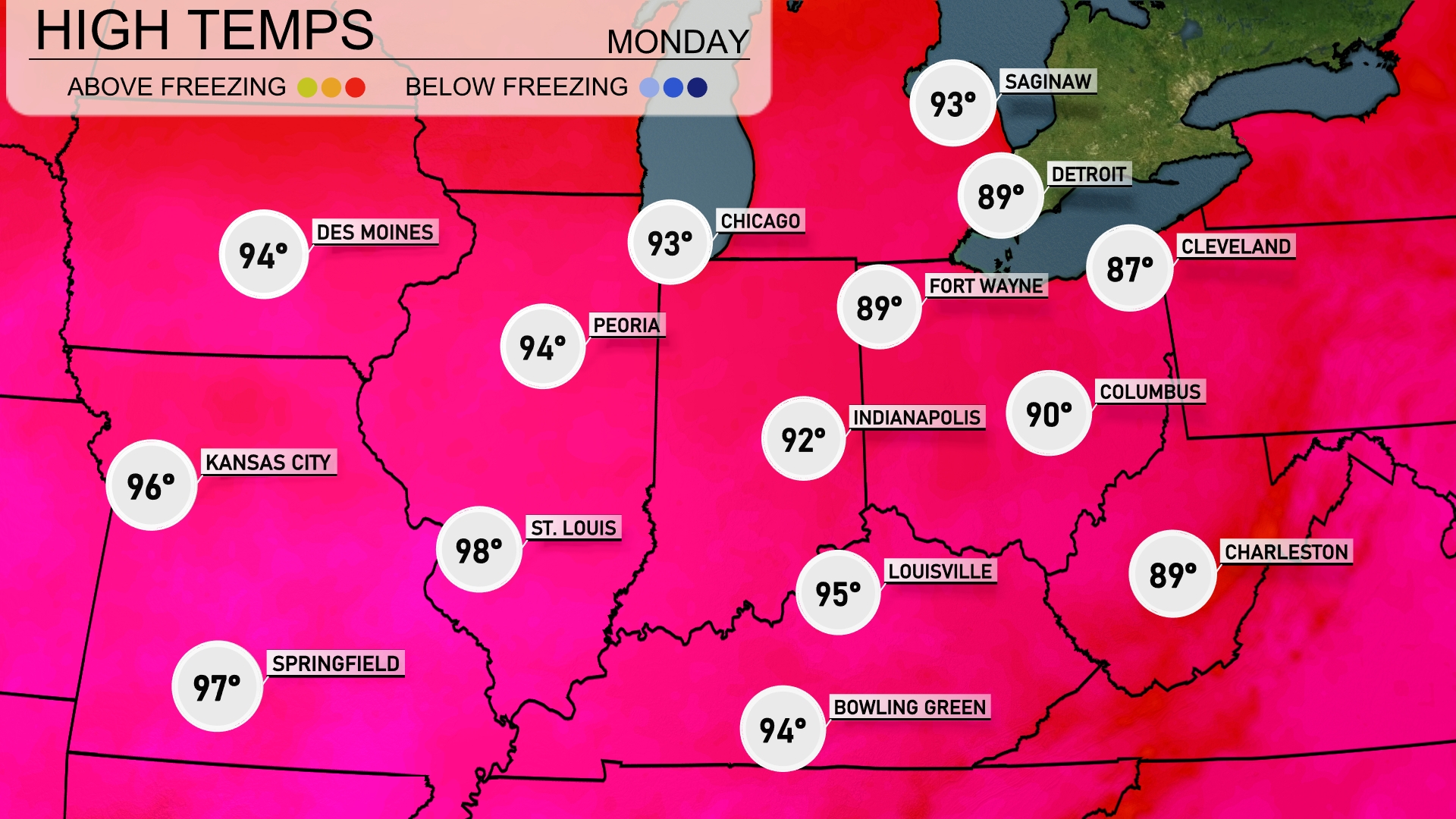
Tomorrow, high temperatures in the Midwest will reach into the mid to upper 90s. St. Louis is expected to hit 98 degrees, while Kansas City warms up to 96. Peoria and Des Moines will see highs of 94 degrees each. Indianapolis and Louisville are slightly cooler at 92 and 95 degrees, respectively. Overall, many areas will experience above-average temperatures as a warm air mass continues to influence the region.
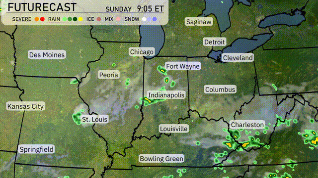
A warm front is moving into the Midwest tomorrow, bringing increased temperatures and humidity. Showers and scattered thunderstorms are expected across central Illinois to western Ohio, with the potential for heavy downpours in some areas. Be prepared for gusty winds and localized flooding, particularly near Indianapolis and Fort Wayne. As this system pushes eastward, expect clearing skies by late afternoon in the western regions, leading to a warm and partly cloudy evening. Temperatures will range from the low 80s in Chicago to the upper 80s in Louisville.
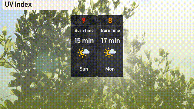
The UV index in Chicago is high today with a value of 9, so sunburn can occur in about 15 minutes. As we move into Monday, the index remains very high at 8, reducing the burn time to 17 minutes. Be cautious and wear sunscreen if you’re planning outdoor activities!
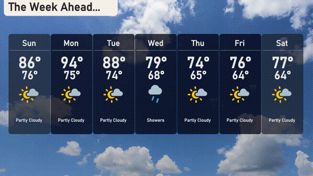
For the 7-day forecast in Chicago:
Sunday: Partly cloudy skies with a high of 86 degrees and a low of 76 degrees.
Monday: Sunny and warm, reaching up to 94 degrees, with a low of 75 degrees.
Tuesday: Partly cloudy, cooler with a high of 88 degrees and a low of 74 degrees.
Wednesday: Expect showers with a high of 79 degrees and a low of 68 degrees.
Thursday: Cooler and sunny with a high of 74 degrees and a low of 65 degrees.
Friday: Partly cloudy, with the temperature reaching 76 degrees as the high and 64 degrees as the low.
Saturday: Mostly partly cloudy, heating up to 77 degrees and cooling to 64 degrees overnight.
Hope that helps you plan your week!