Chicago Weather Watch: From Sunny Days to Stormy Nights
By
Amy Freeze
Explore a detailed breakdown of Chicago's changing weather patterns, from unexpected thunderstorms to warm sunny days, ensuring you stay ahead and prepared.
Get the latest on Chicago’s weather as we track thunderstorms and sunny intervals throughout the Midwest. Stay informed and weather-ready!
Welcome to your Midwest weather update. Chicago is set to experience a range of conditions this week, from steady rain and intense thunderstorms to sunny periods and cooling temperatures at night. The forecast promises temperature variances that highlight a notable Midwest summer, encompassed with stormy and serene weather patterns. With insights into precautionary measures for potential storms and sunny-day activities, this guide offers a holistic view of the week ahead. Check daily updates to stay ahead of the weather curve.
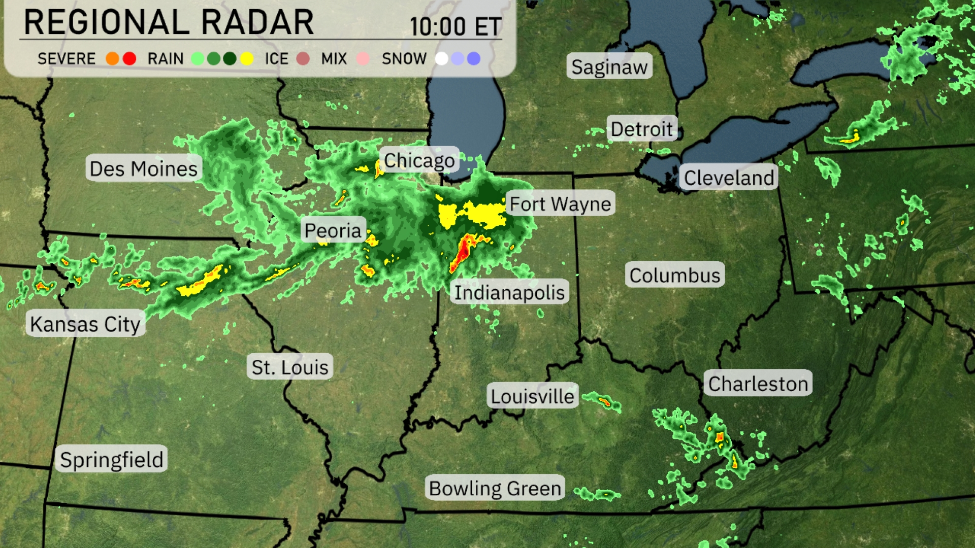
A concentrated band of precipitation stretches from Des Moines to Chicago, delivering steady rain across this corridor. Intense thunderstorms are projected for the Peoria area, with heavy rainfall extending toward Indianapolis. Fort Wayne is experiencing moderate rain, while occasional showers spread out towards Louisville. The northeastern section, including Detroit and Cleveland, currently remains clear, but be prepared for potential clouds moving in from the west.
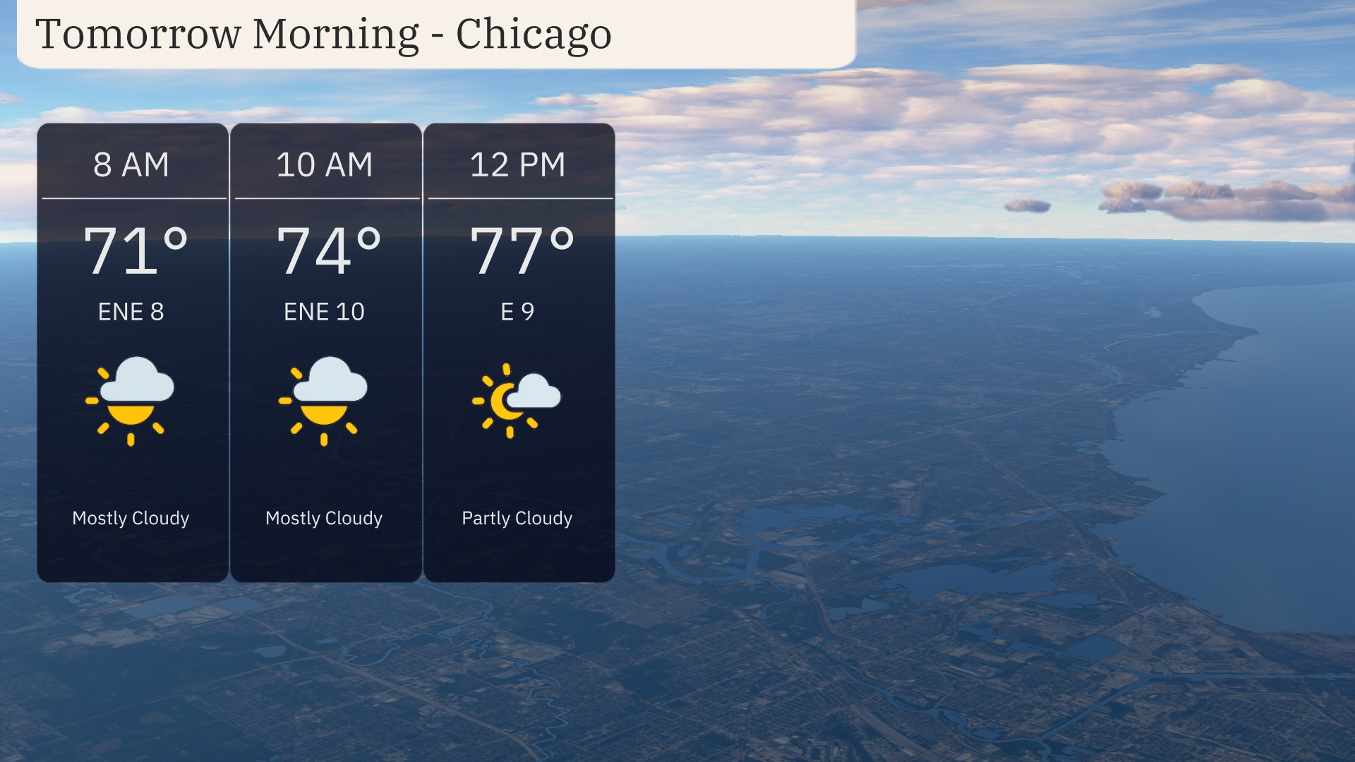
For tomorrow morning in Chicago, temperatures start at 71 degrees, reaching up to 77 degrees by noon. Expect mostly cloudy skies in the early hours with a shift to partly cloudy by midday. Winds will be easterly, ranging from 8 to 10 miles per hour throughout the morning.
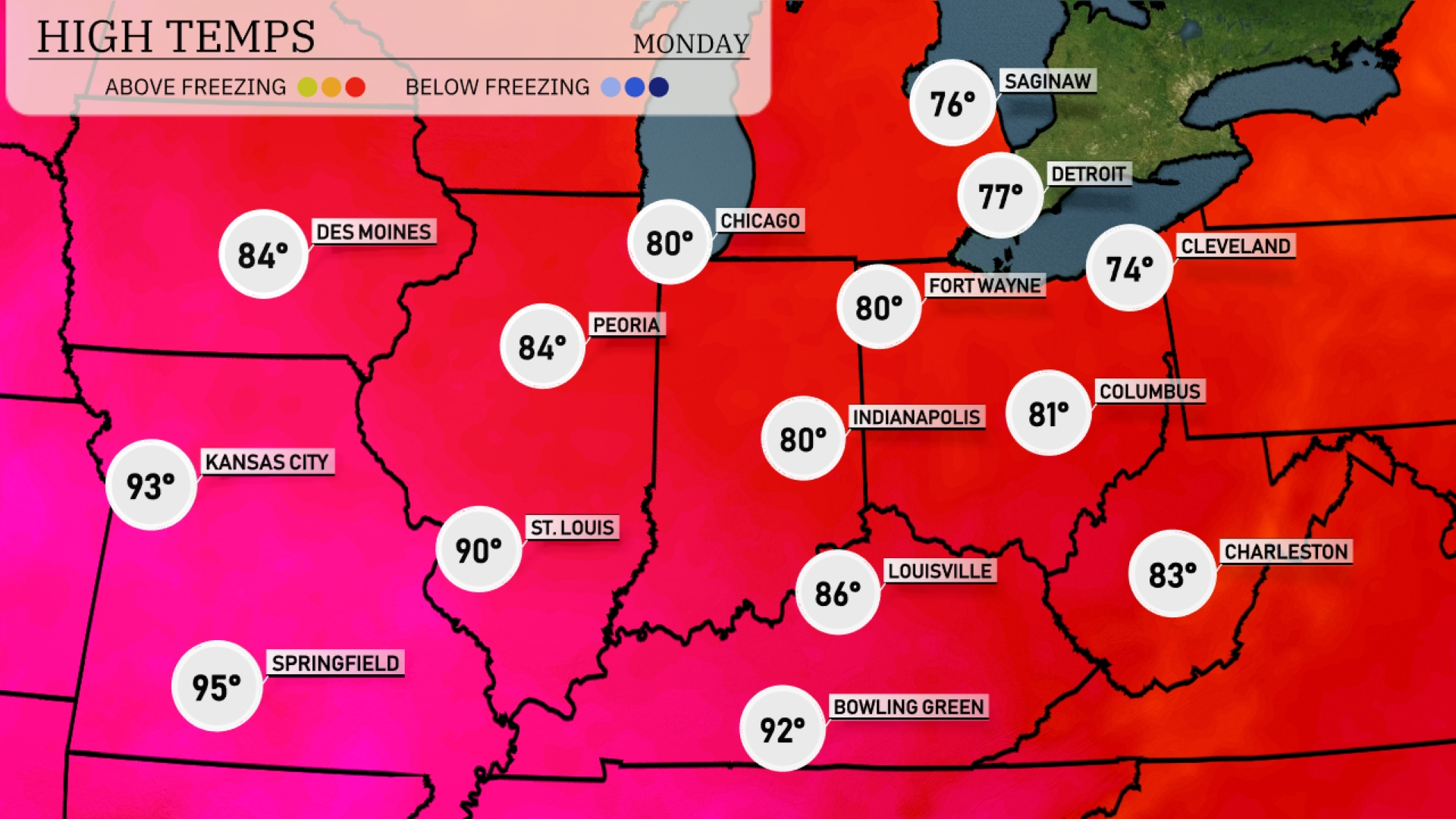
Tomorrow in the Midwest, expect warm temperatures with highs reaching 95 degrees in Springfield and 93 degrees in Kansas City. St. Louis will also see a significant high of 90 degrees. Much of the region will experience above-average temperatures, with other notable highs including 86 degrees in Louisville and 84 degrees in Peoria. Chicago will reach a comfortable 80 degrees, while Fort Wayne and Indianapolis also sit at 80 degrees, reflecting a warm mid-summer trend throughout the area.
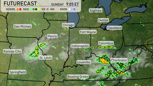
Late Thursday evening, a system brings active weather across the Midwest, with storms and showers from Kansas City to St. Louis. Heavier rainfall and localized lightning are possible, so stay weather aware. By Friday morning, the showers extend northward into Chicago and eastward to Indianapolis with a risk of light flooding in low-lying areas. Temperatures across the region are expected to hover in the mid-70s, creating a cooler start to the day. Looking ahead, conditions should improve heading into the weekend with drier and clearer skies.
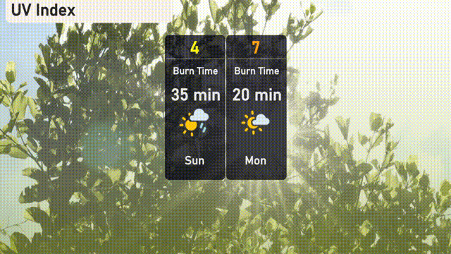
The UV index in Chicago will be moderate on Sunday with a value of 4, indicating a burn time of about 35 minutes in direct sunlight. On Monday, prepare for a high UV index of 7 with a quicker burn time of just 20 minutes. Stay sun-safe with sunscreen and protective wear!
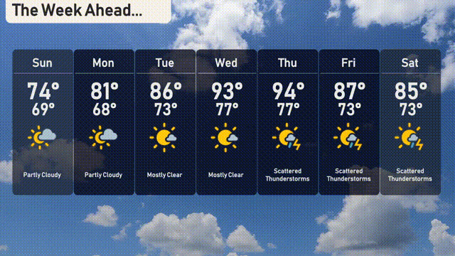
For the 7-day forecast in Chicago:
Sunday: Partly cloudy skies with a comfortable high of 74 degrees and a low of 69 degrees.
Monday: Enjoy partly cloudy weather with temperatures climbing to 81 degrees, cooling down to 68 at night.
Tuesday: Mostly clear skies with a warm high of 86 degrees and a low of 73 degrees.
Wednesday: Expect mostly clear conditions as temperatures soar to 93 degrees with a warm night at 77 degrees.
Thursday: Scattered thunderstorms develop with a high of 94 degrees and a low of 77 degrees.
Friday: More scattered thunderstorms, with temperatures reaching 87 degrees and a low of 73 degrees.
Saturday: Thunderstorms linger as the high hits 85 degrees, dipping down to 73 degrees overnight.
Stay safe and enjoy the week!