Chicago’s Morning Glory: Sunlit Start with a Stormy Twist
By
Amy Freeze
Discover Chicago's delightful dawn under clear skies with potential storm updates and a comprehensive 7-day forecast tailored for you.
Starting your morning in Chicago with clear skies and a gentle breeze? Find out what’s coming next with storm updates and more in our detailed report.
Good morning, Chicagoans! As you step outdoors, you’re met with pleasant 71°F clear skies. But don’t leave your umbrella at home yet—storms are on the horizon! Our blog dives into tomorrow’s weather transitions, from serene mornings to stormy afternoons across the Midwest. We also cover the week-long forecast, giving you all the details from Friday’s mild rain prospects to Thursday’s warmer vibes. Stay prepared and informed with our comprehensive guide at https://amyfreeze.ai/
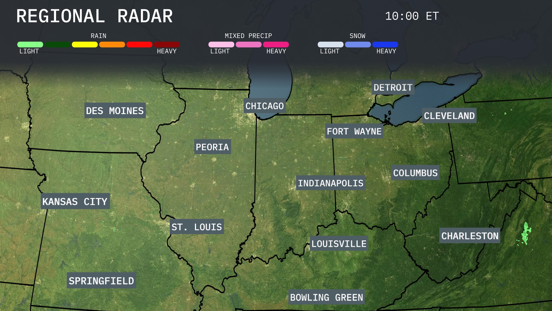
Areas of heavy rain are moving eastward across Springfield towards St. Louis, with additional moderate rain bands heading towards Indianapolis. Chicago is experiencing light rain showers that are expected to gradually move northeast. A mix of precipitation, including ice, is impacting areas west of Cleveland, likely causing slick conditions. Meanwhile, Des Moines and Kansas City remain under mostly clear skies, providing a break from the unsettled weather nearby.
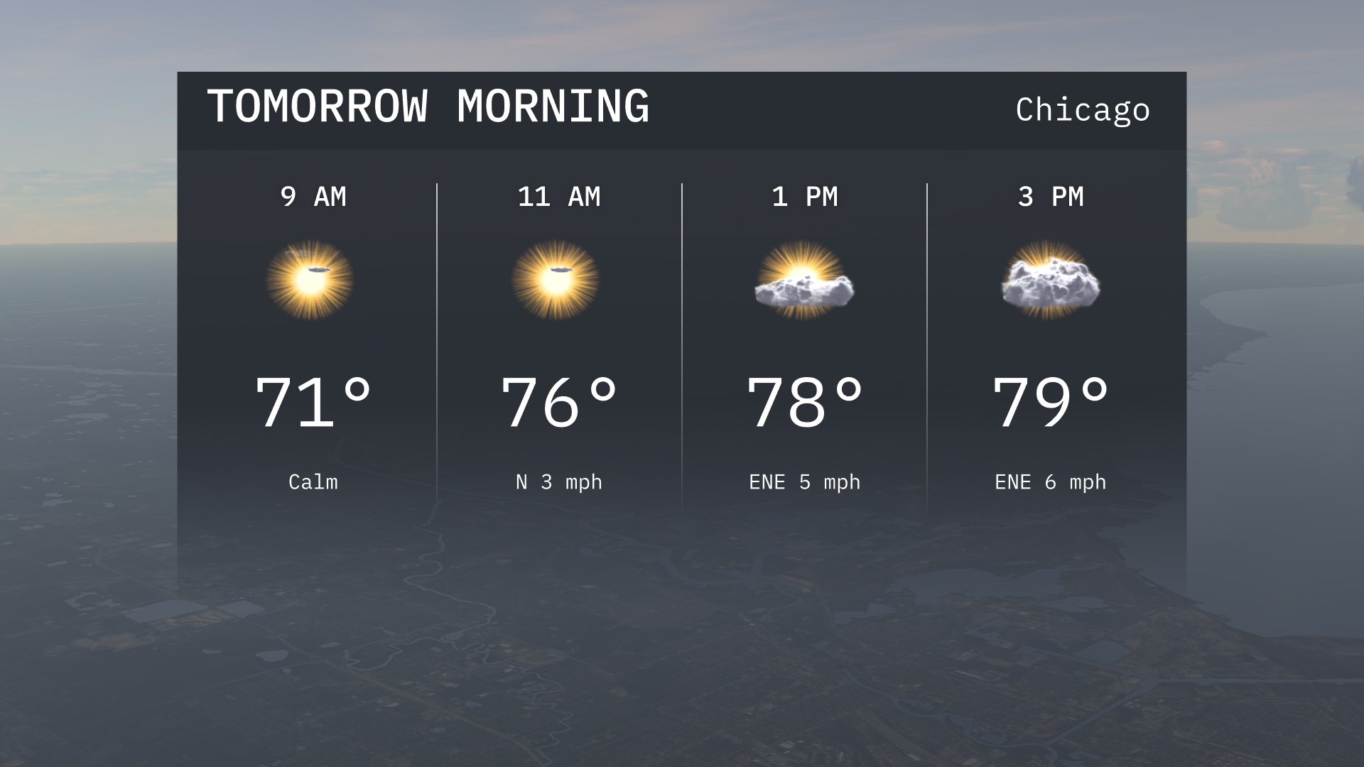
Tomorrow morning in Chicago, temperatures will start at a pleasant 71 degrees by 9 AM under sunny skies. As the morning progresses, temperatures will rise to 76 degrees by 11 AM with a light northerly breeze at 3 miles per hour. Expect calm and clear conditions to begin the day.
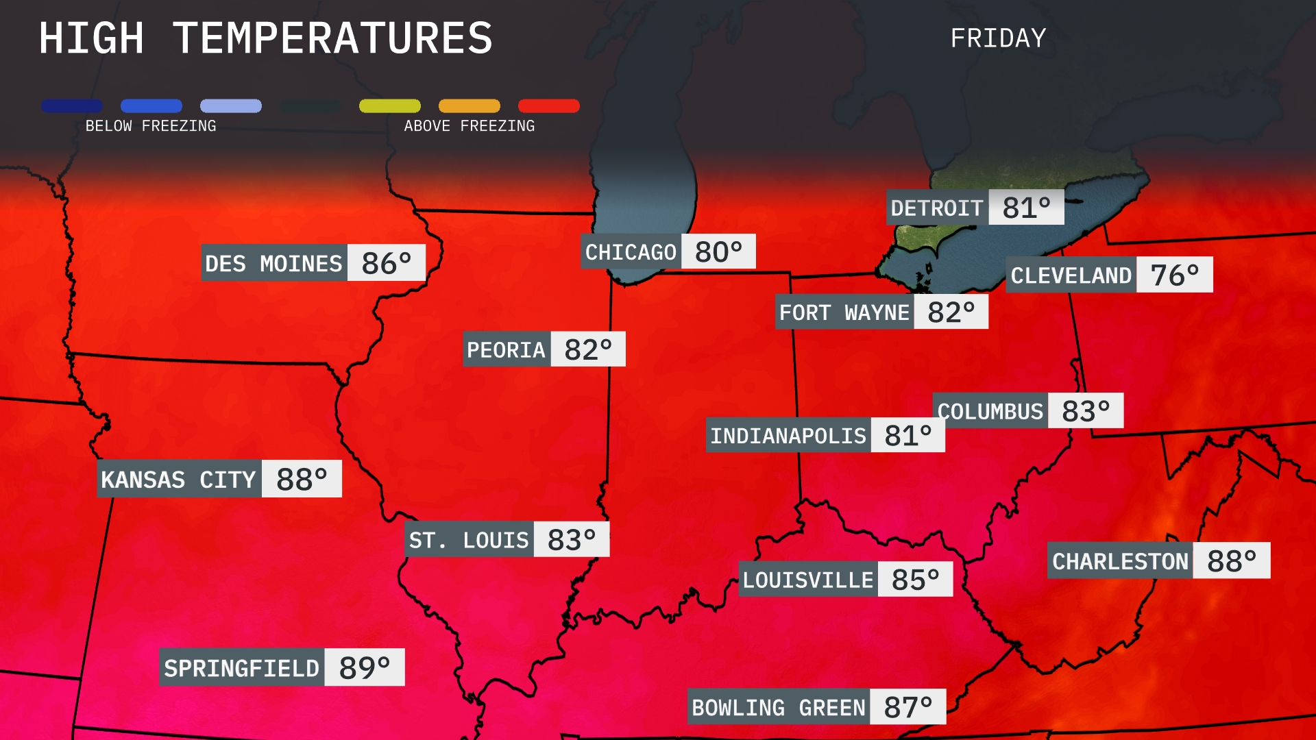
Tomorrow, high temperatures in the Midwest will trend warm, with Kansas City reaching a peak of 88 degrees. Springfield is set to be the region’s warmest spot at 89 degrees, while St. Louis will hit 83. Chicago enjoys a comfortable 80 degrees, and Indianapolis will see highs of 81. Overall, many areas are experiencing above-average temperatures for this time of year, influenced by a warm air mass moving through the region.
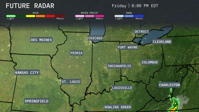
A cold front is sweeping through the Midwest, bringing a chance for strong storms from Kansas City to Louisville. Expect heavy rain and gusty winds, particularly in areas from St. Louis to Indianapolis by tomorrow afternoon. Rainfall could exceed an inch in some locations, raising the possibility of localized flooding. Temperatures will dip by around 10 degrees behind the front, with cooler, drier air settling in as the week moves forward. Watch for clearing skies and a brisk northwest breeze across Detroit and Cleveland by the evening.
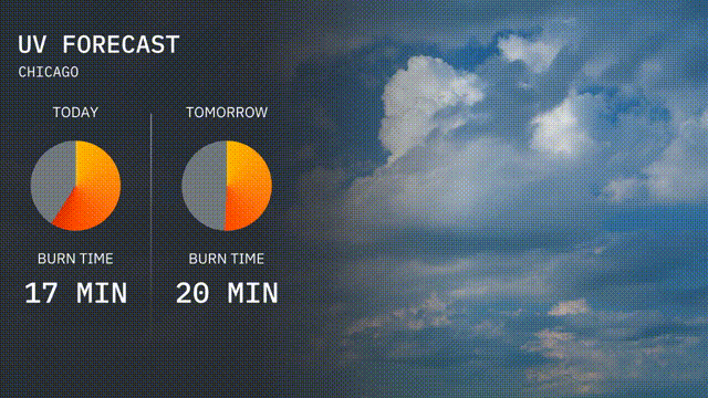
Today’s UV index in Chicago is at a high of 8, leading to a burn time of approximately 17 minutes under direct sunlight. Tomorrow, the index remains at a high level with a value of 7, offering a burn time of about 20 minutes.
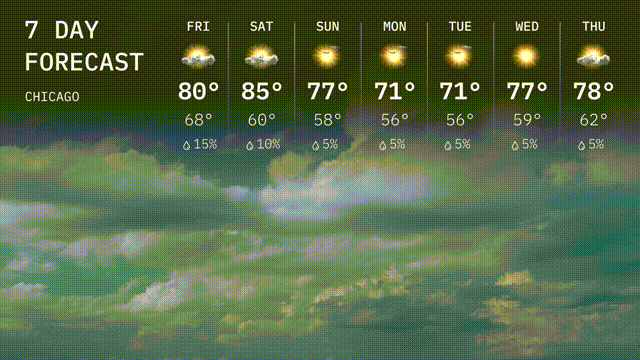
For Chicago’s 7 day outlook:
Friday: A chance of rain with a high of 80 degrees and a low of 68 degrees.
Saturday: Warmer and partly sunny, reaching 85 degrees with a low of 60 degrees.
Sunday: Mostly sunny with a high of 77 degrees and temperatures dropping to 58 degrees at night.
Monday: Sunshine continues, expect a high of 71 degrees and a nighttime low of 56 degrees.
Tuesday: Keep those sunglasses handy with a high of 71 degrees and a low of 56 degrees.
Wednesday: The sun sticks around with a high of 77 degrees and lows around 59 degrees.
Thursday: Warming up nicely with a high of 78 degrees and a low of 62 degrees.