Navigating Through Chicago’s Skies: A Comprehensive Weather Forecast by Amy Freeze
By
Amy Freeze
Explore a detailed weather forecast for Chicago, as Amy Freeze outlines what to expect from calm mornings to unexpected showers across the Midwest. Stay prepared!
Meteorologist Amy Freeze gives you a complete rundown of Chicago’s weather for the week, detailing everything from expected temperatures to storm predictions. Stay informed and prepared!
Join Amy Freeze as she walks you through a comprehensive forecast for Chicago and the Midwest. Whether you’re planning work commutes or weekend outings, her detailed analysis of weather patterns, including temperature variations and rain predictions, ensures that you are fully equipped to tackle the week ahead confidently. Highlights include moderate to cool temperatures throughout the week with potential showers and stormy surprises!
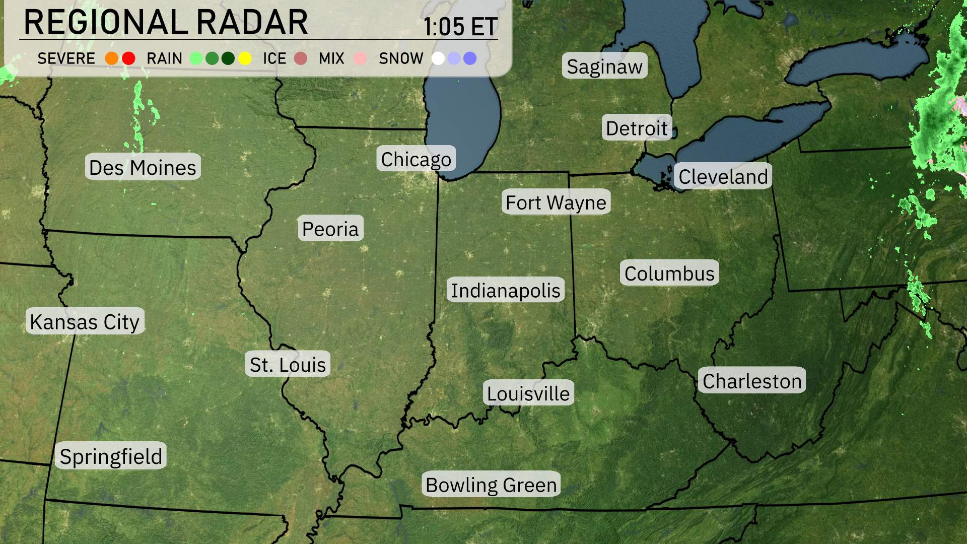
Over the Midwest region, the radar reveals a mostly calm scenario with a few weather systems worth noting. A band of rain showers is stretching into Cleveland, moving in from the east. This system is bringing some light rainfall but is expected to pass quickly. Meanwhile, in the northern areas like Saginaw, skies are mostly clear, providing a pleasant day ahead.
Chicago and Fort Wayne have overcast skies but remain dry for the moment; however, conditions could change as clouds build throughout the day. Farther west in Des Moines and Peoria, dry conditions prevail, making it a good day to step outside and enjoy. The same fair weather extends down to St. Louis and Springfield, where skies remain clear and inviting.
Overall, the Midwest presents a quiet weather day with localized rainfall on the eastern fringes near Cleveland, while the majority of the region enjoys clearer skies and calm conditions. Keep an eye on the developing clouds if you’re in the Chicago to Fort Wayne corridor, as they could impact conditions later.
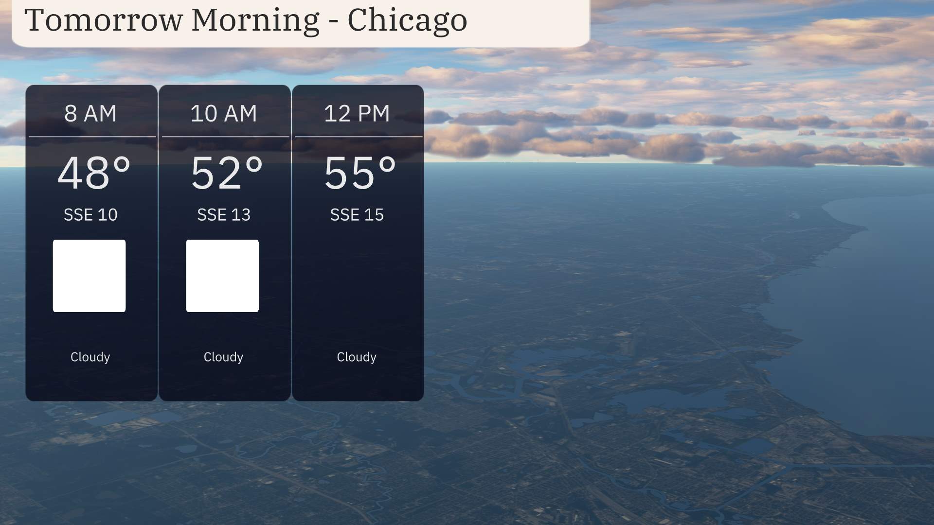
Expect a cloudy start to your Friday morning in Chicago. Temperatures will begin around 48 degrees at 8 AM, gradually climbing to 55 degrees by noon. Winds will be from the south-southeast, starting at 10 miles per hour and picking up slightly to 15 miles per hour as the morning progresses.
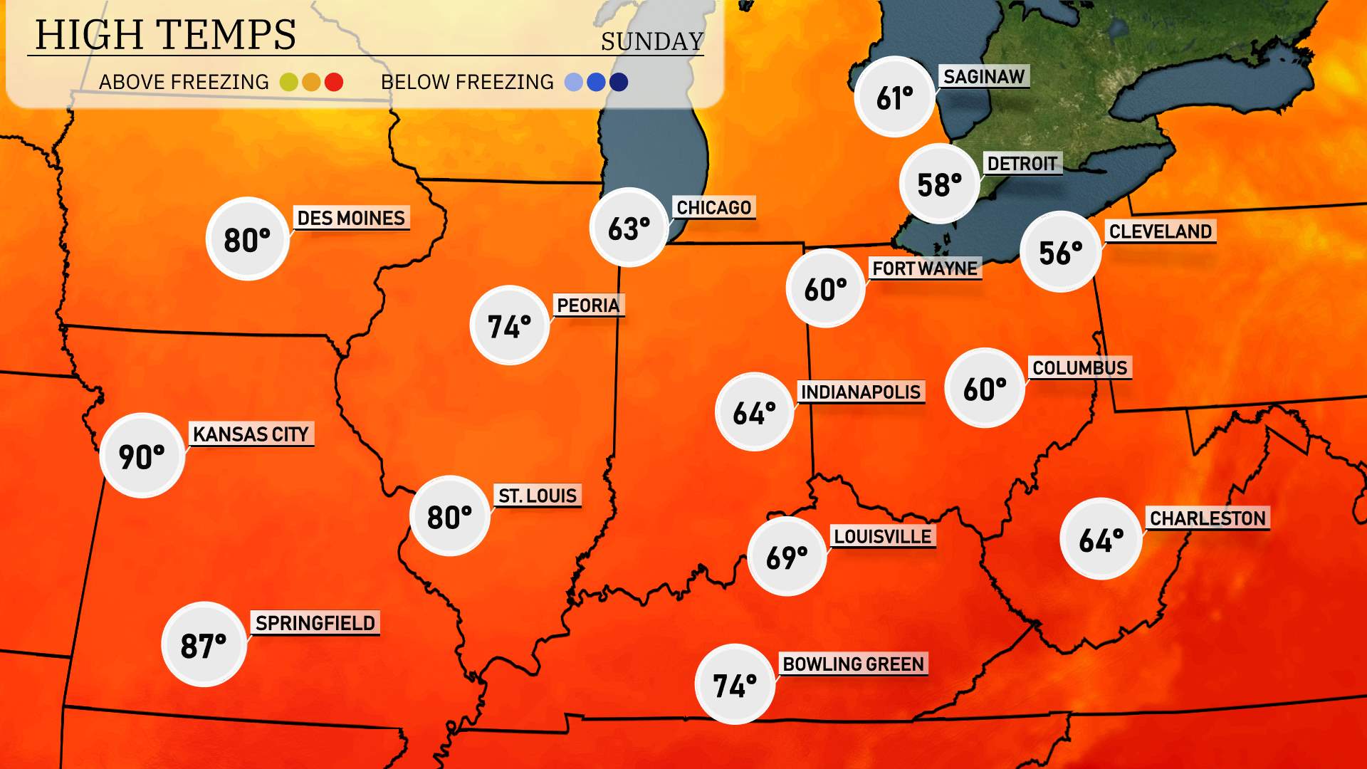
Tomorrow in the Midwest, we’re looking at some impressively warm temperatures as a high-pressure system settles in, delivering above-average readings across the region.
In Kansas City, expect a sizzling high of 90 degrees, making it one of the hottest spots of the day. St. Louis will follow closely behind with a high of 87 degrees. Over in Peoria, temperatures will climb to a pleasant 74 degrees.
Moving east, Indianapolis will see a high of 64 degrees, while Louisville holds at 69 degrees. Chicago will register a more moderate 63 degrees, and further north in Fort Wayne, the high reaches 60 degrees. Columbus is anticipating a similar 60-degree day, while Cleveland remains cooler at 56 degrees.
Across the Midwest, expect a shifting weather pattern with several fronts impacting the region. Tomorrow morning, light rain moves into areas like Columbus and Cleveland, creating a damp start to the day. As the system progresses across the Midwest, Indianapolis and Fort Wayne will see periods of showers interspersed with clearing skies through the afternoon. Thunderstorms could develop farther south, impacting Louisville and Charleston, with a risk for gusty winds but severe storms remain unlikely. Temperatures will trend cooler in Des Moines and Peoria following the cold front, leading to crisp, clear conditions by evening. Keep an eye on developments in St. Louis and Springfield, where late-day clouds may hint at rain into the evening.
The UV index in Chicago will be moderate at 6 on Saturday, with a burn time of about 23 minutes in direct sunlight. On Sunday, expect cloudier conditions with a UV index drop to 3, so sun protection remains essential during sun breaks.
Sunday: Cloudy with a high of 64 degrees and a low of 53.
Monday: It remains cloudy, reaching a high of 61 degrees and a low of 42.
Tuesday: Mostly cloudy conditions continue with a high of 55 degrees, cooling down to 38 degrees.
Wednesday: Partly cloudy skies are on the horizon, bringing a high of 53 degrees and a low of 41.
Thursday: Partly cloudy again, with temperatures peaking at 66 degrees and dipping to 54 overnight.
Friday: Expect showers later in the day, with a high of 67 degrees and a low of 47.
Saturday: Thunderstorms may occur early, as temperatures reach up to 52 degrees during the day, with a low of 42.
Stay safe and enjoy your week!