Riding the Temperature Tide: Chicago’s Dynamic Weather Journey
By
Amy Freeze
From gentle breezes to severe storms, Chicago's weather this week is a lesson in unpredictability. Join us as Meteorologist Amy Freeze takes you through a detailed forecast.
Catch up on this week’s weather extremes with Amy Freeze as we navigate through sun, storms, and cooling temperatures in Chicago and beyond. Visit our blog for the full story.
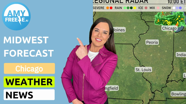
Chicago’s weather is painting a picture of diversity this week from sunny skies to looming thunderstorms. Meteorologist Amy Freeze breaks down the daily forecasts, highlighting the warmth in Des Moines and the potential storms targeting Chicago to Indianapolis. With a UV index hitting high marks and unpredictable rain patches, stay prepared and informed with our comprehensive guide on what’s next.
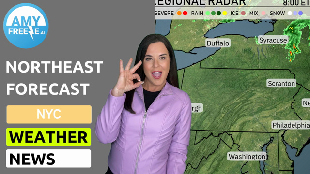
A wave of showers stretches across the Midwest, particularly affecting areas from Chicago towards Fort Wayne where rain is currently underway. Patchy rain showers are also noted near Peoria and Springfield, inching eastward into areas like Indianapolis. The northern parts such as Detroit and Saginaw remain relatively dry but under overcast skies. Cleveland is dealing with precipitation, adding a damp touch to their morning. Elsewhere, cities like Des Moines and Kansas City experience clear skies.
In Chicago this afternoon, temperatures will hold steady, with highs reaching 57 degrees by 4 PM. Expect mostly sunny skies and a northeast wind around 16 miles per hour, maintaining a breeze through the afternoon. As we head into the evening, temperatures will gently drop to 53 degrees by 8 PM, while the wind eases slightly to 14 miles per hour.
Looking at today’s high temperatures in the Midwest, Des Moines is leading the pack with a warm high of 85 degrees. Just to the south, Kansas City isn’t far behind, hitting 84 degrees, while Peoria also enjoys a warm day at 85 degrees. St. Louis will see highs around 79 degrees, a bit milder but still pleasant. Heading northeast, Indianapolis reaches 80 degrees, creating a nice contrast with Chicago, where temperatures dip to 68 degrees. Fort Wayne will warm up to 77 degrees, while Cleveland stays cooler at 70 degrees, showing significant variation across the region.
Chicago is expected to cool down to 51 degrees, while St. Louis will see a low of 60 degrees. Fort Wayne is forecast to dip to 48 degrees, and Indianapolis will have a low of 60. Expect chilly conditions in Cleveland at 53 degrees. Kansas City will remain relatively mild at 56 degrees.
Tomorrow in the Midwest, Kansas City leads the way with a high of 85 degrees, while St. Louis reaches 80. Indianapolis and Louisville will see temperatures at 82 and 83 degrees, respectively. Farther north, Peoria will enjoy a high of 83 degrees, while Chicago sits at 65 degrees, cooler than the rest. A persistent warm front influencing these temperatures is driving the mild conditions across the region.
Tomorrow in the Midwest, expect a broad swath of rain moving in from Des Moines to Cleveland, starting early and continuing through the day. Thunderstorms are possible from Chicago to Indianapolis, with a chance of severe weather, specifically heavy rainfall and damaging winds. Cooler air follows the system, dropping temperatures by nearly ten degrees post-front passage. From St. Louis to Kansas City, skies clear by evening as showers taper off. Keep an eye out for localized flooding given quick rainfall bursts across the region.
The UV index in Chicago is high on Saturday and Sunday, both with a level of 8, indicating a burn time of about 17 minutes in direct sunlight.