From Sun to Storms: A Week of Unpredictable Midwest Weather
By
Amy Freeze
This week, Chicago and the Midwest brace for a mix of sunny skies and impending storms. Read on to discover how varying weather patterns will impact your week.
Experience the shifts from sunny mornings to stormy nights across Chicago and the Midwest this week. Keep up with the latest weather trends and prepare!
As we zip through another week in the Midwest, the weather takes us on a rollercoaster from bright sunny mornings in Chicago to storm clouds gathering by nightfall. Detailed forecasts predict varied temperatures with midweek highs peaking warm, and a cold front introducing strong rains and potential thunderstorms. Find out what this means for your daily plans and how to best prepare for each day’s weather shifts.
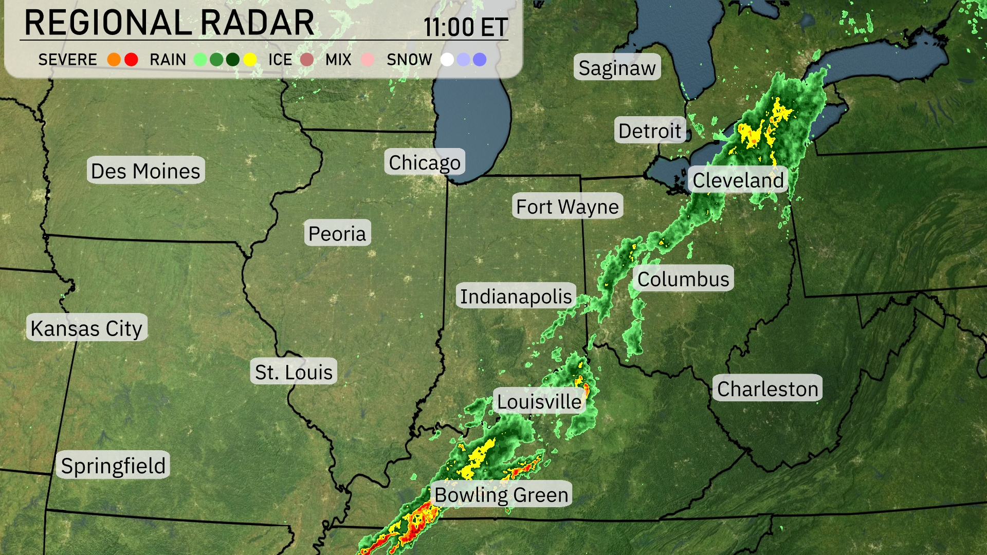
A line of thunderstorms is sweeping through the Midwest, with intense activity stretching from Bowling Green up to Cleveland. Louisville is experiencing heavy storms that are progressing towards Indianapolis. As rain showers continue moving northeast, Fort Wayne and Detroit are experiencing persistent rain, marking a wet day ahead for these areas. Clear conditions prevail in Des Moines and Kansas City, providing a contrast to the more turbulent weather further east.
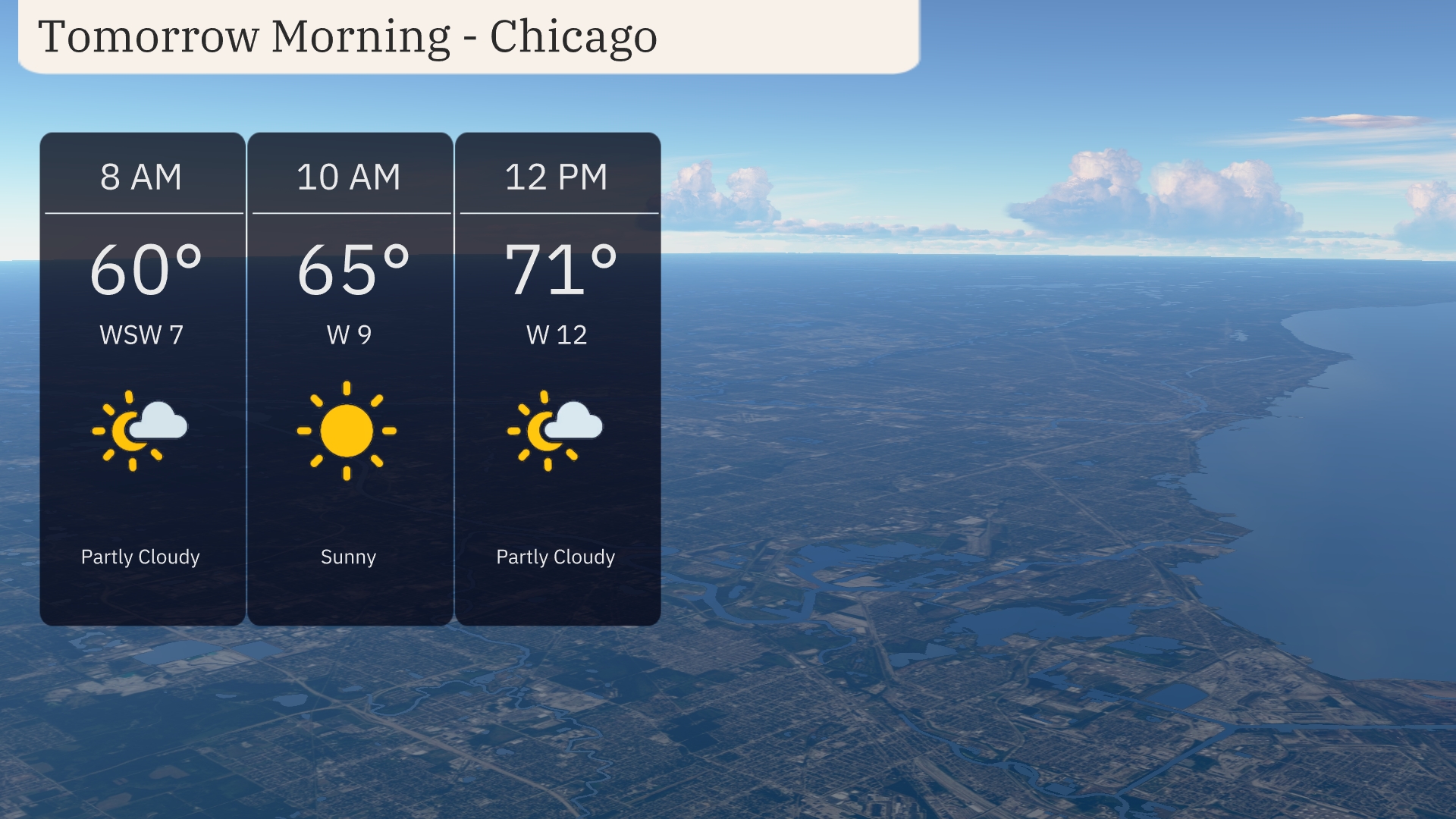
For tomorrow morning in Chicago, prepare for a pleasant start. The temperature will rise from 60 degrees at 8 AM to 71 degrees by noon. Expect partly cloudy skies early with sunshine breaking through mid-morning. Winds will transition from west-southwest at 7 mph to west at 12 mph by midday, creating a refreshing breeze.
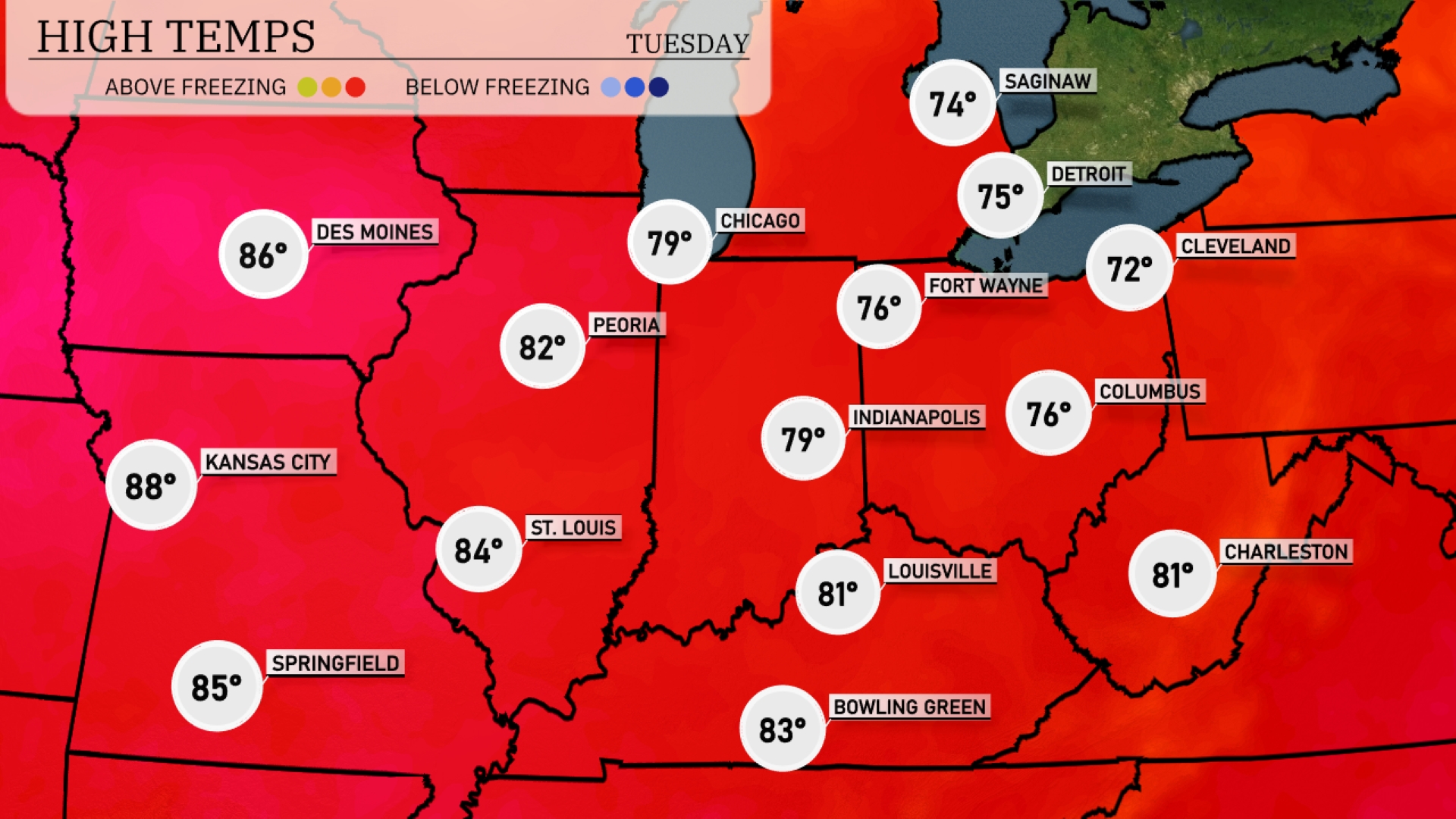
Tomorrow in the Midwest, Kansas City is set to soar to a high of 88 degrees, while St. Louis follows closely at 84. Des Moines will warm up to 86 degrees, and Peoria is expected to hit 82. Indianapolis and Fort Wayne will see highs around 79 and 76 respectively, with Columbus reaching 76 degrees.
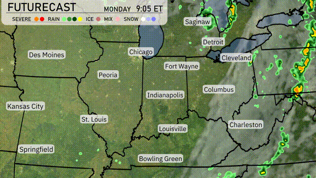
A cold front is set to move through the Midwest overnight, bringing with it the potential for heavy rains and thunderstorms, particularly in areas like Indianapolis and Columbus. Kansas City and St. Louis may also experience strong gusts and downpours. By tomorrow, expect cooler temperatures as the front passes, with rainfall easing by mid-afternoon. For major urban areas like Chicago, drier conditions will gradually set in, though cloudy skies will persist. Stay aware of any possible severe thunderstorm warnings as the system progresses eastward.
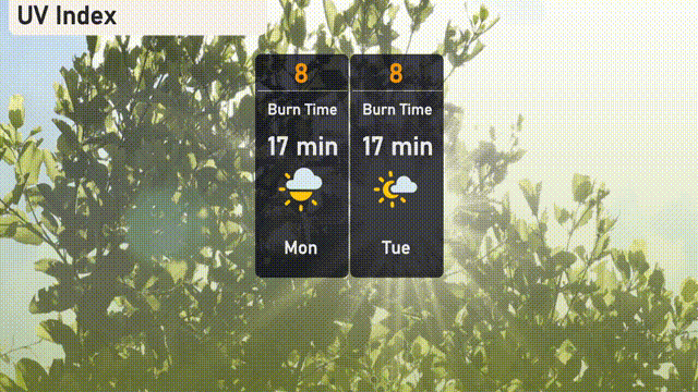
The UV index in Chicago today and tomorrow is high at 8, with a burn time estimated at 17 minutes in direct sunlight.
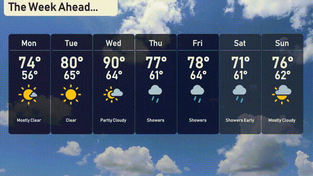
Monday: Mostly clear skies with a high of 74 degrees and a low of 56 degrees.
Tuesday: The warmth continues with clear skies, reaching 80 degrees during the day and cooling to 65 degrees at night.
Wednesday: Partly cloudy skies will dominate, with temperatures climbing to a warm 90 degrees and dipping to 64 overnight.
Thursday: Showers roll in as the high reaches 77 degrees and the low settles at 61 degrees.
Friday: Rain showers continue, with temperatures peaking at 78 degrees during the day and falling to 64 at night.
Saturday: Expect showers early on Saturday, with a daytime high of 71 degrees and a nighttime low of 61 degrees.
Sunday: The week ends with mostly cloudy skies and temperatures reaching 76 degrees for the high and dropping to 62 in the evening.