Morning Clouds and Stormy Horizons: Chicago’s Midweek Weather Glimpse
By
Amy Freeze
From calm mornings to stormy afternoons, explore the dynamic weather shifts hitting Chicago and the broader Midwest this week.
Discover what Chicago’s weather has in store from morning clouds gently warming up to potential stormy disruptions across the Midwest. Essential insights for your week ahead!
Welcome to your definitive guide for Chicago weather. This week, you’ll start with gentle morning clouds and gradually transition to potential tumultuous weather conditions. Rain gears up in southern Missouri while Chicago prepares for a diverse set of conditions. Keep up with our daily updates as we guide you through the weather patterns that could influence your plans and safety across the Midwest.
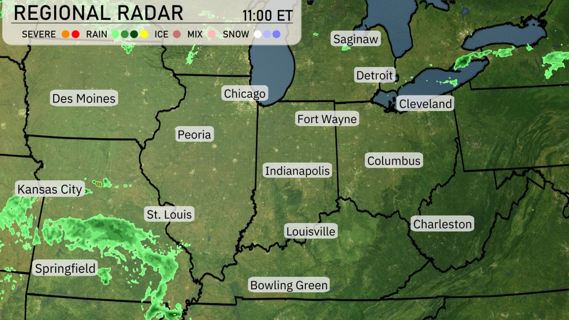
Over the Midwest region, the radar shows notable activity with rain developing in southern Missouri, particularly near Springfield, moving towards St. Louis. Fort Wayne and other areas of Indiana are relatively clear, enjoying calm conditions. The Detroit area is observing some clouds but remains dry for now. Out west, a thick cloud cover with rain is advancing towards Des Moines, bringing wet conditions.
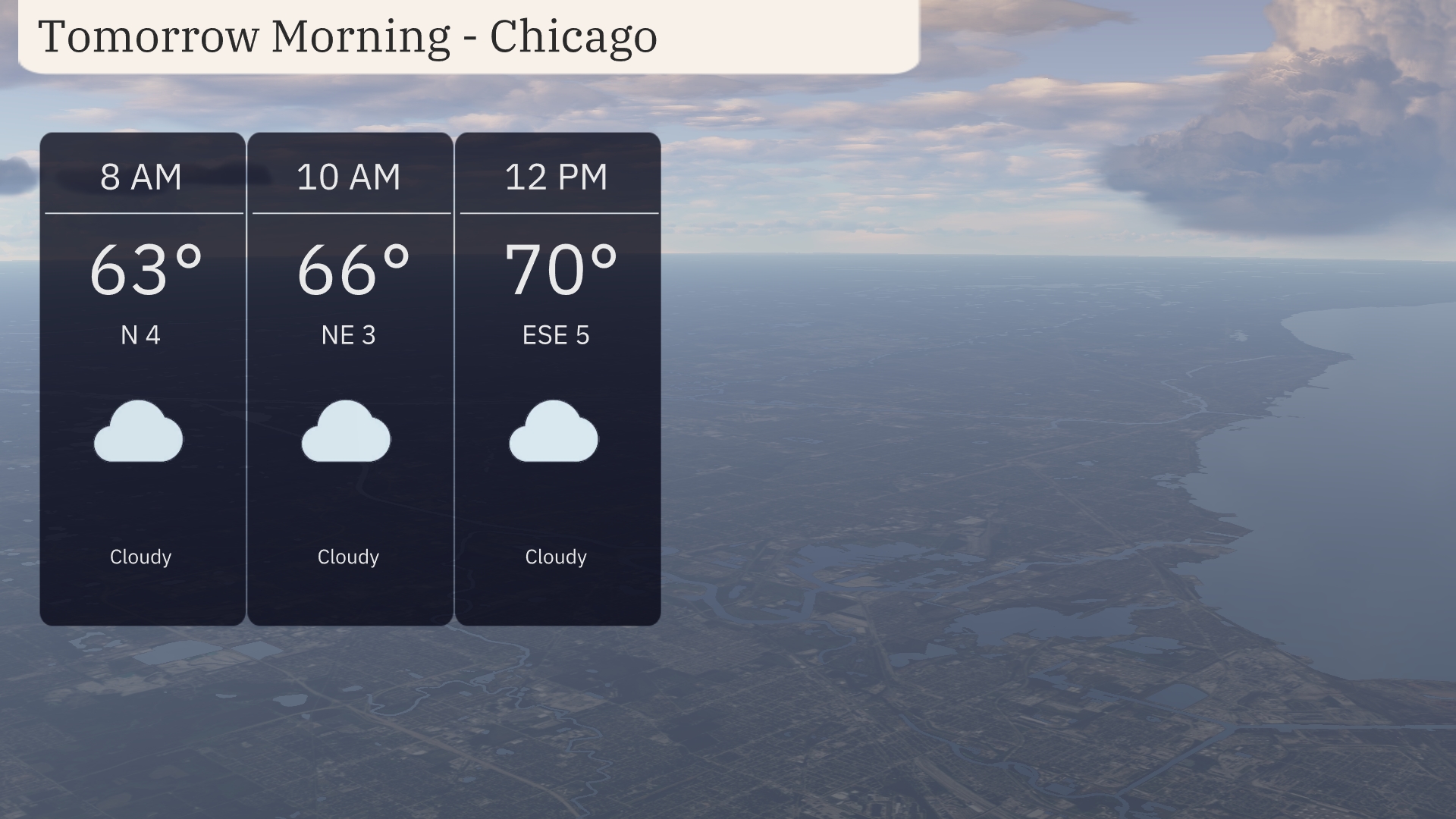
In Chicago, tomorrow morning starts off cloudy with temperatures around 63 degrees by 8 AM, warming to 66 degrees by 10 AM. Winds initially from the north at 4 mph shift to a northeast direction at 3 mph by mid-morning. Temperatures continue to gradually rise, reaching 70 degrees by noon with an east-southeast breeze at 5 mph.
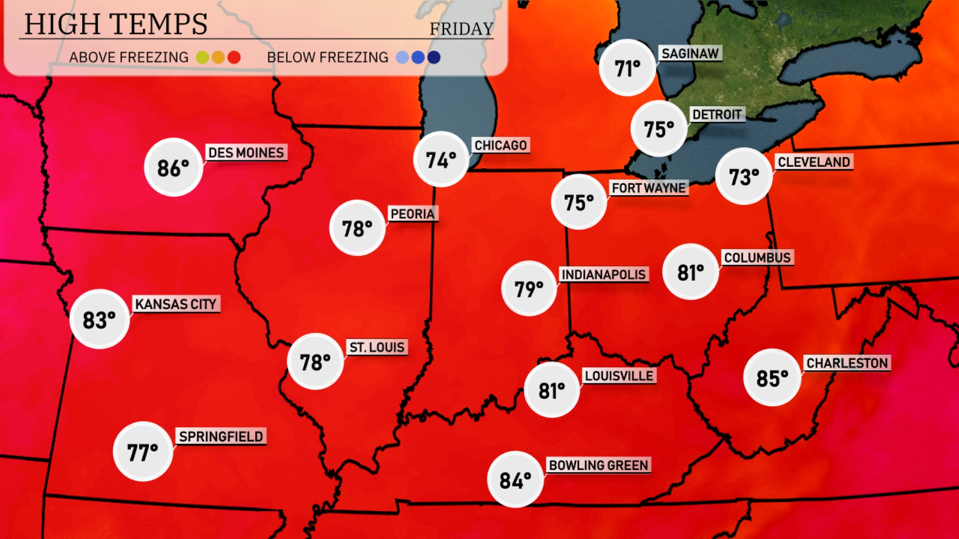
Tomorrow in the Midwest, Des Moines is set to reach an impressive 86 degrees, while Kansas City will enjoy a high of 83. Chicago is anticipating a warm 74, and Indianapolis will see temperatures rise to 79 degrees. Louisville is expected to hit 81, with Bowling Green warming up to 84.
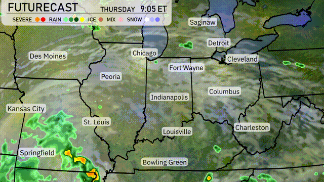
A frontal system will move into the Midwest, bringing showers and thunderstorms to areas like St. Louis and Springfield by Thursday morning. Expect heavy rainfall in these regions, with potential for flooding in low-lying areas. By midday, storms will expand towards Indianapolis and Chicago, increasing the chances for localized downpours. Temperatures will remain warm ahead of the front, but cooler air will follow as the system exits eastward.
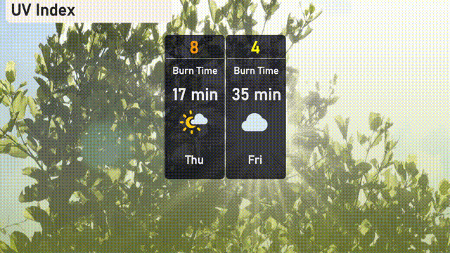
In Chicago, the UV index will reach a high of 8 today with a burn time of about 17 minutes, so protect your skin if you’re outdoors. Tomorrow, the index decreases to 4, making it moderate, with a burn time of 35 minutes.
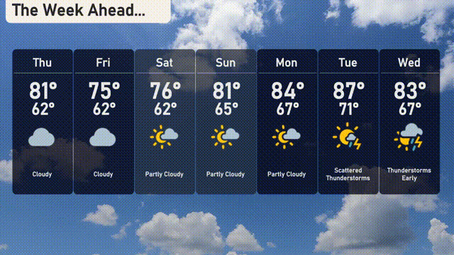
For the 7 day forecast in Chicago:
Thursday: Cloudy, with a high of 81 degrees and a low of 62 degrees.
Friday: More clouds with temperatures dropping to a high of 75 degrees and a low of 62 degrees.
Saturday: Partly cloudy skies, expect a high of 76 degrees and a low of 62 degrees.
Sunday: Temperatures climb to 81 degrees. It’s partly cloudy with a low of 65 degrees.
Monday: Even warmer with a high of 84 degrees and partly sunny skies, the low is 67 degrees.
Tuesday: Scattered thunderstorms move in with a high of 87 degrees and a low of 71 degrees.
Wednesday: Thunderstorms early, cooling slightly to 83 degrees for the high and 67 degrees for the low.