Chicago’s Week of Weather Wonders: From Sunny Days to Stormy Skies
By
Amy Freeze
Explore the varying weather patterns hitting Chicago this week. From mild mornings to potential thunderstorms, we've got your full Metro Midwest forecast!
This week in Chicago, prepare for weather that switches from clear skies to storm warnings. With temperatures swinging and showers coming, here’s what you need to know.
The weather in Chicago this week will take you on a roller coaster of temperatures and conditions. Expect a mostly sunny start with temperatures climbing quickly, but don’t let your guard down as scattered showers and isolated thunderstorms are on the horizon across the Midwest. Noteworthy are the higher temperatures set to sweep from Kansas City to Indianapolis, bringing along potential severe weather conditions into the late afternoon. Dive deeper into our daily and nightly forecasts to plan your week with safety and ease!
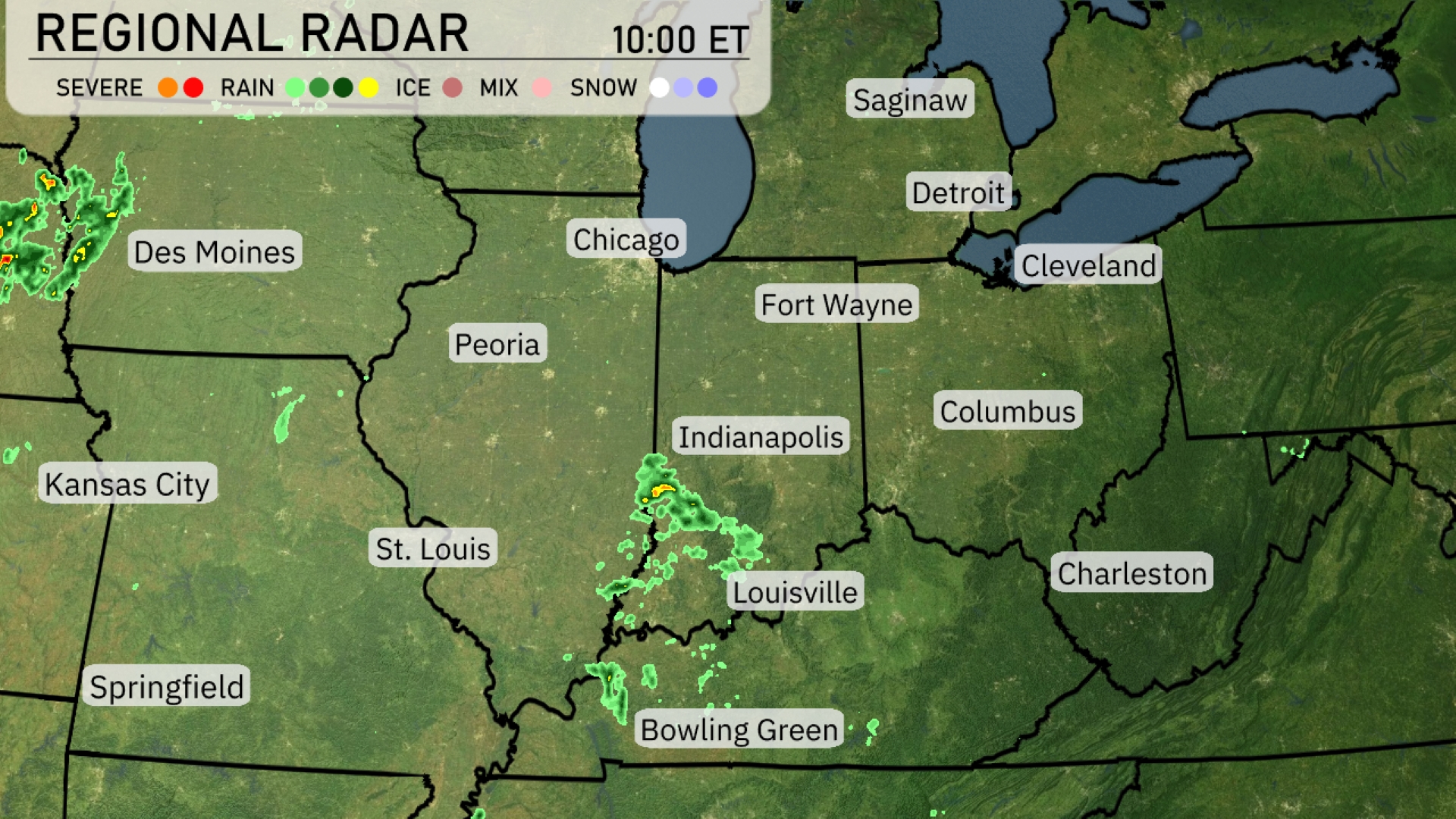
A cluster of showers is spreading from St. Louis towards Louisville, with intermittent rain developing around Indianapolis. Fort Wayne and Columbus are currently under cloud cover, with rain advancing towards these areas. Detroit and Chicago are staying dry for now, while light rain hints at approaching areas south of Springfield. Des Moines heads for clearer skies, although storm clusters are emerging near Kansas City, moving northeast.
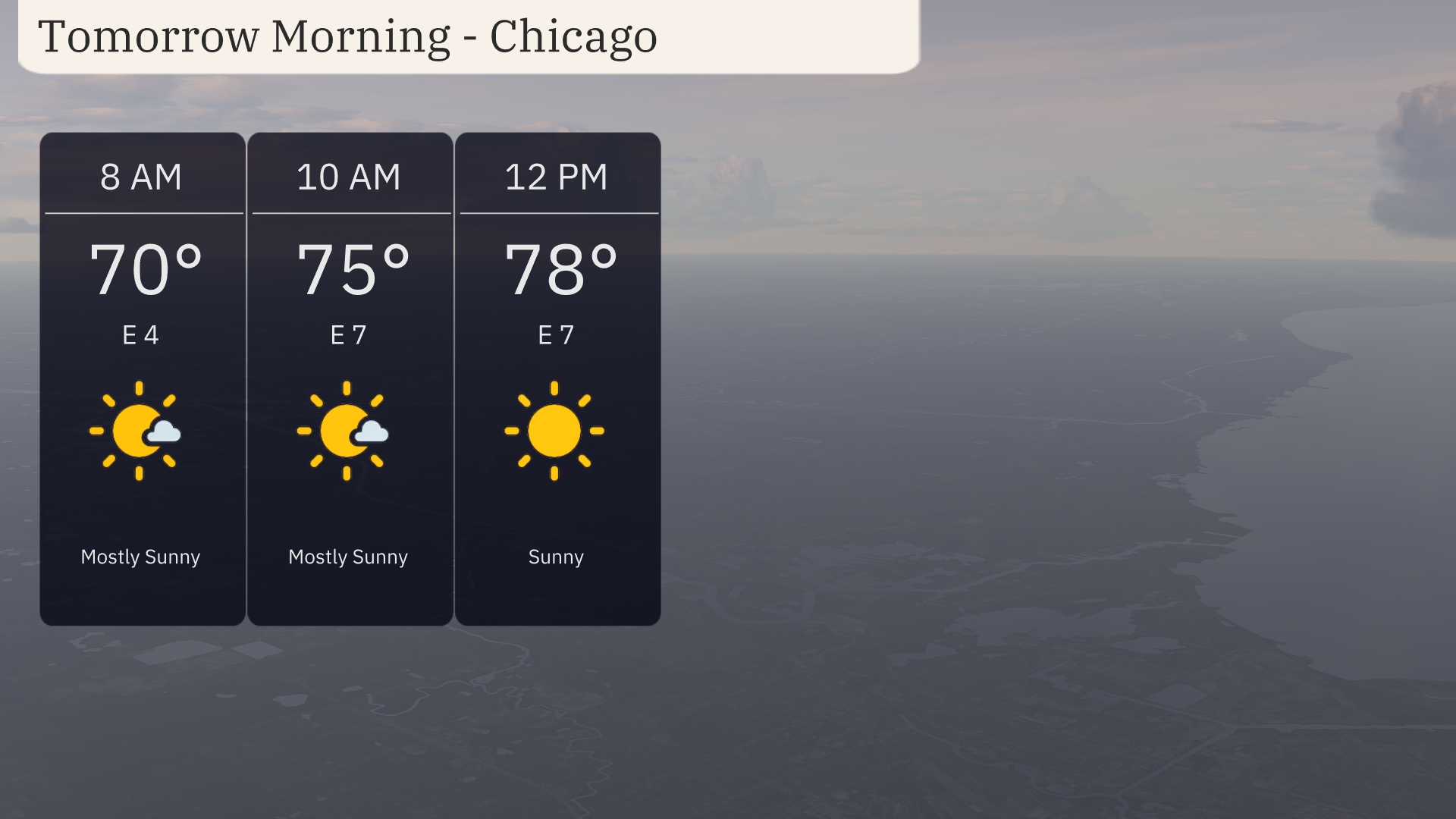
Tomorrow morning in Chicago begins with mostly sunny skies, with temperatures reaching 70 degrees by 8 AM. By 10 AM, expect the temperature to rise to 75 degrees, while the clouds begin to clear out, maintaining a mostly sunny outlook. By midday, temperatures will reach 78 degrees with clear, sunny skies and an easterly wind at 7 miles per hour.
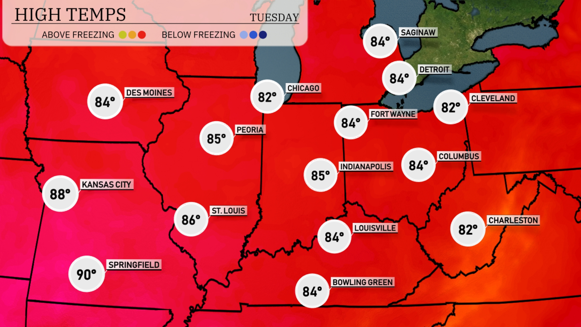
Tomorrow, Kansas City will see a high of 88 degrees, while St. Louis warms up to 86. Chicago is expected to reach 82 degrees, with Peoria slightly warmer at 85. Indianapolis and Louisville are also on track for 85 degrees.
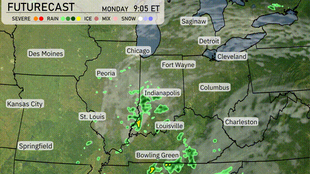
A warm front sweeps through the Midwest tomorrow, bringing scattered showers and isolated thunderstorms from St. Louis to Indianapolis. Heavier rainfall is expected around Louisville and Bowling Green, which could lead to localized flooding concerns. Temperatures will remain mild, with highs reaching the mid-70s across much of the region. Pay attention to shifting weather patterns, as the potential for severe thunderstorms increases into the late afternoon, possibly affecting evening commutes near Chicago and Fort Wayne.
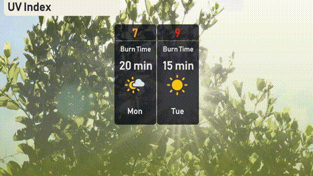
In Chicago, today’s UV index is high at 7 under mostly sunny skies, leading to a 20-minute burn time—make sure to wear sunscreen and seek shade if outdoors. Tomorrow, expect the UV index to increase to 9, with even a brief 15 minutes in the sun leading to potential sunburn.
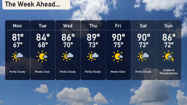
For the 7-day forecast in Chicago:
Monday: Partly cloudy with a high of 81 degrees and a low of 67 degrees.
Tuesday: Mostly clear skies are expected, with temperatures reaching 84 degrees and a low of 68 degrees.
Wednesday: Partly cloudy conditions, warming up to 86 degrees during the day and cooling to 70 degrees at night.
Thursday: Expect a mostly clear day with a high of 89 degrees and a low of 73 degrees.
Friday: Mostly clear again as temperatures peak at 90 degrees and dip to 75 degrees.
Saturday: Another partly cloudy day with a high of 90 degrees and a low around 73 degrees.
Sunday: Scattered thunderstorms develop with a high of 86 degrees and a nighttime low of 72 degrees.