Chicago’s Balmy Days Ahead: Weather Patterns Shift with a Mix of Sun and Storms
By
Amy Freeze
Experience a week of fluctuating weather in Chicago with sunny days, balmy afternoons, and sudden showers. Dive into a detailed day-by-day weather forecast and learn how to dress for the skies!
This week in Chicago starts with partly cloudy skies and pleasant temperatures. However, a cold front brings a mix of rain and potential thunderstorms mid-week. Stay updated with your daily Chicago weather forecast here!
Welcome to your comprehensive guide to the week’s weather in Chicago. Starting the day with mild temperatures on Wednesday, the city will see a gradual increase in cloud cover and temperatures peaking at 76°F. But hold onto your umbrellas, as a cold front is set to move through, bringing in rain and a dip in temperatures. Understand the implications of these changes and how they can affect your daily activities. Prepare for a mix of sun and clouds with a detailed analysis of expected temperatures and weather conditions for each day.
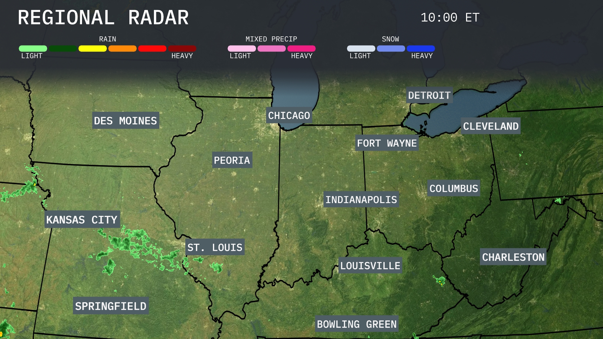
A swath of rain is tracking across eastern Kansas towards western Missouri, with Kansas City observing persistent showers. Northwestern Illinois near Peoria is seeing moderate rainfall moving northeast. Around Indianapolis and Fort Wayne, skies remain clear under high pressure. Meanwhile, areas like Chicago and Detroit are enjoying dry conditions with no precipitation in sight at the moment.
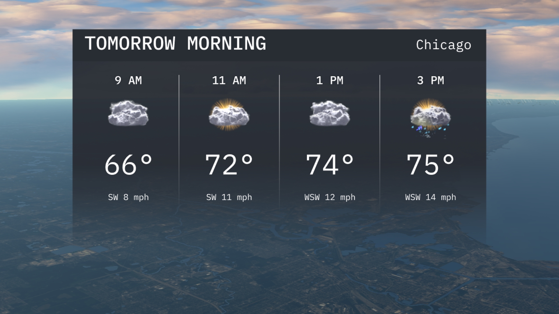
In Chicago, tomorrow morning begins with partly cloudy skies and temperatures starting at 66 degrees by 9 AM. A gentle southwest wind is expected. As the morning progresses, temperatures rise to 72 degrees by 11 AM with increasing cloud cover.
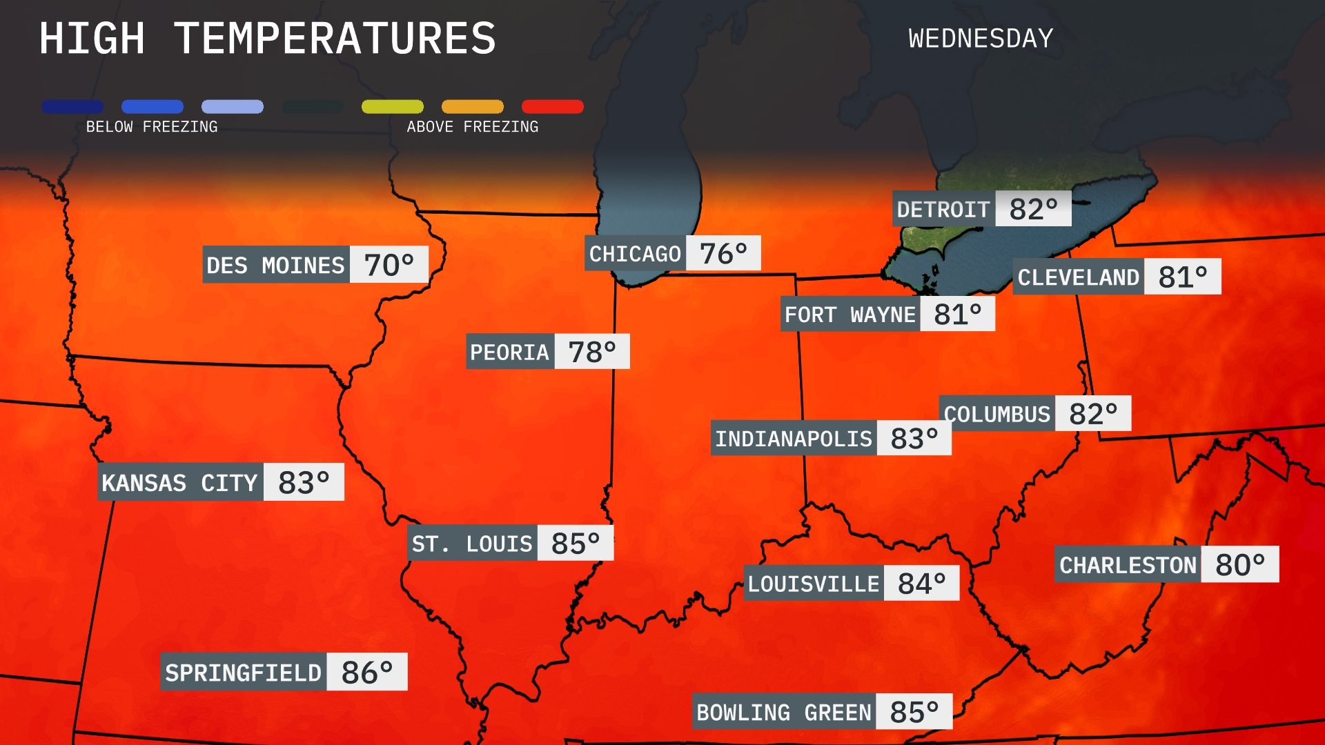
Tomorrow in the Midwest, temperatures are heating up significantly. St. Louis will see a high of 85 degrees, while Kansas City edges up to 83 degrees. Chicago is expected to hit 76, and farther north in Des Moines, a cooler 70 degrees is on the docket. The overall trend shows above-average temperatures for many areas, influenced by a warm front moving through the region. Expect highs in Indianapolis and Columbus reaching 83 and 82 degrees respectively, rounding out a summer-like feel for the day.
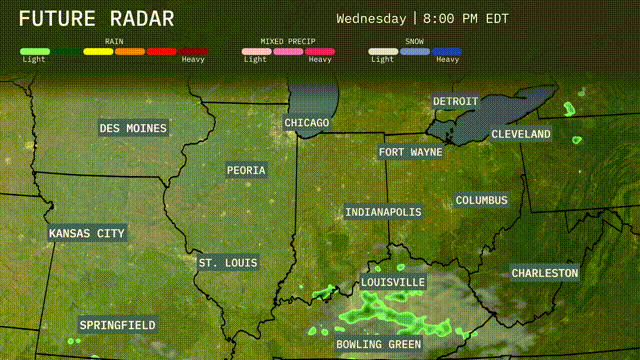
A cold front moves into the Midwest region tomorrow, bringing a mix of rain and thunderstorms from Kansas City to Indianapolis. Expect periods of heavy rain, potentially leading to isolated flooding, especially in low-lying areas. Strong winds are possible in St. Louis and Chicago during the day. Temperatures will begin to drop significantly, giving way to cooler and dry conditions by Thursday.
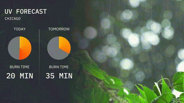
The UV index in Chicago is expected to be high today with a value of 7, leading to a burn time of about 20 minutes in direct sunlight. Tomorrow, the UV index will decrease to a moderate level of 4, with a burn time of approximately 35 minutes.
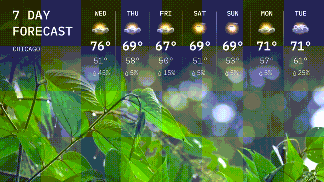
Wednesday: Mostly cloudy with a high of 76 degrees and a low of 51 degrees.
Thursday: Showers likely; cooler with a high of 69 degrees and a low of 58 degrees.
Friday: Expect rain with temperatures reaching a high of 67 degrees and a low of 50 degrees.
Saturday: Mostly sunny, warming up to 69 degrees with a low of 51 degrees.
Sunday: Partly sunny with a high of 69 degrees and a low of 53 degrees.
Monday: A mix of sun and clouds; high of 71 degrees and a low of 61 degrees.
Tuesday: Showers expected; high of 71 degrees.