Chicago’s Forecast: From Sunlit Mornings to Stormy Nights
By
Amy Freeze
Dive into this week’s weather outlook for Chicago, featuring sunny starts and potential stormy evenings. Stay informed with our in-depth daily analysis.
Get ready for a week of mixed weather in Chicago! Starting with sunny mornings and temperatures climbing up, we’re looking at potential thunderstorms in the evenings. Check the details for each day and stay weather-aware!
This week in Chicago, the weather takes us on a roller coaster from sunlit beginnings to possibly stormy nights. We start with temperatures in the mid 60s, climbing into the 80s by midday. As the week progresses, temperatures remain steady but we see increased chances of thunderstorms, especially towards the weekend. It’s crucial to stay updated with the latest predictions as these conditions can change. Don’t forget the sunscreen with a high UV index expected! Visit our blog post for a comprehensive day-by-day weather breakdown and tips on how to navigate Chicago’s dynamic climate https://amyfreeze.ai/
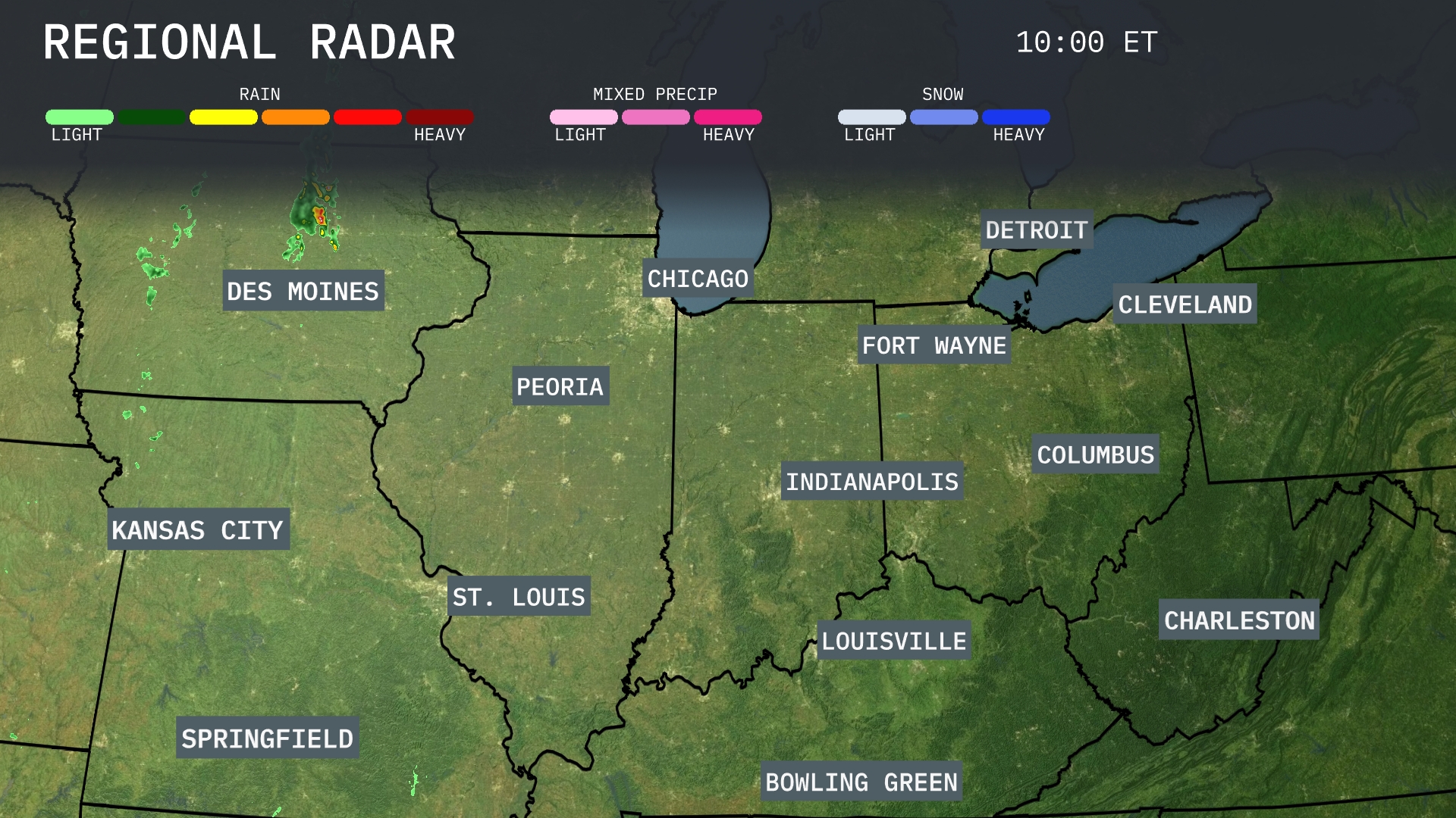
A line of storms is making its way from Des Moines, heading southeast towards Peoria, bringing heavy rain. Light showers are being observed to the northwest of Kansas City, moving intermittently into Missouri. The skies over Chicago, Indianapolis, and Columbus are currently clear, providing a break from any precipitation. Meanwhile, areas including Springfield and St. Louis are seeing increasing cloud cover ahead of potential rain showers.
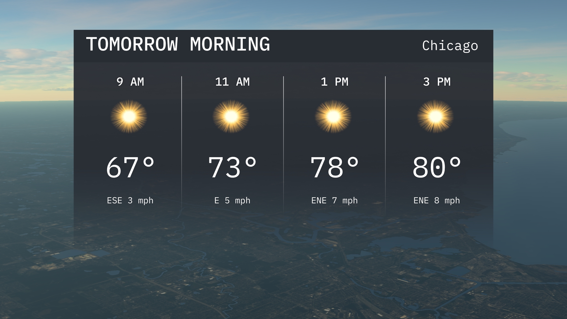
Tomorrow morning in Chicago, anticipate a bright and sunny start with temperatures beginning at 67 degrees by 9 AM. Winds will be light, coming from the east-southeast initially. As the morning progresses, temperatures rise to 73 degrees by 11 AM, with an easterly breeze.
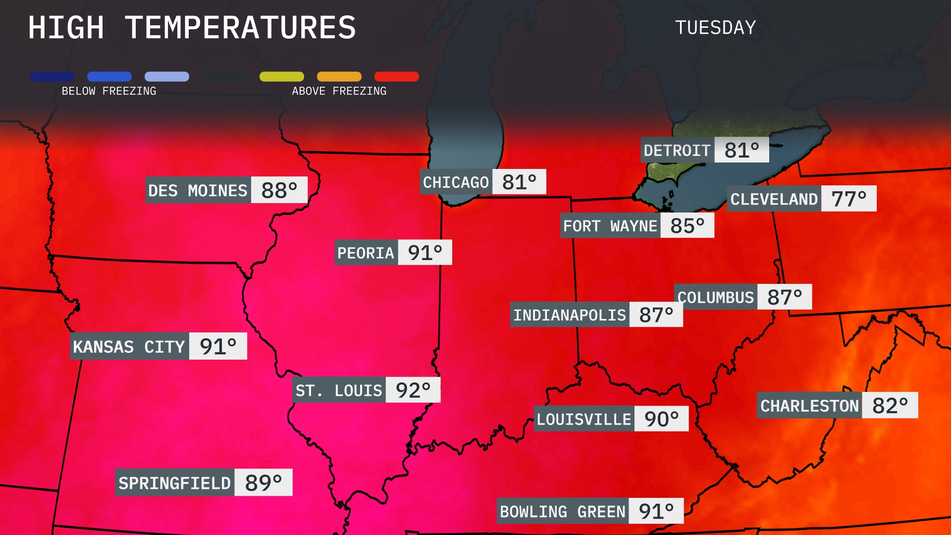
Tomorrow in the Midwest, highs will be quite warm with many areas experiencing above-average temperatures. St. Louis will lead the pack at 92 degrees, followed closely by Kansas City at 91. Peoria is set to reach 91 as well, while Indianapolis checks in at 87 degrees. Chicago will be cooler at 81, and Cleveland will see a high of 77 degrees, which is significantly below the nearby averages.
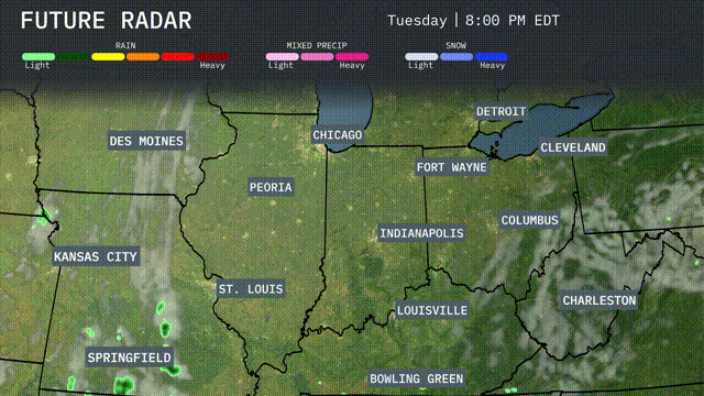
A cold front is expected to move through the Midwest tomorrow, bringing showers and thunderstorms from Kansas City to Indianapolis. Locally heavy rain may cause flash flooding especially in low-lying areas. Temperatures will drop around 10 degrees post-front, offering cooler, drier air into the weekend. Chicago and Detroit should be prepared for gusty winds and scattered storms during the late afternoon and evening. Keep an eye on severe weather alerts, especially around St. Louis where conditions might be more intense.
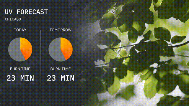
The UV index in Chicago is listed as high for both today and tomorrow, reaching a value of 8. With burn times estimated around 23 minutes, it’s important to apply sunscreen and seek shade during peak sunlight hours.
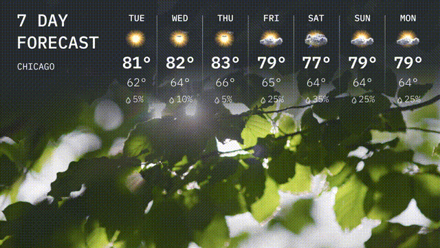
Tuesday: Look forward to a warm day with sunshine, reaching a high of 81 degrees and a comfortable low of 62 degrees.
Wednesday: Another warm day with mostly sunny skies, highs of 82 degrees and lows around 64 degrees.
Thursday: More sunshine on the way, heating up to 83 degrees during the day, cooling to a low of 64 degrees.
Friday: Expect partly sunny conditions with a slightly cooler high of 79 degrees, overnight low of 65 degrees.
Saturday: Clouds move in with a chance of showers, temperatures reaching 77 degrees, dipping to 64 degrees at night.
Sunday: Scattered showers possible, with a high of 79 degrees and lows at 64 degrees.
Monday: Continue to keep your umbrella handy! More chance of showers and temperatures remaining steady with a high of 79 degrees and a low of 64 degrees.