Chicago’s Week of Wild Weather: From Heat Waves to Thunderstorms
By
Amy Freeze
Get the latest on Chicago's fluctuating weather patterns this week—from scorching temperatures to severe storm alerts.
Explore the dynamic shifts in Chicago’s weather this week—from heat spikes to thunder showers and cool evenings. Stay informed and prepared with Amy Freeze’s insights.
Greetings, Chicagoans and Midwest dwellers! This week, your weather is on a captivating journey from high heat to soothing showers. With temperatures soaring and storms brewing, Amy Freeze guides you through each day’s expectations and safety tips. For an in-depth look at what to expect from the Midwest’s capricious skies, your full rundown is right here!
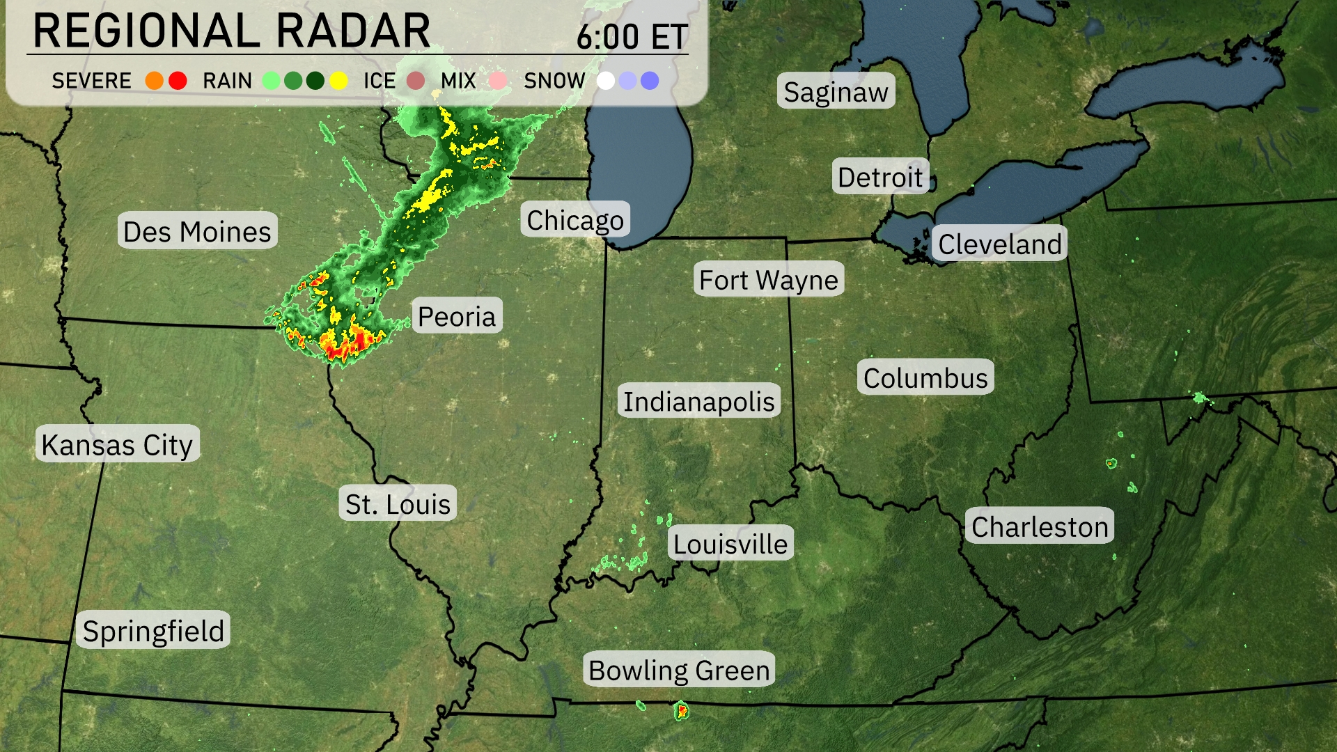
A line of severe storms is currently progressing towards Chicago, bringing significant rainfall and potential severe weather to the area. In Illinois, heavy rain and thunderstorms are targeting Peoria, creating wet and potentially hazardous conditions. Farther east, light showers are occurring near Bowling Green, with isolated rain around Fort Wayne, suggesting a mostly cloudy day with occasional precipitation. Meanwhile, areas near Detroit, Cleveland, and Indianapolis remain relatively calm and dry, offering a brief respite from the active storm system to the west.
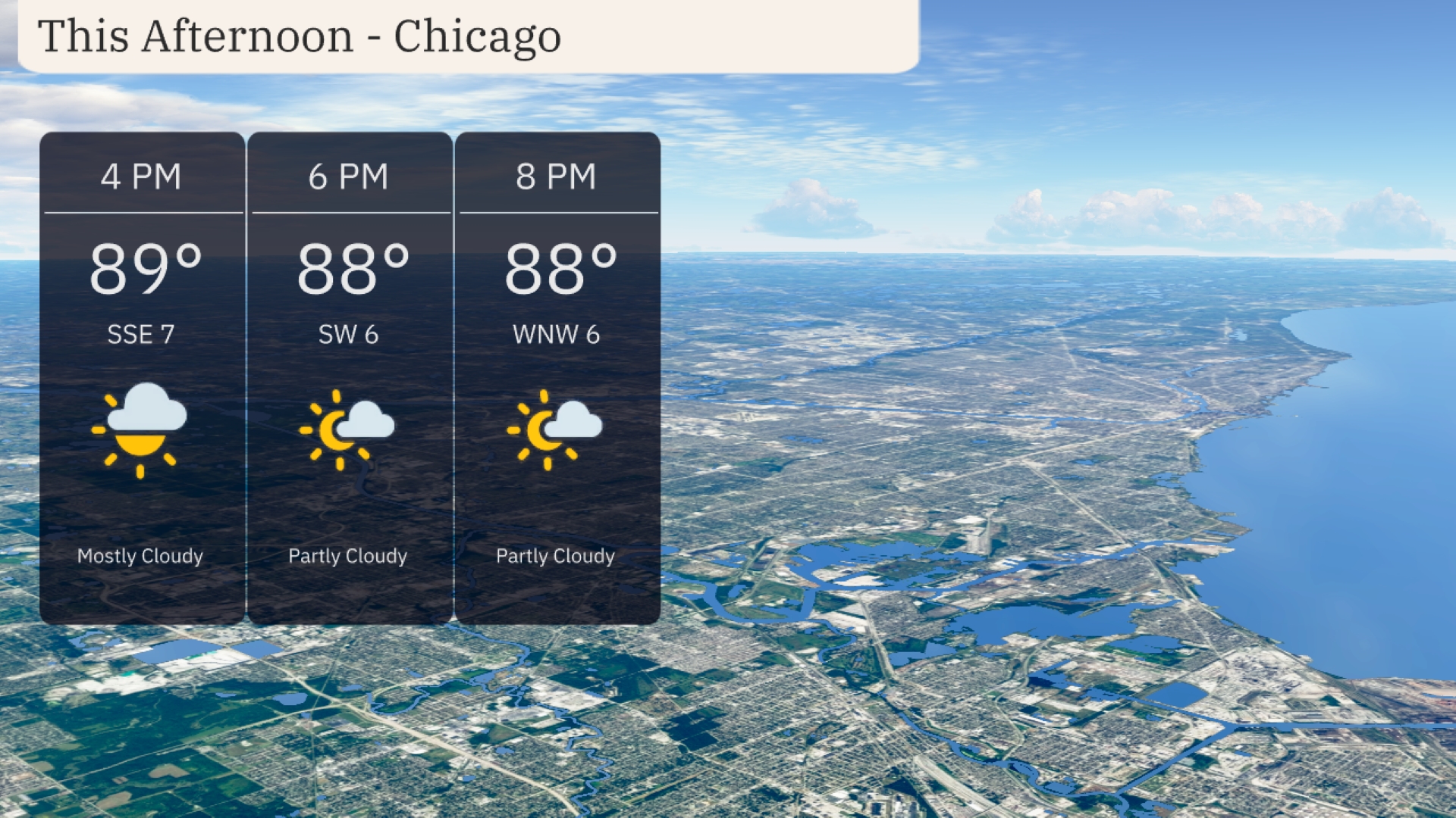
Afternoon temperatures in Chicago will reach 89 degrees with mostly cloudy skies. Winds will be from the south-southeast at around 7 miles per hour. By 6 PM, expect a slight shift to a southwest wind at 6 miles per hour as temperatures ease to 88 degrees. Skies will become partly cloudy by 8 PM with a west-northwest breeze at 6 miles per hour, maintaining 88 degrees.
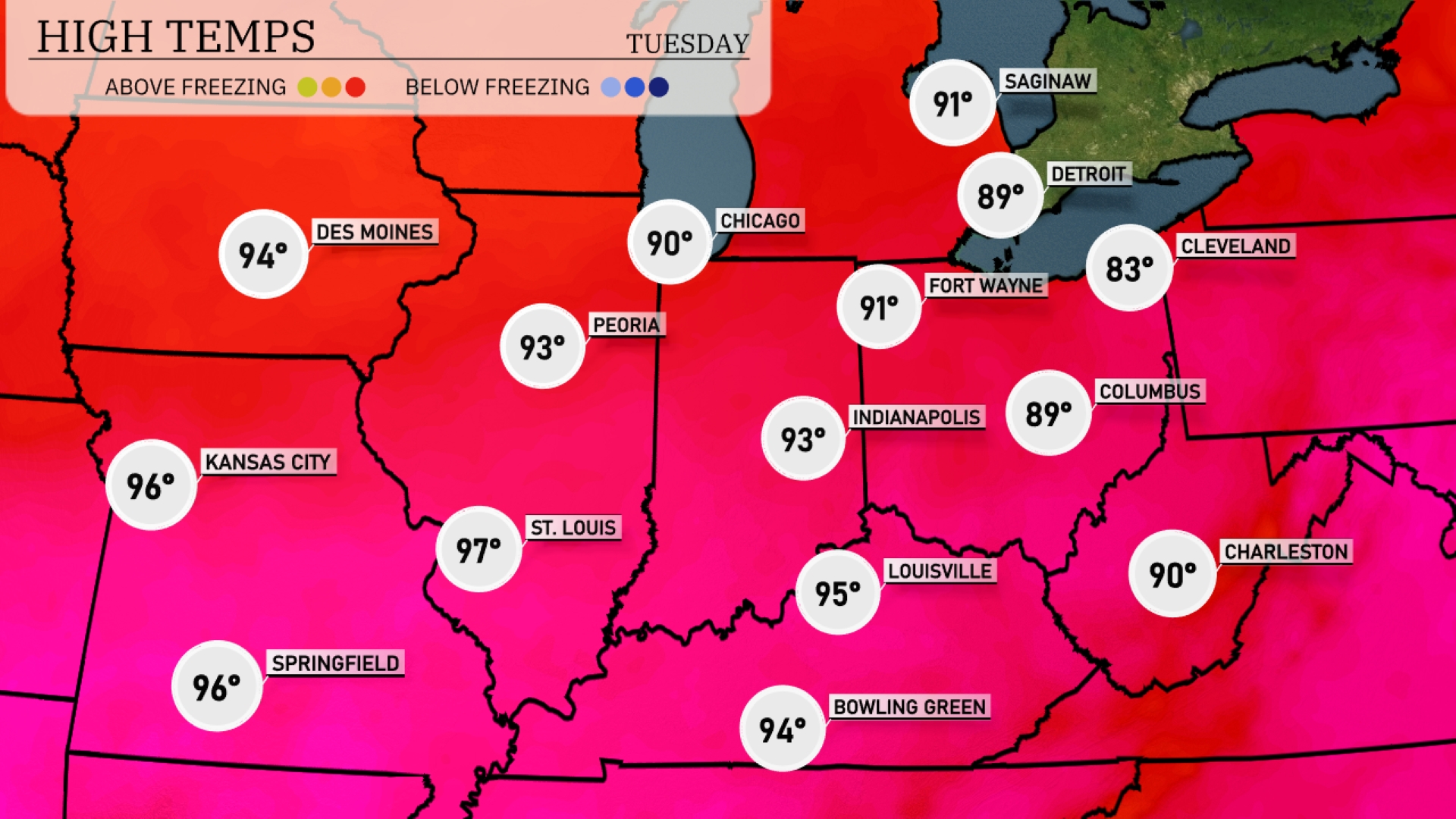
Today in the Midwest, we’re seeing some sizzling temperatures. St. Louis is hitting a high of 97 degrees, while Kansas City is closely following at 96. Chicago is enjoying a relatively cooler day with a high of 90, contrasted with Peoria’s warmer 93 degrees. Indianapolis will reach 93, and Louisville sees a high of 95. Cleveland will be a bit cooler at 83, providing a refreshing contrast to the surrounding warmth.
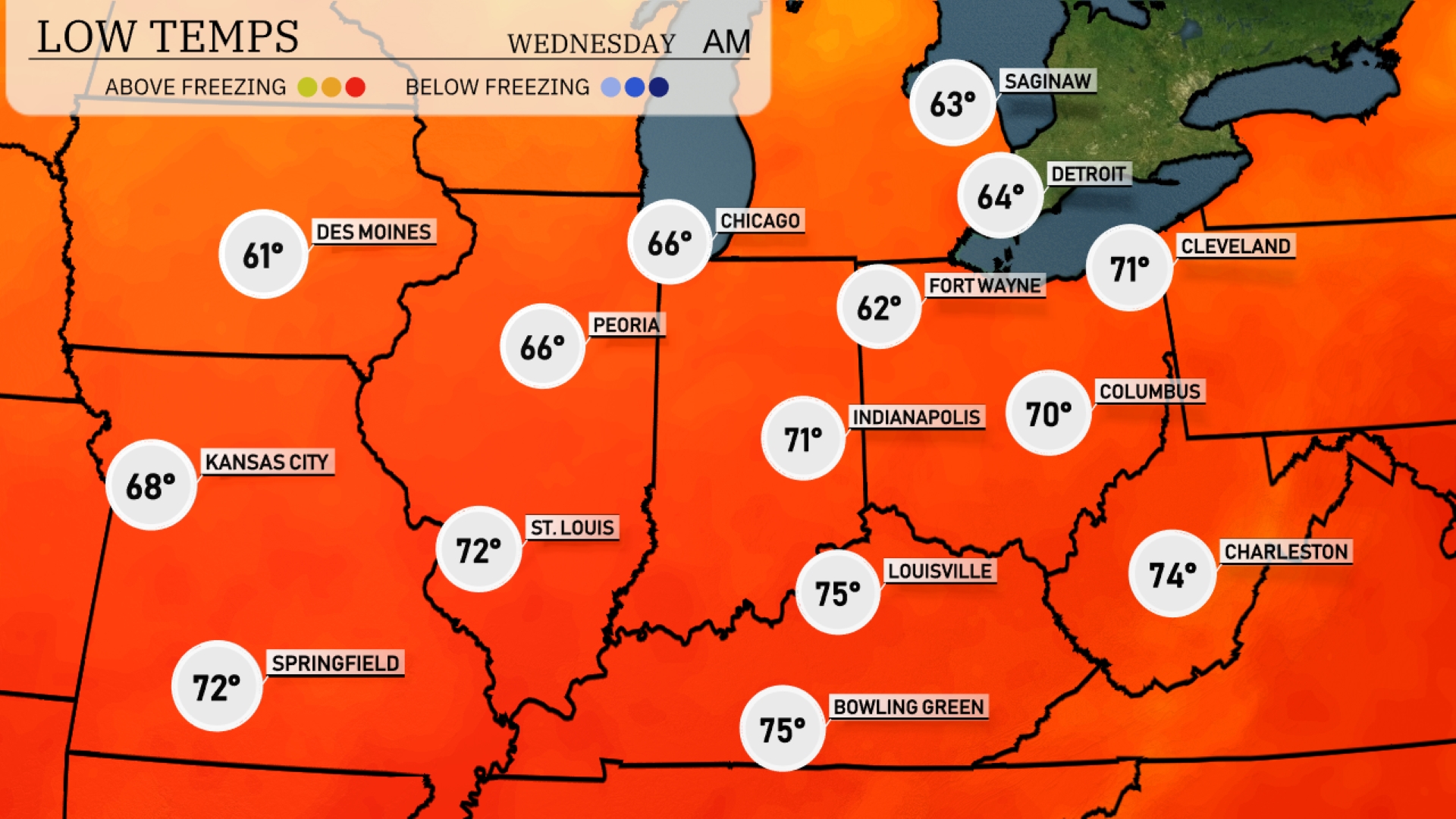
Tonight, Des Moines will see a low of 61 degrees. In Chicago, temperatures are expected to drop to 66 degrees while Fort Wayne cools off to 62. Indianapolis will experience a low of 70 degrees. Kansas City will be slightly cooler at 68 degrees.
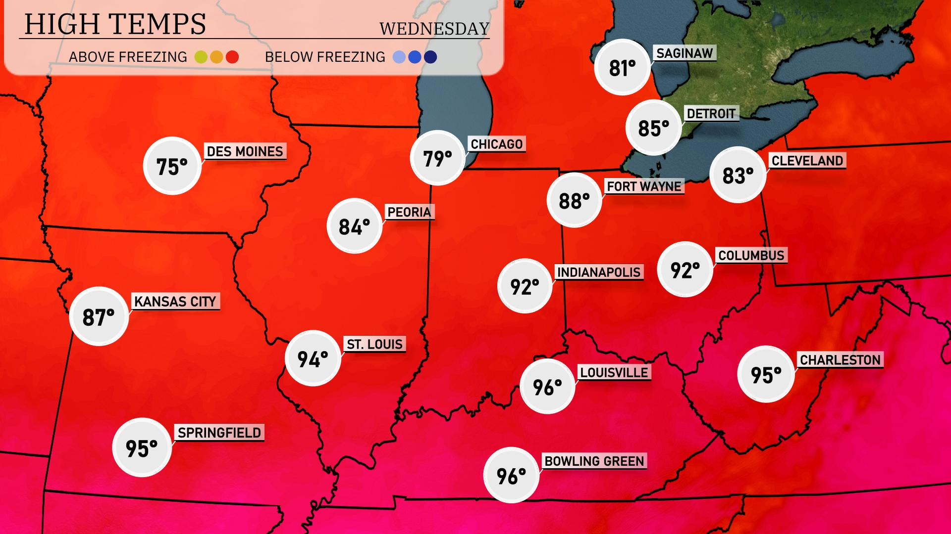
Tomorrow in the Midwest, temperatures are soaring, with St. Louis hitting a high of 94 degrees, while Springfield can expect a sweltering 95. Indianapolis will reach 92, and Louisville isn’t far behind at 96 degrees. The warmest spots will be Bowling Green and Louisville, each registering 96 degrees.
A shifting weather pattern in the Midwest brings cooler temperatures and scattered showers, particularly impacting areas from Kansas City to Indianapolis. Expect a mix of rain and thunderstorms, primarily in the afternoon, with the potential for localized flooding due to heavy downpours. As the cold front moves eastward, temperatures may dip slightly by Wednesday afternoon. Keep mindful of the weather update for potential severe thunderstorm warnings. By late Wednesday, the weather should stabilize, offering drier conditions heading into Thursday.
The UV index in Chicago will be moderate at 6 on Tuesday, with burn times of about 23 minutes under direct sunlight. On Wednesday, the index remains at 6, so plan for similar sun exposure risks. Expect a chance of showers which may provide some relief from the sun, but protection is still recommended!