Chicago’s Weather Whirlwind: From Stormy Skies to Scorching Sun!
By
Amy Freeze
Explore the dynamic weather patterns over Chicago with our latest forecast. From severe thunderstorms to scorching temperatures, find out what this week holds for the Windy City.
Chicago is set for a week of weather extremes! Expect everything from severe storms to blazing high temperatures. Stay tuned to our updates and stay prepared!
Welcome to your weekly weather forecast for Chicago and encompassing Midwestern cities. This detailed guide will navigate you through the current stormy conditions moving southward from Chicago to Indianapolis, and the warming trend that follows. Not just rain, but sizzling temperatures are predicted to rise up to 98 degrees by midweek. Alongside daily forecasts, tips on storm preparedness and heat safety are also included. Remember to check back daily for live updates as the weather patterns evolve.
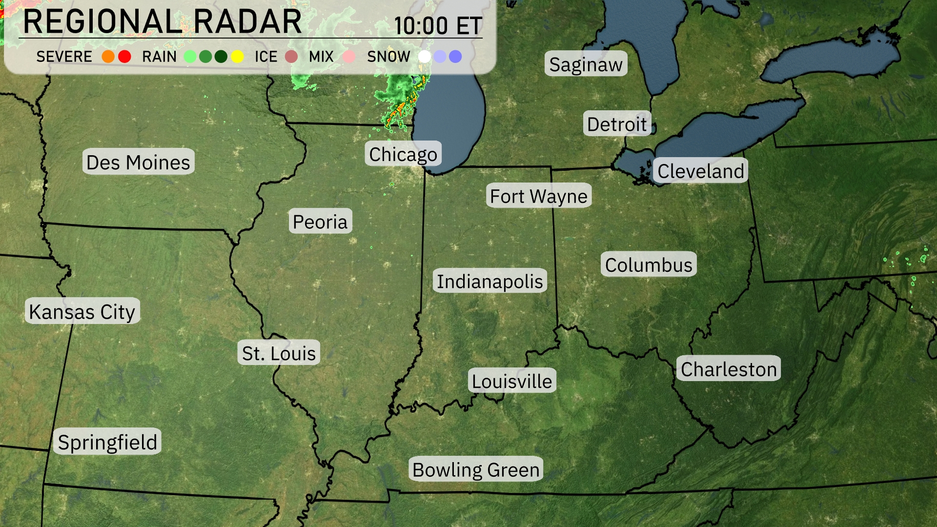
A line of storms is moving across the Midwest region, currently impacting areas around Chicago with severe weather and heavy rain. The storm system is slowly extending southward, bringing rain to areas near Indianapolis and moving toward Fort Wayne. Meanwhile, Columbus is under cloud cover, with rain showers expected to develop soon. Further northwest, Des Moines and St. Louis are in the clear with no significant precipitation observed.
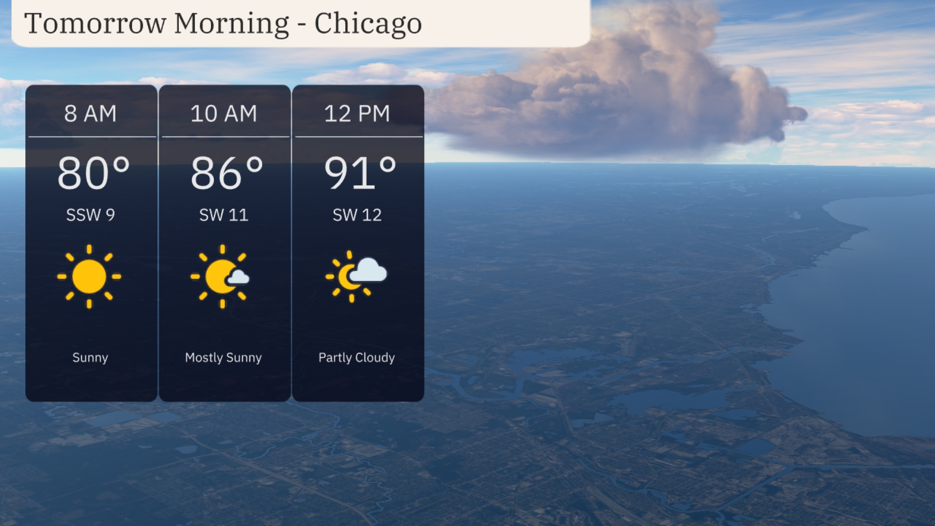
climb to 86 degrees with mostly sunny conditions and a light increase in winds to 11 mph. As noon approaches, expect partly cloudy skies with temperatures reaching 91 degrees and the southwest wind holding steady at 12 mph.
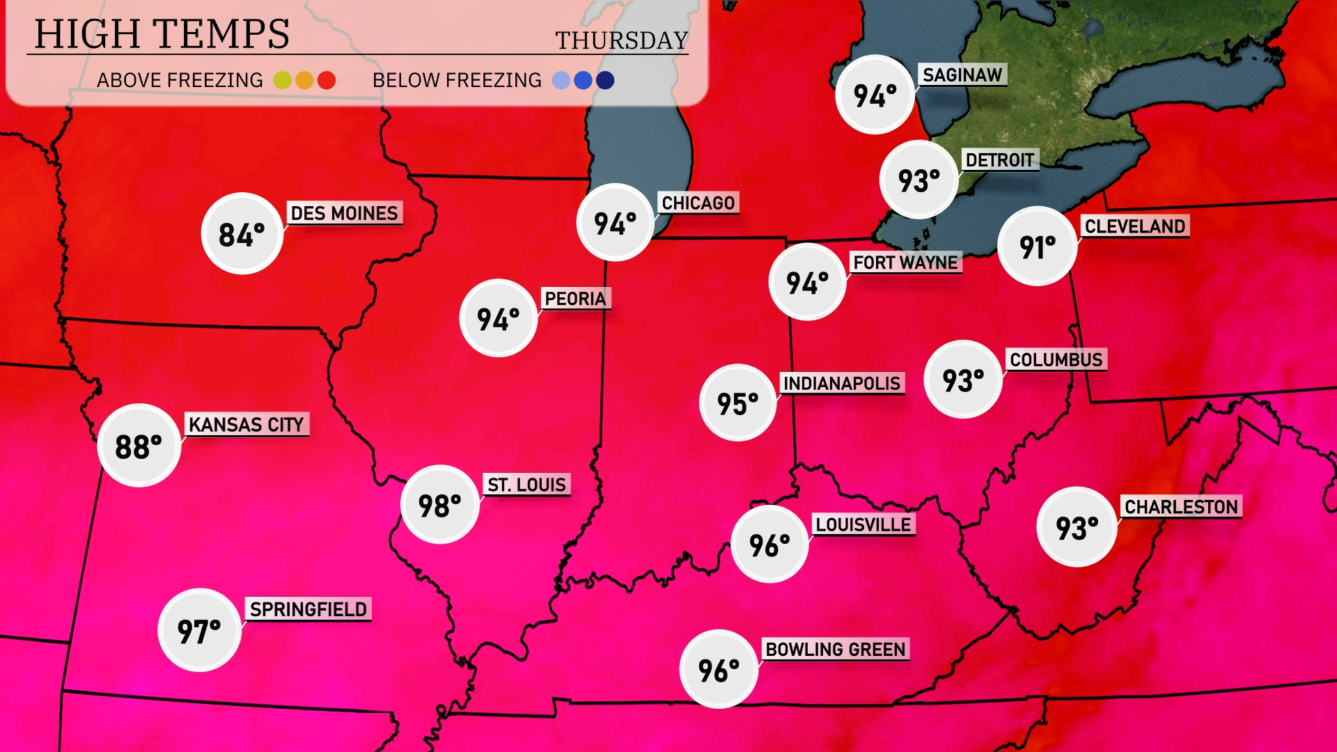
Tomorrow in the Midwest, expect sizzling temperatures across the board. Chicago will reach a high of 94 degrees, while Peoria also matches that at 94. Indianapolis is forecasted to hit 95 degrees, and St. Louis will soar to a steamy 98 degrees. Kansas City will see a more moderate high of 88, but it’s still above average for this time of year. Expect these elevated temperatures to be influenced by a strong high-pressure system settled over the region.
A strong storm system moves into the Midwest, bringing widespread rain and potential severe weather. Expect heavy thunderstorms in areas from Des Moines to Chicago, with gusty winds and localized flooding concerns. Indianapolis to Columbus will experience afternoon rain with the potential for strong storms. As the front progresses, cooler and drier air filters in, leading to a temperature drop across the region by Thursday. Keep an eye out for weather alerts, especially in areas prone to flooding, as more than an inch of rain is expected.
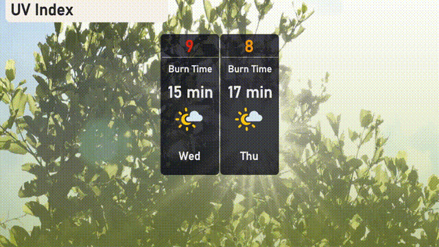
Chicago’s UV index on Wednesday is a very high 9, with a burn time of just 15 minutes in direct sunlight. As we move into Thursday, the UV index decreases slightly to 8, extending the burn time to 17 minutes. Make sure to protect your skin with sunscreen and hats!
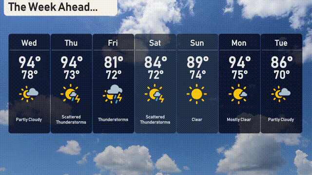
For the 7-day forecast in Chicago:
Wednesday: Mostly sunny to partly cloudy with a high of 94 degrees and a low of 78 degrees. Enjoy the warmth!
Thursday: Get ready for scattered thunderstorms with temperatures around 94 degrees for a high and a low of 73 degrees.
Friday: Thunderstorms continue, cooling down a bit with a high of 81 degrees and a low of 72 degrees.
Saturday: Another day of scattered thunderstorms with temperatures reaching 84 degrees during the day and a low of 72 degrees at night.
Sunday: Clear skies are expected with a high of 89 degrees and a low of 74 degrees.
Monday: Mostly clear with highs reaching around 94 degrees and lows of 75 degrees, a great start to the week!
Tuesday: Wrap up the week with partly cloudy skies, reaching up to 86 degrees in the daytime and a low of 70 degrees at night.
Hope that helps! Stay safe and enjoy the week ahead in the Windy City!