Chicago’s Weather Outlook: Sun, Storms, and Soaring Temperatures!
By
Amy Freeze
Your comprehensive guide to navigating Chicago's ever-changing weather from clear mornings to stormy afternoons.
Get ready for a rollercoaster of weather in Chicago! Expect everything from partly cloudy skies to severe thunderstorm warnings. Stay updated and prepared with our detailed forecast.
Welcome to your ultimate guide to Chicago’s weather. Tomorrow starts with partly cloudy conditions and 76°F, but don’t be fooled by the calm start. We’ll see temperatures rising to 91°F with thunderstorms brewing, especially in the afternoon. Moving into the weekend, watch for fluctuating temps and continued thunder risks. Remember, with a UV index peaking, sun safety is crucial. Dive into our full forecast to ensure you’re always one step ahead of the weather!
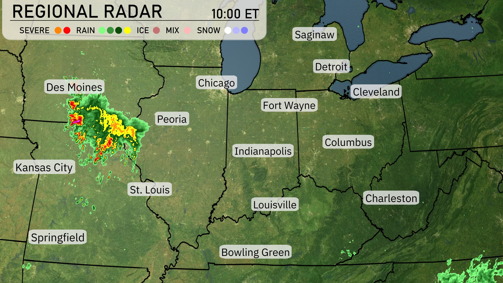
A line of thunderstorms is making its way across Iowa, approaching Des Moines from the west and stretching towards Kansas City. Peoria and St. Louis are under cloudy skies with rain showers beginning to develop. Light rain is showing up in Bowling Green and to the north of Springfield. The rest of the Midwest, including cities like Chicago and Indianapolis, is enjoying clear skies for now, but keep an eye on the skies as weather conditions may change.
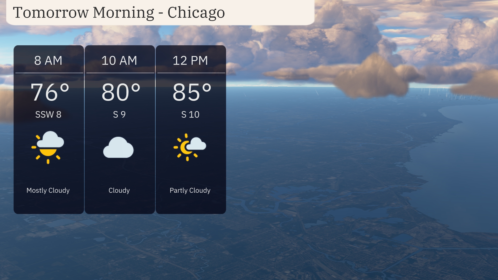
Chicago will start the morning with partly cloudy skies and a temperature of 76 degrees at 8 AM, accompanied by a gentle southwest wind at 8 mph. Moving into the morning, clouds will increase by 10 AM with temperatures reaching 80 degrees and winds shifting to the south at 9 mph. By midday, look for a mix of sun and clouds with a temperature of 85 degrees and a steady south wind at 10 mph.
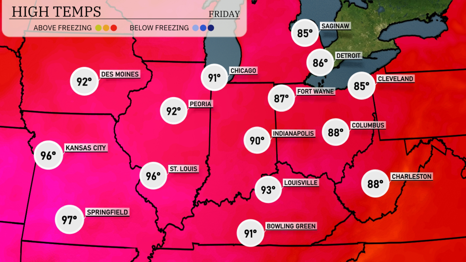
Tomorrow in the Midwest, temperatures are soaring, with Kansas City expecting a high of 96 degrees. St. Louis and Springfield will experience similarly warm conditions, reaching 96 and 97 degrees, respectively. Peoria and Indianapolis are not far behind, with highs of 92 and 90 degrees. Chicago will see a pleasant day at 91 degrees, while Fort Wayne is forecasted to hit 87 degrees.
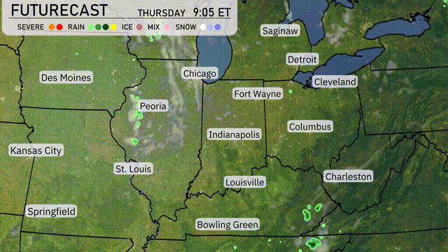
A warm front is moving steadily over the Midwest, with scattered thunderstorms developing mainly in areas like Peoria and Indianapolis by late morning. As we move into the afternoon, expect those storms to intensify, bringing the possibility of heavy rainfall and localized flooding, particularly in Fort Wayne and Columbus. Temperatures will remain warm across the region, hitting the upper 80s to low 90s in St. Louis and Bowling Green. Overnight, a more organized line of storms could shift eastward across Cleveland and Charleston, increasing the risk of wind gusts and thunderstorm activity. Cooler and drier air will settle in early Friday, providing some relief and clearer skies for the weekend.
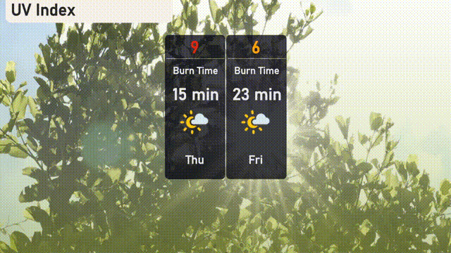
The UV index in Chicago will be a very high 9 on Thursday, with a burn time of 15 minutes, so it’s crucial to limit direct sun exposure and wear protective gear. On Friday, the UV index drops to a high of 6, with a burn time of 23 minutes. Stay sun-safe by reapplying sunscreen frequently if you’ll be outside!
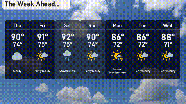
For the 7-day Chicago forecast:
Thursday: Cloudy skies with a high of 90 degrees and a low of 74 degrees.
Friday: Partly cloudy, seeing a high of 91 degrees and a low of 75 degrees.
Saturday: Expect showers to develop later with a high reaching 92 degrees and a low of 75 degrees.
Sunday: Partly cloudy conditions with a high of 90 degrees and a morning low of 74 degrees.
Monday: Isolated thunderstorms potential, as temperatures hit a high of 86 degrees and a low of 72 degrees.
Tuesday: Partly cloudy, maintaining a high around 86 degrees with a low of 72 degrees.
Wednesday: Continuing with partly cloudy skies, temperatures rise to 88 degrees and dip to 71 degrees.