Chill and Thrill: Tackling the Dynamic Weather of the Southwest
By
Amy Freeze
From snow flurries to sizzling highs, read on as Amy Freeze unravels the ever-changing weather patterns of the Southwest.
Discover how a mix of snow and sunshine characterizes this week’s weather across the Southwest, with meteorologist Amy Freeze leading the coverage.
This week’s Southwest forecast brings a mélange of climactic diversity. While Salt Lake City braces for light snow, towns like Las Vegas and Phoenix heat up impressively. Cedar City sees gentle rain, whereas Northern Nevada gets a sprinkle of much-needed moisture. Explore how these diverse conditions affect daily life, with insights from Amy Freeze.
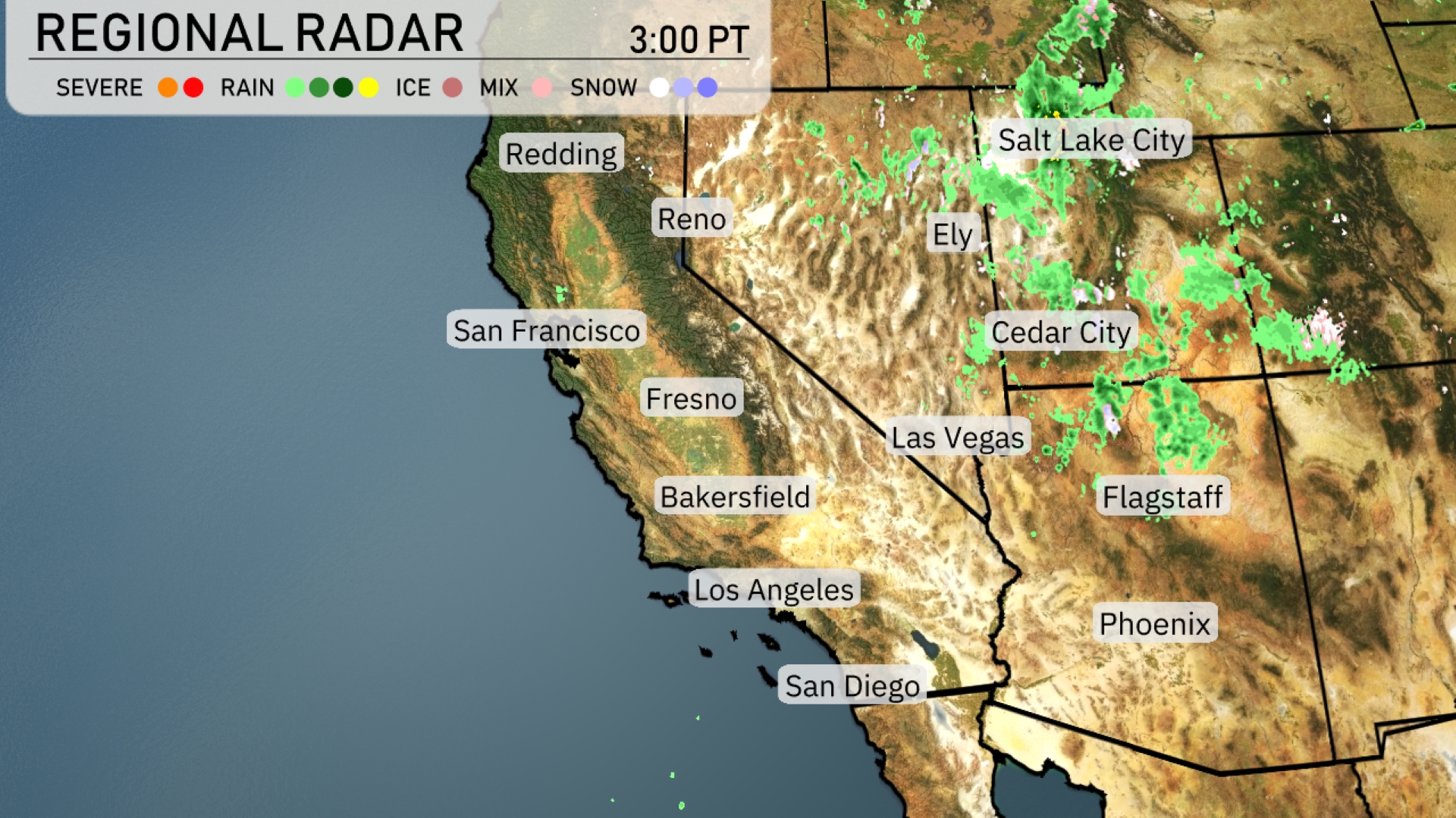
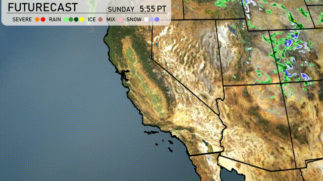
While little or no accumulations is expected in the valley of Salt Lake City, snow could fall on the the Bench. A strong cold front will bring a band of
moderate to heavy snow into early Sunday afternoon. Snow will shift to a showery mode in northwest flow with the heaviest additional accumulations in areas that do well in northwest flow. Salt Lake City, despite its proximity to these storms, should expect only a rain snow mix and any snow that does fall, will not stick. Cedar City is witnessing some light rain showers moving northeast. A gentle stretch of rain is sweeping into northern Nevada towards Ely, bringing some moisture to the typically dry region. No precipitation is occurring in southern California, with clear skies stretching down to San Diego. Flagstaff also stays dry as the weather patterns hold.
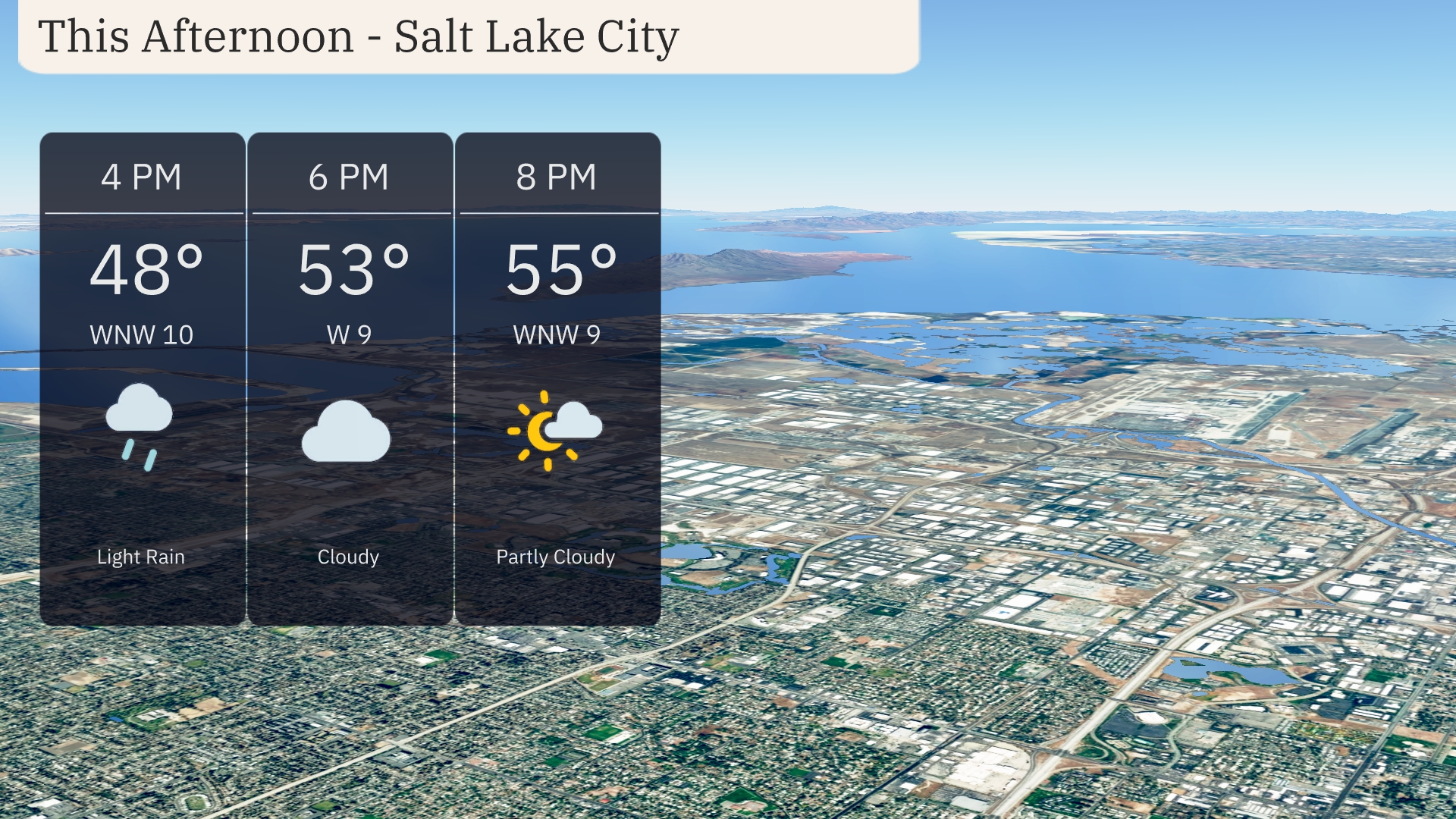
Temperatures in Salt Lake City for this afternoon will rise to 55 degrees by 8 PM. Expect light rain initially, transitioning to cloudy skies with winds from the west-northwest at 10 miles per hour. By 8 PM, clouds begin to break, offering partly cloudy conditions.
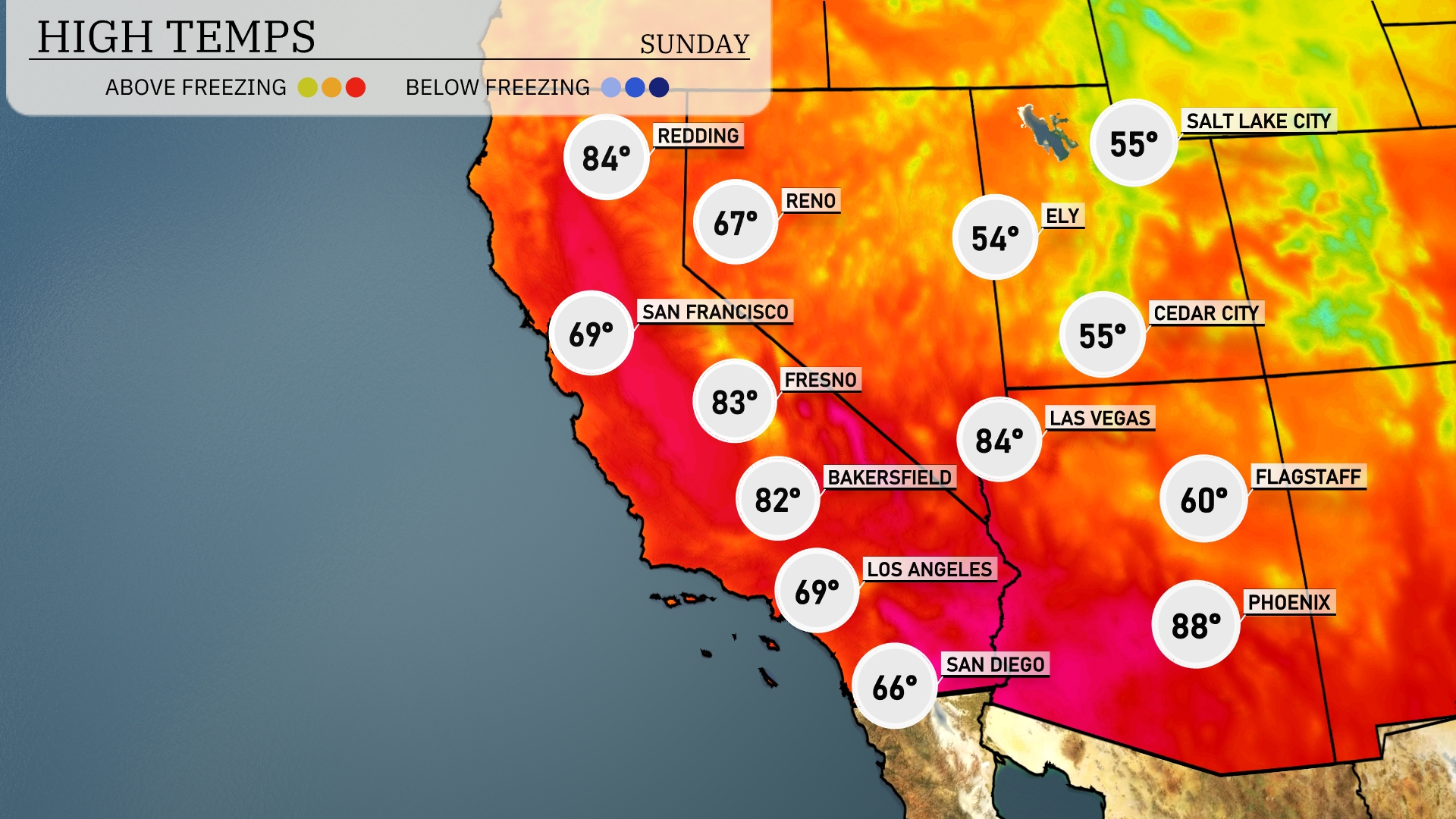
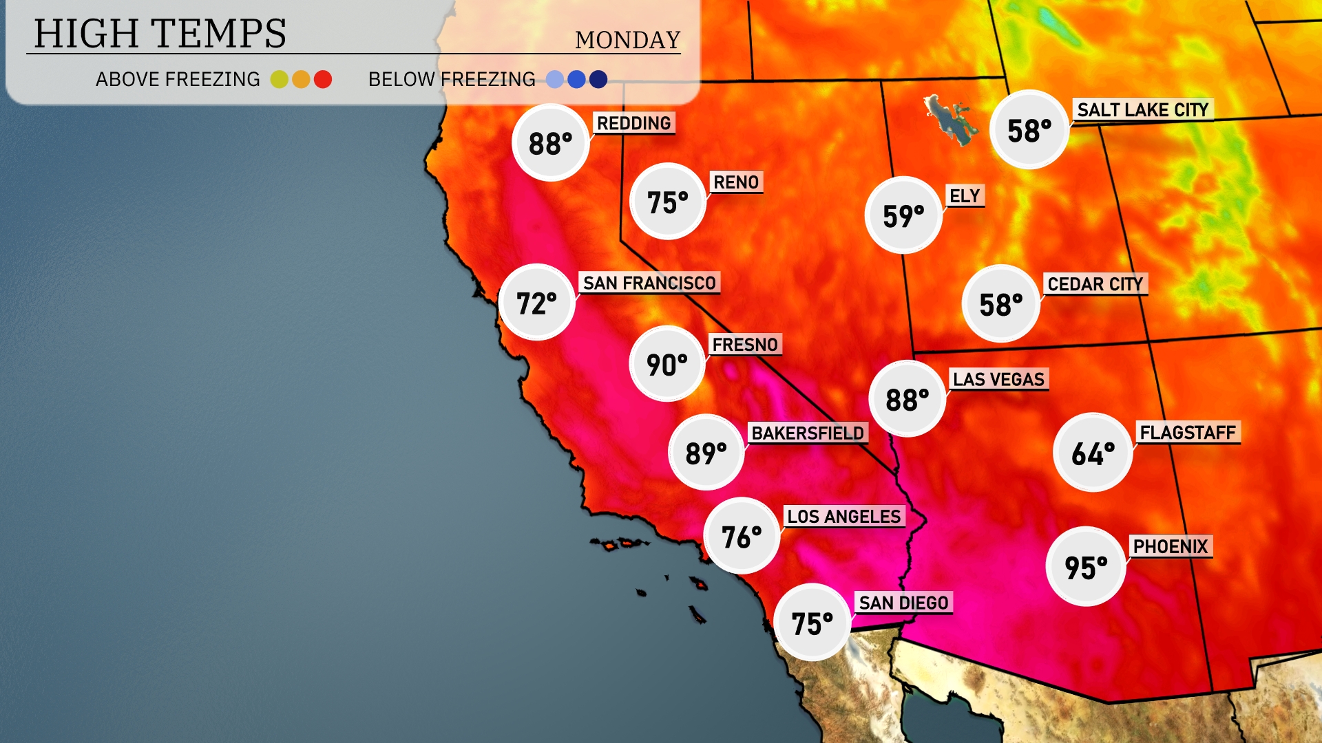
Today in the Southwest, Las Vegas tops the charts with a sizzling 84 degrees, while Phoenix isn’t far behind at a warm 88 degrees. In Southern California, Bakersfield is set to reach 82 degrees, and Fresno will see a high of 83. Coastal areas will be a bit cooler, with San Diego at 66 and Los Angeles climbing to 69 degrees. Interestingly, Flagstaff lags behind with a much cooler high of just 60 degrees.
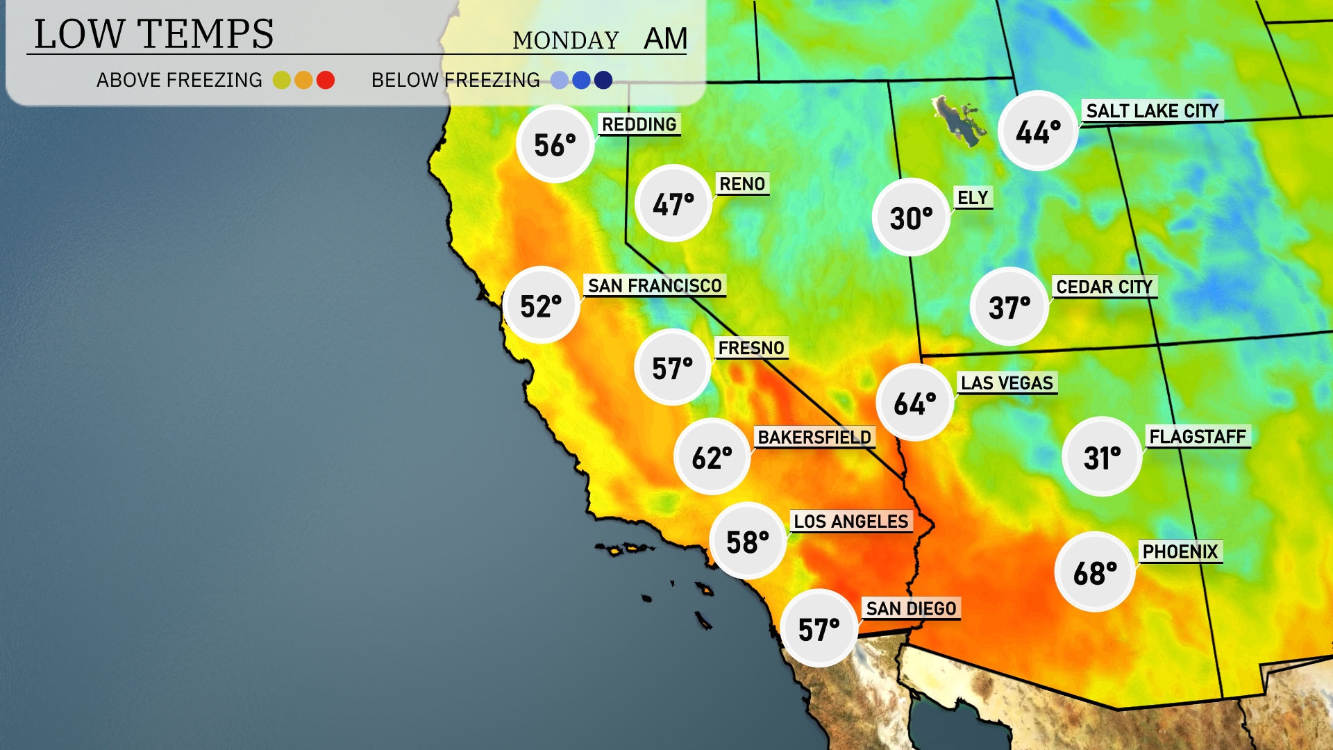
Tonight expect a chilly 30 degrees in Ely and just 31 in Flagstaff, marking colder conditions across the region. Las Vegas will see a low of 64 degrees, while Phoenix remains warmer at 68. In California, San Francisco will cool down to 52 degrees, and Bakersfield will be slightly warmer at 62. Cedar City will hit a low of 37 degrees.
Tomorrow, Phoenix will soar to 95 degrees, while Las Vegas will reach 88 degrees. In California, Fresno is expected to hit 90 degrees, with Bakersfield not far behind at 89 degrees. Coastal areas will be mild with Los Angeles peaking at 76 degrees, the same for San Diego.
Expect a dynamic weather pattern in the Southwest tomorrow. A cold front will move through Arizona, bringing scattered showers and the potential for isolated thunderstorms, especially in the higher elevations. Look out for gusty winds with these storms, which could lead to challenging travel conditions. Temperatures will dip slightly behind the front but remain mild. The clear skies return by evening, offering a pleasant end to the day.
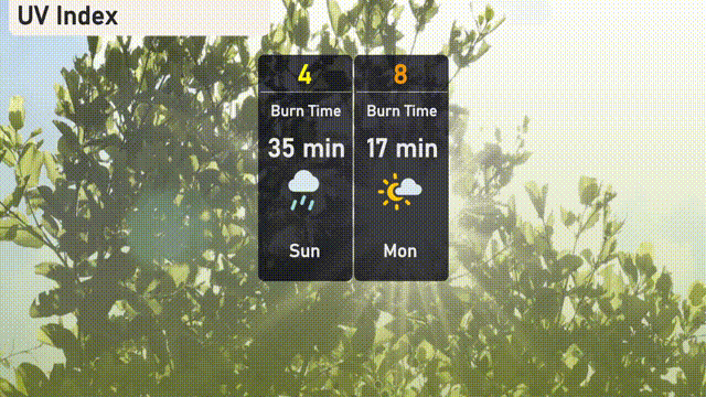
The UV index in Salt Lake City will be moderate on Sunday with a value of 4, with storms potentially reducing direct sun exposure. Looking ahead to Monday, expect the UV index to rise to 8, with a burn time of about 17 minutes in direct sunlight.