From Sunshine to Showers: LA’s Diverse Weather This Week
By
Amy Freeze
Explore the dynamic weather patterns affecting Los Angeles and surrounding areas this week, from clear skies to unexpected rainfall and everything in between, with expert insights from Meteorologist Amy Freeze.
Meteorologist Amy Freeze reports fantastic weather in LA with sunny days ahead but advises readiness for unexpected showers and gusty winds. Click for detailed forecasts and tips to enjoy the week’s weather safely!
Greetings from Amy Freeze with your complete guide to this week’s weather for Los Angeles and the broader Southwest. The week starts with spectacular sunny days ideal for outdoor adventures. However, as the week progresses, expect some shifts. We anticipate cooler temperatures and several rain episodes despite predominant clear skies. Particularly in the San Bernardino Valley, prepare for sporadic heavy rain that may affect travel plans. With temperature fluctuations and a mix of sunny to cloudy days, it’s crucial to stay updated. Follow along as we track these changes closely, providing all the advice you need to manage and enjoy your week’s activities regardless of the weather. Stay tuned and weather-aware!
On the Regional Radar, the Southwest is contending with some dynamic weather patterns today. Southern California enjoys mostly clear skies, with Los Angeles and San Diego experiencing mild conditions and only sporadic cloud cover. However, farther north, San Francisco is witnessing light rain showers moving in from the Pacific.
In the Reno area, a mix of rain and snow is present, creating a challenging weather scenario for travelers. In contrast, Las Vegas remains dry under clear skies, enjoying a peaceful weather day.
Flagstaff is bracing for light snow opportunities as cooler air drifts down from Cedar City. Farther west, Fresno and Bakersfield are experiencing sporadic showers, providing some relief to the dry valley conditions, particularly in these agricultural hubs.
In Los Angeles this afternoon, temperatures will hold steady at 71 degrees through 5 PM before dipping slightly to 70 degrees by 7 PM. Expect sunny skies with a gentle breeze from the south-southwest at 6 to 7 miles per hour, maintaining calm and pleasant conditions for the remainder of the day.
Let’s take a look at today’s high temperatures across the Southwest region. In Las Vegas, we’re seeing a warm high of 82 degrees, while Phoenix is heating up to a notable 88 degrees—making it one of the warmest spots in the area. Over in Fresno, the high reaches 74, and Bakersfield matches that with a 74-degree high as well.
To the west, San Diego is slightly cooler at 69 degrees, and San Francisco comes in at 65 degrees, showing a significant contrast with the desert areas.
Now for the low temperatures, the Southwest is experiencing a brisk night ahead. In Flagstaff, expect a colder low of 36. Las Vegas will see a relatively warmer night at 59 degrees, while Cedar City settles at 40. Further south, Los Angeles has a mild night with a low of 53 degrees and San Diego stays a touch warmer at 54. The temperatures reflect a notable shift as the region feels the effects of colder air patterns moving in.
For tomorrow’s high temperatures in the Southwest region, we are expecting notable warmth across several key cities.
Phoenix will experience a scorching high of 94 degrees, well above average for this time of year.
Over in Las Vegas, temperatures will peak at 87 degrees. Bakersfield comes in hot at 86 degrees, while Fresno reaches 83 degrees.
Los Angeles enjoys a comfortable 82 degrees, San Diego will be slightly cooler at 76 degrees.
To the north, Reno will see a pleasant high of 75 degrees.
A ridge of high pressure is influencing these temperatures, leading to a warm and dry spell across the Southwest.
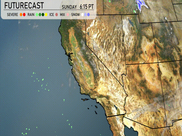
“On the Southwest futurecast for tomorrow, we’re expecting a prominent shift in weather patterns. The coast of Southern California will experience on-and-off showers, particularly impacting the San Bernardino Valley with periods of heavy rain. This could result in slick roads and compromised travel conditions over mountain passes. As the system progresses, look for gusty winds inland, with temperatures cooling slightly by midweek. Continue to monitor updates as further changes develop over the next 24 to 48 hours.”
“In Los Angeles, the UV index is forecasted to be high at 7 on both Sunday and Monday. With the sun shining brightly, expect a quick burn time of about 20 minutes. It’s essential to wear sunscreen and seek shade to protect your skin while enjoying the lovely weather!”