Morning Brew of Weather: Clouds, Sun, and Surprises in the Southwest – 08/14/2025
By
Amy Freeze
Dive into your morning with an advance look at tomorrow's weather across Los Angeles and the Southwest. Understand the skies from cityscapes to mountain escapes.
Find out what’s brewing in the sky tomorrow! Los Angeles wakes up to partly cloudy conditions with temperatures swinging into the mild 60s. Meanwhile, the Southwest stirs with showers, sunshine, and surprises across different cities.
Good morning, Los Angeles! Prepare for a beautiful start with mostly clear skies and light temperatures. Meanwhile, the Sierra Nevada welcomes refreshing showers, and areas like Flagstaff remain calm under cloudy skies. As Southern California heats up, know what temperatures and conditions to expect from Phoenix’s scorching highs to San Diego’s cool breath. From impending thunderstorms to sun-soaked clear skies, be ready for a dynamic week ahead in weather as we monitor developments closely. Stay tuned and stay prepared!
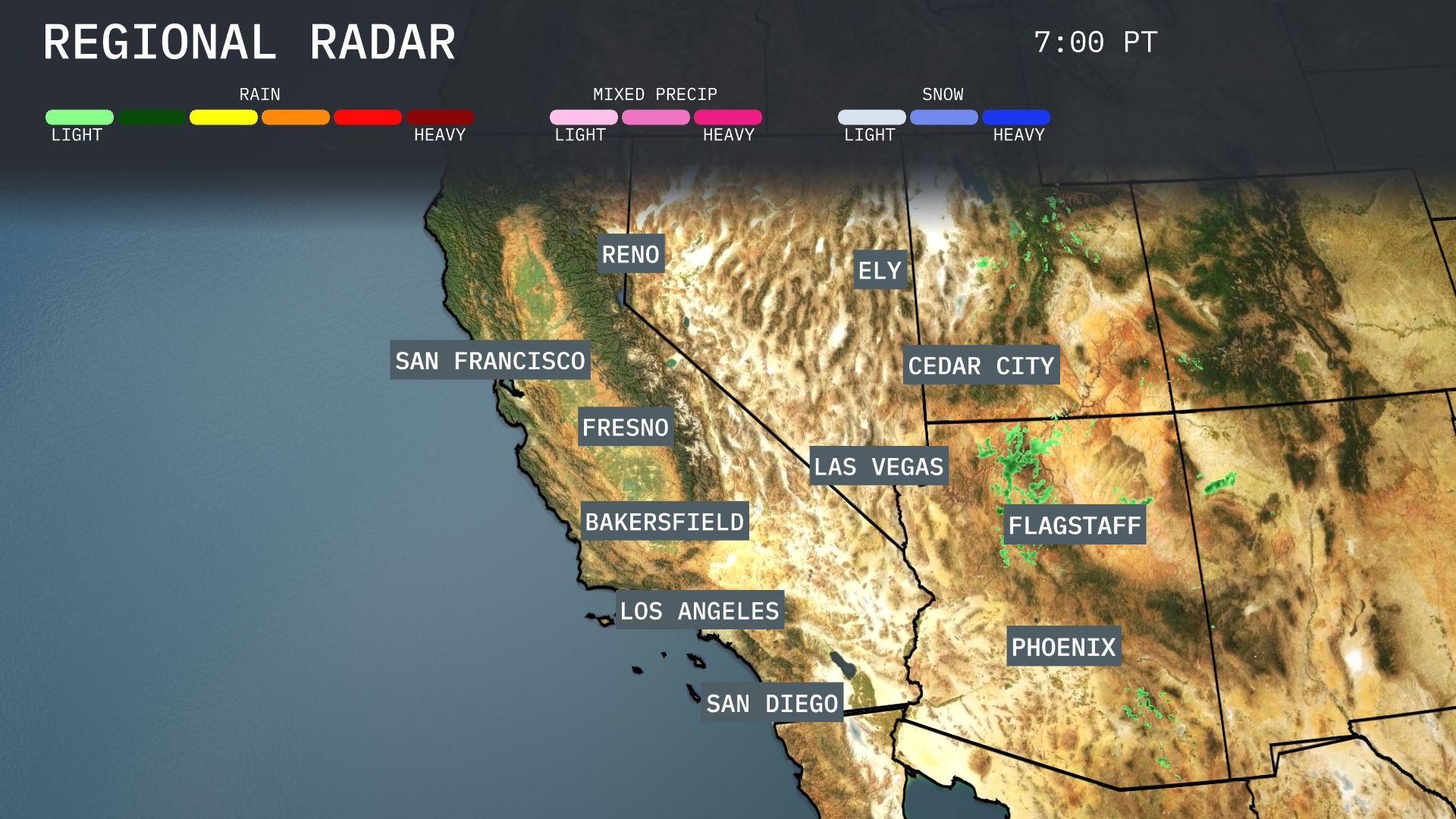
Showers are developing over the Sierra Nevada, including areas near Reno and Fresno, providing some welcome moisture. In Ely, expect precipitation, predominantly rain with potential for light snow in higher elevations. Cedar City is also seeing a mix of rain and possibly some snow, especially over the nearby mountains. Flagstaff remains quiet with just clouds and Las Vegas continues to experience clear and dry conditions.
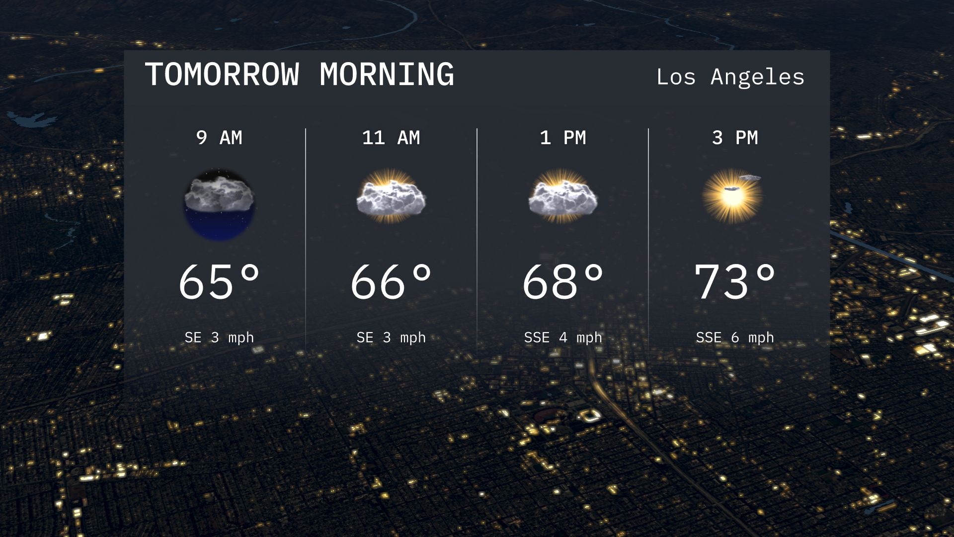
Los Angeles tomorrow morning starts at 65 degrees with light southeast winds under mostly clear skies. By 11 AM, temperatures rise to 66 degrees as clouds begin to increase slightly. The gentle southeast breeze persists.
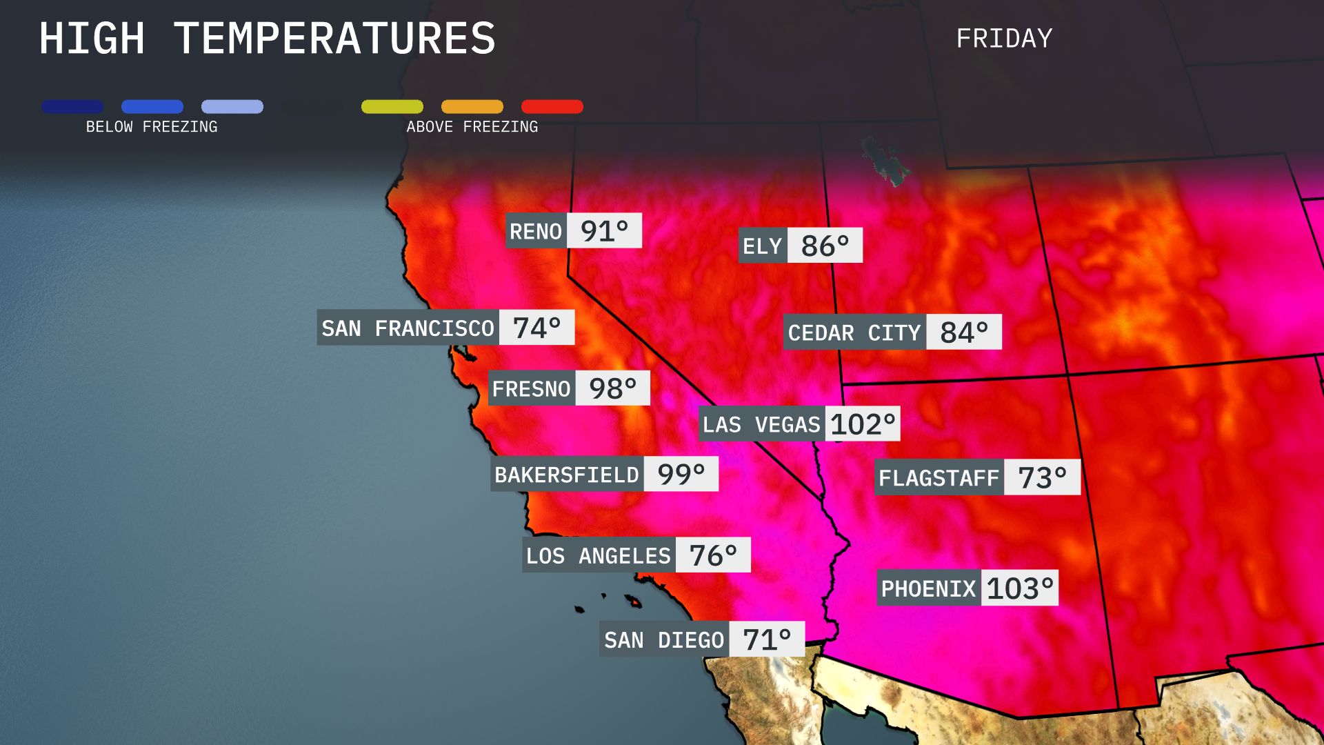
Tomorrow in Phoenix, expect a sizzling high of 103 degrees, well above the average for mid-August. Las Vegas will also be feeling the heat with a high reaching 102 degrees. In Bakersfield, temperatures will soar to 99 degrees, while Fresno could see a high of 98 degrees. San Diego will offer a cooler contrast at 71 degrees, making it the most pleasant spot in Southern California.
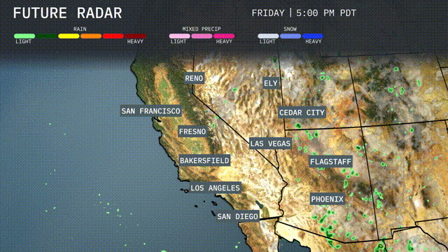
Expect a dynamic day in the Southwest as scattered thunderstorms develop from Flagstaff to Las Vegas by the afternoon. Heavy downpours could lead to localized flooding, particularly in low-lying areas. Temperatures will remain warm with highs reaching into the mid-90s in Phoenix and Las Vegas. Look out for gusty winds and possible lightning in areas surrounding Ely and Cedar City. Coastal regions near Los Angeles and San Diego will see cloudy skies but remain dry over the next 48 hours.
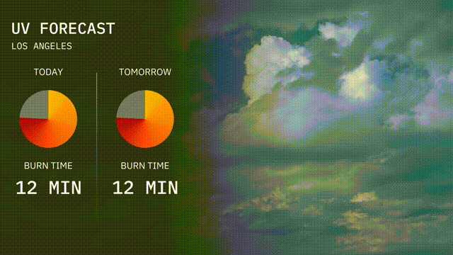
Los Angeles expects a high UV index of 8 today, which means you can experience a burn in just 12 minutes under direct sunlight. Tomorrow’s UV index remains at 8.
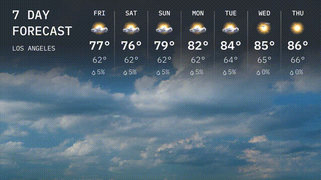
Friday: Mostly cloudy with a high of 77 degrees and a low of 62 degrees.
Saturday: Continues to be cloudy as we see temperatures around 76 degrees, with a low of 62 degrees.
Sunday: With a high of 79 degrees and a low near 62 degrees, expect partly sunny skiea.
Monday: The start of the week is warmer and partly cloudy, reaching up to 82 degrees, the evening cools down to 62 degrees.
Tuesday: Temperature rises to 84 degrees with clouds clearing a bit, while the low is 64 degrees.
Wednesday: Warmer with mostly sunny skies; expect a high of 85 degrees and a low of 64 degrees with no rain expected.
Thursday: The warmest day of the week, bringing plenty of sunshine and a high reaching 86 degrees, the low drops to 66 degrees.