Los Angeles Forecast: Sun-soaked Mornings and Chilly Evenings
By
Amy Freeze
Welcome to a week of dynamic weather in Los Angeles, featuring vibrant sunny days and the crisp evenings of the Southwest region.
Catch a glimpse of what’s in store this week with clear, sunny skies in LA and varied conditions across the Southwest. Find out more about the daily forecasts, from crisp mornings to warm afternoons!
Explore the gorgeous, sunny mornings and slightly chilly nights in Los Angeles before branching out to the broader temperature swings in the Southwest region. From warm afternoons in Phoenix and Bakersfield to cooler evenings in Las Vegas and Flagstaff, and even some rainfall across Nevada and Utah. Make sure to stay prepared for your daily activities by staying updated with our detailed weather insights.
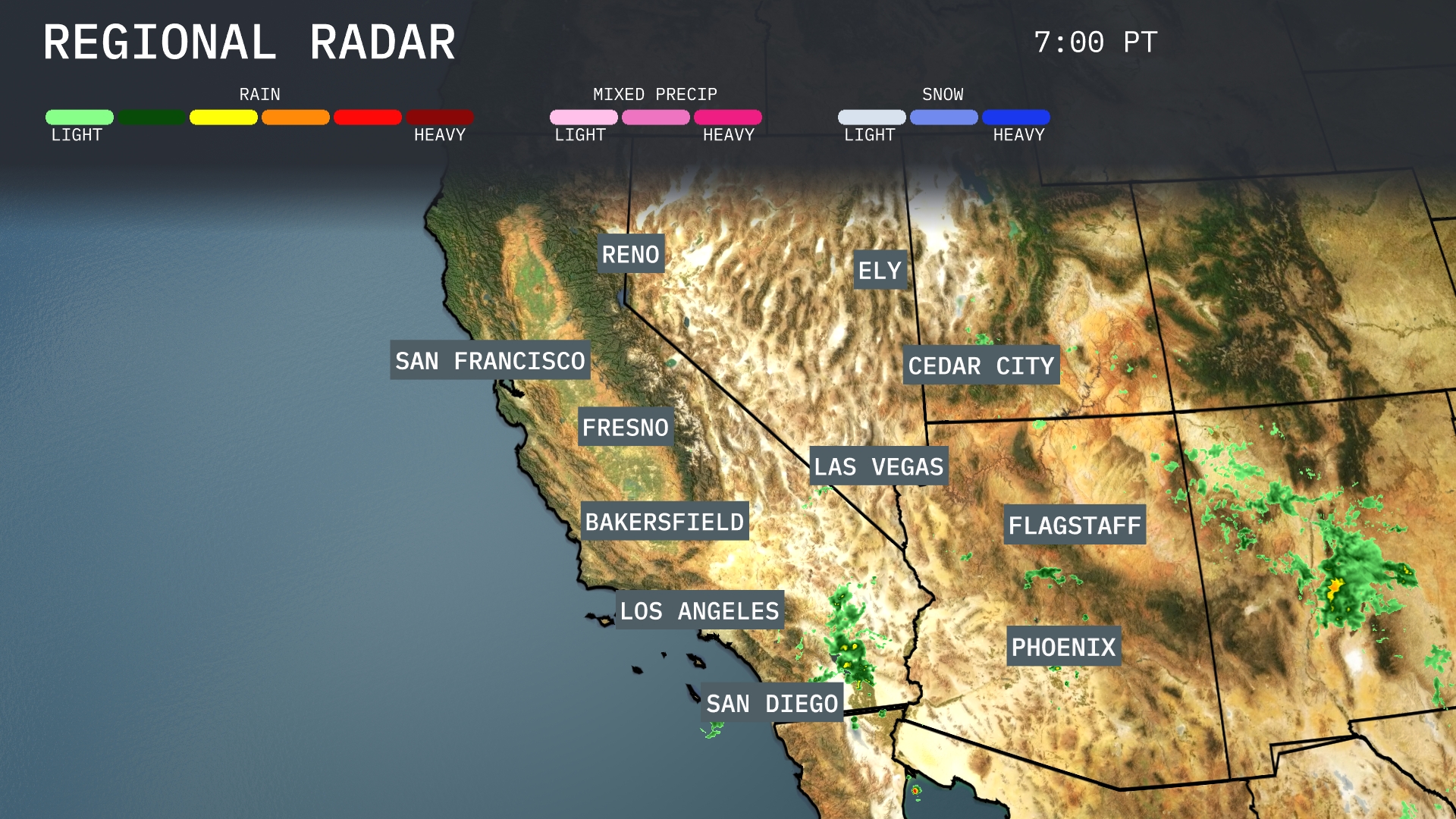
The Southwest region is experiencing varied weather conditions today. Showers are appearing over western Arizona, with parts of Phoenix seeing rainfall and increasing cloud cover stretching towards the Flagstaff area. Clear skies prevail from Los Angeles up through the Central Valley, creating a sunny day for Bakersfield and Fresno. In northern Nevada around Ely, skies remain mostly clear, while Cedar City is enjoying calm and dry conditions.
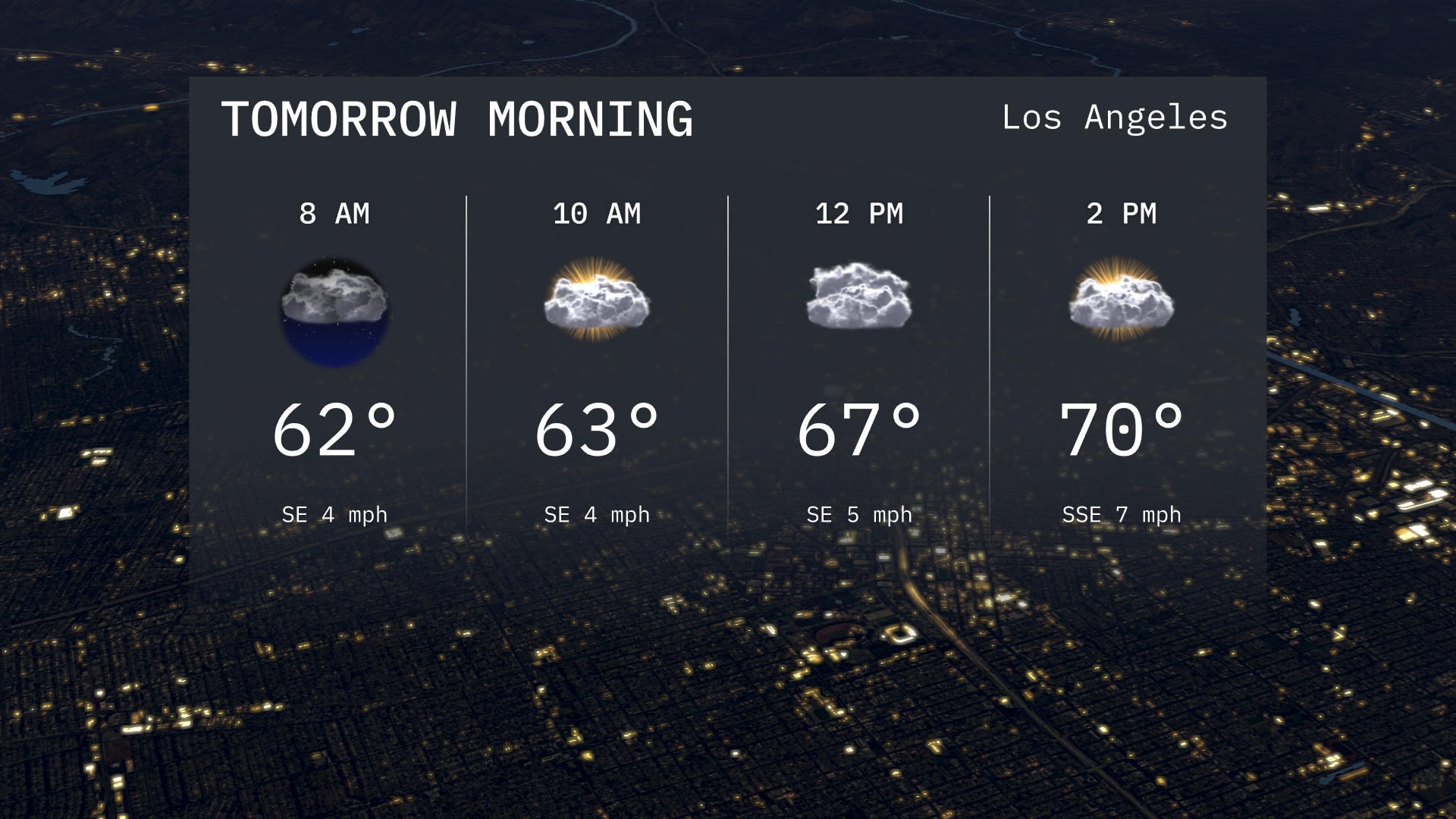
Expect a mild morning in Los Angeles with temperatures starting at 62 degrees at 8 AM. You’ll see a mix of sun and clouds throughout the morning, reaching 63 degrees by 10 AM. A calm southeast breeze will accompany the morning hours, providing a pleasant start to the day.
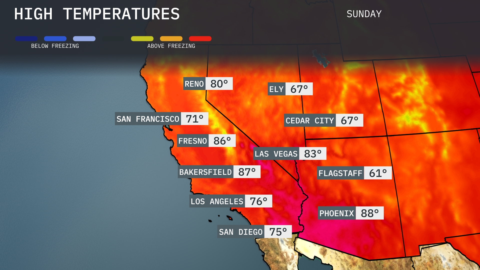
Tomorrow in Phoenix, expect a high of 88 degrees, well above average for this time of year. Las Vegas will reach 83 degrees, maintaining warm conditions typical for late September. Bakersfield is looking at a high of 87 degrees, contributing to a trend of warmer-than-normal temperatures across the Southwest. Further north, Fresno will see a high of 86 degrees, while San Diego cools slightly to 75 degrees. San Francisco stays more moderate with a high of 71 degrees, reflecting coastal influences.
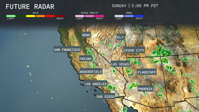
A cold front is bringing light to moderate rain to parts of Nevada and Utah, particularly near Ely and Cedar City. Scattered storms are possible in the Phoenix area, potentially bringing brief heavy rain. Some rain showers are also expected to brush past the Los Angeles area, with noteworthily heavier rain moving through parts of Northern California. Temperatures in areas affected by rain will be cooler, while the desert locales, like Las Vegas, remain dry and warm. Expect improved travel conditions post-rain as we head into mid-week across the Southwest.
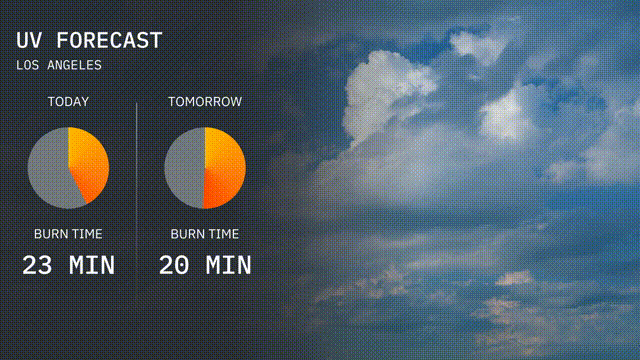
Enjoy the sunshine in Los Angeles, but keep in mind the UV index is 6 today, leading to a burn time of about 23 minutes. For your plans tomorrow, the UV index slightly decreases to 5, with a burn time of 20 minutes. Remember to protect your skin by applying sunscreen and wearing a hat!
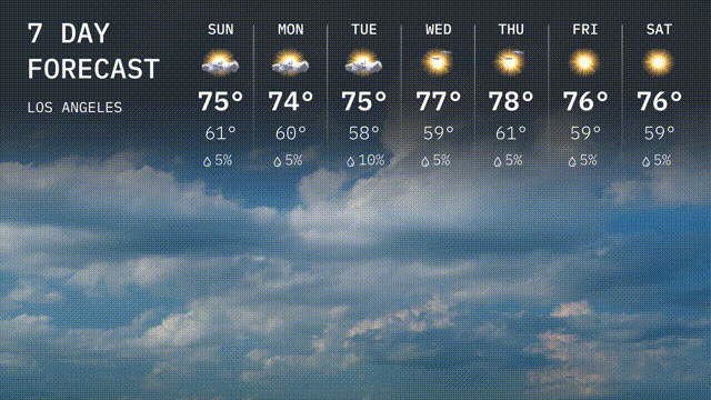
Sunday: Cloudy skies with a high of 75 degrees and a low of 61 degrees.
Monday: Another cloudy day with temperatures reaching 74 degrees for the high and cooling to 60 degrees at night.
Tuesday: Expect cooler weather with partially clear skies and a high of 75 degrees, dropping to 58 degrees overnight.
Wednesday: Warmer, with partly cloudy skies and a high of 77 degrees, the low is 59 degrees.
Thursday: Mostly sunny with a high of 78 degrees and a low of 61 degrees.
Friday: Sunny and pleasant with highs around 76 degrees and a low of 59 degrees.
Saturday: Continued sunshine, with afternoon highs reaching 76 degrees.
Stay safe and enjoy your week!