Skies of Change: Weather Patterns Across Los Angeles
By
Amy Freeze
From mild mornings to sunny forecasts, get the complete rundown on LA's shifting weather landscape and what these changes mean for your week.
Navigating Los Angeles’s varied weather? Here’s a quick guide: expect a mix of clouds tomorrow and clearer skies following, with detailed forecasts for the surrounding regions!
Tomorrow in Los Angeles begins with clouds but promises clearer skies as the day advances. This post delves into the detailed forecasts across the Southwest, including the anticipated temperatures and any precipitation changes. We also explore the UV index and safety tips as Los Angeles temperatures hover around the mid-70s.
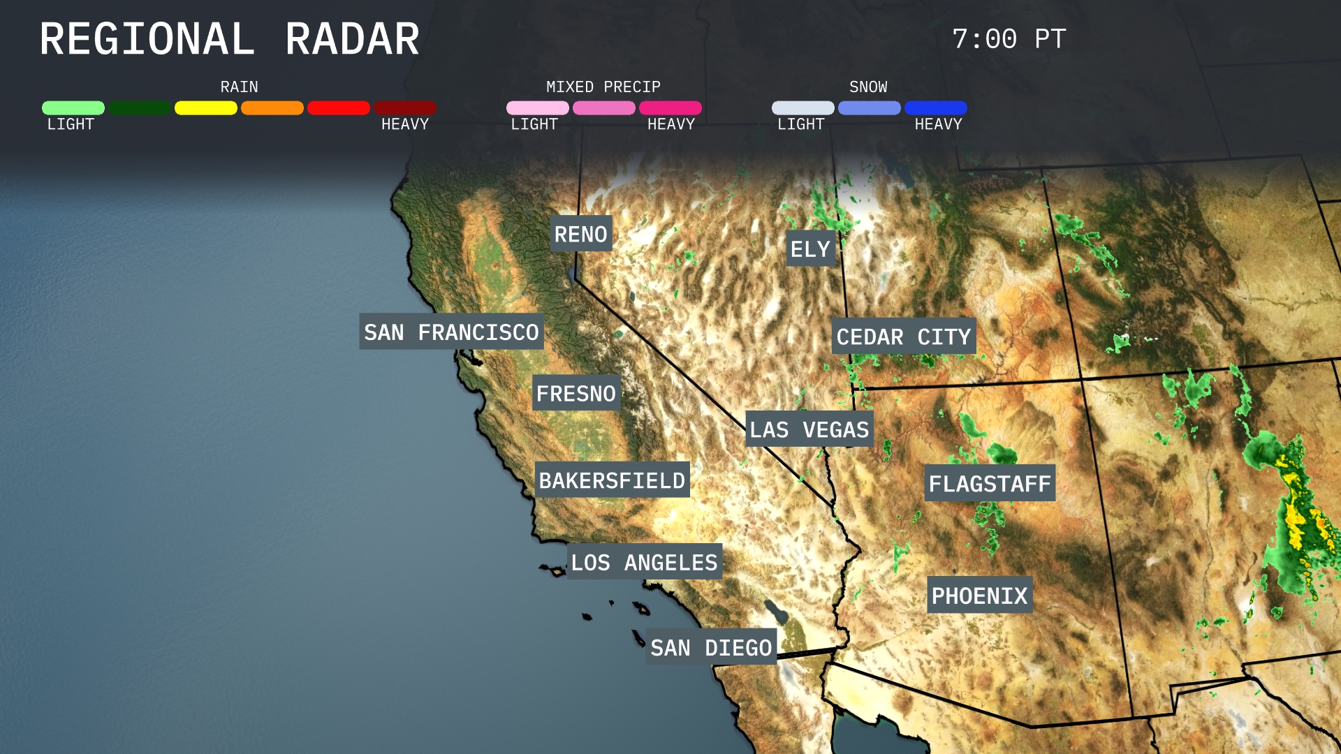
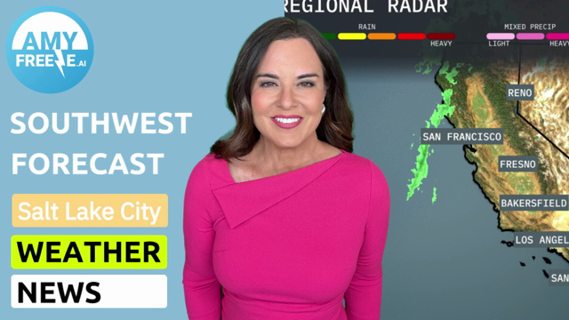
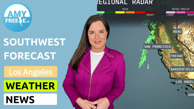
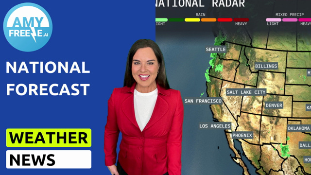
The Southwest region is showing varied weather patterns. Light rain is present along the coastal areas of San Francisco stretching toward Los Angeles, providing some relief along the California coast. Cloud cover and rain are moving from Flagstaff northeastward, impacting locations such as Ely and Cedar City with potential thunderstorms. Las Vegas and Phoenix remain dry with clear skies.
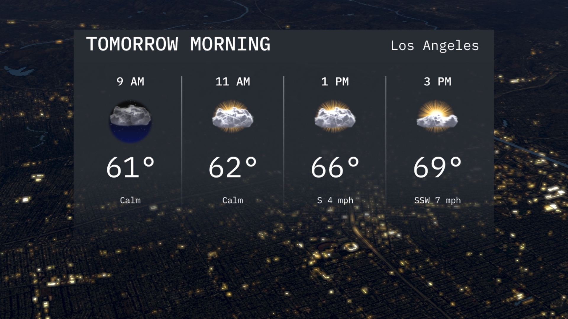
Expect a mild start to your morning in Los Angeles with temperatures around 61 degrees at 9 AM. A mix of clouds and calm conditions sets the tone for the late morning, reaching 62 degrees by 11 AM. Enjoy the tranquil atmosphere as calmer winds accompany the day.
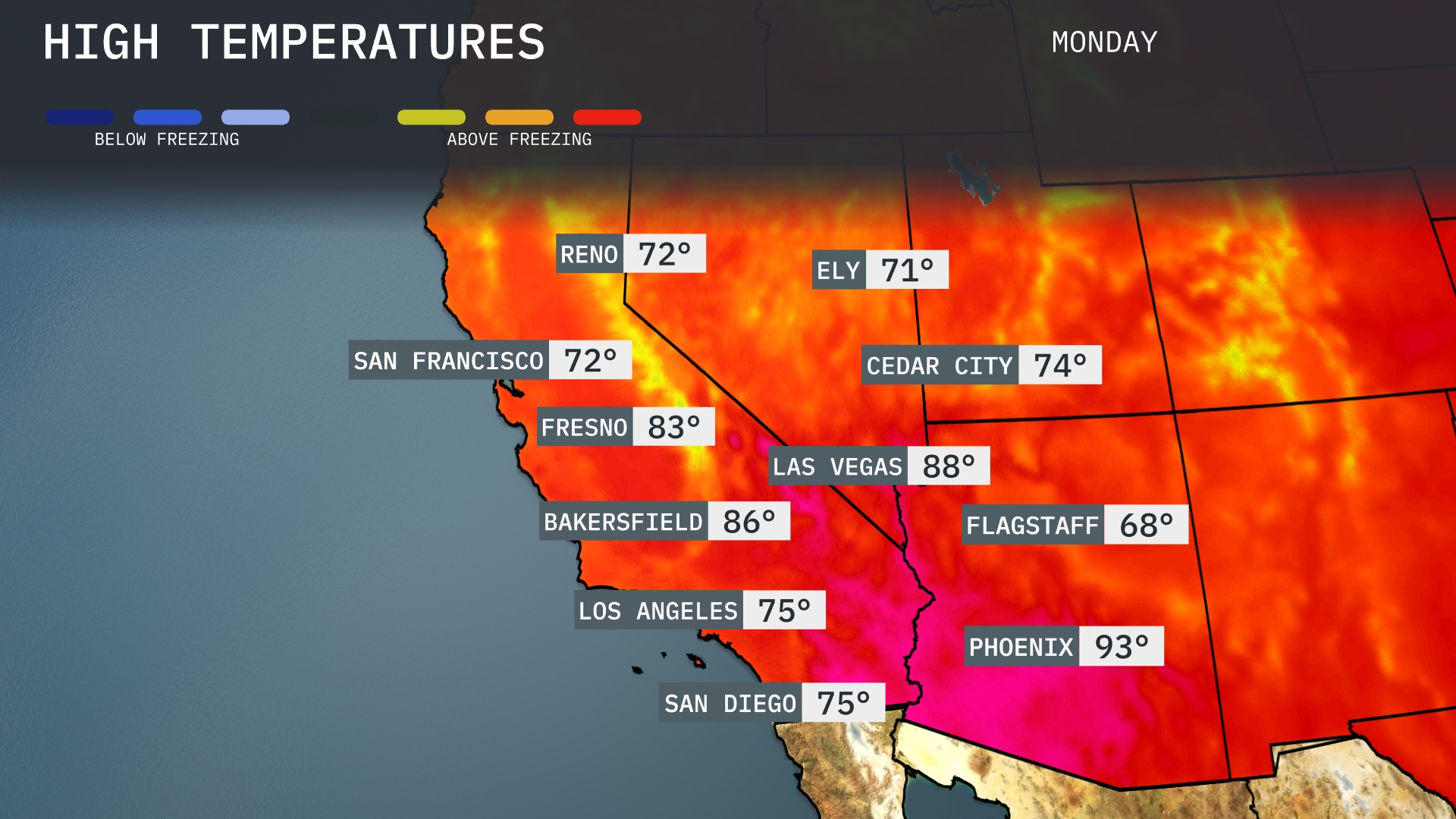
Tomorrow in the Southwest, Phoenix will sizzle with a high of 93 degrees, making it well above the average for this time of year. Las Vegas can expect a warm 88 degrees, while Bakersfield reaches a comfortable 86. Further west, San Diego and Los Angeles will be milder at 75 degrees each. Fresno is on the warmer side with highs around 83 degrees, showcasing a typical late-summer pattern across the region.
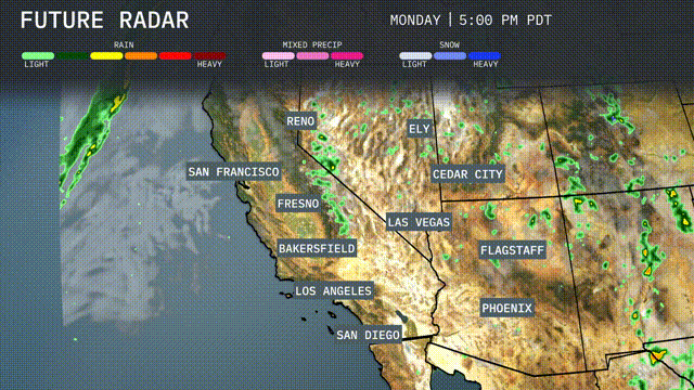
A cold front pushing into the Southwest tomorrow brings an active weather pattern. Expect scattered thunderstorms with heavy rain across Arizona, mainly impacting areas from Phoenix to Flagstaff. Nevada and Utah will see isolated showers, particularly near Las Vegas and Cedar City, while heavy rain showers may disrupt mountain passes in northern California. Temperature rollercoaster ahead as cooler air settles in after the front passes, providing relief from the early fall heat. Stay alert for small stream flooding, especially in desert areas where this rainfall can be overwhelming.
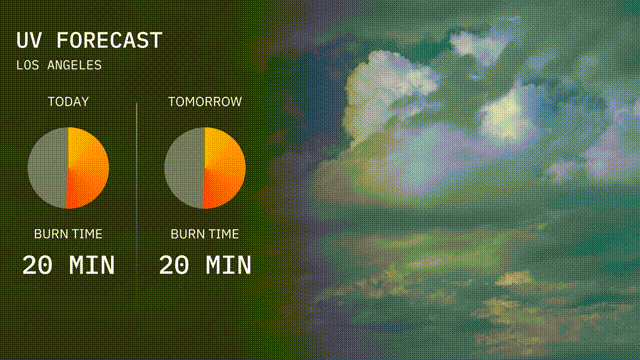
The UV index in Los Angeles today is a high 8, with a burn time of just 20 minutes under direct sunlight. Tomorrow, stay sun-safe with the UV index remaining high at 8 and a similar burn time of 20 minutes. Be sure to use sunscreen and wear protective clothing to reduce the risk of sunburn!
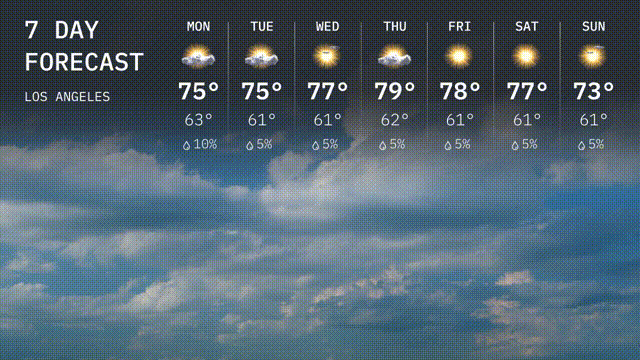
For the 7 day forecast in Los Angeles:
Monday: Expect mostly cloudy skies with a high of 75 degrees and a low of 63 degrees.
Tuesday: Similar conditions with partly cloudy skies, reaching a high of 75 degrees, dipping to 61 degrees at night.
Wednesday: Partly cloudy with temperatures climbing to 77 degrees and a low of 61 degrees.
Thursday: A high of 79 degrees under partly sunny skies, cooling down to 62 degrees overnight.
Friday: Sunny and warm with a high of 78 degrees, decreasing to 61 degrees as the sun sets.
Saturday: Another sunny day with temperatures peaking at 77 degrees and a nighttime low of 60 degrees.
Sunday: Partly sunny with a high of 73 degrees and a comfortable low of 60 degrees.