Los Angeles Weather Update: A Look at Tomorrow’s Skyline – Clouds, Sun, and Precautionary Measures
By
Amy Freeze
Explore what’s expected in Los Angeles’ skies for tomorrow. From partly cloudy mornings to a sizzling day in Phoenix, stay informed and prepared with our detailed forecast.
Get ready for a day of mixed skies in Los Angeles! From partly cloudy mornings to potential thunderstorms, tomorrow’s forecast calls for preparedness. Stay tuned to updates and keep your rain gear handy!
As Los Angeles wakes up to a partly cloudy morning with temperatures starting at a cool 62 degrees, the weather across the Southwest tells a story of contrasts. From the dry, scorching heat in Phoenix at 106 degrees to the cool breeze in San Diego at 76 degrees, prepare for a classic late summer experience. With a cold front on the horizon, expect sudden showers and even some thunderstorms rolling in by late afternoon. Don’t forget – the UV index remains high; protective measures are essential!
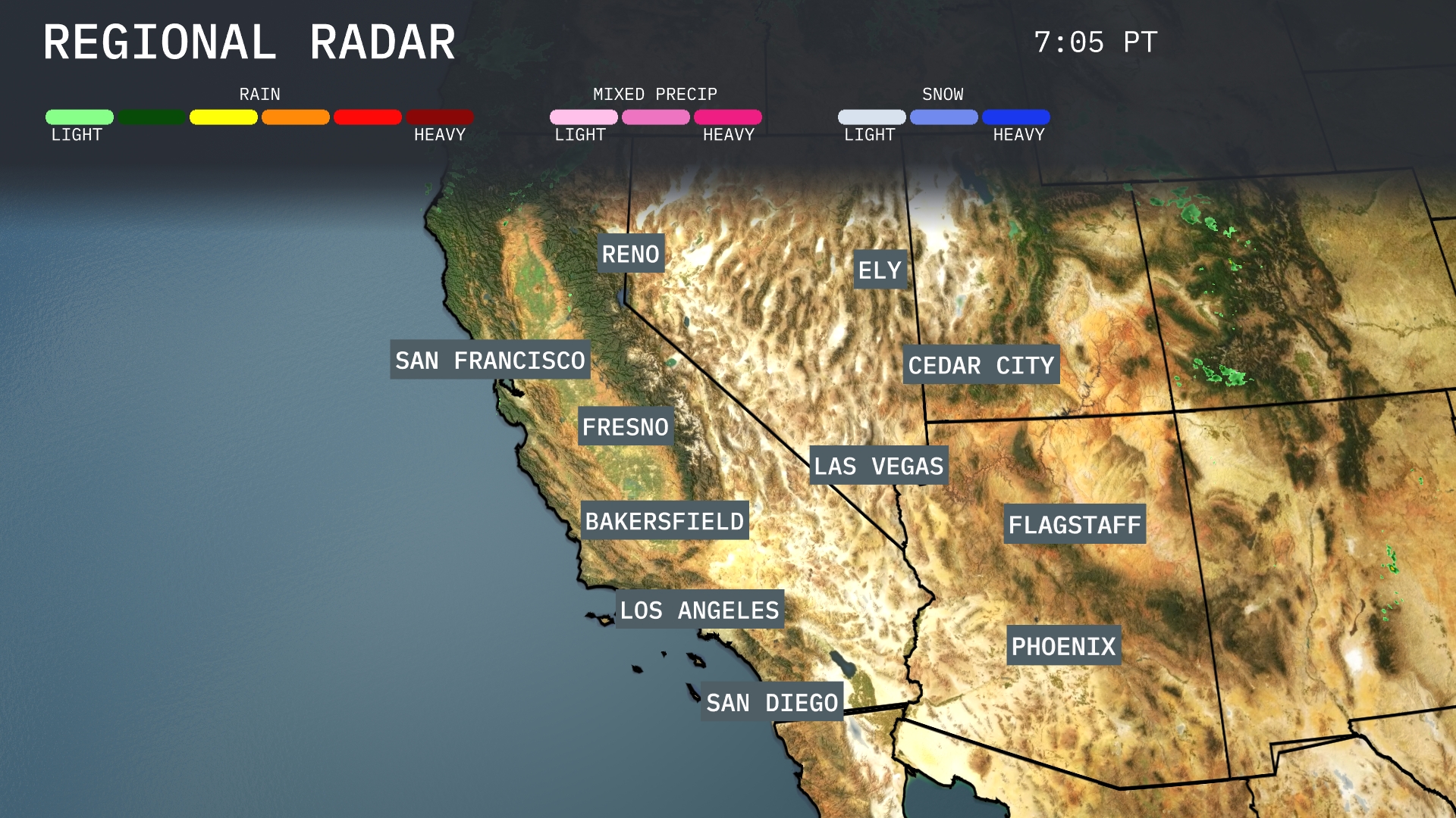
Showers are currently sweeping across the Sierra Nevada region, with Reno experiencing moderate precipitation. Flagstaff is relatively clear, offering a nice break from the clouds enveloping parts of the West. Las Vegas is staying dry, while Cedar City is under light cloud cover with no immediate precipitation. Bakersfield and Fresno remain clear, enjoying uninterrupted sunshine.
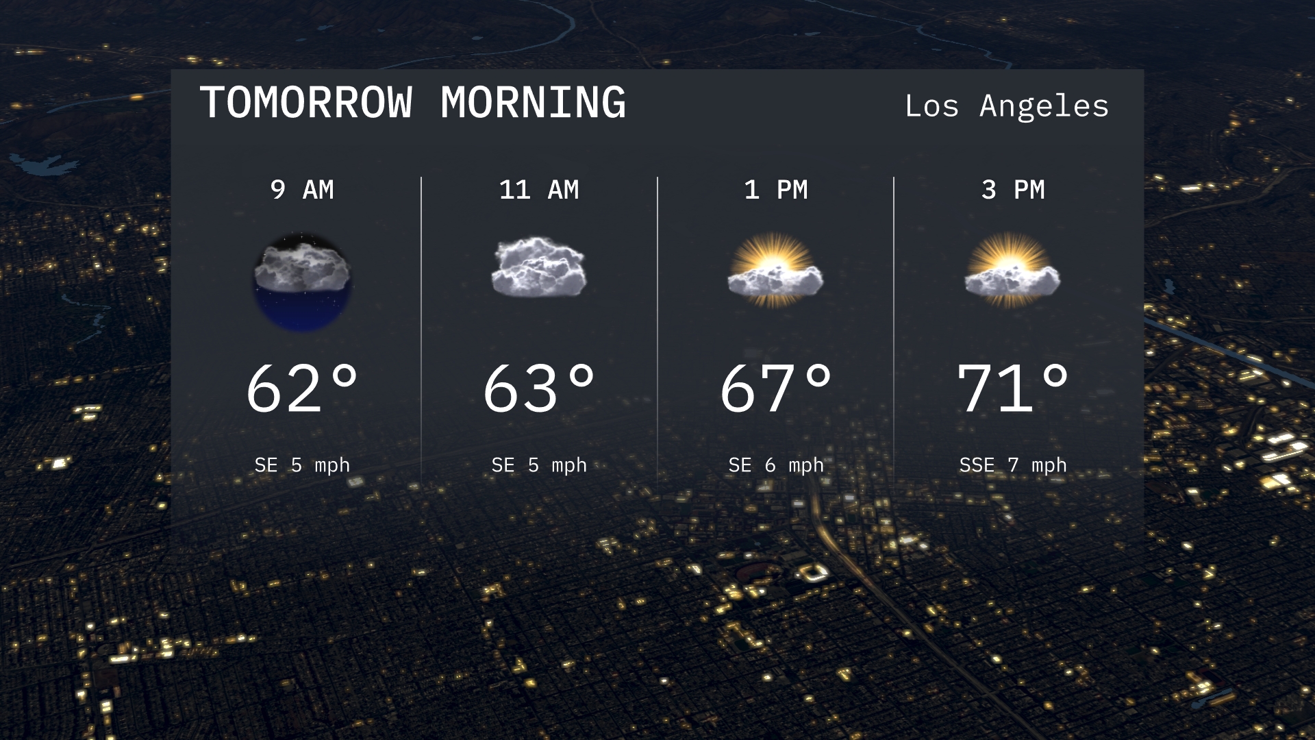
Tomorrow morning in Los Angeles, temperatures will start at 62 degrees at 9 AM with partly cloudy skies. Expect a gentle southeast breeze, providing a calm start to the day. By 11 AM, the temperature will rise slightly to 63 degrees with more cloud cover.
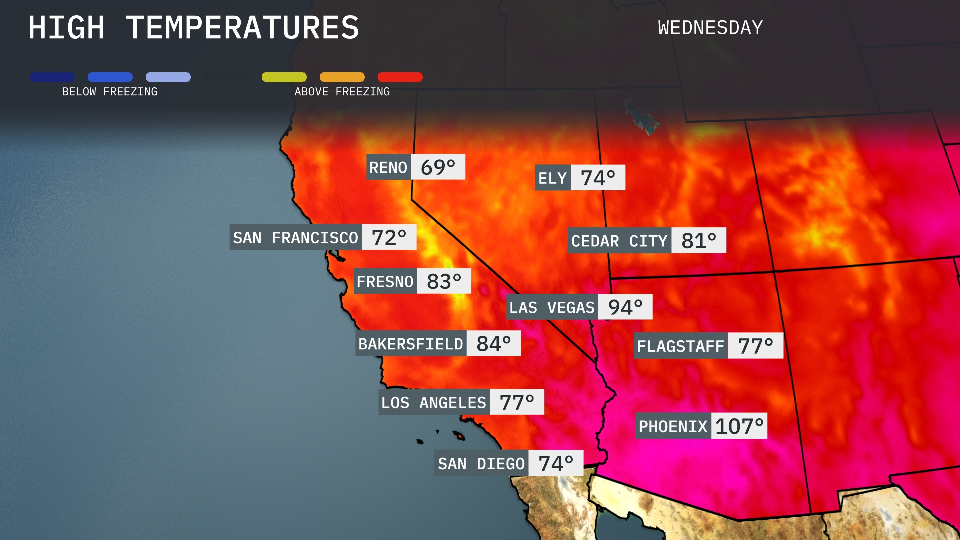
Tomorrow, Phoenix will swelter with a high of 107 degrees, significantly above average for this time of year. Las Vegas isn’t far behind, reaching 94 degrees, also above normal. Bakersfield will see a warm day with temperatures climbing to 84 degrees, while Fresno enjoys a comfortable 83 degrees. San Diego will have a pleasant day at 74 degrees, slightly below average. In the northern part of the region, San Francisco is expected to be cooler at 72 degrees as coastal influences keep temperatures moderated.
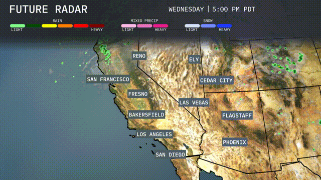
A cold front is advancing across the Southwest, bringing scattered showers and thunderstorms to coastal areas from San Francisco to Los Angeles by late afternoon. Expect periods of heavy rain which may cause travel delays and slick roads, particularly over mountain passes. Las Vegas and Phoenix will remain mostly dry with warm temperatures holding steady. Watch for a surge of cooler air post-front, which will lower temperatures across inland areas on Thursday.
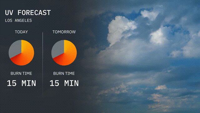
The UV index in Los Angeles will be very high today, reaching a level of 8, with a quick burn time of 15 minutes! Tomorrow, expect similar sun intensity with a UV index of 8 again, so remember your sun safety tips. Sunscreen and hats are your best friends!
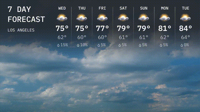
Wednesday: Look for mostly cloudy skies with a high near 75 degrees, and a comfortable low of 62 degrees.
Thursday: We’ll see similar conditions with mostly cloudy skies again. The high will be 75 degrees with a low around 60 degrees.
Friday: The sun tries to peek through a bit more, leading to partly cloudy conditions and a slight warming. Expect highs around 77 degrees and lows at 60 degrees.
Saturday: Mostly cloudy to partly sunny weather expected as afternoon temperatures rise to about 79 degrees, with lows staying at 61 degrees in the evening.
Sunday: The mix of sun and clouds continues, maintaining the day’s high at 79 degrees, and the night dips down to 61 degrees.
Monday: Slightly warmer, with partly sunny skies leading to a high of 81 degrees. Lows will edge up to 62 degrees.
Tuesday: A bit warmer and mostly sunny with temperatures peaking at 84 degrees and lows around 64 degrees.