Miami Wakes to Breezy Mornings and Regional Storm Updates
By
Amy Freeze
Discover how Miami starts the day with gentle breezes and partly cloudy skies, and get the scoop on storm activities across the Southeast.
Tomorrow in Miami starts with partly cloudy skies, a gentle breeze, and warm temperatures. Be prepared for regional updates on a cold front causing storms across the Southeast.
In this update, we delve deep into Miami’s morning weather forecast set for 06/15/2025, predicting partly cloudy skies and a pleasant breeze. We’ll also cover the sweeping cold front bringing thunderstorms and active weather conditions to areas from Texas to Florida. Detailed hourly temperature updates and regional weather insights will keep you prepared. Plus, insights on high UV index readings and how to protect yourself. Stay tuned!
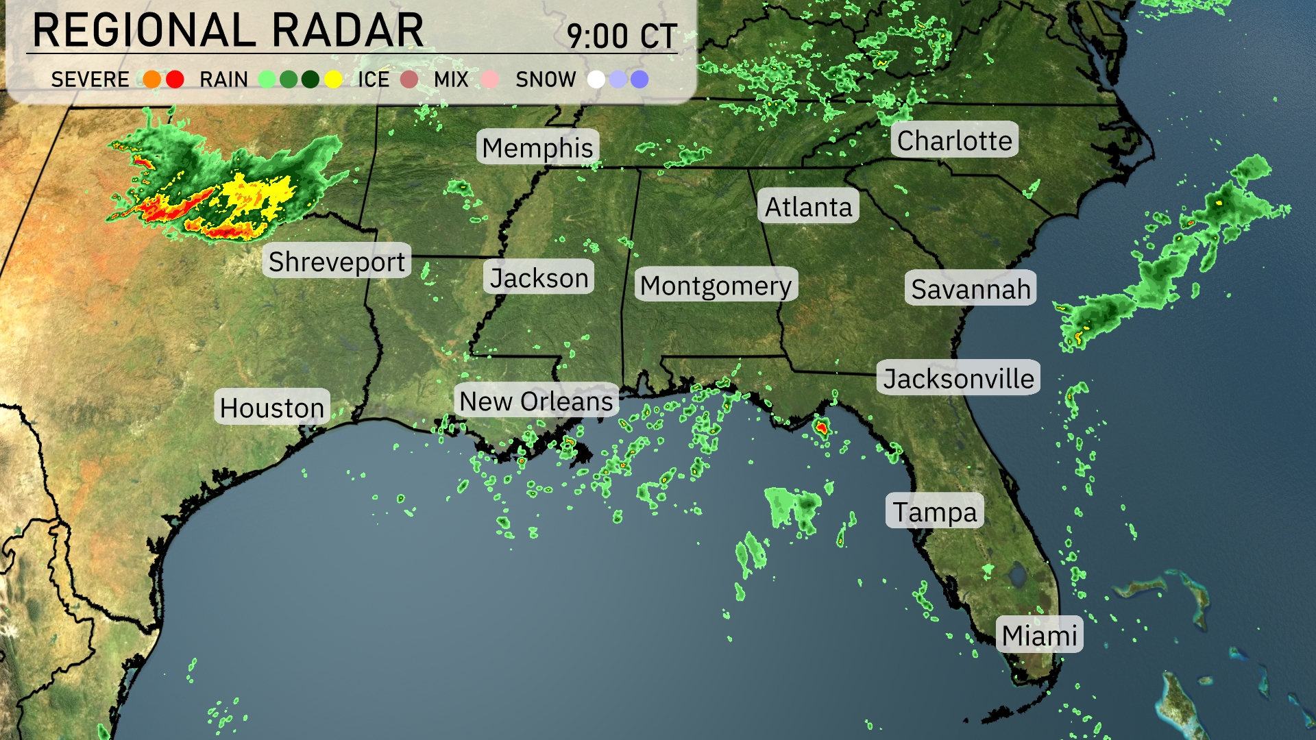
On the Regional Radar, a strong line of storms is crossing from Texas into Louisiana, with Shreveport experiencing severe weather. Showers are moving through eastern Texas toward Houston. Scattered rain showers are forming offshore and moving toward Florida, likely impacting Jacksonville and Tampa later. Cloud cover is currently limited, primarily over areas with rain, leaving most of the Southeast like Atlanta and Charlotte under clearer skies.
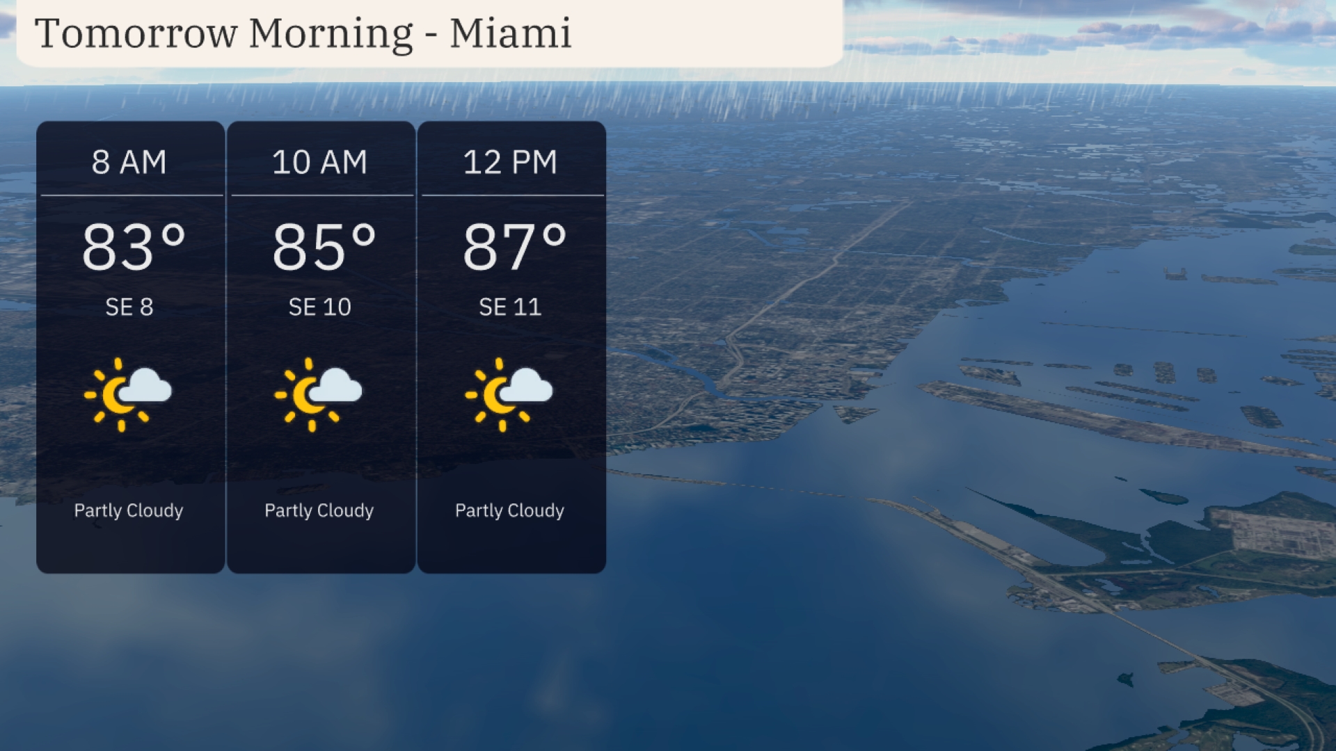
Tomorrow morning in Miami, temperatures start warm at 83 degrees by 8 AM, rising to 85 degrees by 10 AM and reaching 87 degrees by noon. Expect partly cloudy skies throughout the morning, providing occasional shade from the sun. A gentle southeast breeze will accompany you, with winds around 10 to 11 miles per hour.
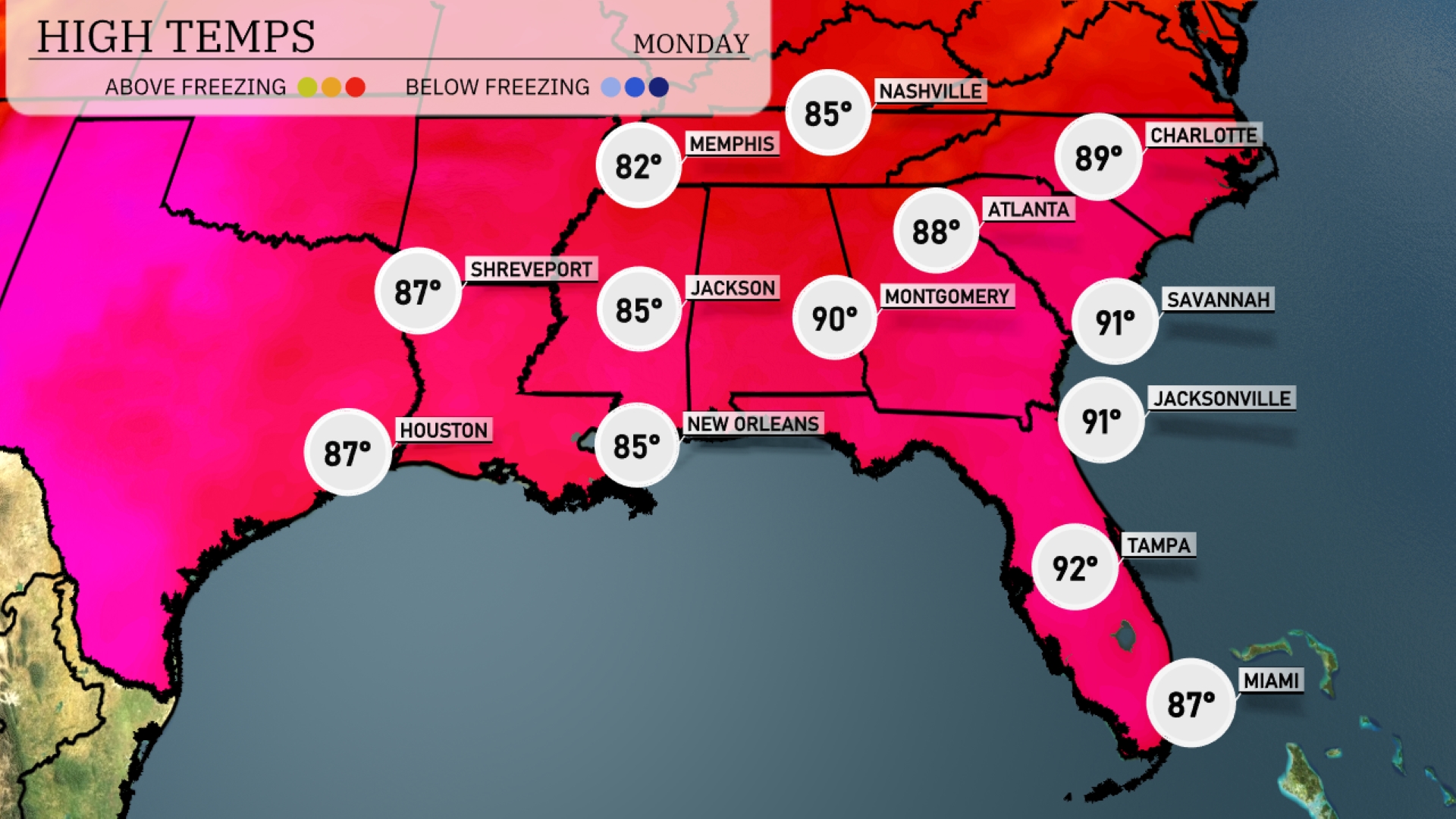
Tomorrow in Montgomery, temperatures will spike to a scorching 90 degrees, indicating a trend well above average for this time of year. Atlanta is not far behind with a high of 88 degrees, reflecting typical summer warmth. Over in Jacksonville and Savannah, expect a sizzling 91 degrees each, underlining the heat being experienced across much of the Southeast. New Orleans and Jackson are set for a warm 85 degrees, while Tampa anticipates a peak of 92 degrees.
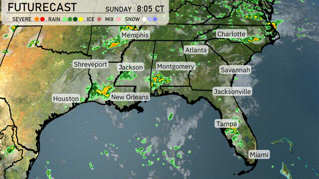
A cold front is making its way through the Southeast, bringing active weather conditions. Expect thunderstorms across Louisiana and Mississippi, moving toward Alabama by tomorrow. Areas from Houston to Shreveport should prepare for strong storms and heavy rain potential tonight. Showers extend from Montgomery to Charlotte, impacting morning commutes. Temperatures behind the front will be cooler, but expect a return to dry skies by late Wednesday.
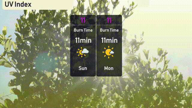
The UV index in Miami is very high at 11 for Sunday, posing a risk of sunburn in just 11 minutes. On Monday, the index remains at 11, so be sure to take precautions by applying sunscreen generously and wearing protective clothing to minimize sun exposure.
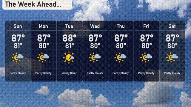
For the 7 day forecast in Miami:
Sunday: Partly cloudy with a high of 87 degrees and a low of 81 degrees.
Monday: Enjoy mostly clear skies with temperatures reaching up to 87 degrees, dipping to 80 degrees at night.
Tuesday: Mostly clear, expect a high of 88 degrees and a low of 81 degrees.
Wednesday: The trend continues with mostly clear skies, highs around 88 degrees, and lows at 80 degrees.
Thursday: Partly cloudy conditions with temperatures peaking at 87 degrees during the day, cooling down to 80 degrees at night.
Friday: Another partly cloudy day, with a high of 87 degrees and a low of 80 degrees.
Saturday: Ending the week with partly cloudy skies, highs of 87 degrees and lows of 80 degrees.