Miami’s Morning Mist: A Guide to Embracing the City’s Unpredictable Weather
By
Amy Freeze
Explore how Miami's weather shapes your morning and what you can expect as you step out the door tomorrow.
Miami greets you with partly sunny skies and a light breeze tomorrow. Join us as we break down the forecast and prepare for a week of mixed weather conditions!
Welcome to your comprehensive guide to Miami’s weather! Tomorrow morning, expect partly cloudy skies followed by a warm and breezy afternoon. Throughout the week, temperatures will vary widely, from soaring highs to gentle evenings. Don’t miss out on details about the approaching cold front and potential severe weather warnings. For more updates, check out our detailed forecast on https://amyfreeze.ai/.
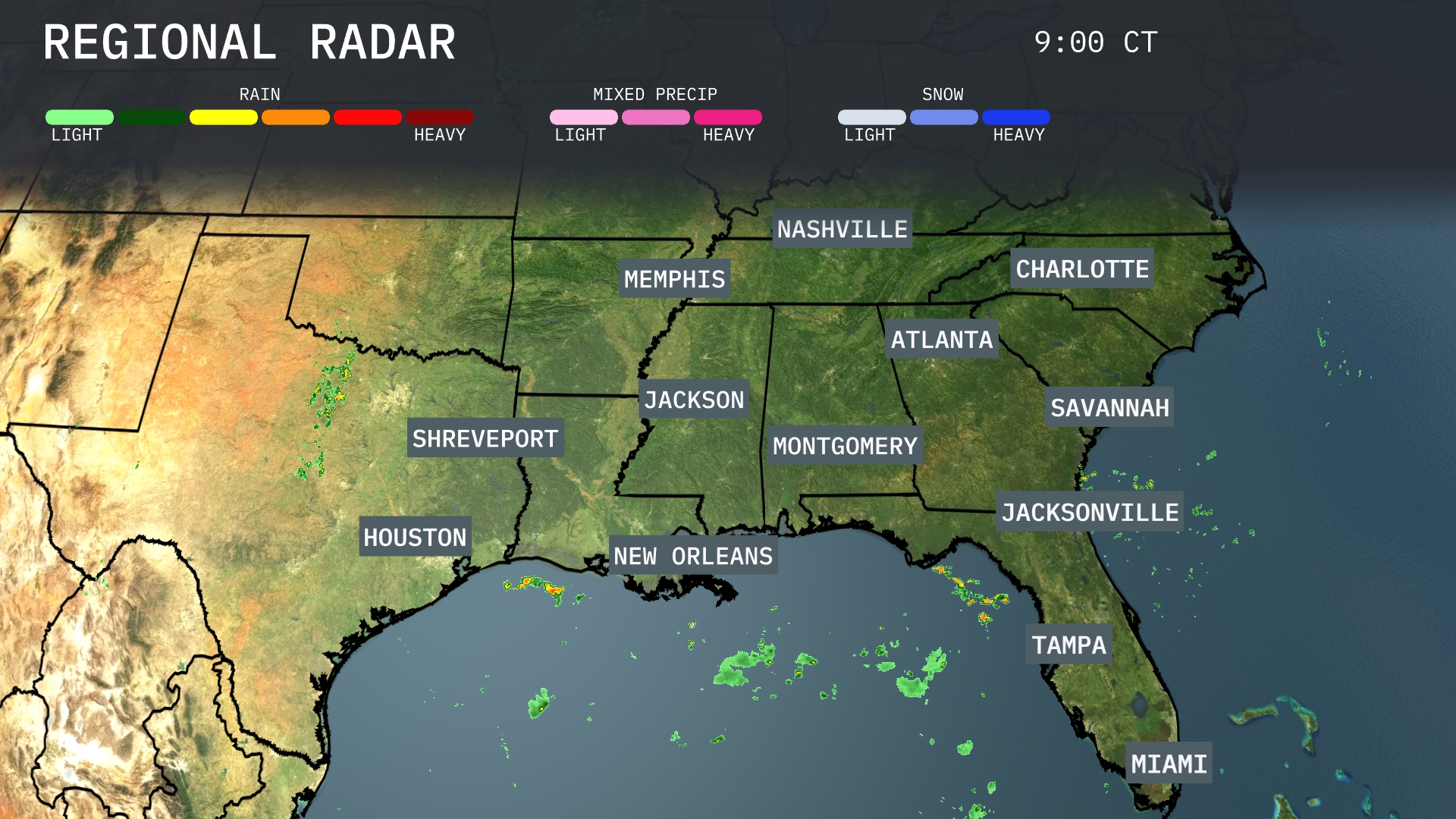
A line of rain showers is moving across the northern Gulf of Mexico toward the southeastern coastline. Spotty rain is impacting areas around New Orleans and Houston, moving eastward. Clouds are increasing over Savannah and Jacksonville ahead of these showers. Overall, much of the interior Southeast, including Nashville and Atlanta, remains dry at this time.
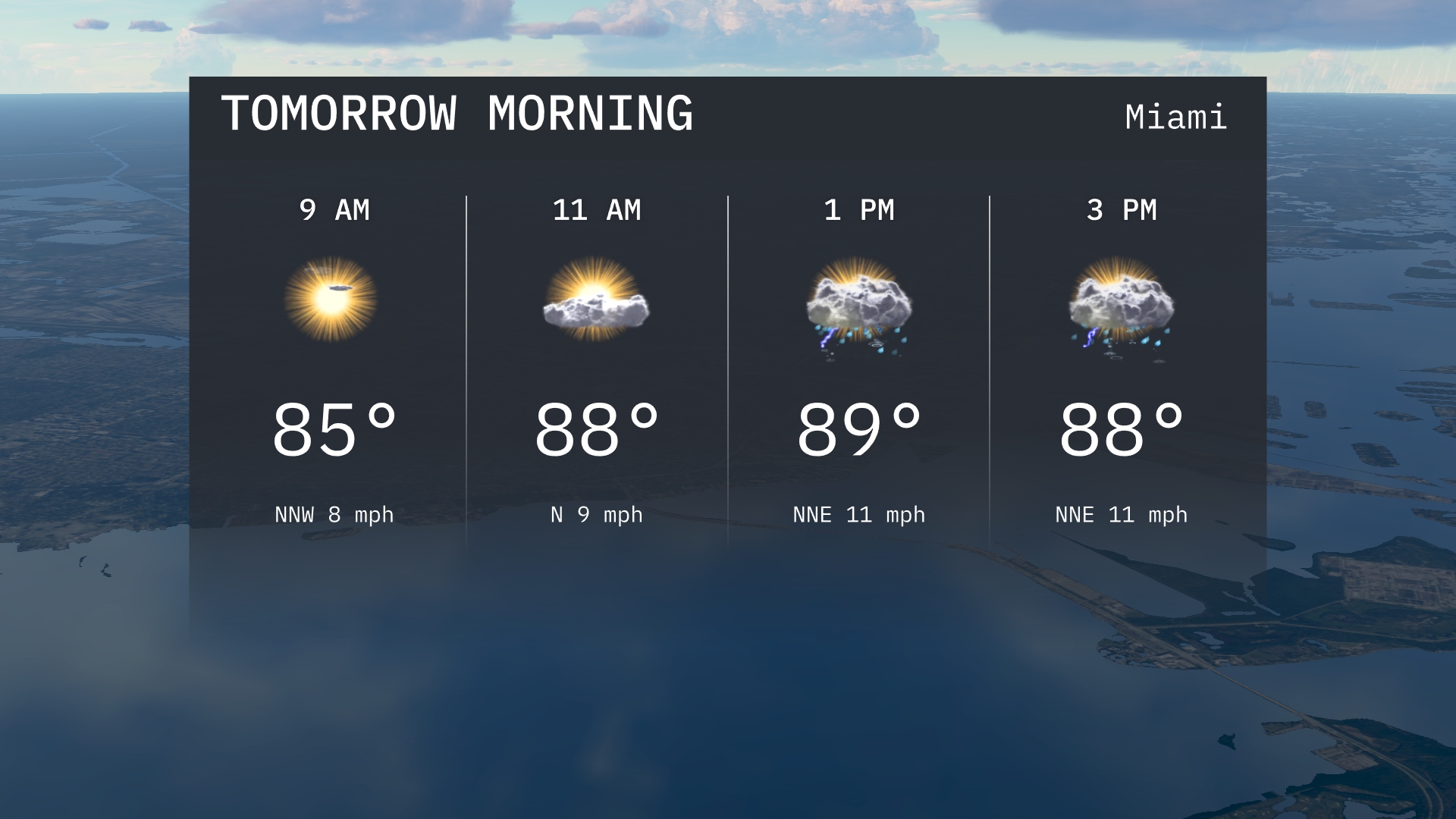
Tomorrow morning in Miami starts with temperatures around 85 degrees at 9 AM, with a northwest wind at 8 mph. By 11 AM, temperatures rise to 88 degrees with partly sunny skies and winds shifting slightly to the north. Expect the morning to remain mostly dry with a light breeze, setting up for potential afternoon showers.
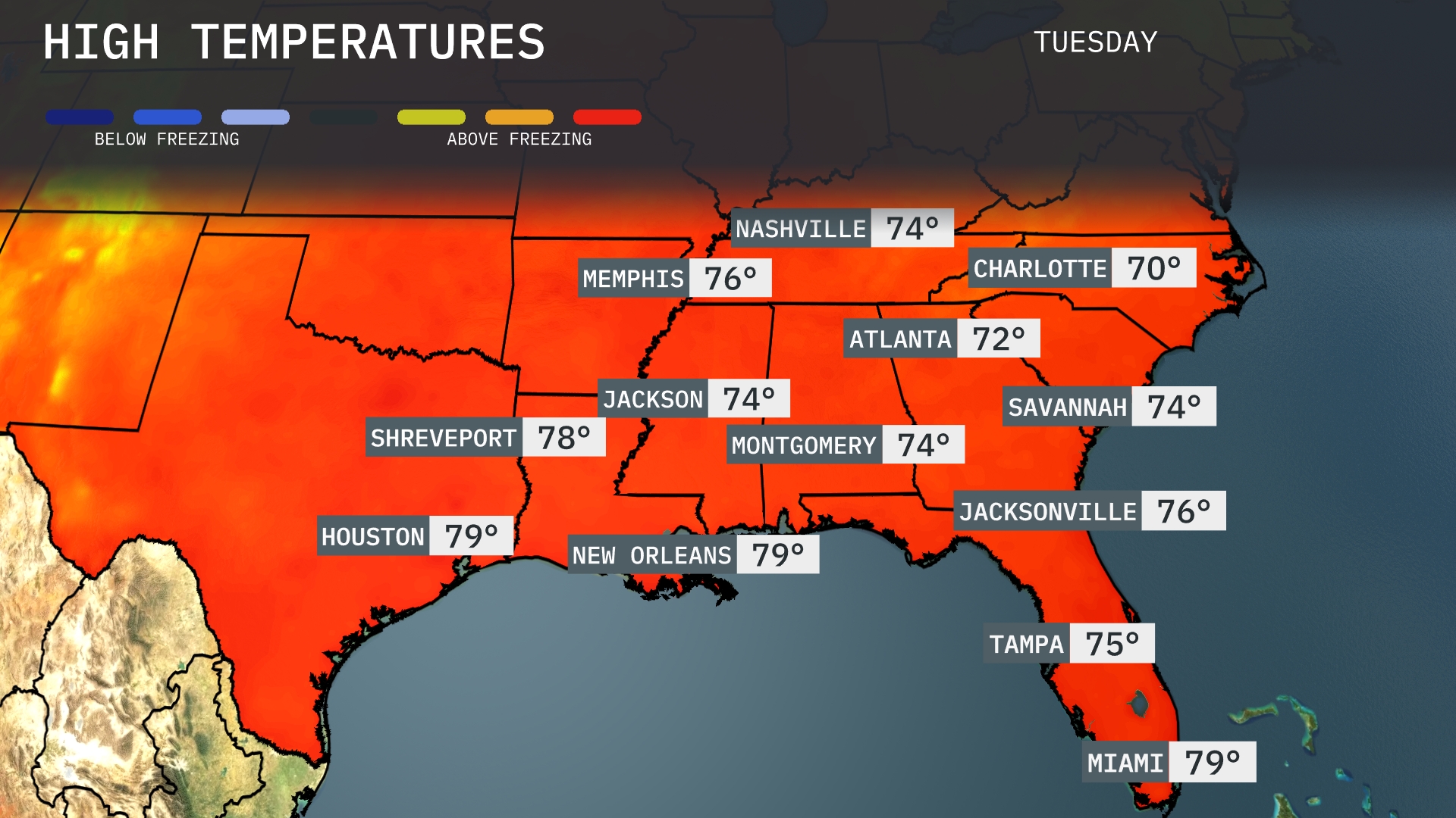
Tomorrow, Memphis will reach a high of 76 degrees, while Nashville stays slightly cooler at 74. Jackson and Montgomery are both expected to hit 74 degrees, with Atlanta slightly below at 72. Over in New Orleans and Houston, temperatures will be a balmy 79 degrees, indicating warmer-than-average conditions for the region. Coastal areas like Jacksonville and Miami will also enjoy highs around 76 and 79 degrees, respectively, as a warm front influences the Southeast.
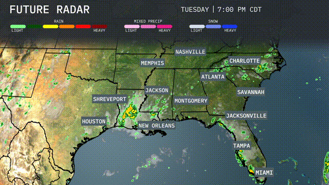
A cold front is advancing through the Southeast, bringing with it storms and potential severe weather from Houston to New Orleans, and extending over to Montgomery by evening. Expect heavy rain with localized flooding possible, especially from Shreveport to Jacksonville. The front continues eastward overnight, with thunderstorms reaching Atlanta by early morning. Cooler, drier air follows behind, leading to a temperature drop and clearing skies for the latter part of the week. Be prepared for travel disruptions due to heavy rainfall and stay alert for possible severe storm warnings.
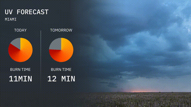
The UV index in Miami is expected to be high today with a UV index of 9, resulting in a burn time of about 11 minutes in direct sunlight. Tomorrow, the UV index will remain high at 9, with a slightly longer burn time of 12 minutes. Make sure to wear sunscreen and limit your sun exposure during peak hours!
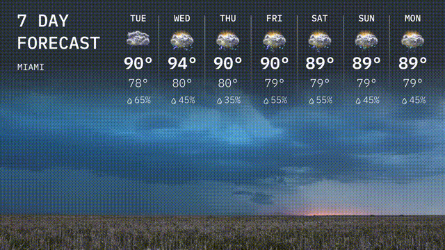
Tuesday: It’s a warm day with scattered clouds, expect a high of 90 degrees and a low near 78 degrees, and a 65 percent chance of rain.
Wednesday: Temperatures climb to 94 degrees, with a low of 80 degrees.
Thursday: Be prepared for a humid day with a high of 90 degrees and a low of 80 degrees.
Friday: Rain chances increase with a high of 90 degrees and a low of 79 degrees.
Saturday: Mostly cloudy skies with a high of 89 degrees, a low at 79 degrees.
Sunday: The cooler trend continues with a high of 89 degrees and a low of 79 degrees.
Monday: The clouds linger into the new week with highs around 89 degrees, lows staying at 79 degree.