Miami’s Weather Landscape: Sunny Days with a Chance of Storms
By
Amy Freeze
Discover Miami's dynamic weather patterns with Amy Freeze as we explore a week of sunny forecasts and storm alerts across the Southeast.
Get the scoop on Miami’s weather from Meteorologist Amy Freeze! Partly cloudy skies and high temperatures, with storm updates for the Southeast.
Miami Afternoon News – 04/29/2025 brings you Amy Freeze with a complete weather update. From partly cloudy skies to storm advisories in the Southeast, understand how to prepare for the week’s weather shifts. High UV index warnings, temperature fluctuations, and potential severe weather alerts are covered in detail.
A robust line of storms is moving across eastern Texas into Shreveport, Louisiana, with the potential for severe weather. Rain is extending across Mississippi, pushing towards Jackson with scattered showers. The day remains dry for most of Alabama and Georgia, including Montgomery and Atlanta, with cloud cover slowly increasing in those areas. A few isolated showers are dotting the Gulf Coast near New Orleans and Houston. The coastal regions from Savannah to Miami remain clear, enjoying relatively calm conditions at the moment. Stay weather aware today in this region!
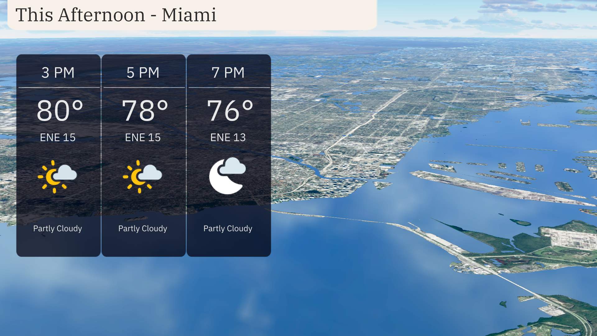
Afternoon temperatures in Miami will reach up to 80 degrees, gradually cooling to 76 degrees by early evening. Expect partly cloudy skies throughout the afternoon. Winds from the east-northeast will maintain a steady pace at around 15 miles per hour.
This afternoon, the Southeast is heating up with some impressive temperatures. Jackson leads the way with a high of 88 degrees, while Shreveport isn’t far behind at 87. Atlanta experiences a comfortable high of 81, a bit cooler than Montgomery, which reaches 87. Over in Florida, Tampa sees warmer conditions at 87, while Miami lingers at 81 due to an onshore breeze. Savannah is sitting at a pleasant 80 degrees today.
Nashville is looking at a low of 69 degrees, while Memphis will drop to 66. Expect 67 in Jackson and 65 in Montgomery. Further south, temperatures will be milder with a low of 73 in New Orleans and 73 in Houston. Miami remains warm at 73 degrees, but expect a notable cool down in Atlanta with a low of 64.
High temperatures for tomorrow across the Southeast are shaping up to be quite warm. Atlanta expects a high of 83 degrees, while Charlotte will see readings reach 87. Birmingham will also experience a balmy day with temperatures peaking at 87 degrees. Memphis is anticipating a high of 88, which is slightly above average for this time of year.
A cold front is advancing southeast from Texas, bringing thunderstorms into Louisiana, Mississippi, and Alabama by tomorrow. Expect a wet commute early in the morning for cities like Jackson and Montgomery, with potential heavy rain and gusty winds. As the front progresses, scattered thunderstorms will impact Atlanta and the Carolinas by late afternoon. Florida will experience intermittent rain showers from Jacksonville to Miami. Monitor for possible severe weather alerts, especially in areas with the most intense storms.
The UV index in Miami will be extremely high at 11 on both Tuesday and Wednesday, posing a serious risk for sunburn with just 11 minutes of unprotected exposure. Sunscreen, hats, and sunglasses are a must, and it’s wise to seek shade during peak midday hours.