Navigating Through Partly Clouds and Storms: Miami’s Weekly Weather Forecast
By
Amy Freeze
Explore a comprehensive guide to this week's weather in Miami and the Southeast, from sunny highs to stormy evenings.
This week in Miami, expect sparkling sunny days with some of the warmest spots in the Southeast, while storms brew nearby. Stay updated on temperatures and storm forecasts!
Get ready for a dynamic week of weather in Miami and across the Southeast. With partly cloudy skies and severe storms in the forecast, Miami shows a mix of sunny scenes and potential wet weekends. This comprehensive blog post dives into daily temperature trends, expected storm activities, and UV index warnings. Whether you’re planning indoor activities or outdoor adventures, be prepared with our detailed insights into Miami and Southeast weather patterns. Find out more at https://amyfreeze.ai/
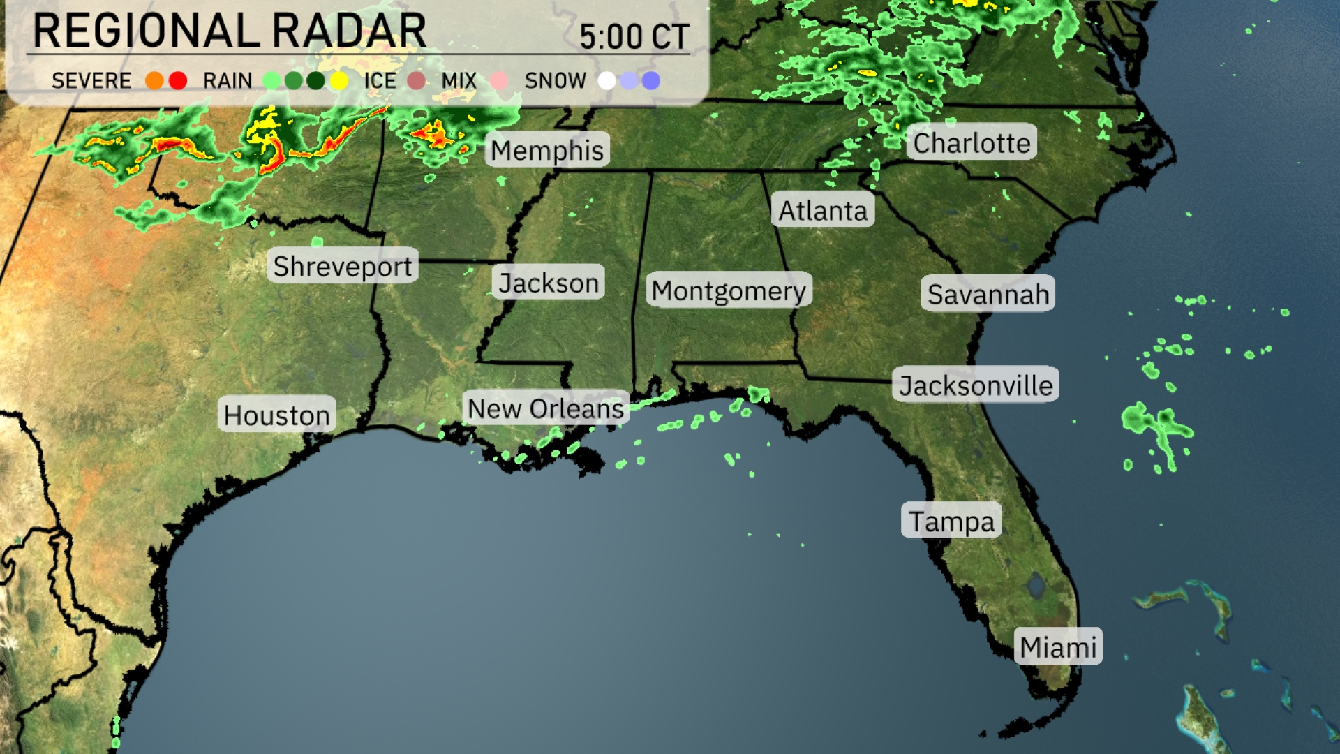
A line of severe storms is pushing across northern Arkansas, heading towards Memphis, bringing potential thunderstorms to the area. Scattered showers are noted over southeastern Louisiana near New Orleans, moving eastward. Cloud cover is increasing across Georgia, with isolated rain patches approaching Atlanta. Clear skies are holding over much of Florida.
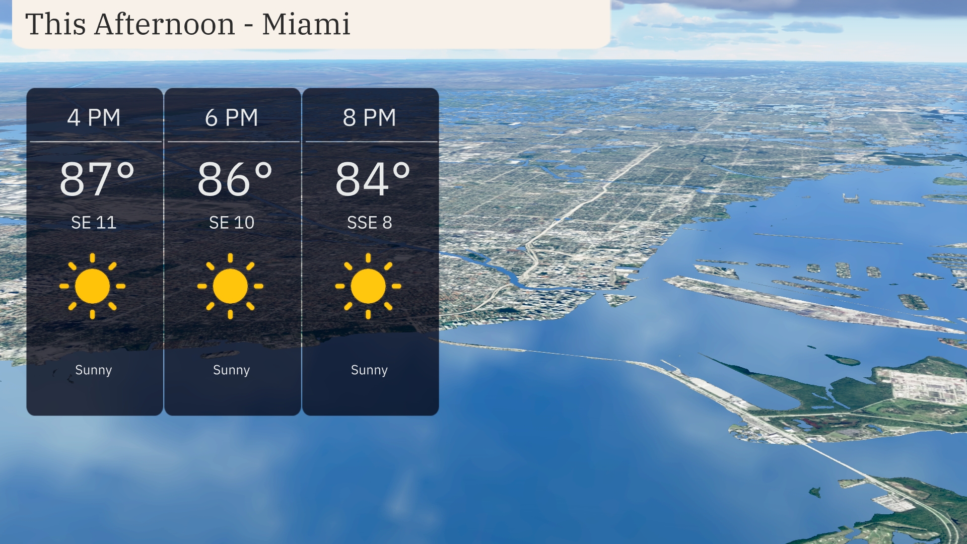
In the afternoon hours in Miami, temperatures will reach up to 87 degrees by 4 PM, maintaining a sunny outlook. Expect a light southeast wind blowing at 11 mph, creating a pleasant breeze. By 6 PM, temperatures slightly drop to 86 degrees with winds continuing southeast at 11 mph. Sunny skies persist into the evening, with temperatures easing to 84 degrees and winds shifting to south-southeast at 8 mph.
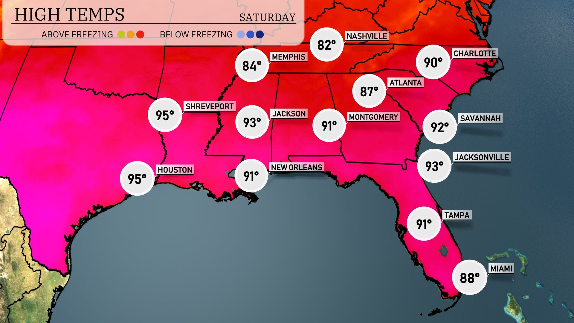
This afternoon, temperatures are heating up across the Southeast. In Shreveport and Houston, we’re looking at highs of 95 degrees, making it one of the hottest spots in the region. Jackson is slightly cooler at 93 degrees, while both New Orleans and Montgomery will see highs around 91 degrees. Moving east, Jacksonville is expected to hit 93, and Savannah will be just a touch warmer at 92 degrees, with Atlanta not far behind at 90. Miami remains milder with a high of 88 degrees, showcasing a bit of a temperature contrast compared to its northern neighbors.
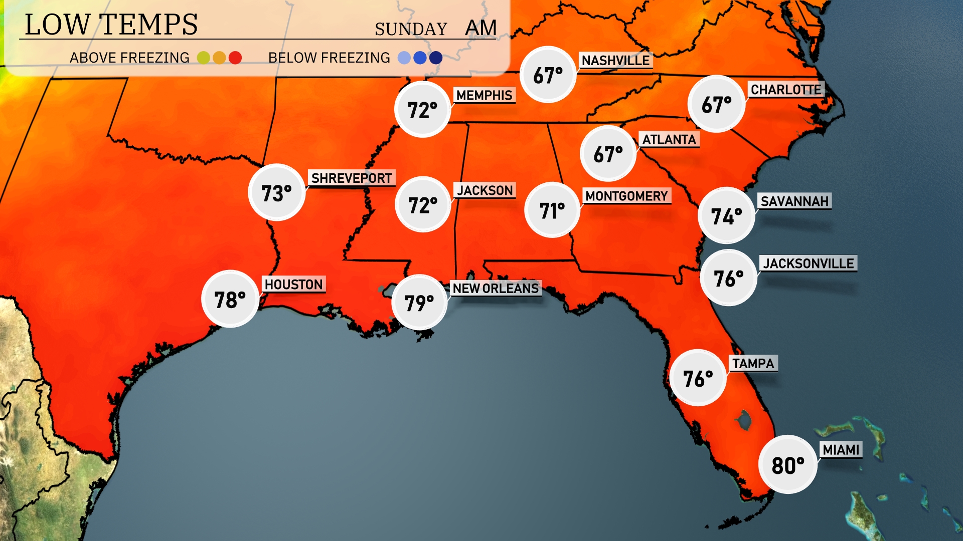
Tonight, Jacksonville will cool down to 76 degrees, while Atlanta is expected to reach a low of 67. Montgomery will drop to 71 degrees, with Nashville seeing a similar temperature of 67. Memphis is set for a low of 72 degrees, making for a mild night across the Southeast region.
Tomorrow in the Southeast, temperatures are soaring, with Houston hitting a blistering 96 degrees, marking a definite above-average day. New Orleans follows closely with a high of 92 degrees, while Jackson can expect 87 degrees. Atlanta will see a warm afternoon high of 82 degrees, and in Montgomery, temperatures will reach 85 degrees. The trend continues with Miami also warming up to 88 degrees, influenced by a strong ridge of high pressure settling over the region.
A frontal system is pushing through the Southeast, bringing scattered showers and thunderstorms from Jackson to Atlanta. Late Saturday into Sunday, expect heavy rains along with gusty winds, with isolated severe storms possible in areas like Montgomery and Savannah. Temperatures will remain warm ahead of the front, but slightly cooler air will sweep in once it passes, especially noticeable on Sunday afternoon. Rainfall could be significant in spots, increasing the risk of localized flooding.
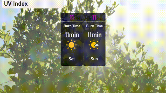
This weekend in Miami, the UV index will be extremely high at 11 on both Saturday and Sunday, with an expected burn time of just 11 minutes.